



Snøtinden Hike
Key facts about the hike
- Difficulty Hikes are rated from very easy to very hard: my difficulty scale
- Moderate
- Duration Estimated time, short breaks included (photos, water, snacks), picnic not included: how it is calculated
- 5h
- Distance
- 9.9km
- Elevation gain
- 870m
- Technical difficulty Swiss Alpine Club scale, from T1 (easy path) to T6 (difficult alpine hiking): the six grades of difficulty
- T2
- Type of route
- Out and back
- Maximum altitude
- 638 m
- Vertiginous Three levels, depending on exposure to drops: the levels in detail
- No
- Marked
- No
- Popularity
- Very low
- Best time
- June to September
- Island
- Hinnøya, Lofoten
- Start point
- 68.30415, 15.01061
- Activity
- Hiking
Hike overview
At the eastern end of Lofoten, the village of Digermulen guards the southern mouth of Raftsundet, the long sound between Hinnøya and the island of Austvågøya. Above the village, Snøtinden (638 m) looks straight across at some of the highest peaks in Lofoten and their sheer rock walls, while to the south an islet-scattered sea runs out to the horizon.
The 360° panorama from the summit is exceptional, and you can enjoy it in perfect peace, as hardly anyone walks this path. This hike is a real favourite of mine: I can't fault it, and it deserves far more attention than it gets.
Map and elevation profile of the hike
Snøtinden Hike
Description and difficulties of the hike
Through the woods to Keiservarden
The path leaves the coast road at a wooden sign and heads straight into the birch woods. It is steep for much of the way, with only a few short level stretches. At around 220 m, still in the trees, you join the path coming up from Digermulen village. Soon after, a few sloping slabs have fixed ropes, most useful when the rock is wet.
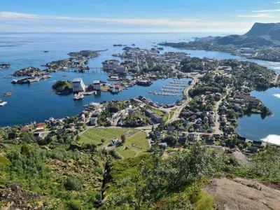
You leave the trees just before the first viewpoint, a cairn on a broad slab with a view down over the village, its quay and a beach lapped by turquoise water. Three hundred metres further on, at 383 m, two large cairns mark Keiservarden, “the Emperor's cairn”. On 21 July 1889 the German Emperor Wilhelm II, who had sailed in on the imperial yacht Hohenzollern, climbed up here, and his entourage built a cairn. A plaque in German marks the visit, which Digermulen regards as the start of tourism in northern Norway. Its story is told in more detail on the Keiservarden page.
The lake plateau
The path drops 90 m to Digermulvatnet, a lake ringed by low birches, with a wooden table on the shore. Just beyond the lake comes the only slightly unnerving section of the route, a short traverse across the hillside. From there the path climbs onto a plateau dotted with tarns and pools. The path isn't waymarked but is easy to follow, and where the line is less obvious, posts and a few arrows point the way.
The final climb is the steepest on the route, but zigzags make it perfectly manageable. As you gain height the view widens: the tarns in the foreground, then the sound and the sea.
The summit
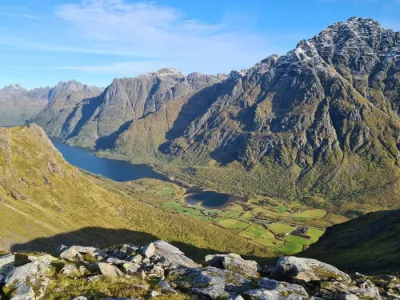
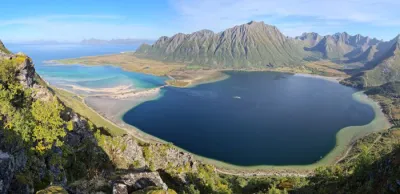
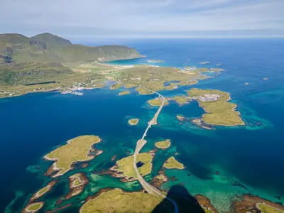
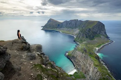
The summit is a broad grassy dome with plenty of flat spots for a picnic. The view is open on every side, and magnificent. Below you lies Raftsundet, the 25 km sound between Hinnøya and Austvågøya, from which the famous Trollfjord branches off. On the far shore, Trolltindan, Geitgaljen and Rulten rise in sheer rock walls, still holding snow in early summer. Directly below, a channel of clear water and a white beach separate two small wooded islands, and to the south Raftsundet opens out into the Vestfjord and its scattering of islets. The silence is total, and there's a good chance you'll have the summit to yourself. You return the same way, with 90 m of reascent to Keiservarden.
What you'll love
- Sitting on the summit, facing the great peaks of Austvågøya, among the highest in Lofoten.
- The variety of a route that changes scenery at every stage: the birch woods, the Emperor's viewpoint above the village, then a plateau of tarns that gradually opens onto the sound.
- The peace of a little-known hike, far from the crowds on Lofoten's classic routes.
Practical information
Access and parking
You reach Digermulen on road 868, a superb drive between the mountains and the sound, which follows Raftsundet from the Raftsund Bridge on the E10. The trailhead is just under 2 km beyond the village, towards Valen. Opposite the start of the path, on the seaward side, a small free car park takes about five cars.
Variant
A path also leaves from Digermulen village itself (signposted “Digermulkollen / Keiservarden”, blue dotted line on the map) and joins this route in the woods. Distance and ascent are almost identical (GPX track from Digermulen), and it's the way most locals go. For a shorter outing, the Keiservarden hike stops at the Emperor's cairn and leaves time to explore the viewpoints on the plateau.
Photos
See all 20 photos →


More hikes to do in Norway
Nearby hikes





















Printed from www.horizonrando.fr/en/norway/snotinden/