Plan your next adventure — 400 hikes explored and documented
Everything you need to choose, plan, and set off — freely accessible and 100% free : detailed guides, downloadable GPS tracks, interactive maps and ready-to-go itineraries.
Every route has been hiked personally, and every detail has been verified on the ground.
Choose your adventure destination
100+ hikes · 4 Top 5s · 2 circuits
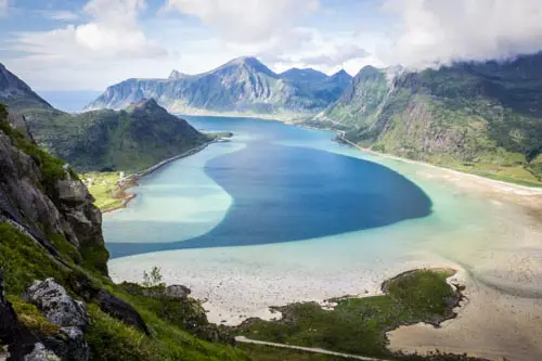
Norway
From the southern fjords to the Arctic peaks of Lofoten and Senja — the most comprehensive guide to hiking in Norway.

60+ hikes · 50 viewpoints · 4 Top 5s · 2 circuits
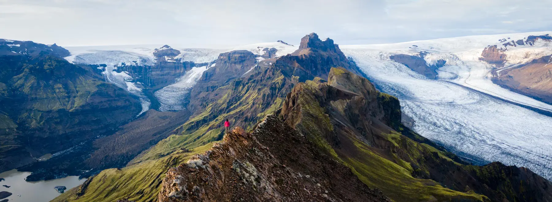
Iceland
Active volcanoes, lava fields, glaciers, and hot springs — 60 hikes to explore the Highlands and the rest of the island on foot.
80+ hikes · 6 Top 5s · 3 circuits
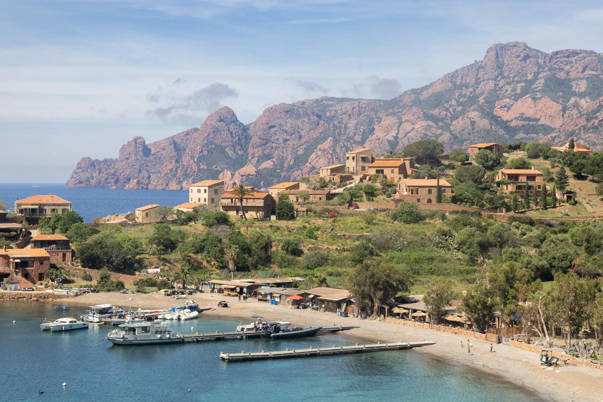
Corsica
High mountain peaks, natural pools, idyllic beaches, and the GR20 trails — 80 hikes covering the entire island, from Cap Corse to Bonifacio.

80 hikes · 4 Top 5 · 2 circuits
Scotland
Highland peaks, islands, lochs, and legendary castles — 80 itineraries in a wild and often deserted Scotland.

Guides in the works
Dolomites
Vertical cliffs, legendary mountain huts, via ferrata — 70 routes for hiking in one of the most spectacular mountain ranges in the Alps.
A hiking site, not a travel blog
Much more than a travel journal: practical tools to help you plan, compare and set off on your hike with peace of mind.
Interactive maps
Each hike geolocated on a map, filterable by your criteria: difficulty, duration, popularity.
Thematic Top 5s
Panoramic views, family-friendly, off the beaten path… my personal favorites, country by country.
Turnkey itineraries
Complete itineraries, from 7 to 14 days, available in several difficulty levels.
Detailed sheets
Everything you need to set off prepared: technical details, description, difficulty, GPS track, map, and photos.
On-the-ground photos
Thousands of photos to help you visualize each trail before you go.
Practical FAQs
Best time of year, gear, access, budget — everything you need to know, destination by destination.

François, a hiker for 30 years and founder of Horizonrando
While planning my trips, I quickly realised a problem: the vast majority of websites recommend the same hikes — the ones whose photos flood social media. The result is overcrowded trails and hidden gems that remain overlooked.
Horizonrando does the opposite. Every year, I hike over 2 000 kilometres and complete around a hundred hikes per destination in order to compare routes and identify those that are truly worth the detour — from the must-see classics to the lesser-known trails.
Each guide is the result of real-world experience : GPS data collected on site, authentic photos, and an honest opinion on the difficulty and appeal of the route. No sheet is written without having walked the trail, and none are sponsored.
Latest Hikes Added
New routes are published regularly. Here are the latest sheets online.

Jordalsnuten Hike
- Destination : Norway
- Difficulty : Moderate
- Duration : 4 h 30
- Distance : 9.5 km
- Elevation gain : 850 m

Helgehornet Hike
- Destination : Norway
- Difficulty : Easy
- Duration : 1 h 45
- Distance : 4.1 km
- Elevation gain : 370 m

Vardefjellet Hike
- Destination : Norway
- Difficulty : Easy
- Duration : 2 h
- Distance : 4.3 km
- Elevation gain : 390 m

Storhornet Hike
- Destination : Norway
- Difficulty : Moderate
- Duration : 4 h
- Distance : 9.3 km
- Elevation gain : 730 m

Husedalen Waterfall Hike
- Destination : Norway
- Difficulty : Moderate
- Duration : 4 h 30
- Distance : 10.6 km
- Elevation gain : 650 m

Glomnesnakken Hike
- Destination : Norway
- Difficulty : Easy
- Duration : 2 h 45
- Distance : 6.5 km
- Elevation gain : 440 m

A reliable guide thanks to your feedback
Check the FAQs for quick answers about planning your trip, gear, or using the site's tools. Country-specific questions are covered in a dedicated FAQ section, which you can access from each destination guide.
Contact me directly if you notice an error, if a trail has changed since my last visit, or if you would like to share your experience of a route. Your feedback from the field is invaluable — it helps to keep each guide up to date and reliable.