
Fjords Region Hiking Guide – Trails & Practical Advice
- Map of Hiking Trails in the Fjords region
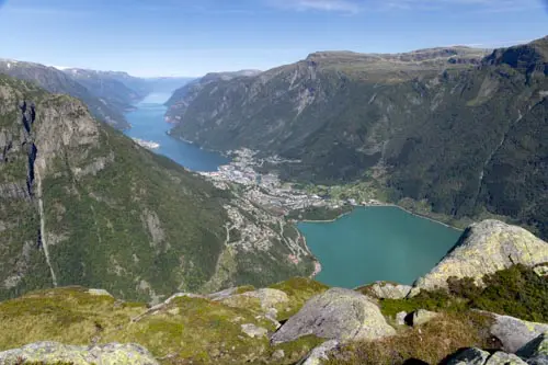
- Urkeegga – panoramic ridge above the Hjørundfjord
- Jordalsnuten – fjord, glacier and high-altitude lakes, far from the crowds
- Glomnesnakken – a hidden gem above Lake Oppstrynsvatnet
- Klovane – a bird's-eye view of the Oldedalen valley
- Raudmelen – breathtaking views of the Sognefjord
- Vardefjellet – panoramic views of the Norddalsfjord
- List of hikes in the fjord region
The Fjords Region is home to some of Norway's most spectacular sights, including dizzying cliffs, glacial valleys and jagged peaks plunging into deep blue waters. From the Lysefjord to the Sognefjord — the country's longest fjord — via the Sunnmøre Alps, the scenery is breathtaking at every turn.
Below are more than 50 hikes spread across three counties: Rogaland, which is home to the iconic sites of Preikestolen and Kjeragbolten; Vestland, which is home to the Sognefjord and its many branches; and Møre og Romsdal, which is home to the wild territory of the Sunnmøre Alps and Trollveggen. There are routes to suit all abilities, from family walks along the fjord to challenging ridge crossings reserved for seasoned hikers.
Map of Hiking Trails in the Fjords region
Iconic Hikes

Kjerag – the rock suspended above the Lysefjord
Difficulty: Moderate
Duration: 4 h 30
Distance: 10 km
Elevation gain: 730 m
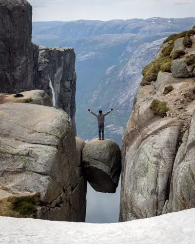
The Kjerag hike leads to the legendary Kjeragbolten, a rock wedged between two cliffs, suspended 984 meters above the Lysefjord, one of Norway's most beautiful fjords. This site is a true icon for thrill-seekers and photography enthusiasts. The route plunges hikers into the heart of raw landscapes, where every effort is rewarded with impressive panoramic views of the steep walls and turquoise waters of the fjord. However, the popularity of Kjeragbolten attracts many hikers, especially during the high season, which can detract from the feeling of solitude and wilderness.

Preikestolen – the iconic cliff overlooking the Lysefjord
Difficulty: Easy / Moderate
Duration: 3 h 30
Distance: 8.1 km
Elevation gain: 480 m
Preikestolen, also known as Pulpit Rock, is an impressive granite cliff that rises 604 meters above the sparkling waters of the Lysefjord in southwestern Norway. Formed around 10,000 years ago at the end of the last Ice Age, this iconic geological formation has become one of the country's most photographed natural sites.
Each year, over 300,000 hikers come to walk on its famous square plateau, which is 25 meters on each side. They are attracted by the spectacular view of the fjord and the surrounding mountains. In the summer, this number can rise to 5,000 or even 10,000 people per day. Needless to say, you shouldn't expect a solitary experience in nature!

Briksdalsbreen – an easy walk at the foot of a legendary glacier
Difficulty: Easy
Duration: 1 h 45
Distance: 4.7 km
Elevation gain: 180 m
The hike to the Briksdal Glacier (the word "breen" means glacier in Norwegian) is an unmissable experience when travelling in Norway. It provides remarkably easy access to one of the most iconic and photogenic arms of Jostedalsbreen, the largest ice cap in Western Europe.
The trail winds through the lush, deeply carved valley of Briksdalen, following a rushing river and revealing impressive waterfalls. Arriving at the foot of the glacier is a spectacular visual reward: the milky glacial lake, Briksdalsbrevatnet, and the blue walls of the ice giant.

Romsdalseggen – a ridge traverse offering views of the Troll Wall
Difficulty: Hard
Duration: 6 h
Distance: 11.4 km
Elevation gain: 950 m
Often cited as one of Norway's most beautiful hikes, the Romsdalseggen trail promises an unforgettable adventure. Prepare for a spectacular ridge traverse offering breathtaking panoramic views of the surrounding fjords and the majestic Romsdalen Valley. As you hike, your gaze will wander far, taking in iconic alpine peaks, including the impressive Trollveggen (the Troll Wall) — Europe's highest vertical rock face, which rises 1,100 metres above the valley.

Trollkirka – marble caves and an underground waterfall
Difficulty: Easy / Moderate
Duration: 3 h
Distance: 6.6 km
Elevation gain: 460 m
Trollkirka, meaning “troll church,” is not a religious building, but a natural wonder located near Norway's famous Atlantic Road. Prepare for an immersive hike winding through a pine forest before revealing its secret: a fascinating network of marble and limestone caves. Patiently carved by water over thousands of years, these cavities are now home to underground rivers and impressive waterfalls.
My favourite hikes!

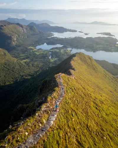
Urkeegga – panoramic ridge above the Hjørundfjord
Difficulty: Hard
Duration: 5 h 30
Distance: 10.3 km
Elevation gain: 960 m
Discover Urkeegga, a spectacular and unforgettable hike in the heart of the Sunnmøre Alps in Norway. Overlooking the picturesque village of Urke and the emerald waters of the Hjørundfjord, this route features a magnificent ridge crossing – Urkeegga literally means “Urke's Ridge.” Immerse yourself in a wild landscape, where the panoramic views of the fjord and the surrounding peaks, so characteristic of the region, will leave you speechless.

Jordalsnuten – fjord, glacier and high-altitude lakes, far from the crowds
Difficulty: Moderate
Duration: 4 h 30
Distance: 9.5 km
Elevation gain: 850 m
Discover Jordalsnuten, a spectacular hike located near Odda in the heart of Norway's magnificent Hardangerfjord region. From the 1,043-metre summit, enjoy a breathtaking 360° panorama of the fjord, the Buarbreen glacier and the surrounding mountain ranges.
This route showcases the diverse beauty of Norwegian landscapes, offering high-altitude lakes, waterfalls, fjords, rugged mountains, forests, and even a glacier as a backdrop. And the most surprising part? This gem remains little-known and uncrowded, despite being located just a few kilometres from the famous Trolltunga hike.

Glomnesnakken – a hidden gem above Lake Oppstrynsvatnet
Difficulty: Easy
Duration: 2 h 45
Distance: 6.5 km
Elevation gain: 440 m
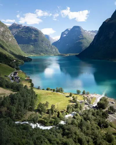
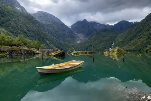
Discover the Glomnesnakken hike, a hidden gem located in the Oppstryn region of Norway. Far from the beaten path, this route reveals magnificent views of Lake Oppstrynsvatnet and its emerald green waters framed by towering mountains plunging directly into the water.
Enhance your exploration with a visit to the historic Segestad farm, now a small museum offering a fascinating glimpse into rural Norwegian life of yesteryear. On a clear day, you can expect an immersive experience in the heart of nature that will leave a lasting impression. This accessible and incredibly rewarding trail is sure to become a favorite!

Klovane – a bird's-eye view of the Oldedalen valley
Difficulty: Hard
Duration: 4 h 30
Distance: 6 km
Elevation gain: 950 m
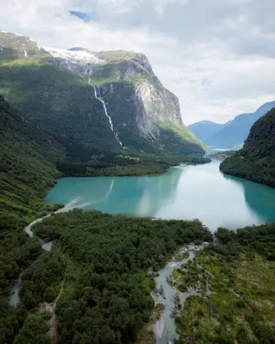
Overlooking the spectacular Oldedalen Valley in Norway, the Klovane hike takes you to a 982-meter peak offering unforgettable views. Although challenging, this climb reveals a unique panorama of the emerald green waters of Oldevatnet, majestic mountains, and surrounding glaciers.
Klovane is an excellent choice for experienced hikers seeking a physical challenge and stunning vistas in the heart of one of Norway's most beautiful valleys.

Raudmelen – breathtaking views of the Sognefjord
Difficulty: Moderate
Duration: 5 h
Distance: 9.8 km
Elevation gain: 920 m
The Raudmelen hike (972 m) is a must-do in the Balestrand region. It offers spectacular panoramic views of the Sognefjord — Norway's longest fjord — as well as the surrounding mountains. Popular with locals, this hike offers an authentic immersion in Norwegian nature and features an excellent, well-maintained trail dotted with unforgettable viewpoints.
Raudmelen embodies the complete hiking experience, offering diverse landscapes, a high-quality trail, exceptional views and few crowds. At the summit, there is a modern mountain hut where you can spend the night and extend your adventure. It's a unique experience between fjord and mountain.

Vardefjellet – panoramic views of the Norddalsfjord
Difficulty: Easy
Duration: 2 h
Distance: 4.3 km
Elevation gain: 390 m
Overlooking the majestic Norddalsfjord, near Valldal in Norway, the Vardefjellet hike offers a concentration of spectacular landscapes. This little-used route is appealing for its excellent effort-to-reward ratio: it provides exceptional views of the fjords and surrounding peaks for moderate physical exertion.
The trail starts at an elevation of about 500 meters, close to the local tree line. This means that nearly the entire hike takes place in open terrain. You will therefore enjoy unobstructed and remarkable views along almost the entire route.
Geography and climate of the fjord region
Geographical location and topography
The extent of the region
The 'fjord region' refers to the heart of western Norway, a vast territory stretching over 600 km from north to south. It extends from the Romsdalsfjord and the Sunnmøre Alps in the north (in the county of Møre og Romsdal) to the Lysefjord in the south (in the county of Rogaland), passing through the vast county of Vestland. This region is home to the cities of Bergen and Stavanger, as well as the fjords of Sognefjord and Hardangerfjord.
- Latitude: between 59° and 63° North (from the Lysefjord to the Romsdalsfjord)
- Counties: Rogaland, Vestland and Møre og Romsdal
- Major cities: Stavanger, Bergen, Stryn, Åndalsnes and Ålesund
Unlike the Lofoten Islands, which can be crossed in three hours, the fjord region covers a considerable area. The distance as the crow flies can be misleading as the steep-sided valleys and mountain ranges force significant detours. For instance, travelling from Stavanger in the south to Ålesund in the north by road takes over twelve hours, despite the distance being just 400 km as the crow flies.
The fjords and steep terrain
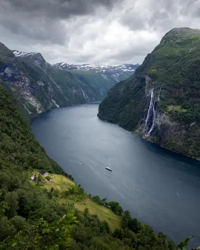
Norwegian fjords are ancient glacial valleys flooded by the sea at the end of the last Ice Age. The Sognefjord, Norway's longest, extends 204 km inland, and the Geirangerfjord, a UNESCO World Heritage Site, is famous for its vertiginous slopes, which rise over 1,000 metres above the fjord's waters, and its spectacular waterfalls, which cascade down the rocky walls.
Hikers will find the ever-present verticality of the terrain challenging. The mountains rise directly from sea level or from valley floors, resulting in significant elevation gains despite often modest altitudes (between 500 and 1,500 metres).
Vegetation and glaciers
Vegetation changes rapidly with altitude: there are dense forests of birch and pine at the valley floor, barren heathland around the tree line (generally between 500 and 600 metres depending on latitude and exposure) and then rocky, open terrain above. This rapid transition is one of the highlights of hiking in the fjords — each route traverses several vegetation zones and landscapes.
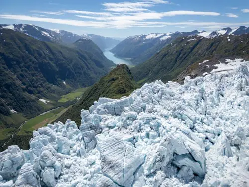
Glaciers are another major feature of the landscape, particularly around Jostedalsbreen, the largest glacier in continental Europe. Several of the hikes featured on this site allow you to get close to its glacier tongues (Briksdalsbreen, Nigardsbreen, Flatbreen, Kjenndalbrenn), revealing a permanent natural spectacle and serving as a reminder of the impact of climate change, as these glaciers retreat year after year.
Climate
A very wet oceanic climate
The fjord region enjoys an oceanic climate, tempered by the Gulf Stream and its extensions along the Norwegian coast. Winters are remarkably mild for this latitude, rarely dropping below 0 °C on the coast, and summers remain cool, with average daily temperatures ranging between 14 and 16 °C in July.
The dominant climatic feature, however, is the exceptional rainfall. Bergen, often cited as one of the rainiest cities in Europe, receives an average of nearly 2,500 mm of precipitation per year — about three times more than Paris. This is due to the orographic effect: as humid air masses from the Atlantic encounter the first coastal mountains, they are forced to rise, cool and condense their water vapour, thus generating precipitation.
The good news for hikers is that precipitation decreases significantly as soon as you head inland and are sheltered from the first mountain ranges. Contrasts are striking even over short distances: Stryn municipality, for example, receives 1,661 mm of precipitation, six times more than Skjåk, which is located 90 minutes away by car. Meanwhile, Bergen receives five times more precipitation than the municipality of Lærdal, which is located in the same county.
Temperatures and precipitation
May and June are generally the driest months, while autumn and winter see the heaviest precipitation. Summer highs of 17–20 °C in Bergen and 15–18 °C in Sogndal offer ideal hiking conditions — mild enough to walk comfortably without the oppressive heat of the Mediterranean mountains.
In Bergen (west coast):| Month | Min (°C) | Avg (°C) | Max (°C) | Precip. (mm) |
|---|---|---|---|---|
| January | 0.6 | 2.6 | 4.7 | 255 |
| February | 0.1 | 2.5 | 4.9 | 210 |
| March | 1.3 | 4.1 | 6.9 | 200 |
| April | 3.9 | 7.5 | 11.1 | 140 |
| May | 7.0 | 11.0 | 15.0 | 110 |
| June | 10.0 | 13.8 | 17.5 | 135 |
| July | 12.5 | 16.1 | 19.7 | 155 |
| August | 12.4 | 15.8 | 19.3 | 210 |
| September | 9.9 | 13.0 | 16.2 | 245 |
| October | 6.1 | 8.9 | 11.6 | 270 |
| November | 3.0 | 5.3 | 7.6 | 270 |
| December | 0.9 | 3.1 | 5.2 | 290 |
| Year | 5.7 | 8.6 | 11.7 | 2,490 |
In Sogndal (centre of the fjord region):
| Month | Min (°C) | Avg (°C) | Max (°C) | Precip. (mm) |
|---|---|---|---|---|
| January | -6.7 | -3.9 | -1.0 | 183 |
| February | -6.7 | -3.6 | -0.6 | 164 |
| March | -4.4 | -1.1 | 2.1 | 144 |
| April | -1.0 | 2.5 | 6.1 | 100 |
| May | 2.9 | 7.0 | 11.0 | 99 |
| June | 7.4 | 11.5 | 15.6 | 125 |
| July | 10.5 | 14.4 | 18.3 | 131 |
| August | 9.6 | 13.3 | 17.0 | 133 |
| September | 5.9 | 9.3 | 12.7 | 156 |
| October | 0.5 | 3.5 | 6.5 | 155 |
| November | -4.4 | -1.4 | 1.6 | 156 |
| December | -7.1 | -4.1 | -1.1 | 186 |
| Year | 0.5 | 3.9 | 7.4 | 1,732 |
Source: Meteorologisk institutt (1991–2020 normals) / weather-and-climate.com
Contrasts between the coast, valleys and higher elevations
The contrast between the coast and the interior is an important factor to consider when planning hikes. The west coast (Bergen and Ålesund) receives significantly more rainfall, but enjoys milder winters. Inland valleys (e.g. Sogndal, Stryn and Odda) are drier, but experience more pronounced temperature variations, with colder winters and summer days that are sometimes significantly warmer. It is not uncommon to see temperatures of 25–30 °C in the sheltered valleys of the Sognefjord or Hardangerfjord in July.
At higher elevations, expect a temperature drop of about 6 °C for every 1,000 metres gained. Therefore, a starting temperature of 15 °C at the fjord's edge could mean temperatures close to 5 °C at the summit, compounded by wind chill. Snowfields persist through July on north-facing slopes and above 1,200 metres, making certain sections challenging early in the season.
The mountainous terrain also creates numerous microclimates: it can rain heavily on one slope while the opposite slope, just a few kilometres away, enjoys bright sunshine. This variability is a constant feature of hiking in the fjords, so it is advisable to check the weather forecast on the official Norwegian website before setting out.
Planning Your Hiking Trip
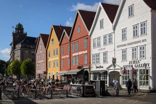
When is the best time to go hiking?
The ideal time to explore the fjord region on foot is from mid-June to mid-September. During this period, you can enjoy the best conditions for hiking, with snow-free trails, long days and pleasant temperatures.
September is an excellent choice for those who wish to avoid the summer crowds while still enjoying favourable conditions and landscapes enhanced by autumn colours. May, on the other hand, is appealing for its tranquillity, but you are limited to low- and mid-altitude hikes.
Although the most famous hikes (Preikestolen and Kjerag) can be busy in summer, there are plenty of magnificent, lesser-known routes in the region, even in the heart of the season. Check out the hikes featured on this site to discover these hidden gems.
Getting to the Fjord Region
Flights and airports
The Fjord Region is served by several airports, the main ones being:
Bergen Flesland (BGO): the main hub for Western Norway. Many airlines offer direct or connecting flights from major European cities. Bergen is an ideal starting point for exploring the Hardangerfjord, the Sognefjord and the surrounding area.
Stavanger Sola (SVG): ideal for accessing the Lysefjord (Preikestolen and Kjerag). It is well-connected with direct flights from several European cities.
Ålesund Vigra (AES): the gateway to the Sunnmøre Alps, the Geirangerfjord and the Romsdal Valley. Flights are mainly via Oslo.
A classic itinerary from France is: Paris → Oslo → Bergen/Stavanger/Ålesund. Domestic flights are operated by SAS, Norwegian and Widerøe. Alternatively, you can reach the fjord region from Oslo by car and take the opportunity to visit the Norwegian capital.
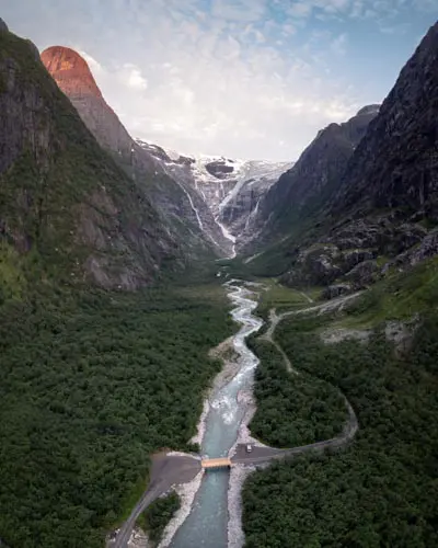
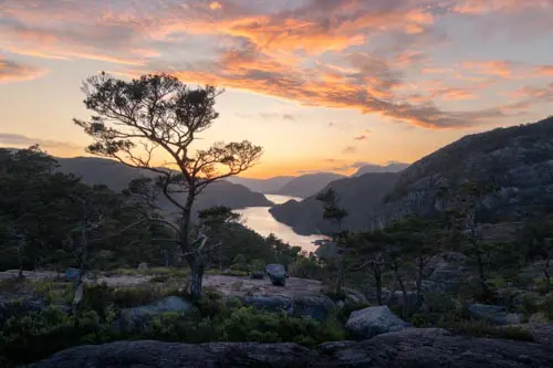
You can check out my two 14-day itineraries, both of which start in Oslo and cover most of the hikes in the fjord region:
Getting around
By car: almost essential!
A car is the most practical way to hike in the fjord region. Public transport is available, but the schedules and locations of the hiking trailheads often do not align with it, as they are often situated at the ends of roads or in remote valleys.
Car rentals are available at all airports and in major cities. Book several months in advance during peak season to get the best rates.
Important: actual distances:
In the fjord region, travel times are consistently longer than you might estimate based on a map. The roads follow the contours of the fjords and terrain, so a point that seems close on a map can require a detour of several dozen kilometres. However, rest assured that driving in Norway is a constant visual treat, and these winding roads offer magnificent views around every bend.
Ferries:
Ferries are an integral part of the Norwegian road network in the fjord region. Numerous crossings are required to connect the different areas, and they add to the charm of the journey. On the main routes, ferries depart frequently — every 20 to 60 minutes — and no reservation is required. Simply show up at the dock and board in order of arrival. Payment can be made on board or via the AutoPASS app. Fares are very affordable, and since 2023, many crossings have become free (those with an annual passenger count of under 100,000).
If you're travelling with your own vehicle, be sure to create an account on autopass.no before you leave: this will enable you to pay automatically for road tolls and ferries. If you opt for a rental, these fees will be billed directly by the agency upon your return.
Difficulty Level and Elevation Gains
Don't be fooled by the region's modest peak elevations (rarely above 1,200 m): hiking in the fjords is far more demanding than it appears. The mountains rise directly from sea level, meaning every metre of elevation must be earned through sheer leg strength, with no gradual warm-up on a valley trail.
Slopes in Norway are often steep and rarely allow time to catch your breath. Furthermore, the trails are often quite direct, with few switchbacks. However, an increasing number of hikes now feature stone steps built by Nepalese Sherpas to facilitate the ascent on the steepest sections (Rørsethornet and Ulriken notably).
The region offers many more accessible options for beginners or families: Briksdalsbreen, Glomnesnakken, Hamnanova, Bondhusdalen and Vardefjellet are just a few examples.
Trail Markings and Navigation
Trail markings in the fjord region are generally better than those in Lofoten, but they still vary by area. The most popular hikes (Preikestolen, Romsdalseggen and Kjerag) have clear markers and well-maintained trails with cairns and markings on the rocks (DNT's red Ts).
Conversely, many lesser-known routes — which are sometimes the most beautiful — have only minimal or even no trail markings. The trail may consist of nothing more than a faint path through the vegetation, occasionally marked by widely spaced cairns. In foggy or rainy weather, navigation can become tricky.
My advice: always have the GPS track of your route on your phone (using an offline app) or on a dedicated hiking GPS device. This is the best way to ensure a worry-free hike, even on marked trails where low-hanging clouds can reduce visibility to zero in a matter of minutes.
Recommended gear
The changeable nature of Western Norway's climate requires thorough preparation. You may encounter sun, rain, wind and fog all in a single day, regardless of the season.
- Hiking boots: preferably waterproof and high-cut. The terrain is often wet (streams, bogs, etc.) and rocky/rugged.
- Clothing: a layered system is essential. Bring a high-quality windproof and waterproof jacket, plus one or two warm layers, such as fleece and/or a lightweight down jacket, even in summer. The wind at higher elevations causes temperatures to drop significantly.
- Waterproof trousers: these are more useful here than in most other hiking regions given the frequency of rain. Lightweight overtrousers are sufficient.
- Navigation: use a GPS tracker on your phone or a dedicated GPS device to record your route.
- Hiking poles: these are particularly useful for steep ascents and descents on rugged terrain, which are common in the region.
As a final reminder, check the weather forecast on the official Norwegian website before every mountain outing.
List of hikes in the fjord region
| Name of the hike | Photo | Region | Difficulty | Duration | Length | Elevation gain | Popularity | My rating |
|---|