HomeNorwayHiking on Senja Island

Senja Island Hiking Guide – Trails & Practical Advice

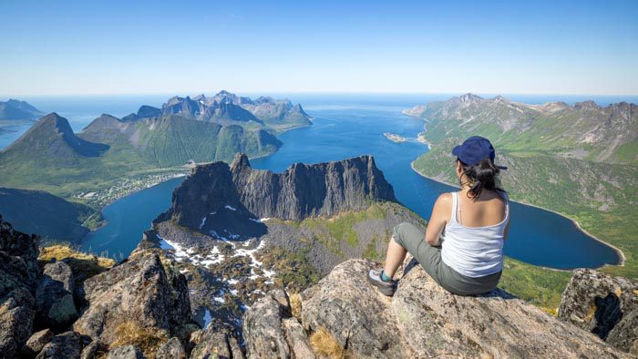
Panorama depuis Grytetyppen, Senja

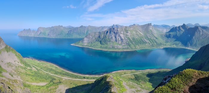
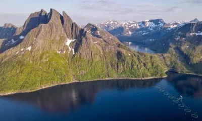
Nicknamed ' Norway in miniature', Senja is the country's second-largest island. Located north of the Arctic Circle, it boasts a remarkable diversity of landscapes across an area of just 1,600 km². With its fjords, steep-sided peaks, isolated fishing villages and white-sand beaches, the island encompasses all the features that make Northern Norway famous.

The nine hikes presented here showcase this diversity. From the family-friendly summit of Husfjellet, which offers a 360° panoramic view of the northern fjords and archipelagos, to the challenging ascent of Keipen, which rises to 938 metres, each route reveals a different facet of the island.

Map of Hiking Trails on the island of Senja

My favourite hikes on Senja

Husfjellet - Panoramic views of the northern part of the island

Difficulty: Moderate
Duration: 4 h
Distance: 8.8 km
Elevation gain: 670 m

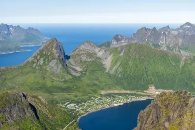
The hike up Husfjellet is an accessible climb that offers magnificent, panoramic views of the northern part of Senja Island. From the summit, you can enjoy a magnificent 360° view of the Steinfjorden and Bergsfjorden fjords, which are dotted with small islands, as well as the impressive surrounding mountain ranges.

This hike is ideal for families and offers an excellent introduction to the spectacular landscapes of this wild island in northern Norway.

Hesten - The iconic viewpoint overlooking Segla

Difficulty: Moderate
Duration: 3 h 15
Distance: 4 km
Elevation gain: 490 m

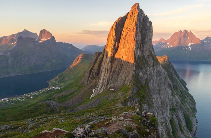
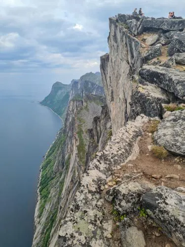
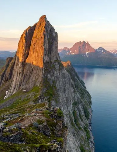
Senja's legendary photo spot, offering a striking view of the sharp peak of Segla. From the 558-metre summit, you can also take in the panoramic views of the Øyfjorden and Mefjorden fjords. It is a steady climb, though less crowded and less steep than Segla, and offers equally impressive views.

Keipen and Grytetippen - Twin peaks offering exceptional panoramic views

Difficulty: Hard
Duration: 6 h
Distance: 9.6 km
Elevation gain: 1140 m

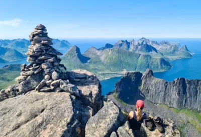
Hiking to Grytetippen and Keipen takes you to two of the most iconic peaks on the island of Senja. It is considered one of the most beautiful hikes in the region. From these two rocky peaks, you can enjoy spectacular panoramic views of the northern part of the island and sweeping vistas of the Ørnfjorden, the picturesque villages of Husøy and Fjordgård, as well as the legendary peaks of Segla, Barden and Breidtinden.

Planning your hiking trip to Senja Island

Segla depuis Barden, Senja
Village de Hamn, Senja, automne
Riven, Senja

When is the best time to go hiking in Senja?

Low-altitude hikes (under 500 m): Trails are accessible from May to October, though there is often residual snow on north-facing slopes and in sheltered valleys in May and early June.

Mid-altitude hikes (500–1,000 m): Opt for the period from mid-June to September. Before mid-June, there is still snow on the peaks, and certain sections may be risky due to steep snow-covered slopes and frozen snowfields. After September, the first autumn snows make conditions more unpredictable.

Pros and cons by season

May–early June: Arctic spring

Pros: Very few tourists, lower accommodation rates, days getting longer quickly (midnight sun from 20 May), relatively dry months, first Arctic flowers.

Disadvantages: Heavy snow at higher elevations that lingers longer than in the Lofoten Islands; many accommodation options are still closed; and there is very limited tourist infrastructure.


Mid-June to July: the midnight sun

Pros: The midnight sun phenomenon (21 May–23 July) means the sun never sets, offering magical light at all hours and total flexibility for hiking. This is ideal for long hiking days or high-altitude bivouacs under constant golden light. Optimal mountain conditions mean that all routes are accessible.

Drawbacks: The start of the peak tourist season (especially from July onwards), high accommodation prices and mosquitoes in low-altitude wetlands.


July–August: the high season

Advantages: Mildest temperatures (highs around 14°C), all tourist services open, and ideal conditions for exploring the entire island.

Disadvantages: Crowds at iconic sites such as Segla and Hesten, though significantly smaller than in the Lofoten Islands. Accommodation rates are at their highest, so booking several months in advance is recommended to secure the best locations.


September: Golden autumn

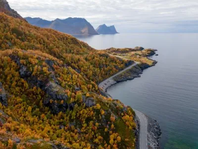
Pros: The island regains its tranquillity and boasts magnificent autumn colours (tundra ablaze, golden birches and orange mosses). The first Northern Lights are visible as early as mid-September. Accommodation rates drop sharply and the superb autumn light is ideal for photography. Temperatures are still acceptable for hiking.

Disadvantages: Days getting shorter rapidly (by about 1 hour per week), significantly more unpredictable weather with more rain, first snow possible at higher elevations and some accommodation providers begin to close.


October–April: Arctic winter

This season is dedicated to winter activities such as ski touring, snowshoeing and viewing the Northern Lights. Hiking in summer is no longer feasible due to snow, cold and darkness. The polar night lasts from early December to early January.

Adapting to the weather:
Regardless of the season, always check the forecast on the Norwegian weather website (yr.no) before setting out. The weather can change drastically in a matter of hours, even in summer. The proximity of the Atlantic Ocean and the mountainous terrain make the weather particularly changeable on Senja.

My recommendation

The best time to explore Senja on foot is from mid-June to mid-August. During this time, you can enjoy the best conditions for exploring the island, particularly thanks to the exceptional phenomenon of the midnight sun, which provides magical light and total flexibility for planning your hiking days.

Unlike the Lofoten Islands, Senja remains relatively untouched by mass tourism, even at the height of the summer season. You can enjoy remarkable tranquillity on most trails, except for the most iconic routes, such as Segla. So if you're looking for tranquillity and landscapes as spectacular as those in the Lofoten Islands, but without the crowds, Senja is the destination for you.

For Northern Lights enthusiasts, September and early October offer the perfect balance: the days are still ideal for hiking, even if the weather is getting rougher, and the nights are dark enough to observe the aurora in exceptional conditions, far from any light pollution.

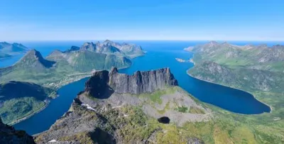
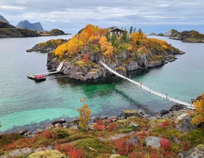
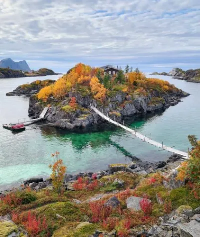
Maison sur un îlot relié par une passerelle aux couleurs d'automne à Hamn, île de Senja, Norvège
Fjordgård, Senja

Where should you stay on Senja?

Accommodation options

Unlike more touristy destinations, the island has retained its intimate character, offering small-scale accommodation.

Rorbuer, the traditional fishermen's cabins on stilts, can be found on Senja, but in smaller numbers than on other Norwegian islands. They are mainly found in fishing villages along the west coast and offer spectacular views of the ocean and mountains.

Senja also offers several high-quality, small-scale hotels that are seamlessly integrated into the landscape. The most iconic of these is undoubtedly the renowned Hamn i Senja resort, located on its own island to the north.

Renting a house is the preferred option for many travellers. These traditional wooden family homes offer good value for money and an insight into the Scandinavian way of life.

Well-equipped campsites

Senja has numerous well-equipped campsites, often situated in beautiful locations by lakes, fjords or at the entrance to protected natural areas.

Approximate rates:

  • Tent site: 200–300 NOK/night (approx. €18–27)
  • RV site with electricity: 300–400 NOK/night (approx. €27–37)
  • Camping cabin rental: from 700 NOK per night (approx. €65)

Wild camping

Norwegian law grants the right of public access to nature (allemannsretten), which includes wild camping, but only if certain strict rules are followed:

  • A minimum distance of 150 metres from residential areas
  • Maximum two consecutive nights in the same spot (longer in mountainous or remote areas)
  • Prohibited on cultivated or fenced-in land
  • Absolute respect for nature (leave no trace)

Norwegians place great importance on cleanliness and the environment. All rubbish must be taken with you and the site left in pristine condition.

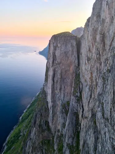
Falaises de Segla, Senja
Sentier vers Hesten, Senja

Trail characteristics

Don't be fooled by Senja's modest peak elevations (the highest point, Breidtinden, reaches 1,017 m): hiking on the island is far more demanding than it appears. As in the Lofoten Islands, the mountains rise directly from sea level on the west coast, meaning every metre of elevation is gained through sheer leg strength, with no gradual warm-up on a valley trail.


One notable advantage: well-marked trails
Unlike many other Norwegian destinations, Senja stands out for its excellent trail marking on all its main hiking routes, not just the most popular ones. This makes navigation much easier, though a GPS track is still recommended in bad weather or fog.


The terrain is varied and challenging
The slopes are often very steep, particularly along the spectacular west coast. The terrain alternates between wet grass, rocks, marshy areas, unstable scree and rocky slabs. In rainy or foggy weather, certain sections can become challenging. The strong winds that often blow on the island of Senja are also a factor to consider on ridges and exposed summits.


Accessibility and options for all skill levels
Despite these challenges, Senja offers routes for all skill levels. For beginners or families, there are several accessible hikes offering spectacular views: Riven, Husfjellet and walks further inland where the terrain is gentler. Experienced hikers can tackle more challenging climbs such as Keipen, Hesten or Breidtinden.


Senja's climate is particularly unpredictable and harsh. Located in the middle of the Atlantic Ocean and beyond the Arctic Circle, the island experiences weather conditions that can change drastically within a few hours. You may encounter sunshine, heavy rain, strong winds and even snow in the course of a single day, even in summer. It is therefore essential to check the forecast on the official Norwegian weather website before every mountain outing.

Recommended gear:

  • Hiking boots: waterproof and high-top are recommended as the terrain is often wet and rocky
  • Warm clothing: a layered system comprising thermal underwear, a fleece and a lightweight down jacket, even in summer. High-altitude winds and ocean exposure cause the wind chill to drop drastically
  • Rain and wind protection: a high-quality waterproof and windproof jacket and trousers
  • Navigation: GPS track of your route (although the trails are generally marked, visibility may be zero due to fog)
  • Hiking poles: these are particularly useful for the frequent steep descents on the island and for walking on unstable terrain

The geography and climate of the island

Sommet de Grytetyppen, Senja
Breitinden, Senja

Geographical location and topography

Location of the island

Senja is one of the largest islands in northern Norway:

  • Latitude: approximately 69° North (300 km beyond the Arctic Circle)
  • Distance from the mainland: it is separated from mainland Norway by the Gisund Strait, which is only one kilometre wide at Silsand
  • Area: 1,586 km² (the second largest island in Norway after Hinnøya)

It is located northeast of the Lofoten and Vesterålen islands and southwest of Tromsø in the county of Troms og Finnmark. The island is surrounded by the Norwegian Sea to the west, with deep fjords along its northern and southern coasts.

Demographic data
Total population ~7,900 (2017)
Density 5 inhabitants/km²
Main town Silsand (~1,600 inhabitants)

An island of two faces

Senja presents a striking contrast between its two coasts. The west coast, exposed to the winds and waves of the Atlantic Ocean, features spectacular terrain: steep cliffs plunging into the sea, jagged peaks rising over 1,000 metres (such as Breidtinden at 1,017 metres) and numerous fjords. This wild natural beauty has earned Senja the nickname 'Norway in miniature'.

In contrast, the east coast offers a much gentler landscape of green valleys, birch forests, sandy beaches and villages sheltered from Atlantic storms. This geographical diversity makes Senja a unique hiking destination where you can choose between spectacular alpine climbs with ocean views and more leisurely hikes through forests and along the coast.

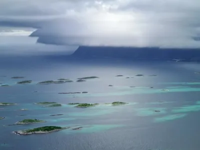
Nuages menaçants sur Bergsfjorden, Senja
Falaises de Segla, Senja
Segla depuis Keipen, Senja

Climate

The climate is temperate and oceanic, influenced by the Gulf Stream

Like the Lofoten Islands, Senja enjoys a remarkably mild climate for its latitude (69° North). Located more than 300 km north of the Arctic Circle, the island's mild temperatures are due to the influence of the Gulf Stream and its extensions.

However, the island exhibits marked climatic contrasts between its western coast, which is exposed to the Norwegian Sea, and its more sheltered eastern coast facing the mainland. The western part of Senja has a subpolar oceanic climate similar to that at the Hekkingen lighthouse (see weather data below), with mild but windy winters. In contrast, the east coast, near Laukhella and Silsand, experiences a more typical boreal climate, with warmer summers and slightly colder winters.

Temperatures and precipitation in Laukhella (east coast)

Month Average temp. (°C) Precip. (mm)
January -3.9 102
February -3.8 85
March -2 97
April 1.8 63
May 6.4 51
June 10.6 57
July 13.5 66
August 12.5 77
September 8.4 117
October 3.3 114
November -0.3 88
December -2.4 105
Year 3.7 1,120

Source: Meteorologisk institutt (averages 1991–2020)

Temperatures and precipitation at the Hekkingen lighthouse (west coast)

Month Average max. temp. (°C) Average temp. (°C) Average min. temp. (°C) Precip. (mm)
January 1.2 -1 -2.7 100
February 0.8 -1.4 -3 71
March 1.8 -0.2 -1.9 77
April 4.5 2.4 0.5 51
May 8.6 6 4 45
June 11.5 9 7.3 43
July 14.4 11.8 9.9 63
August 14.1 11.7 10 87
September 11.2 9.1 7.5 111
October 6.7 4.9 3.5 110
November 4 2.1 0.6 90
December 2.4 0.3 -1.3 83
Year 6.8 4.6 2.9 931

Source: Meteostat (1991–2020 averages)

May and June are the driest months, while September and October see the heaviest rainfall. The west coast (Hekkingen) receives less precipitation than the east coast (Laukhella), but is more exposed to ocean winds. Temperatures can exceed 25°C in summer on occasion (the record high is 28.3°C in Laukhella in July), and summer days with temperatures between 20 and 23°C are common.

Village de Hamn, Senja, automne
L'aiguille rocheuse de Segla vue depuis le sommet de Hesten au coucher du soleil, Senja, Norvège
Couleurs automnales, Senja

The Arctic Light Cycle

A Unique Natural Spectacle

Located north of the Arctic Circle (69°N), the island of Senja experiences extreme variations in light throughout the year. This significantly influences the planning of hikes and the hiking experience, depending on the time of year.

In summer, the island enjoys the midnight sun: the sun remaining visible 24 hours a day and never setting. In contrast, winter plunges Senja into polar night, a period during which the sun never rises above the horizon. Between these extremes, the length of the days varies dramatically, increasing by around an hour per week in spring and decreasing by the same amount in autumn.

Key periods in Silsand (located at the island's mid-latitude)

Midnight sun: 21 May to 23 July (24 hours of continuous daylight)
Polar night: 30 November to 12 January (sun below the horizon)

Day length

Month Date Sunrise Sunset Day length
January 1st - - 0h (polar night)
13 11:27 a.m. 12:26 p.m. 59 min
15 11:04 a.m. 12:51 p.m. 1h 47min
February 1st 9:21 a.m. 2:42 p.m. 5h 21min
15 8:15 a.m. 3:50 p.m. 7h 35min
March 1st 7:12 a.m. 4:50 p.m. 9h 38min
15 6:10 a.m. 5:45 p.m. 11h 35min
April 1st 5:54 a.m. 7:52 p.m. 13h 58min
15 4:49 a.m. 8:49 p.m. 16h 00min
May 1st 3:30 a.m. 10:03 p.m. 18h 33min
15 2:02 a.m. 11:34 p.m. 21h 32min
21 - - 24h (midnight sun)
June All month - - 24h (midnight sun)
July 1st to 23rd - - 24h (midnight sun)
24 1:05 a.m. 12:44 a.m. 23h 39min
31 2:29 a.m. 11:13 p.m. 20h 44min
August 1st 2:36 a.m. 11:06 p.m. 20h 30min
15 3:53 a.m. 9:47 p.m. 17h 54min
September 1st 5:07 a.m. 8:26 p.m. 15h 19min
15 6:01 a.m. 7:22 p.m. 13h 21min
October 1st 7:02 a.m. 6:11 p.m. 11h 9min
15 7:57 a.m. 5:09 p.m. 9h 12min
November 1st 8:10 a.m. 2:51 p.m. 6h 41min
15 9:21 a.m. 1:43 p.m. 4h 22min
30 - - 0h (polar night)
December All month - - 0h (polar night)

Source: timeanddate.com – data for Silsand (69.24°N, 17.30°E)

Impact on hiking planning

Summer (June–July): Constant daylight allows for hiking at any time, offering great flexibility to enjoy the most beautiful light and avoid peak hours. Sunrises and sunsets blend into a long golden hour with the sun skimming the horizon.

Spring and autumn: The rapid increase in daylight hours (by around 4 hours per month) provides exceptional low-angle light for photography, and the Northern Lights can be seen as early as September.

Winter: The polar night does not mean total darkness. For several hours, a bluish twilight bathes the landscape, creating a unique atmosphere for winter hikes on snowshoes or cross-country skis. The Northern Lights are at their most active during this time.

List of hikes on Senja Island

Name of the hike Photo Difficulty Duration Length Elevation gain Popularity My rating