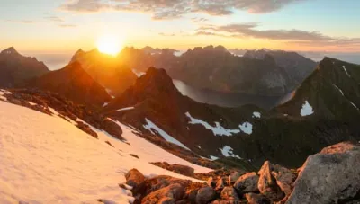
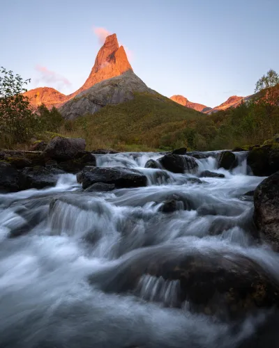
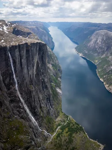
Hiking in Norway: Complete Guide and my 100+ Routes
- Reinebringen – Iconic view of the Lofoten Islands
- Besseggen – Norway's most famous ridge traverse
- Preikestolen – The iconic cliff overlooking the Lysefjord
- Kjerag – The rock suspended above the Lysefjord
- Ryten and Kvalvika Beach – Panoramic summit and dream beach
- Romsdalseggen – A ridge crossing with views of Trollveggen
- Helvete – Exceptional panorama away from the crowds
- Grytetippen and Keipen – Senja's Twin Peaks
- Jordalsnuten – The 360° panorama of the Hardangerfjord
- Hermannsdalstinden – The roof of Moskenesøya for seasoned hikers
- Glomnesnakken – A hidden gem above Lake Oppstrynsvatnet
- Urkeegga – Panoramic ridge above the Hjørundfjord
Why hike in Norway ?
Spectacular landscapes
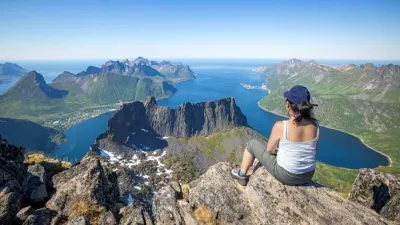
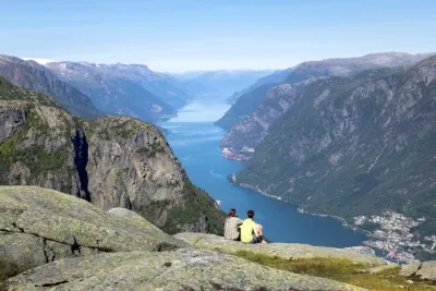
Norway is one of the world's top hiking destinations. From fjords carved between vertiginous cliffs and glaciers descending to lap at the valleys to jagged peaks and pristine white-sand beaches, the country boasts a concentration of spectacular landscapes that is hard to match.
But what truly sets Norway apart is that this beauty isn't confined to just a few iconic sites. Here, the journey is as important as the destination. You don't just head towards beautiful landscapes — you're constantly surrounded by them. Every stage of a road trip and every valley you pass through holds its own discoveries. In this sense, Norway lends itself just as well to a week-long stay focused on a single region as it does to a journey spanning several weeks from south to north.
Remarkable infrastructure
Norway doesn't just offer exceptional scenery; it makes it accessible. The right of public access to nature (allemannsretten) has been enshrined in law since 1957. This allows everyone to roam freely and camp on uncultivated land — a privilege that is becoming increasingly rare across Europe.
The Norwegian Trekking Association (DNT) maintains around 20,000 km of marked trails and manages over 550 shelters across the country. These range from staffed lodges serving hot meals to isolated self-service cabins. It's hard to find such a network dedicated to such well-preserved nature elsewhere.
The Arctic Light
The Norwegian summer offers a unique experience that can only truly be appreciated once you are there: the light. Beyond the Arctic Circle, the midnight sun allows you to hike at any hour between June and mid-July. Further south, days easily exceed 18 to 19 hours of daylight. This extended daylight transforms the hiking experience: you can start late, linger on a summit or wait for the mist to clear over a fjord without ever worrying about nightfall.
Having hiked over 100 trails, I can sum up what keeps me coming back every year in a few words: raw, untouched nature; remarkable-quality trails that are often deserted; and unforgettable landscapes.
Major hiking regions in Norway
Geography and topography
Norway stretches nearly 1,800 kilometres from Cape Lindesnes in the south to the North Cape beyond the 71st parallel. A mountainous spine runs along the Swedish border throughout, reaching its highest point of 2,469 metres at Galdhøpiggen in the Jotunheimen mountain range.
To the east, the terrain slopes gently down towards wooded valleys. In contrast, to the west, the mountains plunge steeply towards the sea. It is here that glaciers carved out the fjords — these ancient river valleys were deepened by the weight of the ice and then flooded by the ocean as the ice melted. Some of these fjords are up to 200 kilometres long and over 1,000 metres deep.
North of the Arctic Circle, the mountainous archipelagos of Lofoten, Vesterålen and Senja rise from the Norwegian Sea, with granite and gabbro peaks exceeding 1,000 metres just a few kilometres from the shore.
Mountains cover 60% of the country, while forests cover more than a third. Norway is one of the wildest and least densely populated countries in Europe, which is precisely what makes it an exceptional hiking destination.
On Horizonrando, I have organised my 100+ itineraries around three major hiking regions, each with its own distinct character: the Fjord Region in the southwest, the Lofoten Islands and the island of Senja in the north. The map opposite allows you to view these regions and access their dedicated guides directly.
Fjord Region (southwest)
The Fjord Region stretches over 600 kilometres along the western coast, from Stavanger in the south to the Sunnmøre Alps in the north, crossing three counties (Rogaland, Vestland and Møre og Romsdal). The ice ages left their most striking marks here: the Sognefjord cuts 204 kilometres inland, while the Geirangerfjord — a UNESCO World Heritage Site — features cliffs rising over 1,000 metres above the water. Further inland, the Jostedalsbreen glacier, the largest on the European mainland, extends its tongues all the way to the valleys.
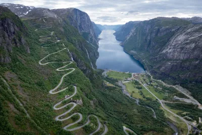
For hikers, this translates to challenging terrain: trails start at sea level and climb 500–1,000 metres in elevation over just a few kilometres. This is the region of Preikestolen, Kjerag and Besseggen, as well as dozens of lesser-known routes — such as ridge trails above the Hjørundfjord, glacier approaches in the Oldedalen valley and secluded lookouts over the Sognefjord — which offer equally stunning panoramic views away from the crowds.
I have listed more than 50 hikes here, ranging from family walks at the foot of the Briksdalsbreen glacier to challenging climbs such as Slogen (1,564 m).
Lofoten Archipelago
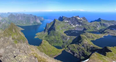
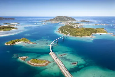
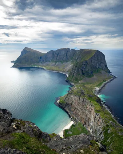
Seventy kilometres beyond the Arctic Circle, the Lofoten Archipelago stretches 150 kilometres as a string of five main islands, from Austvågøya in the north to Moskenesøya in the south. The landscape is striking: granite and gabbro peaks rising over 1,000 metres surge directly from the ocean, separated by narrow fjords and bordered by white-sand beaches with turquoise waters.
The Gulf Stream maintains a remarkably mild climate for this latitude, providing ideal hiking conditions for much of the year.
The 34 routes I suggest across the archipelago cater for all abilities: ranging from the accessible Kvalvika beach to the challenging ascent of Hermannsdalstinden (1,029 m). The most popular routes — Reinebringen, Ryten and Kvalvika — attract the majority of summer visitors. Routes such as Helvete, Kollfjellet or Narvtinden offer comparable panoramas in almost total solitude.
Senja Island
Senja is Norway's second-largest island (1,600 km²) and the least well-known of the three regions featured here. Nicknamed "Norway in miniature", it packs winding fjords, white-sand beaches and jagged peaks into a small area.
The rugged, mountainous west coast, with its rocky spires plunging into the Norwegian Sea, contrasts starkly with the forested interior and gentler eastern shores. The island can be reached from Tromsø in a two-hour drive, or by ferry from Andenes in the Vesterålen Islands.
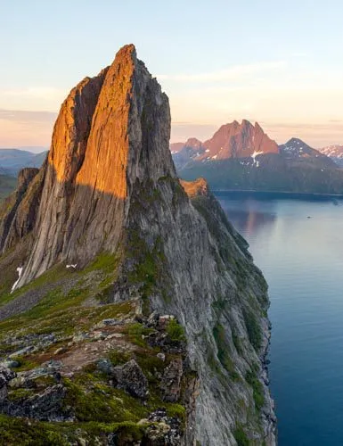
Senja shares the ever-present jagged peaks and the Arctic Ocean with the neighbouring Lofoten Islands, but has fewer visitors. The nine hikes featured range from the family-friendly Husfjellet — which offers 360° panoramic views of the fjords — to the challenging ascent of Keipen (938 m), which towers over the entire northern part of the island. The summit of Hesten, meanwhile, offers one of the most beautiful views in Northern Norway, with a view of the iconic spire of Segla.
Popular Hikes in Norway
It's impossible to talk about hiking in Norway without mentioning these trails. They are highly popular — and sometimes victims of their own success — but they remain unforgettable experiences set against iconic landscapes.
Reinebringen – Iconic view of the Lofoten Islands
Difficulty: Easy
Duration: 2 h 30
Distance: 3.7 km
Elevation gain: 480 m
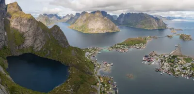
This is the quintessential hike in the Lofoten Islands, and it fully lives up to its reputation. In under an hour and a half of climbing a well-maintained stone staircase, you reach one of the archipelago's most beautiful viewpoints, offering a bird's-eye view of the village of Reine, its colourful fishermen's cabins and the turquoise waters of the Reinefjord. The effort-to-reward ratio is unbeatable.
Besseggen – Norway's most famous ridge traverse
Difficulty: Hard
Duration: 6 h 30
Distance: 14.4 km
Elevation gain: 1100 m
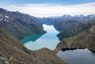
This 14 km traverse through Jotunheimen National Park owes its fame to an iconic image: the narrow ridge that separates the emerald waters of Lake Gjende, located 400 metres below, from the dark blue waters of Lake Bessvatnet. Taking the ferry across Lake Gjende to reach the starting point adds an extra element of adventure to this Norwegian classic. It is a demanding yet very popular hike — with 60,000 people completing it per season.
Preikestolen – The iconic cliff overlooking the Lysefjord
Difficulty: Easy / Moderate
Duration: 3 h 30
Distance: 8.1 km
Elevation gain: 480 m
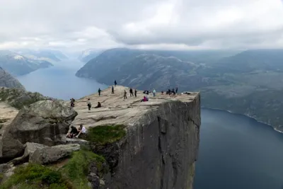
This 25-metre-wide granite plateau is suspended 604 metres above the Lysefjord and is likely Norway's most famous hike. The well-maintained trail remains accessible to most hikers. The reward is well worth it: the void beneath your feet and the fjord stretching as far as the eye can see. With over 300,000 visitors a year, set out early or late in the day to avoid the crowds.
Kjerag – The rock suspended above the Lysefjord
Difficulty: Moderate
Duration: 4 h 30
Distance: 10 km
Elevation gain: 730 m
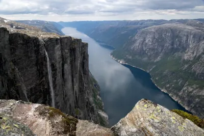
The route crosses a high-altitude plateau with a lunar landscape before opening up to reveal a bird's-eye view, nearly 1,000 metres above the Lysefjord. However, it is the Kjeragbolten that steals the show: a boulder wedged between two cliffs above the void, where the most daring come to pose for a photo.
Ryten and Kvalvika Beach – Panoramic summit and dream beach
Difficulty: Moderate
Duration: 4 h
Distance: 10.1 km
Elevation gain: 770 m
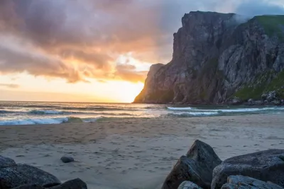
From Ryten's summit (543 m), you can look down on Kvalvika Beach, with its white sand and turquoise waters framed by cliffs — one of the most iconic images of the Lofoten Islands. The accessible and well-maintained trail can be extended with a descent to the beach, a popular camping spot. This is a distillation of the archipelago in a single outing.
Romsdalseggen – A ridge crossing with views of Trollveggen
Difficulty: Hard
Duration: 6 h
Distance: 11.4 km
Elevation gain: 950 m
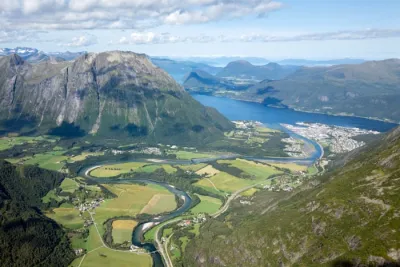
Often cited as one of Norway's most beautiful hikes, the Romsdalseggen trail promises an unforgettable adventure. Prepare for a spectacular ridge crossing offering breathtaking panoramic views of the majestic Romsdalen Valley. Admire iconic peaks, including the impressive Trollveggen (the Troll Wall) — Europe's highest vertical rock face, which rises 1,100 metres above the valley.
My favourites — Lesser-known hikes
Norway is more than just its famous trails. After hiking over a hundred routes across the country, the lesser-known hikes stand out to me the most — those that the crowds haven't discovered yet, whose landscapes are every bit as stunning as the great classics.
Helvete – Exceptional panorama away from the crowds
Difficulty: Hard
Duration: 5 h 30
Distance: 9.6 km
Elevation gain: 850 m
Just a few kilometres from the popular Reinebringen, Helvete offers an equally impressive panorama of Reine and the Moskenesøya fjords — but in a completely different setting. The route passes through waterfalls and high-altitude lakes before opening onto a summit plateau with views of Kirkfjorden, Reinefjorden and Bunesfjorden, and there are very few people here. A true sense of exploration!
Grytetippen and Keipen – Senja's Twin Peaks
Difficulty: Hard
Duration: 6 h
Distance: 9.6 km
Elevation gain: 1140 m
Two peaks, one route and one of Senja's most beautiful panoramas. From the peaks, you can overlook Ørnfjorden, the village of Husøy, and the jagged peaks of Segla and Barden. Grytetippen's vertical silhouette seems impregnable when viewed from below, but the climb proves otherwise. It is an excellent spot for viewing the midnight sun.
Jordalsnuten – The 360° panorama of the Hardangerfjord
Difficulty: Moderate
Duration: 4 h 30
Distance: 9.5 km
Elevation gain: 850 m
Jordalsnuten (1,043 m) packs a diversity of Norwegian landscapes into a single hike, including waterfalls, forests, high-altitude lakes and the Buarbreen Glacier. The 360° panoramic view from the summit of the Hardangerfjord and the surrounding mountain ranges is worth the detour alone. Just a few kilometres from Trolltunga, this peak remains relatively unknown and uncrowded — a true hidden gem.
Hermannsdalstinden – The roof of Moskenesøya for seasoned hikers
Difficulty: Very Hard
Duration: 10 h
Distance: 21.2 km
Elevation gain: 1810 m
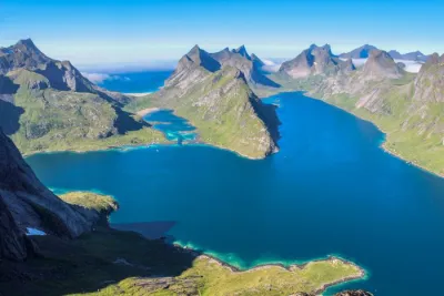
At 1,029 metres above sea level, Hermannsdalstinden is the highest peak on Moskenesøya in the Lofoten archipelago, and a major adventure reserved for well-trained hikers. The long, rugged route traverses diverse and absolutely magnificent landscapes. At the summit, the entire island panorama unfolds: jagged peaks, high-altitude lakes, turquoise fjords and the Arctic Ocean stretching as far as the eye can see. Overnight camping is possible at the Munkebu huts.
Glomnesnakken – A hidden gem above Lake Oppstrynsvatnet
Difficulty: Easy
Duration: 2 h 45
Distance: 6.5 km
Elevation gain: 440 m
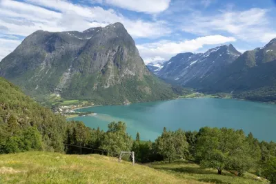
Glomnesnakken is the kind of hike you stumble upon by chance and never forget. This short loop in the Oppstryn region offers magnificent panoramic views of Lake Oppstrynsvatnet and its emerald waters surrounded by steep mountains. The Segestad Farm Museum adds a cultural touch to this accessible, off-the-beaten-track outing.
Urkeegga – Panoramic ridge above the Hjørundfjord
Difficulty: Hard
Duration: 5 h 30
Distance: 10.3 km
Elevation gain: 960 m
In the Sunnmøre Alps, Urkeegga — literally "Urke's Ridge" — is a long ridge hike overlooking the pristine Hjørundfjord. The loop climbs up to Maudekollen (1,021 m) before following the ridge, offering continuous views of the emerald waters of the fjord, the village of Urke and the surrounding jagged peaks. This is a still-undiscovered region that is well worth the detour.
Explore the 100 Hikes — Search Tools
With over 100 documented routes stretching from southern Norway to the Lofoten Islands and Senja, it can be difficult to know where to start. I have therefore designed several tools to help you find hikes that match your skill level, location and current preferences.
Interactive hiking maps
Norway stretches nearly 1,800 kilometres from north to south. To make navigation easier, I have divided the hikes into two interactive maps: one for the south (the fjord region and the west coast) and one for the north (the Lofoten archipelago, Senja and Vesterålen).
List of Hikes in Norway
The maps provide a geographical overview, while the table offers a numerical summary. You can view the 100 hikes and their technical details, and filter by region or difficulty to narrow down your selection. This is the perfect tool for quickly comparing multiple routes, identifying the most accessible ones or sorting by personal rating.
Thematic Rankings — The Top 5
Not sure where to start? These four thematic rankings each present the five best routes: the hikes I recommend most highly across all categories; those suitable for families; the most striking viewpoints; and off-the-beaten-path routes for those looking to avoid popular trails.
14-Day Itineraries — Two Turnkey Road Trips
Planning a two-week road trip in Norway can be time-consuming, from calculating distances between sites to sequencing hikes and choosing regions. I've designed two 14-day itineraries to solve these logistical challenges. They both cover the same territory — the southern fjords — but one focuses on accessible trails and the other on challenging peaks and long days in the mountains.
Frequently Asked Questions About Hiking in Norway
Are you planning a hiking trip to Norway? Here are the answers to the questions I'm asked most often. For more detailed information — month-by-month weather forecasts, reviews of popular trails, advice on dealing with mosquitoes and much more — check out the complete FAQ on Norway.
What is the best time to go hiking in Norway?
The hiking season typically runs from mid-June to mid-September. During this time, most trails are snow-free, the days are longest, and the weather is mildest.
However, this varies by region and elevation: Coastal or low-altitude trails (below 500 meters) are accessible as early as May, while peaks above 1,000 meters may remain snow-covered until early July.
Beyond the Arctic Circle — Lofoten and Senja — the midnight sun provides continuous light from early June to late July, making it ideal for hiking at any time of day. Fall (mid-September to October) is another attractive option for viewing the fall colors and the Northern Lights, if you don't mind shorter days and more unpredictable weather.
Are hikes in Norway difficult?
For all the routes I suggest on the site, you'll find a difficulty rating. The Top 5 Family Hikes is a good place to start for easy outings.
You can also use the hike table to sort hikes by difficulty (from easiest to hardest): list of 100 hikes in Norway
Is wild camping allowed in Norway?
Some popular sites, such as Preikestolen and certain beaches in the Lofoten Islands, may have additional restrictions. In practice, this freedom allows hikers to extend their trips by spending nights in the great outdoors.
How do you navigate the trails in Norway?
Norway has one of the densest networks of marked trails in Europe, with over 20,000 km maintained largely by the Norwegian Trekking Association (DNT). On the island of Senja, as in most of the fjord region, the trails are well-marked and in excellent condition, even in less-traveled areas. The Lofoten archipelago is an exception; outside the most well-known routes, such as Reinebringen and Ryten, trail markings are often absent. Some hikes take place off-trail on undeveloped natural terrain.
Even on a marked trail, however, Norwegian weather can change quickly — with fog, sudden rain, and low clouds — and make navigation difficult. Therefore, it is best to always have a GPS track and know how to use it. Each hike profile on Horizonrando includes a downloadable GPX file designed for this purpose. The official website yr.no provides reliable weather forecasts, which are essential to check before every departure.
Are popular trails in Norway overcrowded?
However, this observation applies only to a handful of overhyped routes. The vast majority of Norwegian trails remain uncrowded, including hikes with views that are just as remarkable, if not more so, than those of the major classics. In fact, this is one of the reasons I created a Top 5 hikes off the beaten path and a section My favourites - lesser-known hikes: to show that by straying from established trails, you can rediscover the essence of hiking in Norway — raw nature, tranquility, and vastness.
Do you need a guide to hike in Norway?
The key is to thoroughly prepare for each outing: Check the weather, bring a GPS track, adapt the route to your skill level, and bring gear suitable for rapid weather changes, even in summer.
Horizonrando's detailed guides (GPX track, map, terrain description, and difficulty rating) are designed to enable self-guided hiking, even on difficult and unmarked routes.