Suðurnámur Hike
Hike overview
Discover Suðurnámur, a 920-meter-high mountain located in the heart of the Fjallabak Nature Reserve in Iceland. Though it is much less frequented than the iconic peaks of Bláhnúkur or Brennisteinsalda, this hike offers equally spectacular panoramic views.
The trail winds through lava fields and vast plains before climbing up to a ridge that offers 360-degree views of the Highlands.
Remarks
Getting to Landmannalaugar: The roads in the highlands are only open in the summer. Several bus companies provide connections to Reykjavik. If you prefer to drive, you will need a 4WD vehicle to travel on F-roads. There are three options available to you:
- The F208 road from the north: the easiest option, with no river crossings.
- The F225 road: more picturesque but requires crossing several shallow rivers.
- The F208 road from the south: crosses several medium-depth rivers.
See my dedicated page on driving in the Highlands for more information.
Parking: It is now necessary to reserve a parking space before your arrival.
Hiking in Landmannalaugar: Check out my Landmannalaugar guide to help you choose your hikes.
Difficulties of the hike
As with all Landmannalaugar hikes, this trail is well-maintained and clearly marked. The route is relatively easy except for a few steep and slippery slopes, especially during wet weather and on the initial ascent.
For an even more memorable experience, it is easy to combine this hike with the Brennisteinsalda hike, as part of the routes are shared.
What you'll love
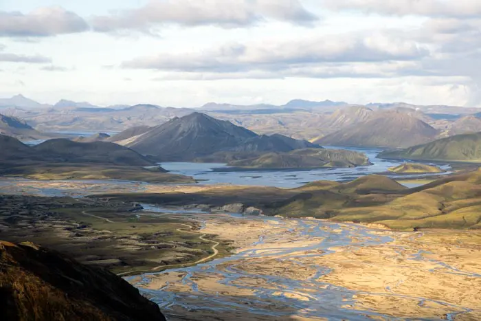
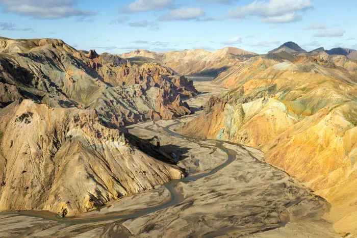
- The exceptional panoramic views from the Suðurnámur ridge. From there, you can see the entire Landmannalaugar region, the lava fields, the multicolored rhyolite mountains, and the intertwining rivers.
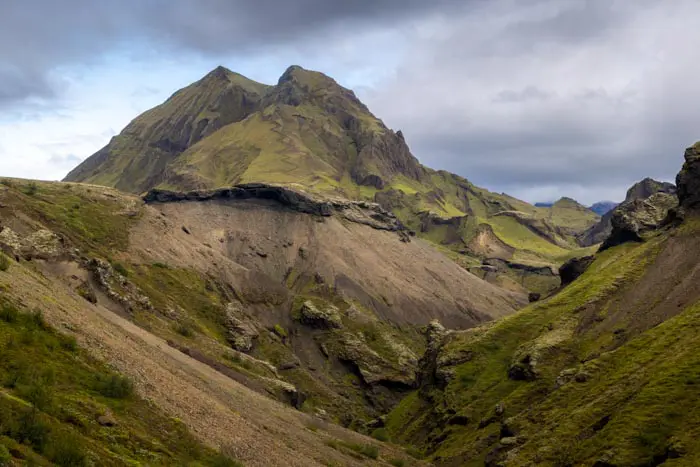
- Crossing the wild Vondugil Valley, which has wildflower meadows that contrast with the surrounding rock formations.
- The peaceful atmosphere, which is a welcome change from the bustle of other popular peaks in Landmannalaugar.
- Relaxing bath: opportunity to relax in the natural hot spring at Landmannalaugar, perfect for soothing your muscles after the hike.
Hike technical sheet
➡️ Hiking parameters
➡️ Hiking parameters
➡️ Hiking parameters
Map and elevation profile of the hike
Slideshow


Nearby hikes

Bláhnúkur Hike
- Difficulty : Easy
- Duration : 2 h 30
- Distance : 6.3 km
- Elevation gain : 400 m

Bláhnúkur and Brennisteinsalda Hike
- Difficulty : Moderate
- Duration : 4 h
- Distance : 9.9 km
- Elevation gain : 620 m

Brennisteinsalda Hike
- Difficulty : Easy
- Duration : 2 h 45
- Distance : 7.5 km
- Elevation gain : 350 m
Bláhnúkur, Skalli and Grænihryggur Circuit
- Difficulty : Very Hard
- Duration : 9 h
- Distance : 23.7 km
- Elevation gain : 1500 m
Map of the 10 closest hikes
Hikes to discover
Let chance guide your steps: discover a random selection of the best hikes in Iceland.

Dettifoss East Hike
- Difficulty : Easy
- Duration : 1 h 30
- Distance : 3.9 km
- Elevation gain : 70 m

Thakgil Yellow Circuit Hike
- Difficulty : Hard
- Duration : 6 h
- Distance : 15.1 km
- Elevation gain : 770 m

Vestrahorn et la plage de Stokksnes

Stuðlagil Canyon Hike
- Difficulty : Very easy
- Duration : 1 h 30
- Distance : 5.2 km
- Elevation gain : 100 m

Tindfjöll Circuit Hike
- Difficulty : Moderate
- Duration : 3 h 30
- Distance : 8.8 km
- Elevation gain : 380 m
Rjúpnafell Hike
- Difficulty : Very Hard
- Duration : 6 h
- Distance : 14.3 km
- Elevation gain : 920 m