
Monte Coldai Hike
Hike overview
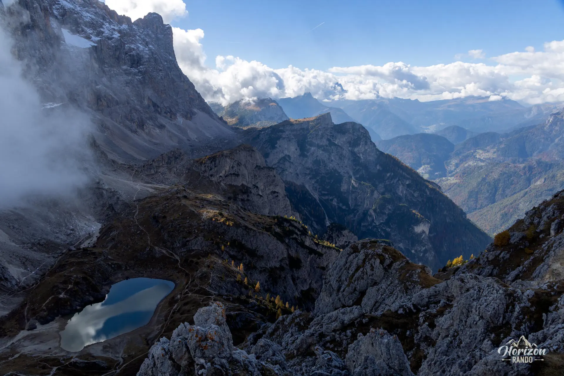
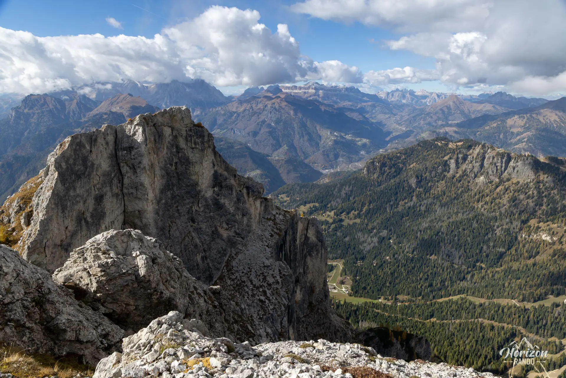
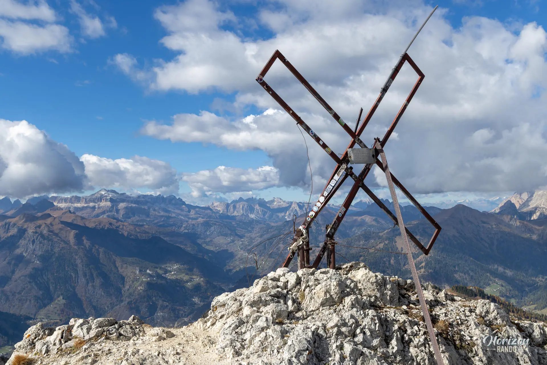
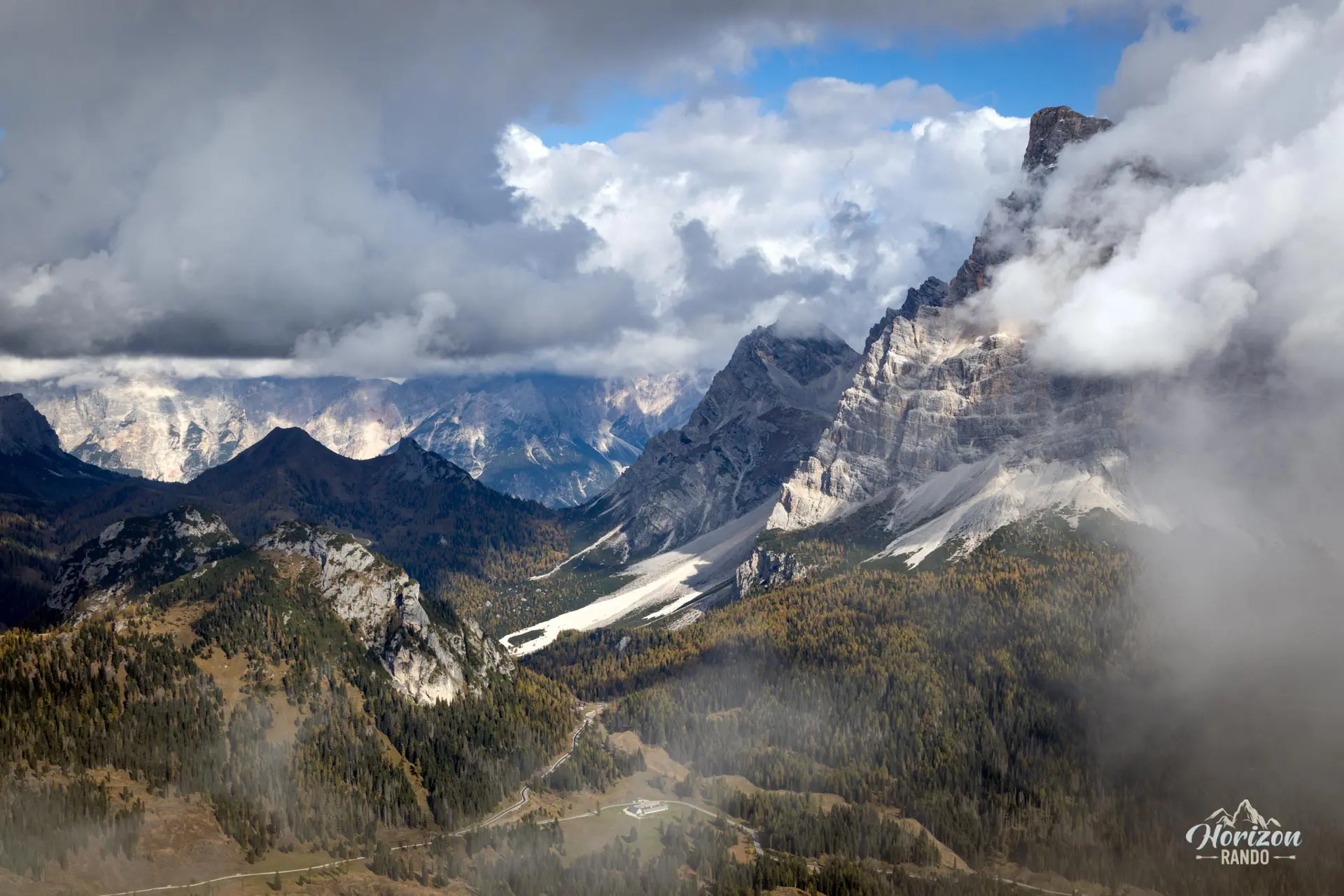
Monte Coldai (2,403 m) is a peak in the Civetta massif of the Dolomites. While Lake Coldai attracts a steady stream of hikers every summer, the final ascent to the summit remains surprisingly quiet—and that is precisely what makes it so appealing. The 360° panorama rivals those of the region's most beautiful viewpoints. It takes in Pelmo, Marmolada, and the imposing northwest face of Civetta.
However, caution is advised for the final few meters, which are highly exposed and not suitable for hikers prone to vertigo.
Remarks
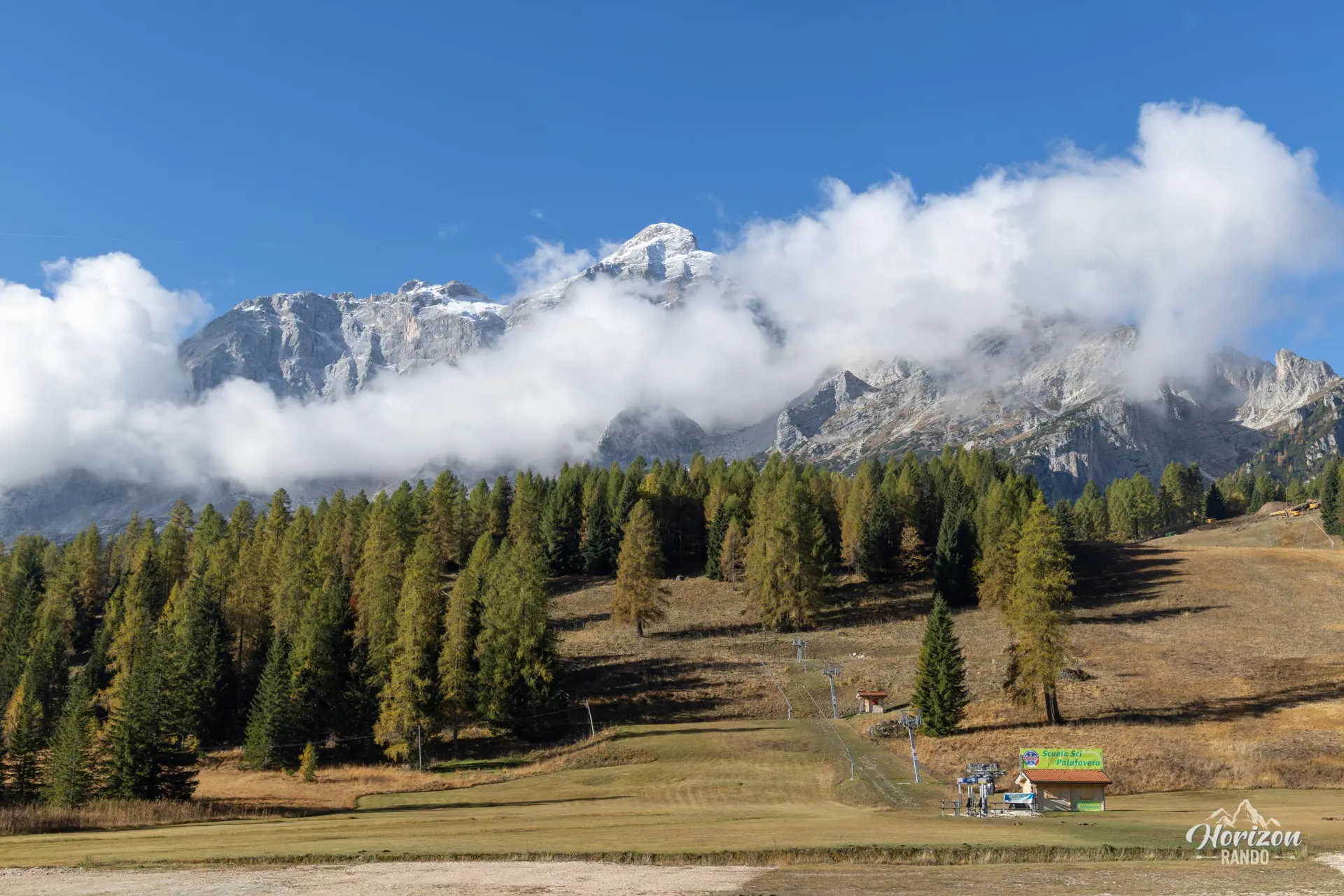
Parking: There is a large, free parking lot at Rifugio Palafavera. A few spaces are reserved for lodge guests, so be sure to locate the authorized parking spots.
Alternative route: You can significantly shorten the hike by taking the chairlift from Alleghe, which serves the Lago Coldai area. See the Lago di Coldai hike description for details on the route from Alleghe.
Ideal time: The ideal time of year is late June through October. The final section must be tackled on dry rock, so avoid it in wet weather or when there is lingering snow.
Description and difficulties of the hike
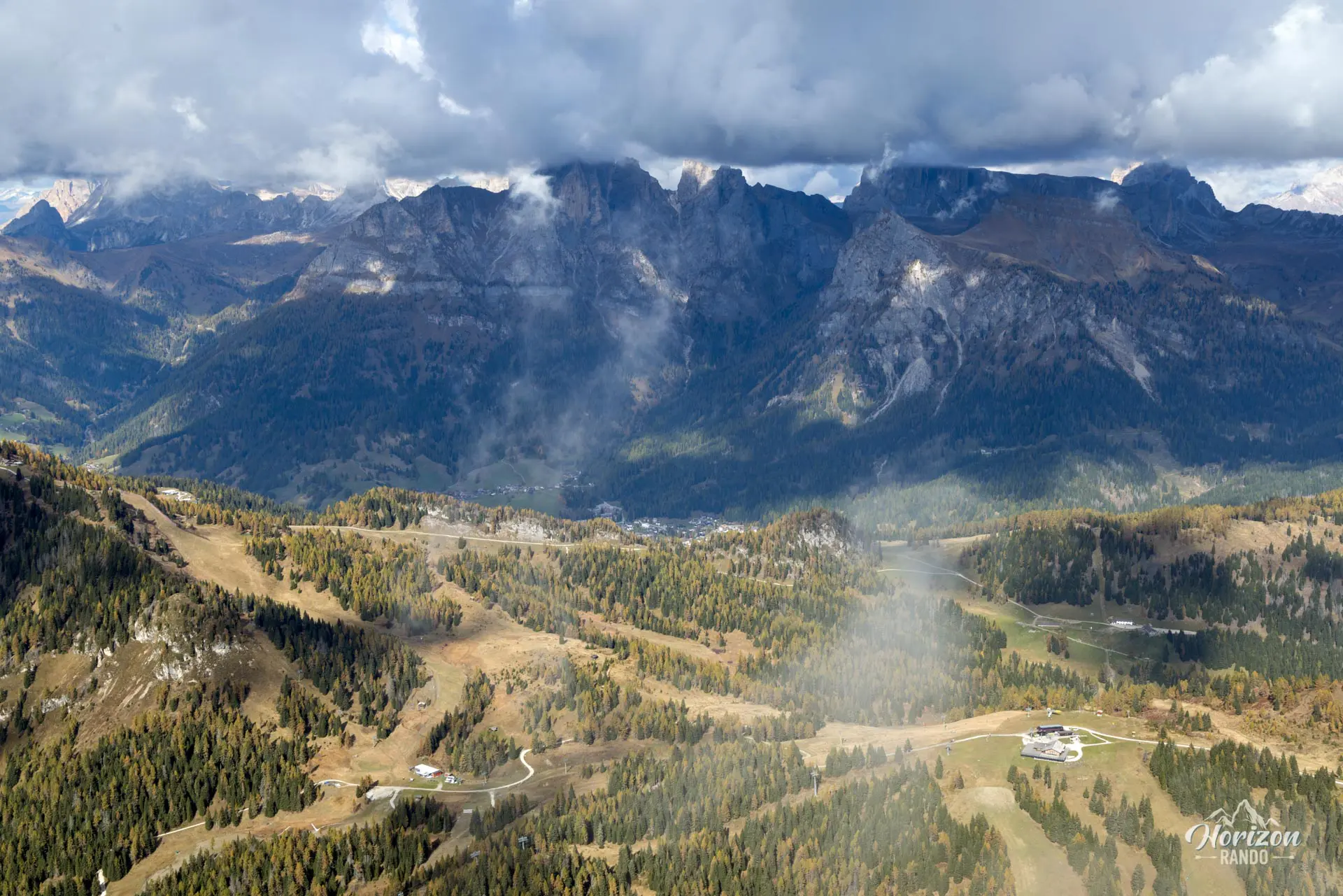
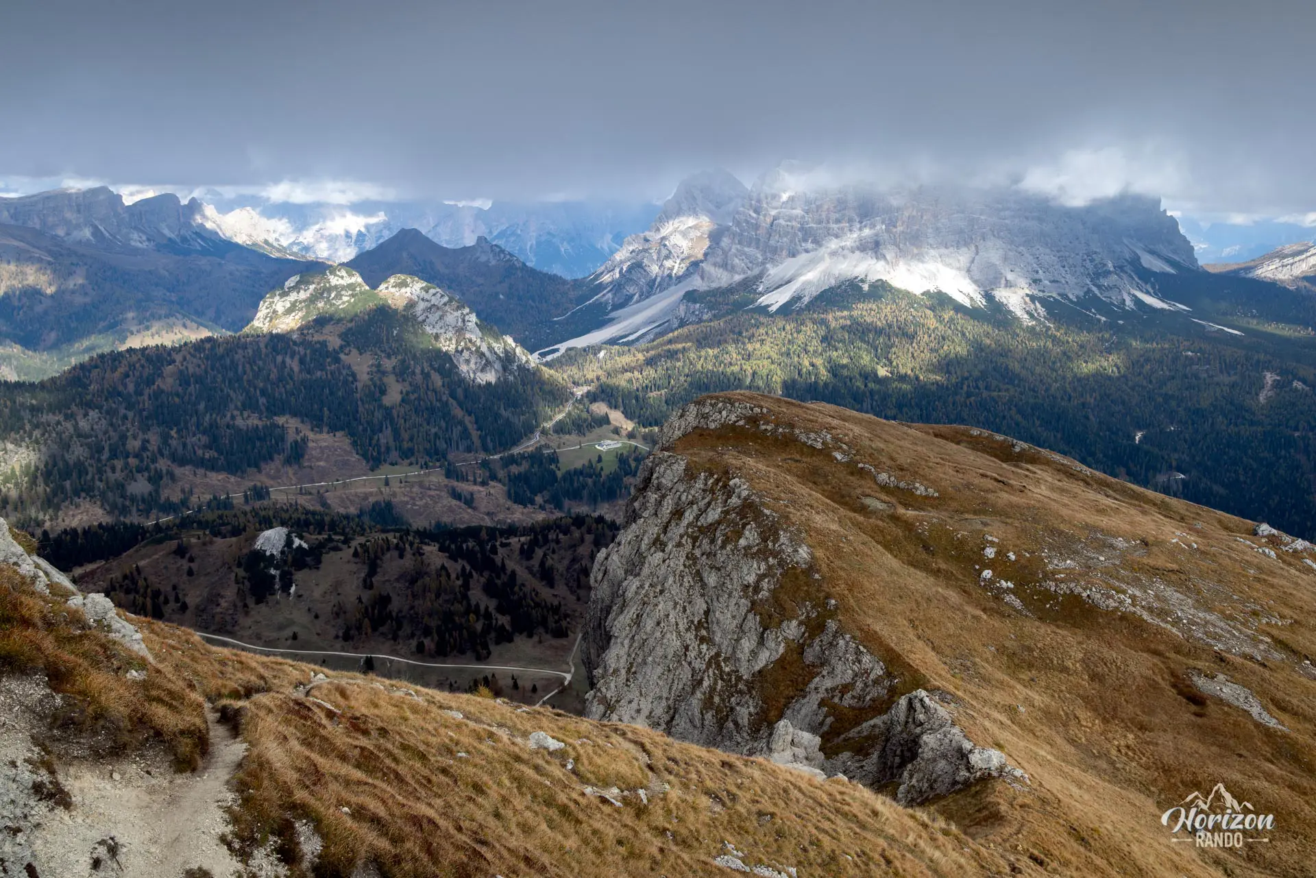
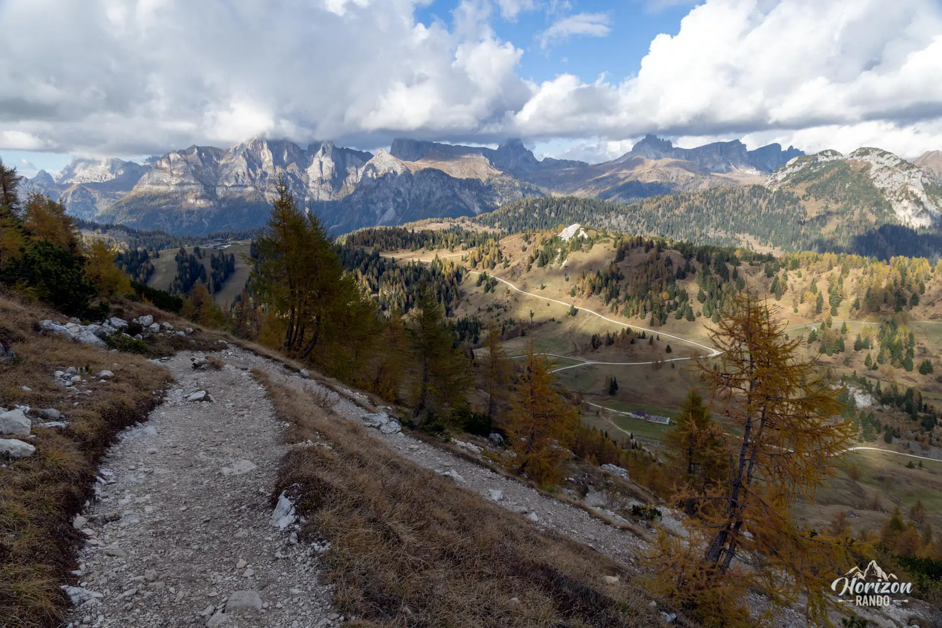
From the Rifugio Palafavera parking lot (1,514 m), follow wide track 564 west through the forest to Casera di Pioda (1,816 m), heading toward Rifugio Sonino al Coldai.
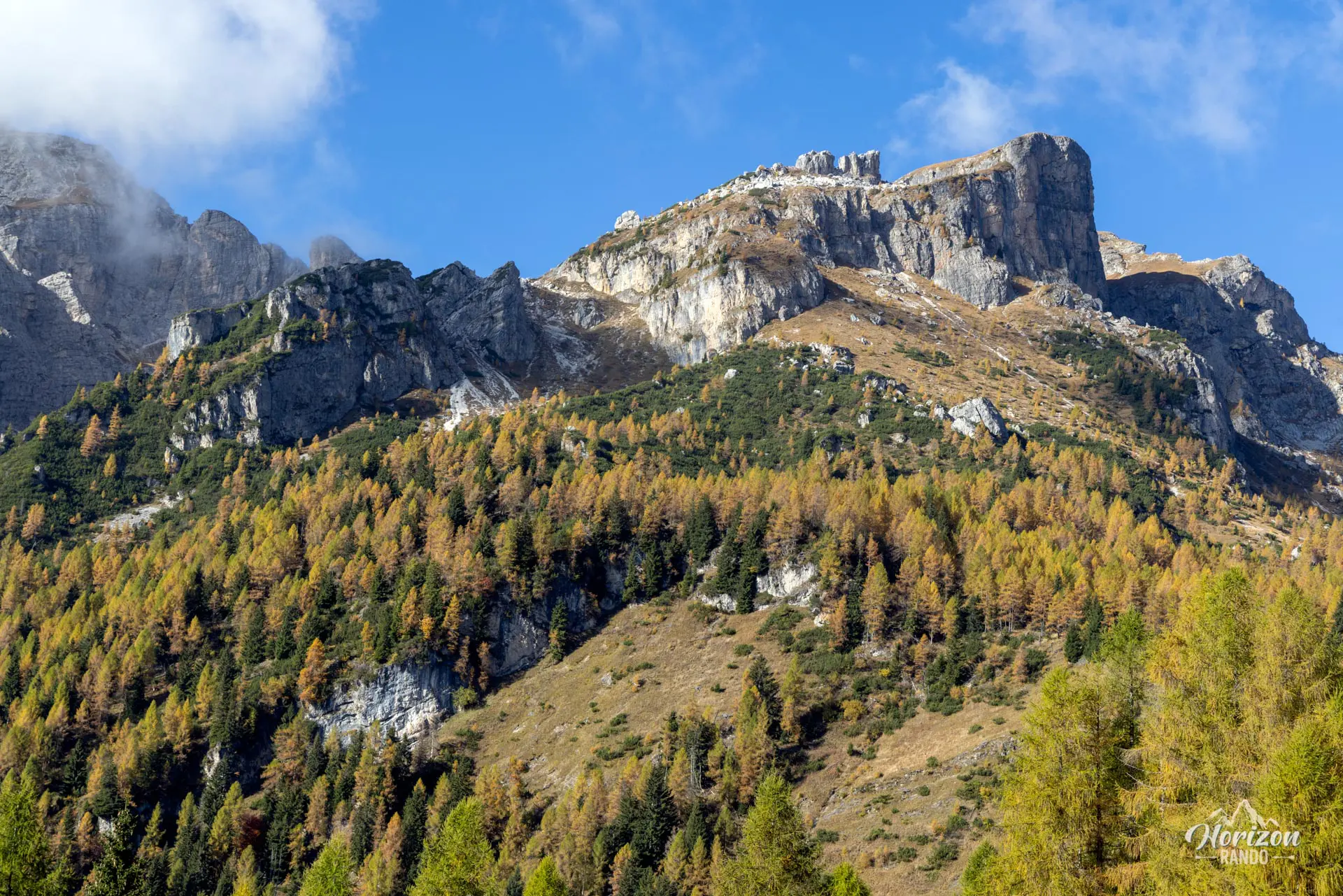
At this point, leave the track and turn left onto trail 556. The junction is not signposted, and the trail is faint, so be careful. The trail markers then become more frequent, and the path crosses scree before winding upward to Rifugio Coldai (2,135 m).
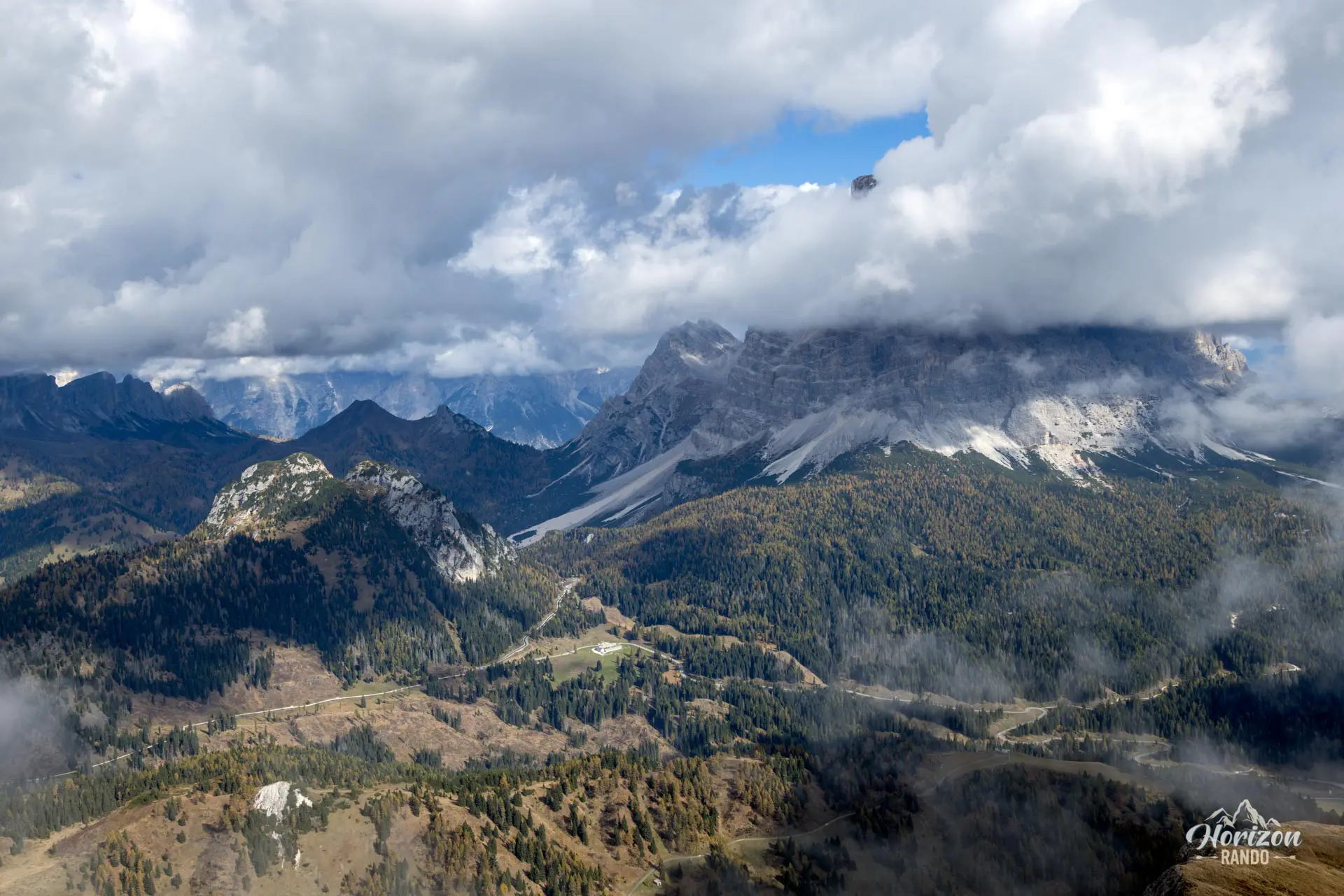
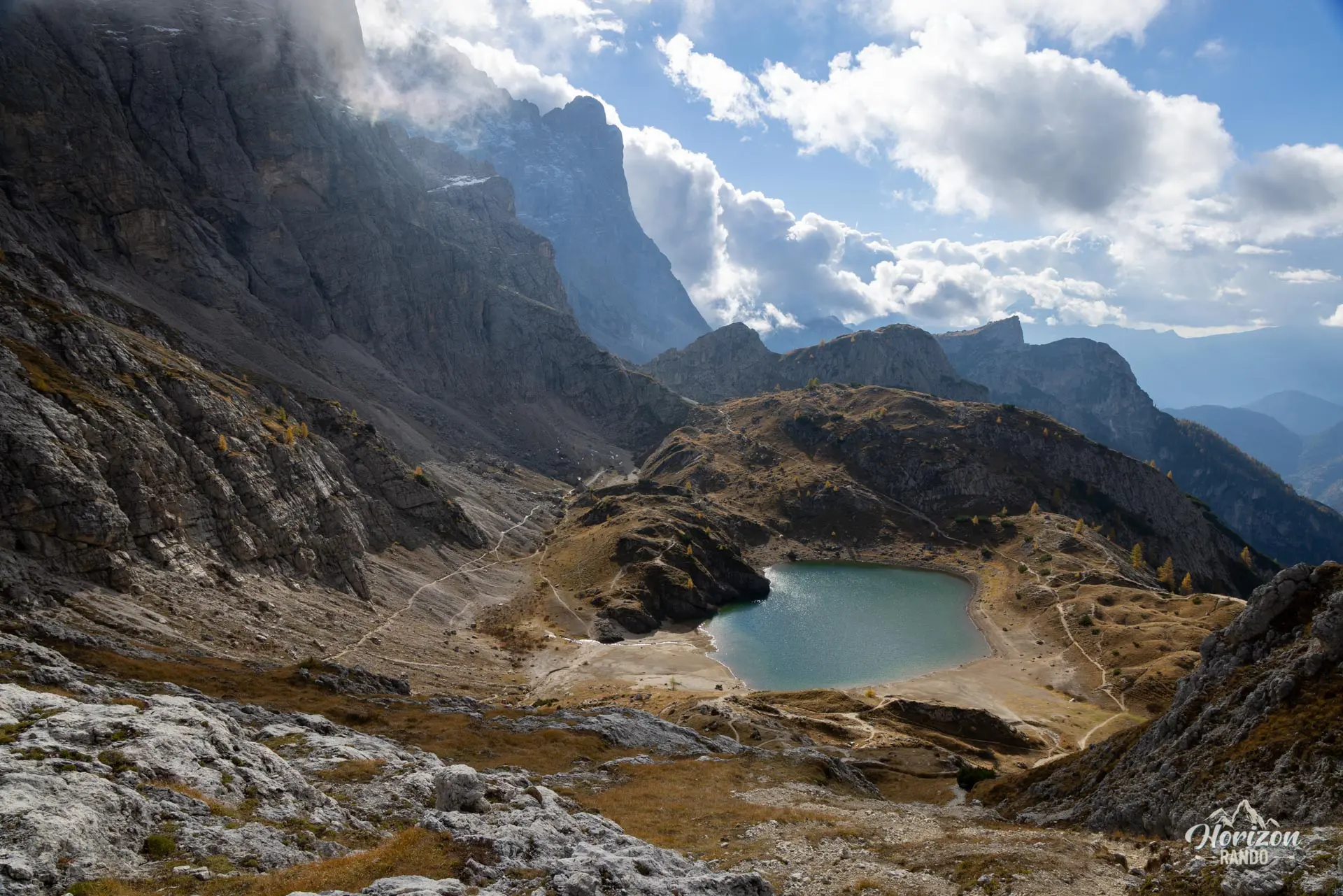
From the refuge, continue briefly toward Forcella Coldai, where you will get your first views of Lago di Coldai, nestled in a rocky cirque facing Civetta. After the refuge, signposts for Cima di Coldai appear. A trail branches off to the north on the right.
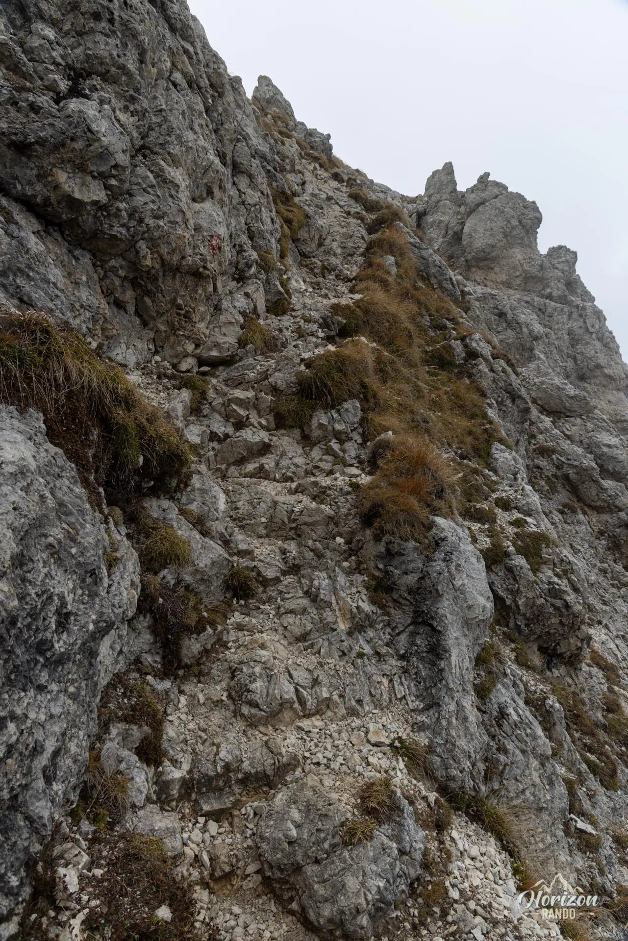
The terrain remains easy for most of the ascent until the final hundred meters. There, the trail narrows and becomes airy. A rock step requires some scrambling; no equipment is in place. It's short but technical.
After enjoying the magnificent panorama from the summit, descend via the same route.
What you'll love
- The exceptional summit views of nearby Civetta, Pelmo, Marmolada, and Val di Zoldo.
- Lake Coldai, with its deep blue waters reflecting the Civetta wall in a magnificent rock cirque.
- The tranquility of the summit, a luxury that has become rare in the Dolomites.
- The Rifugio Sonino al Coldai, ideal for a break on the way back.
Hike technical sheet
➡️ Hiking parameters
➡️ Hiking parameters
➡️ Hiking parameters
Map and elevation profile of the hike
Slideshow


Nearby hikes

Lago di Coldai Hike
- Difficulty : Moderate
- Duration : 3 h
- Distance : 8.3 km
- Elevation gain : 530 m

Col de la Puina Hike
- Difficulty : Moderate
- Duration : 3 h
- Distance : 7.3 km
- Elevation gain : 610 m

Monte Nuvolau, Monte Averau and Cinque Torri Circuit
- Hiking Difficulty : Hard
- Via Ferrata Difficulty : A/B (Easy)
- Duration : 5 h 30
- Distance : 11.4 km
- Elevation gain : 950 m

Monte Cernera Hike
- Difficulty : Moderate / Hard
- Duration : 2 h 45
- Distance : 5.9 km
- Elevation gain : 530 m
Map of the 11 closest hikes
Hikes to discover

Lago di Braies Loop
- Difficulty : Very easy
- Duration : 1 h 15
- Distance : 3.7 km
- Elevation gain : 90 m

Forca Rossa and Rifugio Fuciade Hike
- Difficulty : Moderate
- Duration : 4 h 15
- Distance : 10.9 km
- Elevation gain : 680 m

Via Ferrata Merlone - from Lago d'Antorno to Cima Cadin
- Hiking Difficulty : Moderate
- Via Ferrata Difficulty : B/C (Moderatly difficult)
- Duration : 6 h
- Distance : 9.6 km
- Elevation gain : 1010 m

Via Ferrata Innerkofler - Monte Paterno
- Hiking Difficulty : Moderate
- Via Ferrata Difficulty : A/B (Easy)
- Duration : 4 h 30
- Distance : 9.5 km
- Elevation gain : 650 m

Sass de Putia Hike and Via Ferrata
- Hiking Difficulty : Hard
- Via Ferrata Difficulty : A (Easy)
- Duration : 7 h
- Distance : 17.4 km
- Elevation gain : 1200 m

Via Ferrata Lipella - Tofana di Rozes Summit
- Hiking Difficulty : Hard
- Via Ferrata Difficulty : C/D (Difficult)
- Duration : 8 h
- Distance : 11.6 km
- Elevation gain : 1320 m