
Via Ferrata Innerkofler - Monte Paterno
Hike overview
The Via Ferrata Innerkofler, also known as De Luca, named after the two protagonists of a World War I battle fought on these rock faces. It ascends Monte Paterno (2,744 m) via its north face, right in the heart of the Tre Cime Nature Park.
This route is suitable for beginners and combines military tunnels, long exposed ledges, and a summit that offers one of the most beautiful views of the north faces of the Tre Cime di Lavaredo in the Dolomites. The downside is that it gets very crowded during peak season, with possible wait times at the equipped sections.
Remarks
Parking: starting in 2025, online reservations are required via the official website auronzo.info. Indicative rates in 2025: €40 per car, €26 per motorcycle, and €60 per camper van, valid for 12 hours. The best time slots sell out several weeks in advance during peak season.
Bus alternative: shuttles run from Cortina d'Ampezzo, Misurina, and Dobbiaco to Rifugio Auronzo from early June to mid-October. Online booking is recommended.
Equipment: a helmet, harness, and via ferrata lanyard are mandatory. A headlamp is recommended for the tunnels.
Ideal period: early July to late September. The access road closes in the winter. Exercise caution in the couloir below Forcella dei Camosci and on the scree slope toward Forcella Passaporto, as there may be snow or ice there early in the season and in the fall.
Description and difficulties of the hike
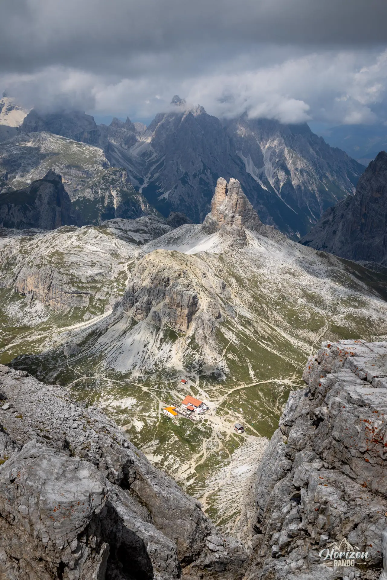
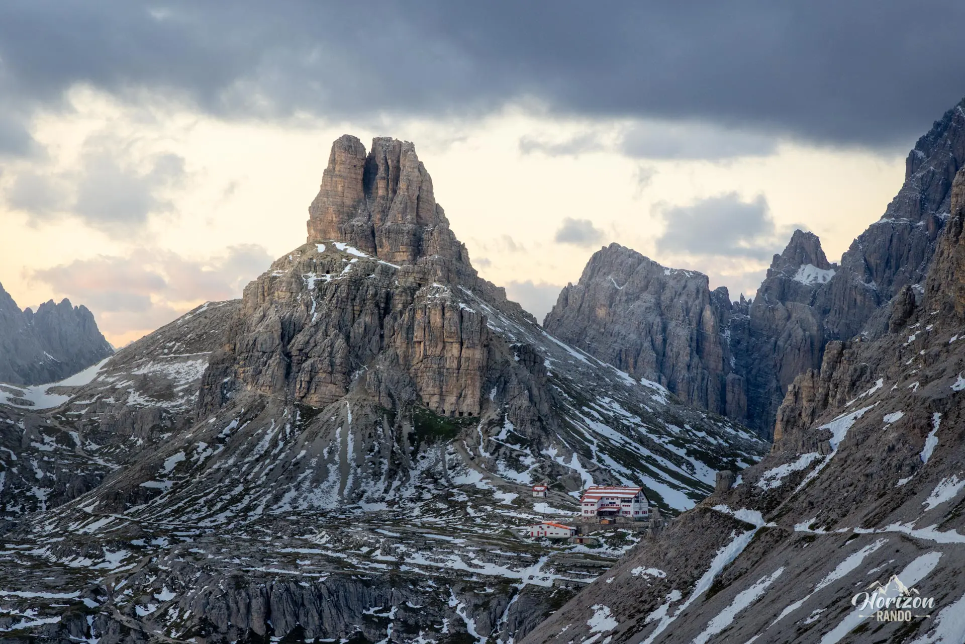
From the Rifugio Auronzo parking lot (2,330 m), take the wide trail no. 101 eastward beneath the south faces of the Tre Cime. Pass the Cappella degli Alpini and the Rifugio Lavaredo, then cross the Forcella Lavaredo (2,454 m). Here, you'll get your first view of the north faces of the three peaks and Monte Paterno. The trail then descends toward Rifugio Locatelli (2,450 m), reached after about 1 hour 15 minutes of walking.
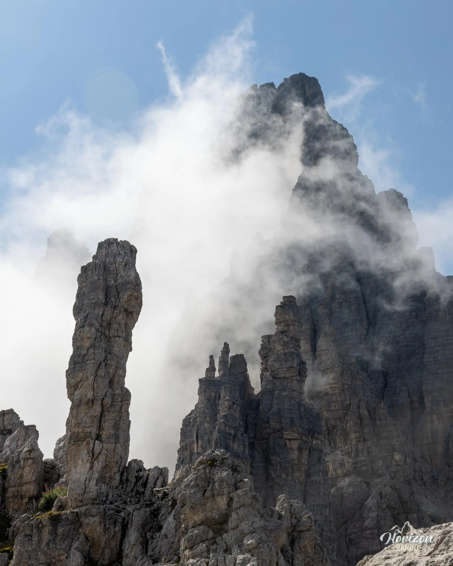
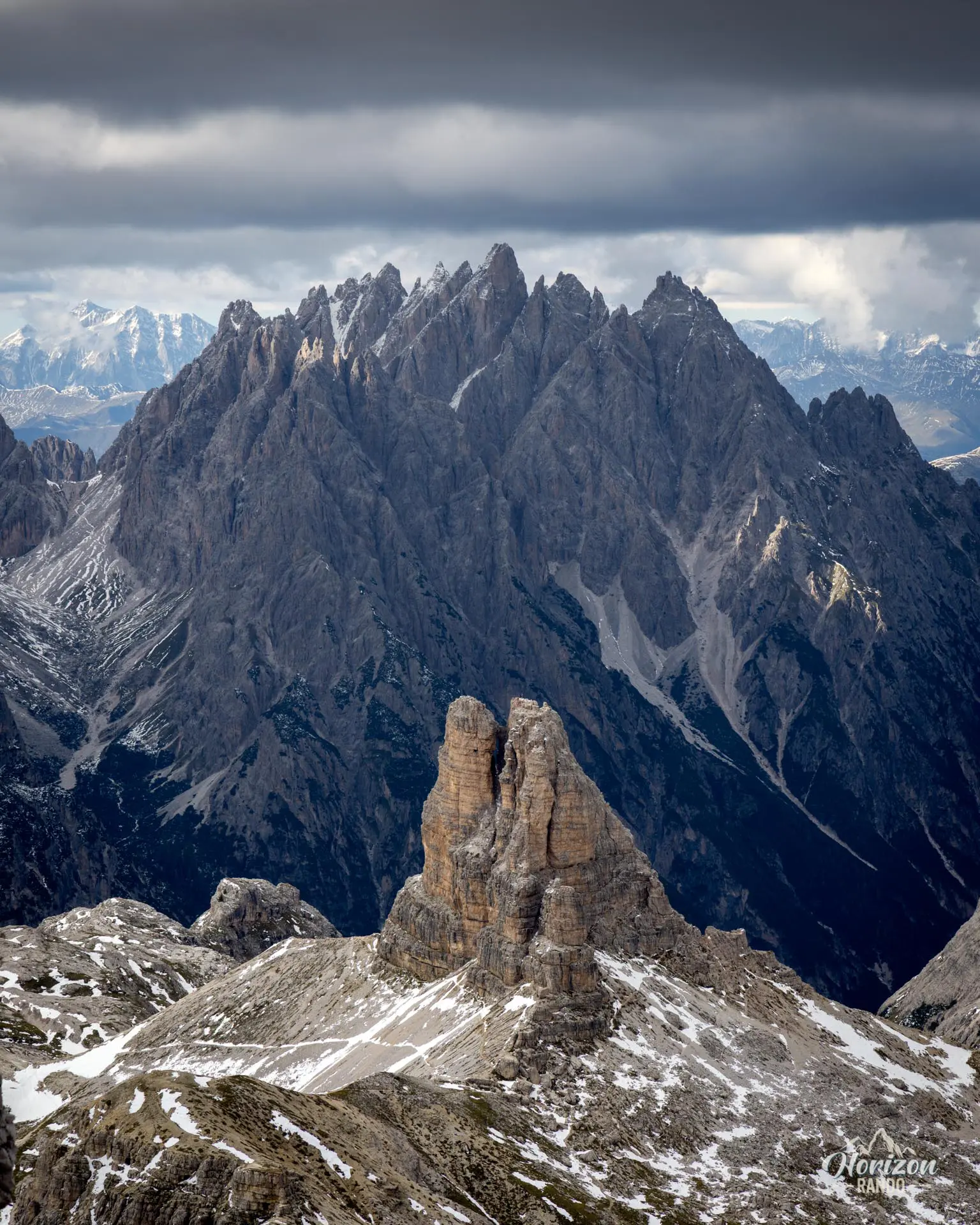
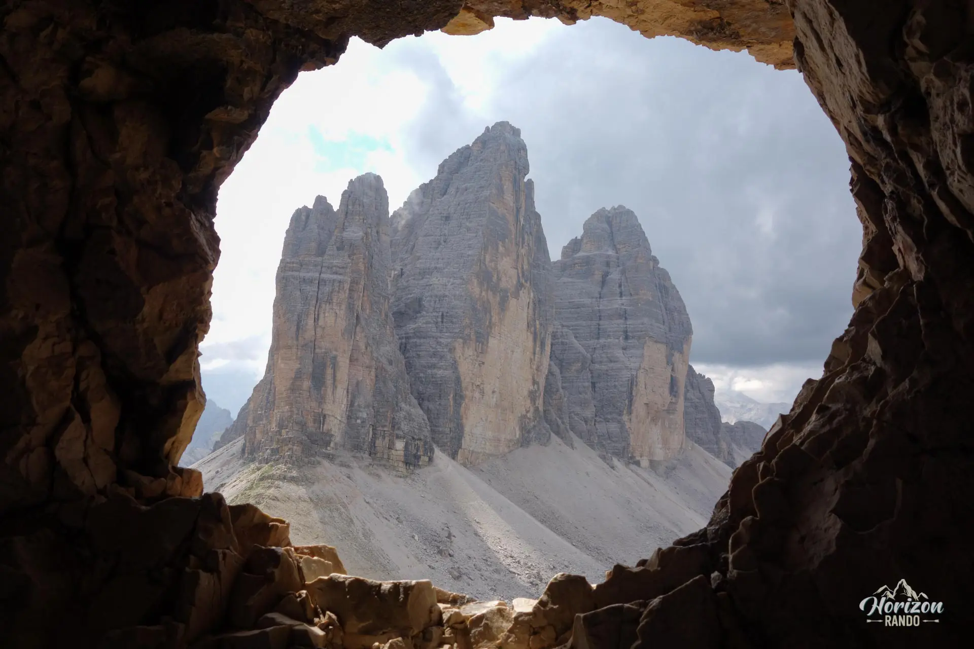
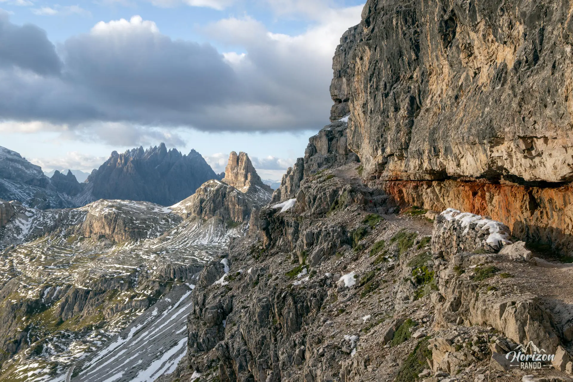
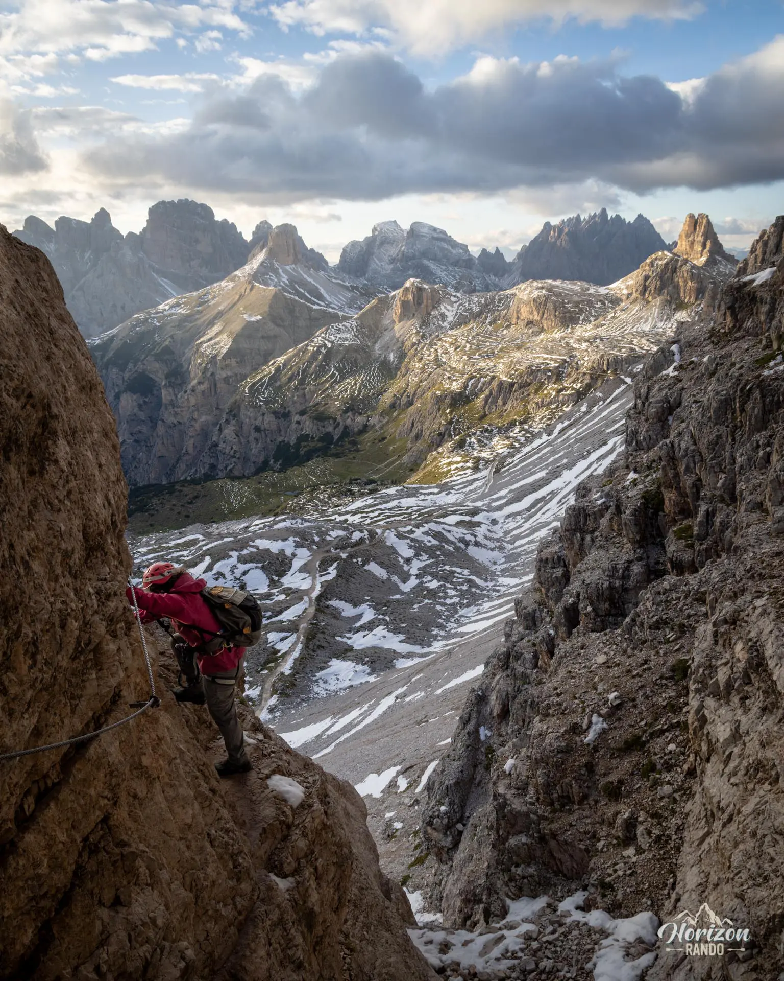
The start of the via ferrata is located just above the refuge. Pass the base of a distinctive pinnacle nicknamed Frankfurter Wurstl ("Frankfurt sausage"), which marks the entrance to a system of tunnels dug during World War I. The first tunnel has a low ceiling and a few natural openings. The second tunnel is about 300 m long, so a headlamp is essential as the light from the openings is insufficient. You will emerge onto the east face at around 2,500 meters, at the base of the via ferrata.
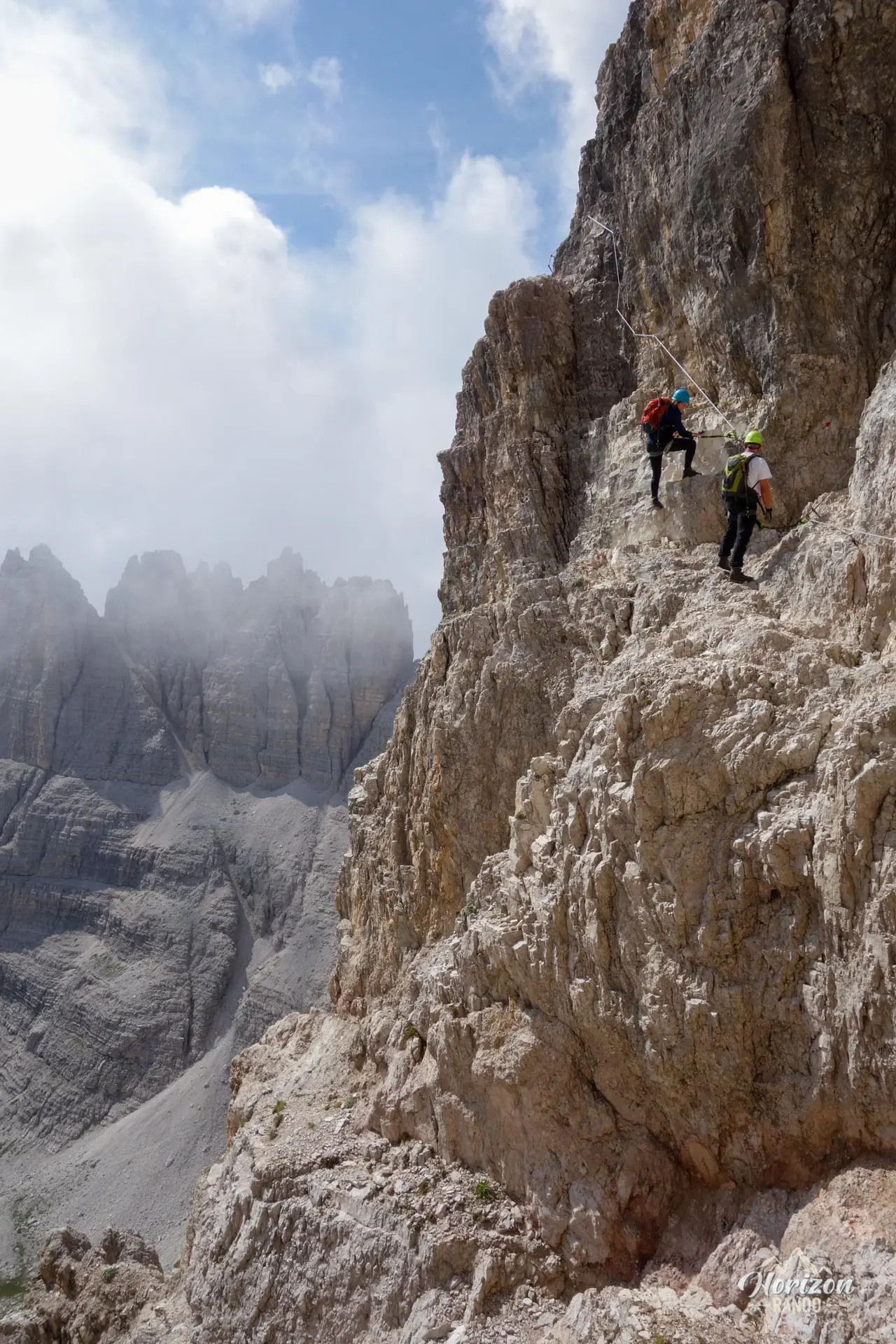
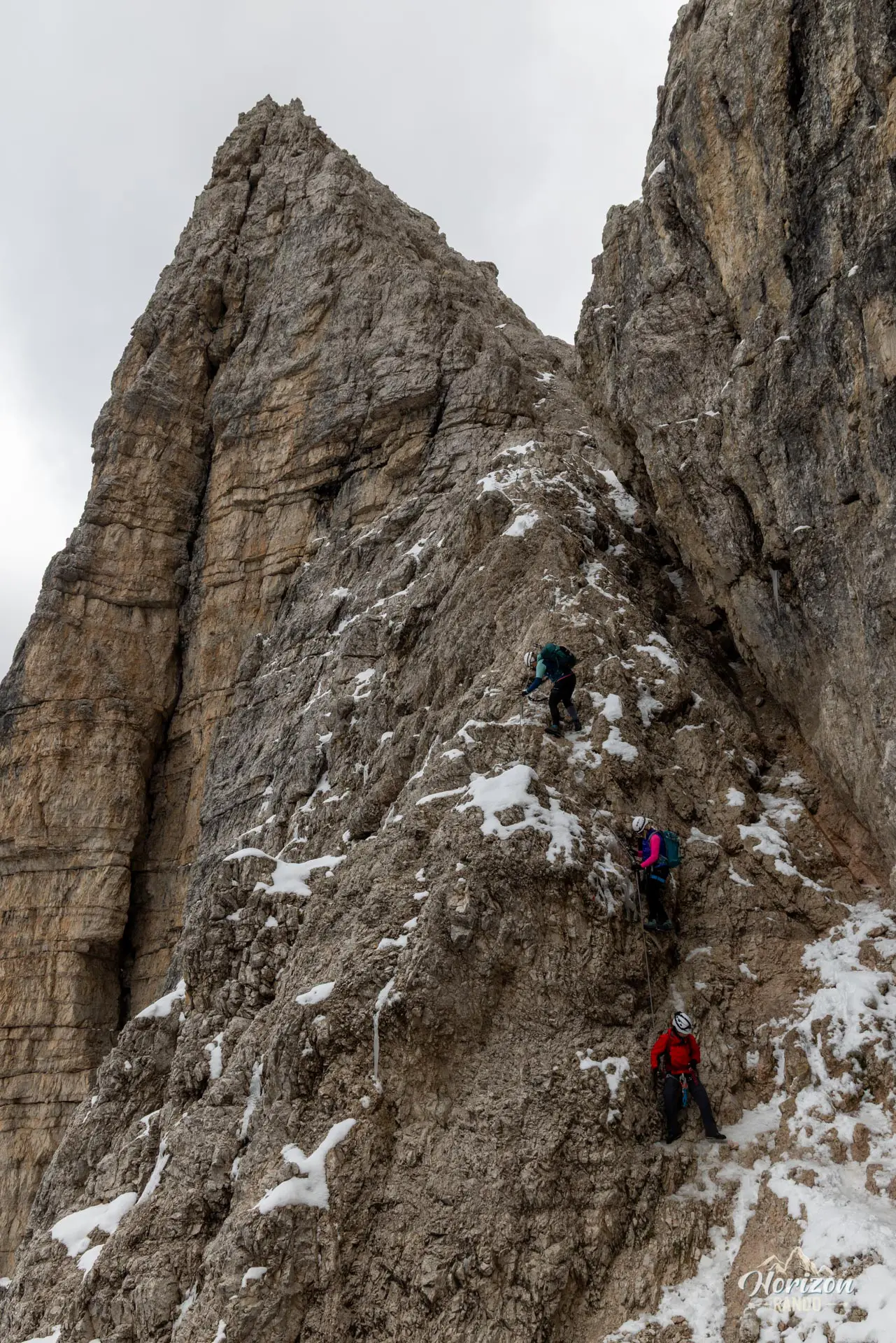
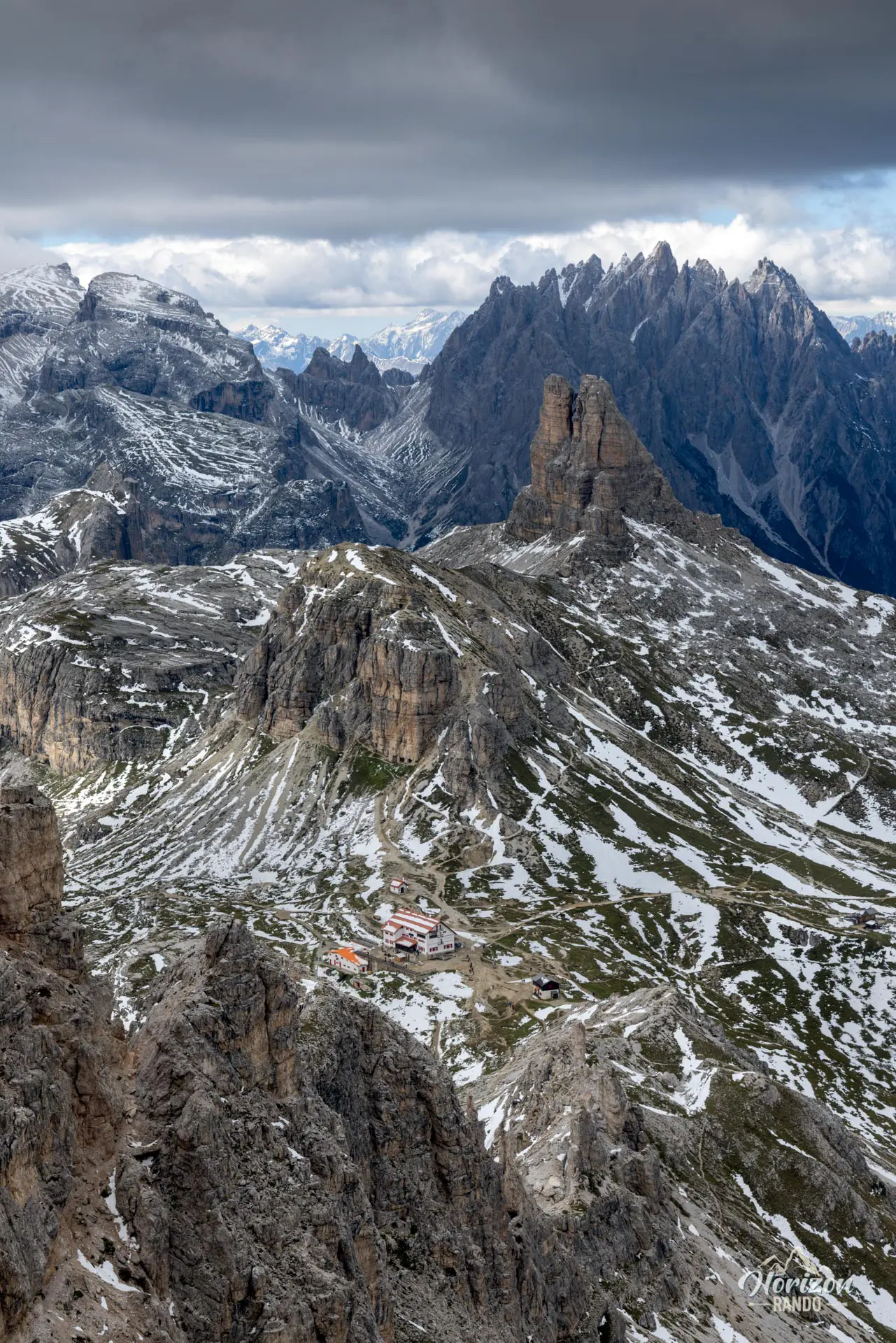
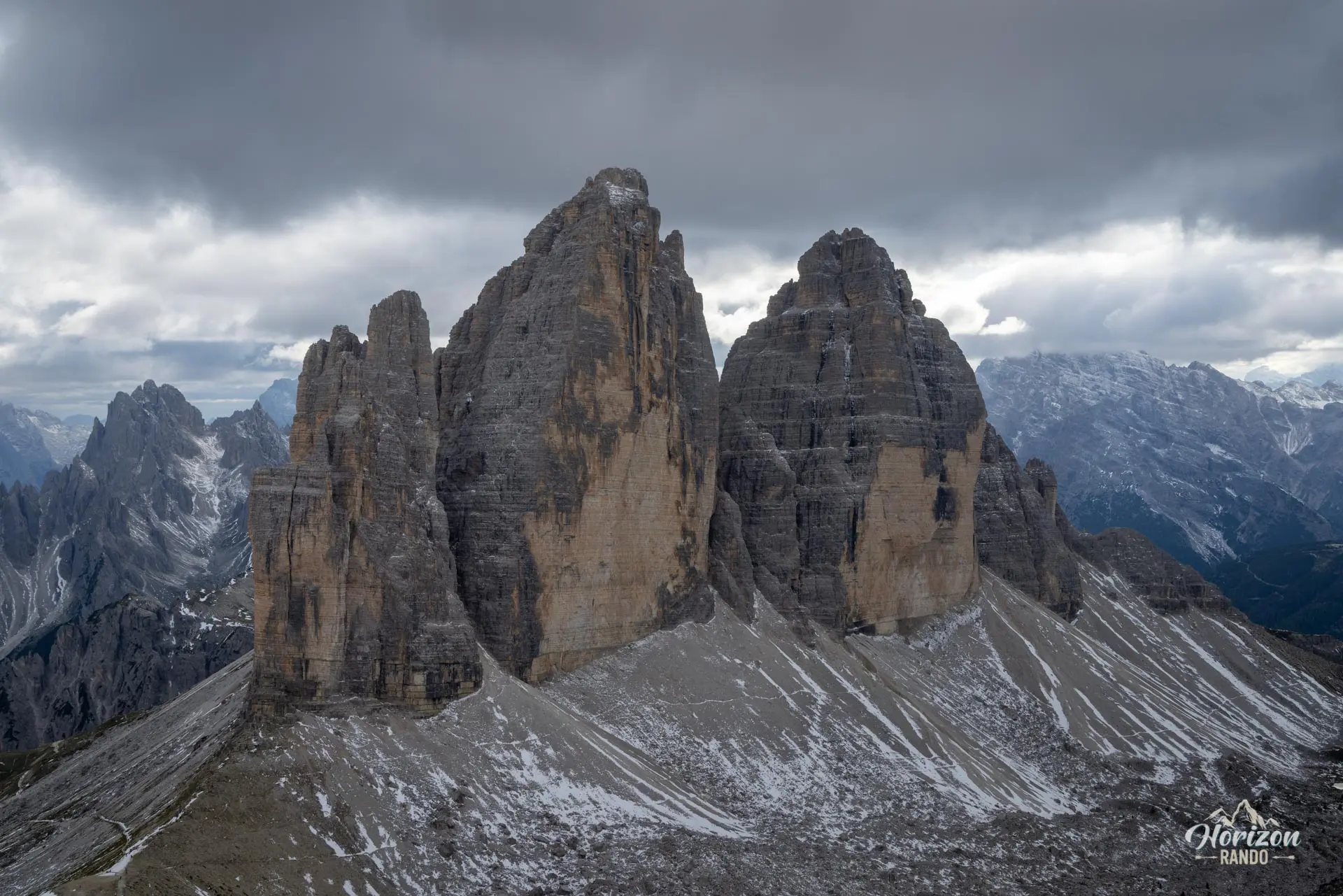
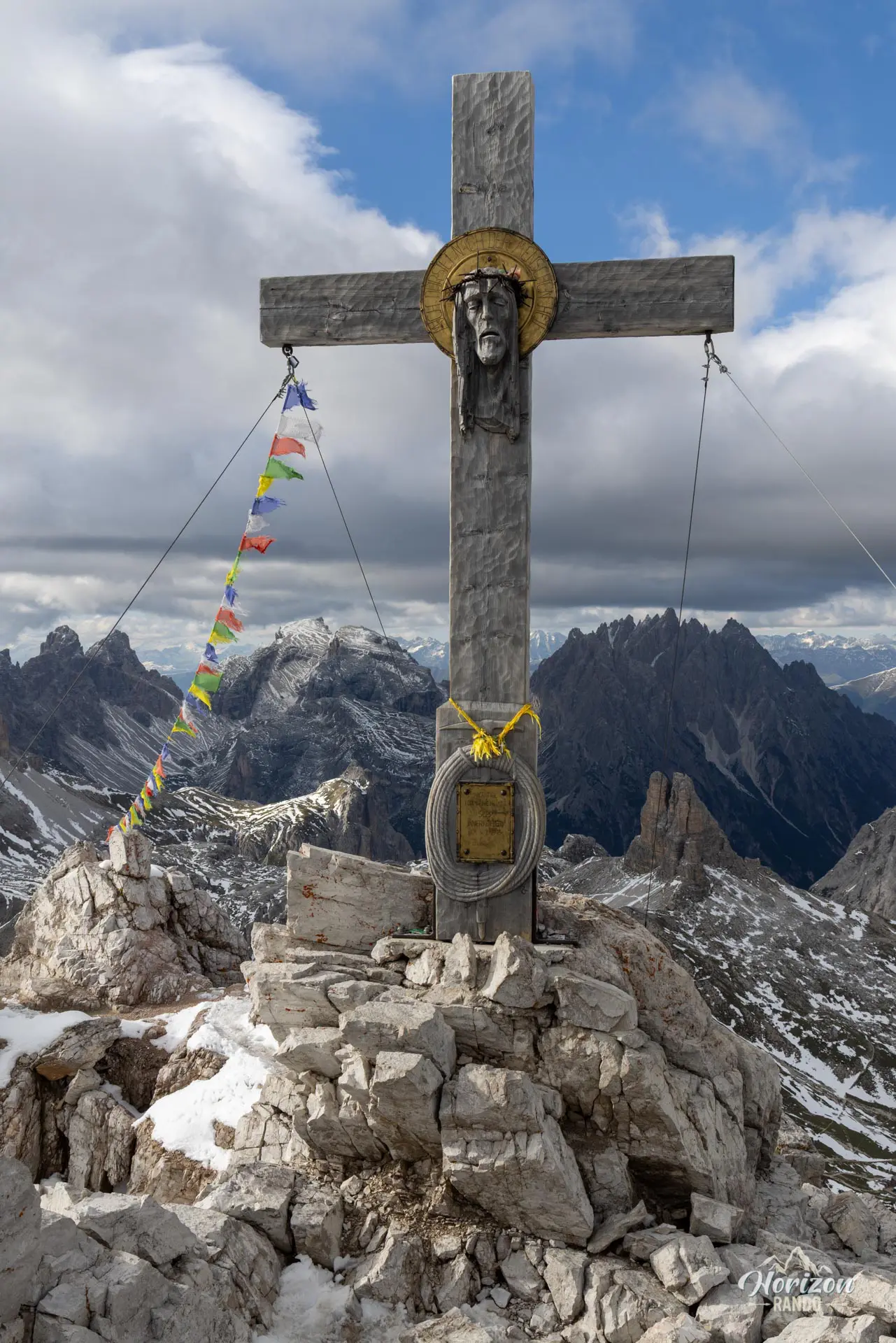
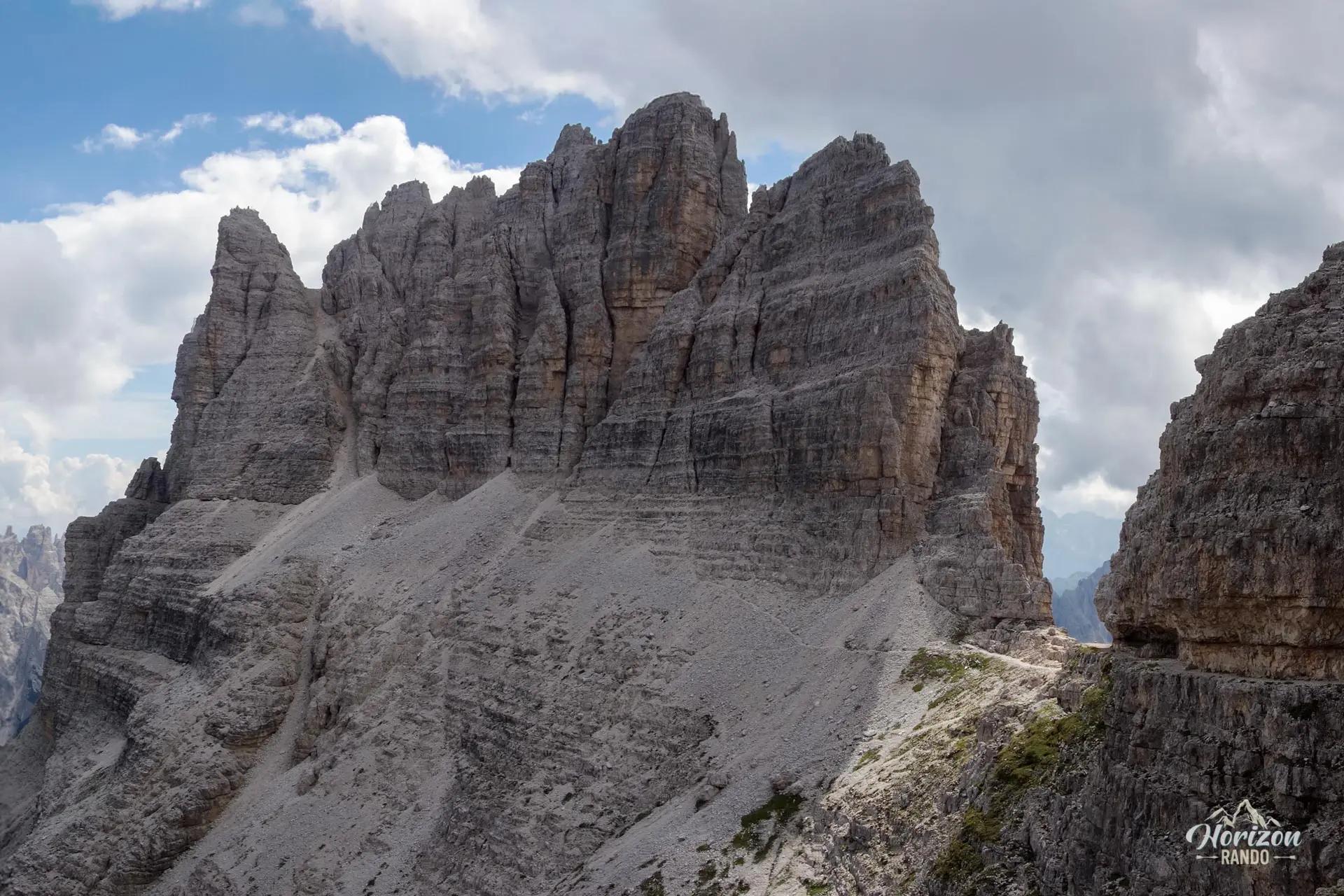
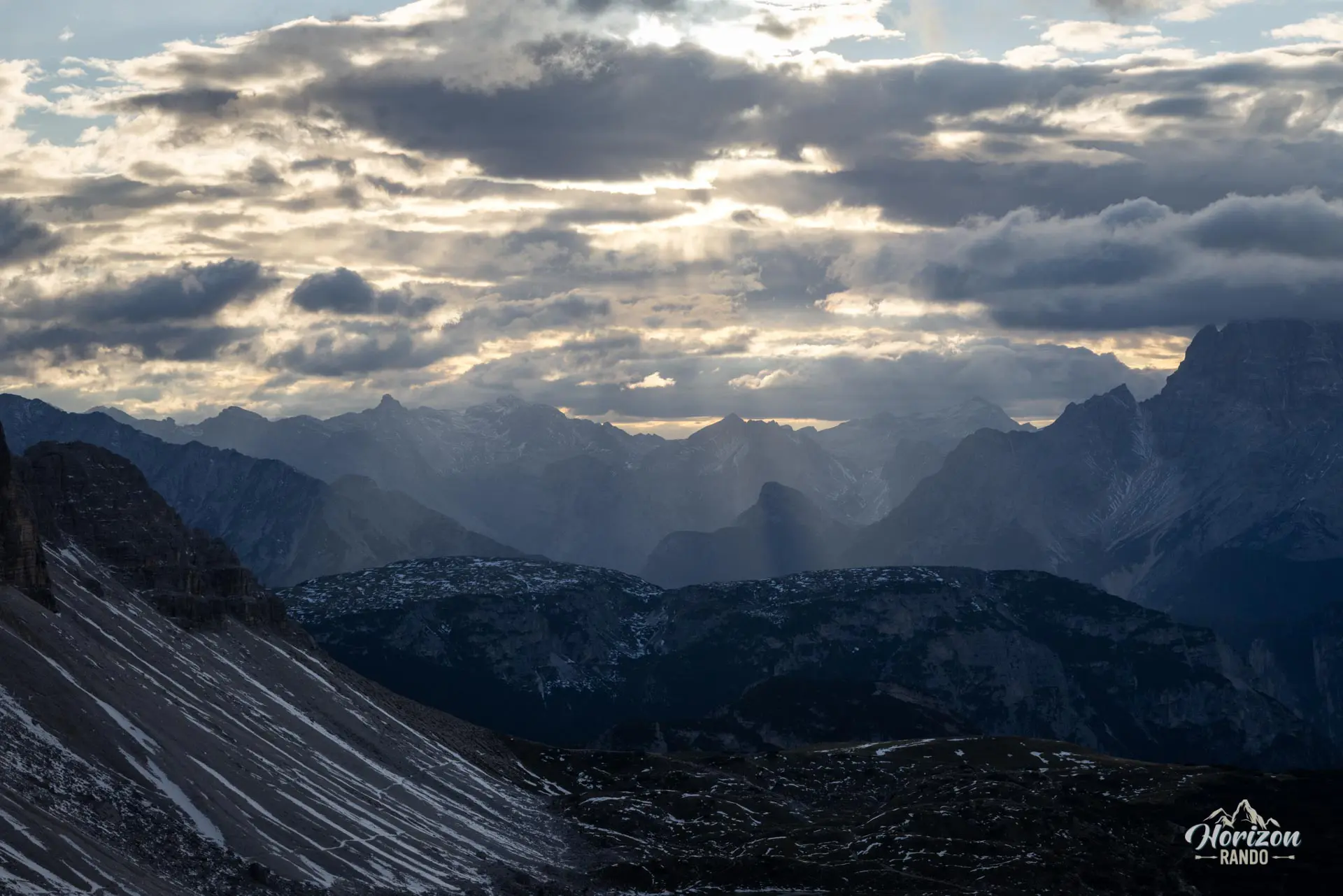
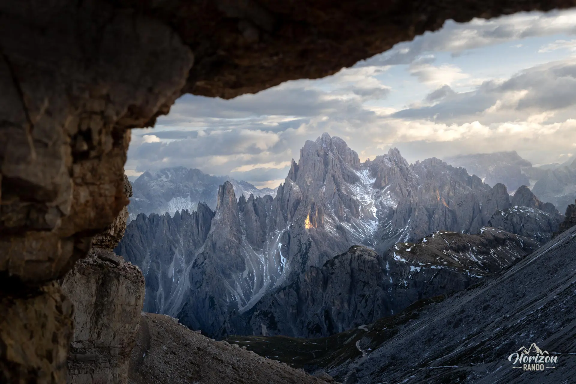
The via ferrata starts with a rock step with good handholds, a ledge, and a gully that leads to the Forcella dei Camosci (2,680 m). A 20-minute round trip from there takes you to the summit cross of Monte Paterno (2,744 m) via a final equipped section. The panorama includes the north faces of the Tre Cime, the Cadini di Misurina group, and the numerous jagged peaks of the Sesto Dolomites—an exceptional view.
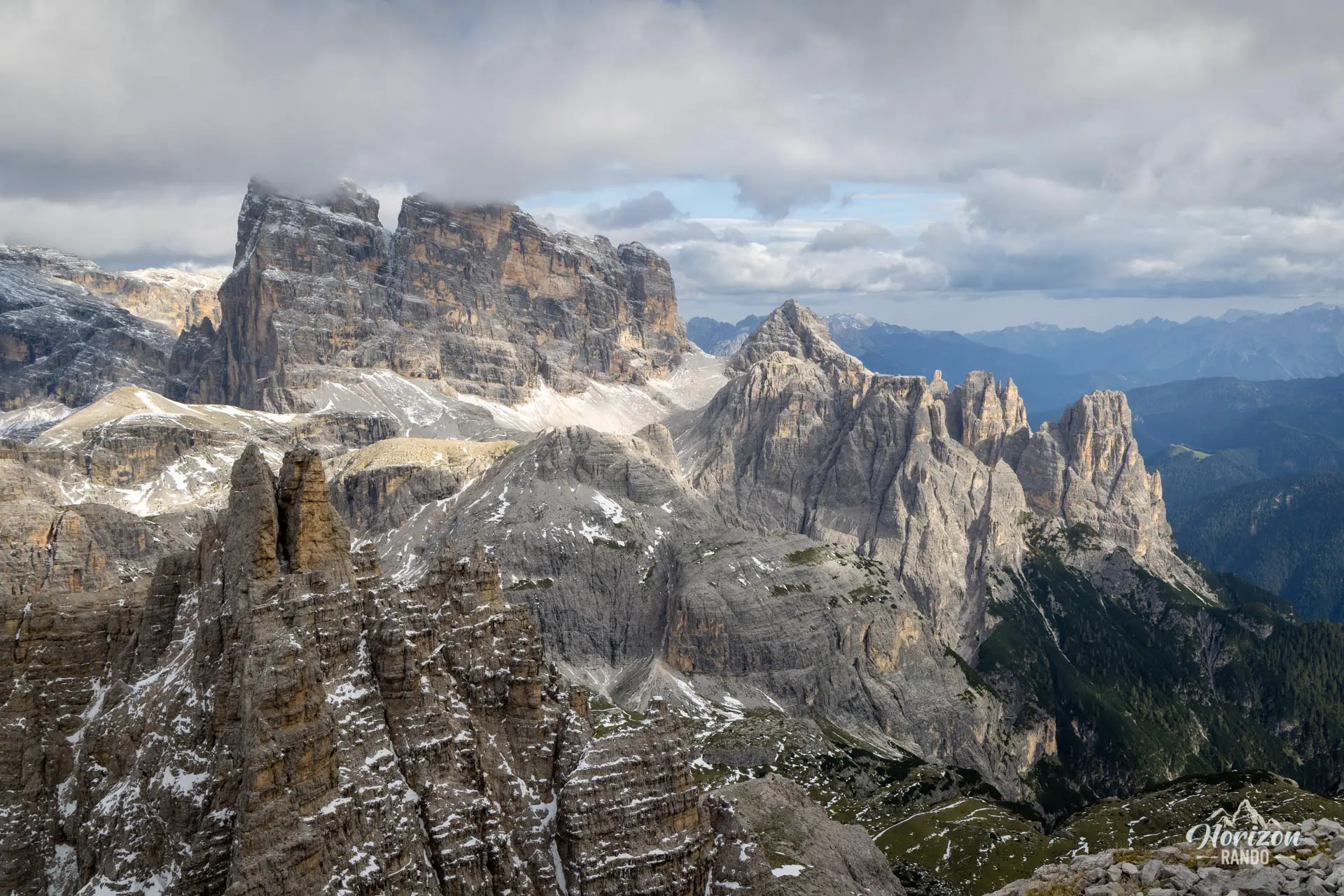
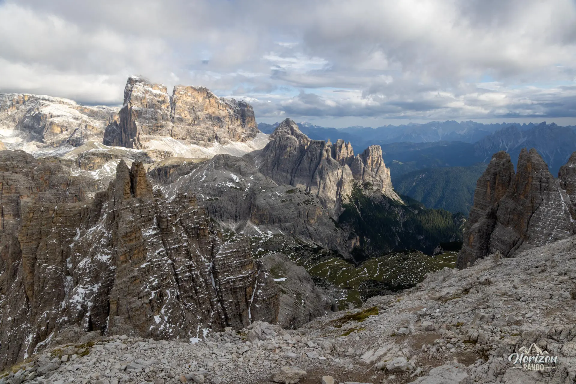
Back at Forcella dei Camosci, switch to the southeast face of Monte Paterno. The descent begins in an unequipped scree gully and continues along a narrow ledge, also without cables. This second section is less frequented. You move through an unusual silence, surrounded by vertical walls whose sheer scale is dizzying. You then alternate between equipped ledges and short tunnels, with the Tre Cime constantly in view — certainly one of the most beautiful vantage points in the park. Finally, you emerge at Forcella Lavaredo, where you rejoin trail no. 101, which takes you back to Rifugio Auronzo via the outward route.
What you'll love
- The panoramic views of the north rock faces of the Tre Cime, one of the most spectacular in the Dolomites.
- The ledges on the descent to Forcella Lavaredo, facing the Tre Cime — a spectacular viewpoint significantly less crowded than the rest of the route.
- The excellent introductory nature of the via ferrata: recent cables and short rock steps with plenty of handholds.
- The historical context: the via ferrata is dedicated to Sepp Innerkofler, a Tyrolean mountain guide who died in 1915 while attacking the Paterno, and Pietro De Luca, an Italian soldier who was defending the position.
Hike technical sheet
➡️ Hiking parameters
➡️ Hiking parameters
➡️ Hiking parameters
Map and elevation profile of the hike
Slideshow


Nearby hikes

Cadini di Misurina Viewpoint Hike
- Difficulty : Very easy
- Duration : 1 h 15
- Distance : 3.8 km
- Elevation gain : 200 m

Tre Cime di Lavaredo Loop
- Difficulty : Easy
- Duration : 3 h 30
- Distance : 9.2 km
- Elevation gain : 470 m

Lago d'Antorno to Rifugio Savio Hike
- Difficulty : Moderate
- Duration : 3 h
- Distance : 7.3 km
- Elevation gain : 580 m

Via Ferrata Merlone - from Lago d'Antorno to Cima Cadin
- Hiking Difficulty : Moderate
- Via Ferrata Difficulty : B/C (Moderatly difficult)
- Duration : 6 h
- Distance : 9.6 km
- Elevation gain : 1010 m
Map of the 11 closest hikes
Hikes to discover

Via Ferrata Lipella - Tofana di Rozes Summit
- Hiking Difficulty : Hard
- Via Ferrata Difficulty : C/D (Difficult)
- Duration : 8 h
- Distance : 11.6 km
- Elevation gain : 1320 m

Sass de Putia Hike and Via Ferrata
- Hiking Difficulty : Hard
- Via Ferrata Difficulty : A (Easy)
- Duration : 7 h
- Distance : 17.4 km
- Elevation gain : 1200 m

Via Ferrata Lipella - Tofana di Rozes Loop
- Hiking Difficulty : Moderate
- Via Ferrata Difficulty : C (Difficult)
- Duration : 6 h
- Distance : 9.2 km
- Elevation gain : 810 m

Monte Mulaz Hike
- Difficulty : Hard
- Duration : 7 h 30
- Distance : 18.6 km
- Elevation gain : 1420 m

Lago Limides, Monte Nuvolau and Cinque Torri Circuit
- Difficulty : Moderate
- Duration : 4 h 30
- Distance : 11.1 km
- Elevation gain : 790 m

Lago di Braies Loop
- Difficulty : Very easy
- Duration : 1 h 15
- Distance : 3.7 km
- Elevation gain : 90 m