
Via Ferrata Lipella - Tofana di Rozes Loop
Hike overview
The Giovanni Lipella Via Ferrata is one of the great equipped routes in the Dolomites. It ascends the west face of Tofana di Rozes (3,225 m), passing through the spectacular Castelletto Gallery and along airy ledges and an impressive rocky amphitheater.
The Tofana di Rozes loop follows the same ascent route as the summit route, but it branches off at the Tre Dita. It then heads directly to the Giussani Hut via the bypass path (Cantore), bypassing the final amphitheater and the summit. This is a more accessible variant that allows you to discover the most beautiful sections of the via ferrata while reducing the technical and physical demands.
Remarks
Parking: large free parking area at the Dibona refuge. Note: a height restriction barrier (2.45 m) applies on the last 4 km of gravel road from the junction with SR 48 Cortina–Passo Falzarego.
Equipment: helmet, harness, lanyard with shock absorber, and headlamp (essential in the tunnel).
Ideal period: from mid-July to mid-September when the snow patches have melted and the risk of black ice is reduced. As the rock face is north-west-facing, it remains cool and damp for much of the day.
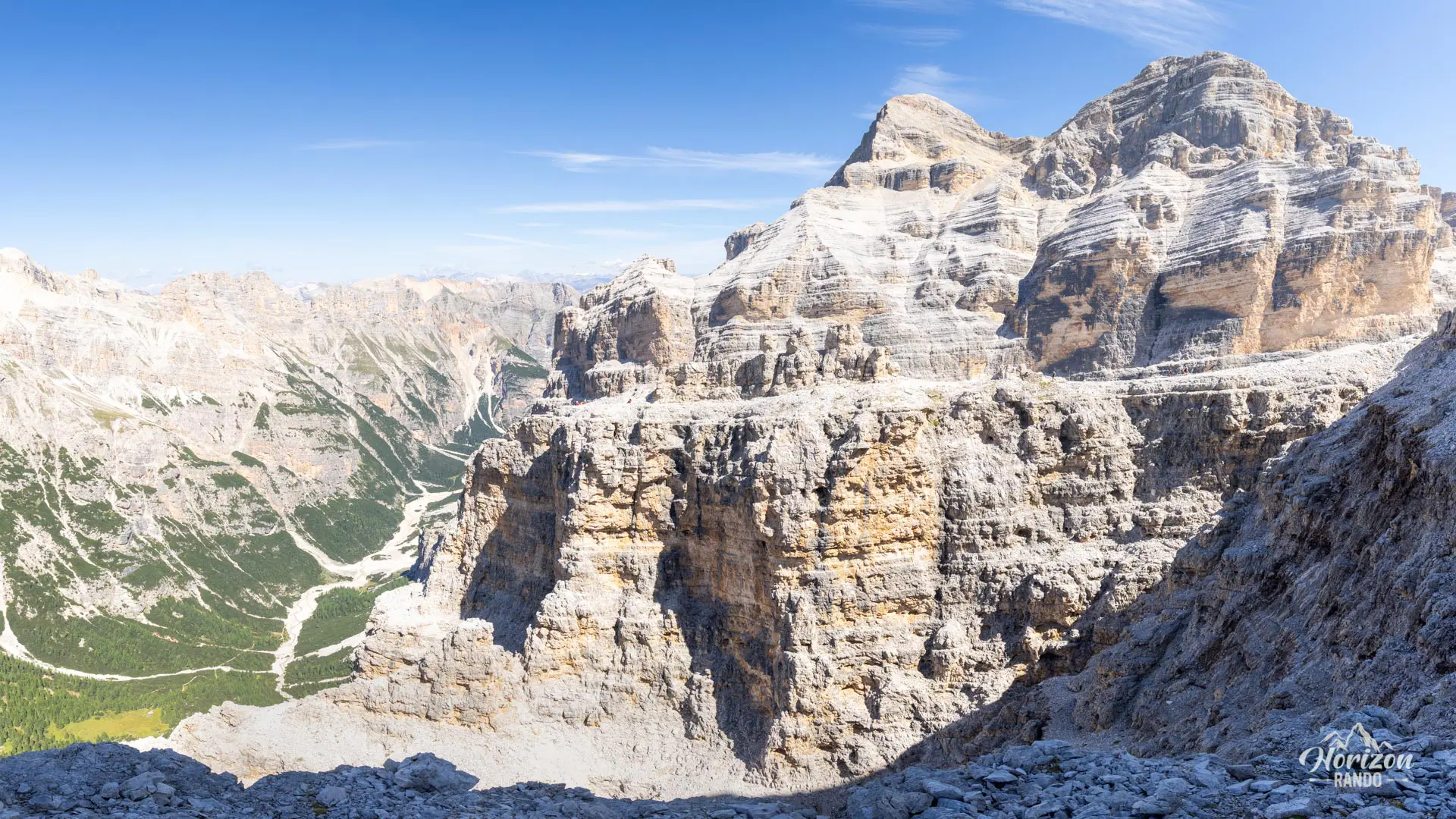
Alternative route to the summit: to continue to the summit of Tofana di Rozes (3,225 m), follow the "cima" branch at Tre Dita and traverse the final amphitheater. See the guide for the Lipella via ferrata - summit of Tofana di Rozes.
Description and difficulties of the hike
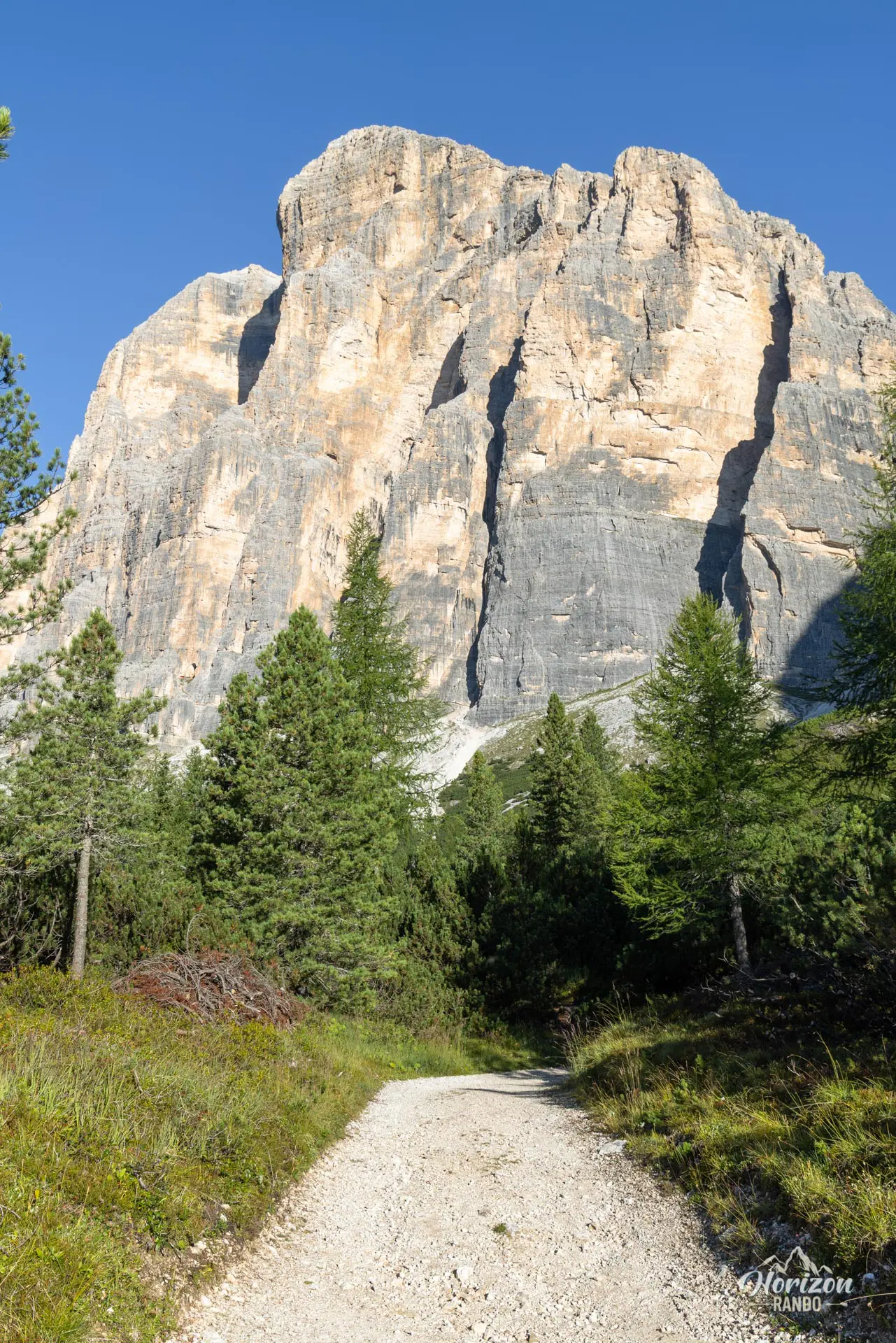
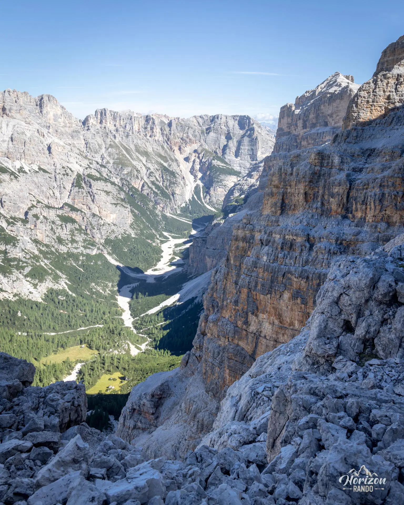
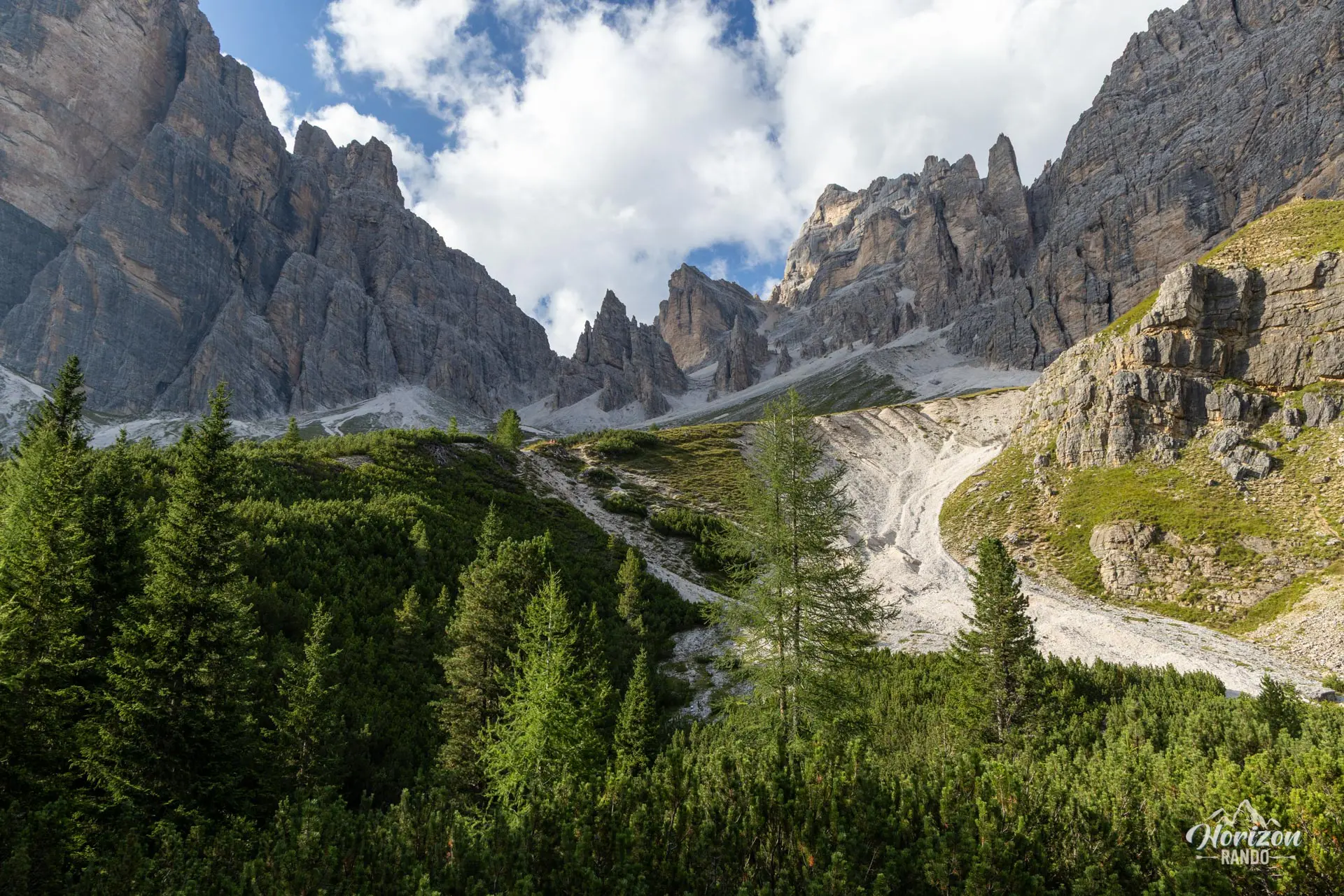
From the Dibona Refuge (2,037 m), follow the wide trail westward, then Trail No. 404, which runs alongside the imposing south face of Tofana di Rozes. The approach takes about an hour to reach the Castelletto Gallery (2,475 m). The start is easy to miss: a commemorative plaque set into the rock marks the tunnel entrance.
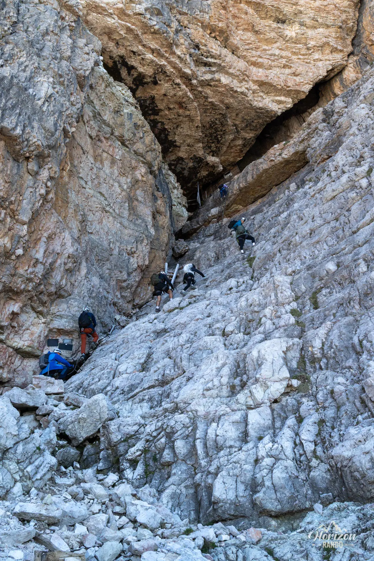
A short equipped section and a metal ladder lead to the tunnel entrance, which was dug by the Alpini during World War I. The tunnel is approximately 500 meters long, with a 100-meter elevation drop. A headlamp is essential as it is pitch black for long stretches and the ground is often damp and slippery. The embrasures and observation posts carved into the walls attest to the site's strategic importance between 1915 and 1917.
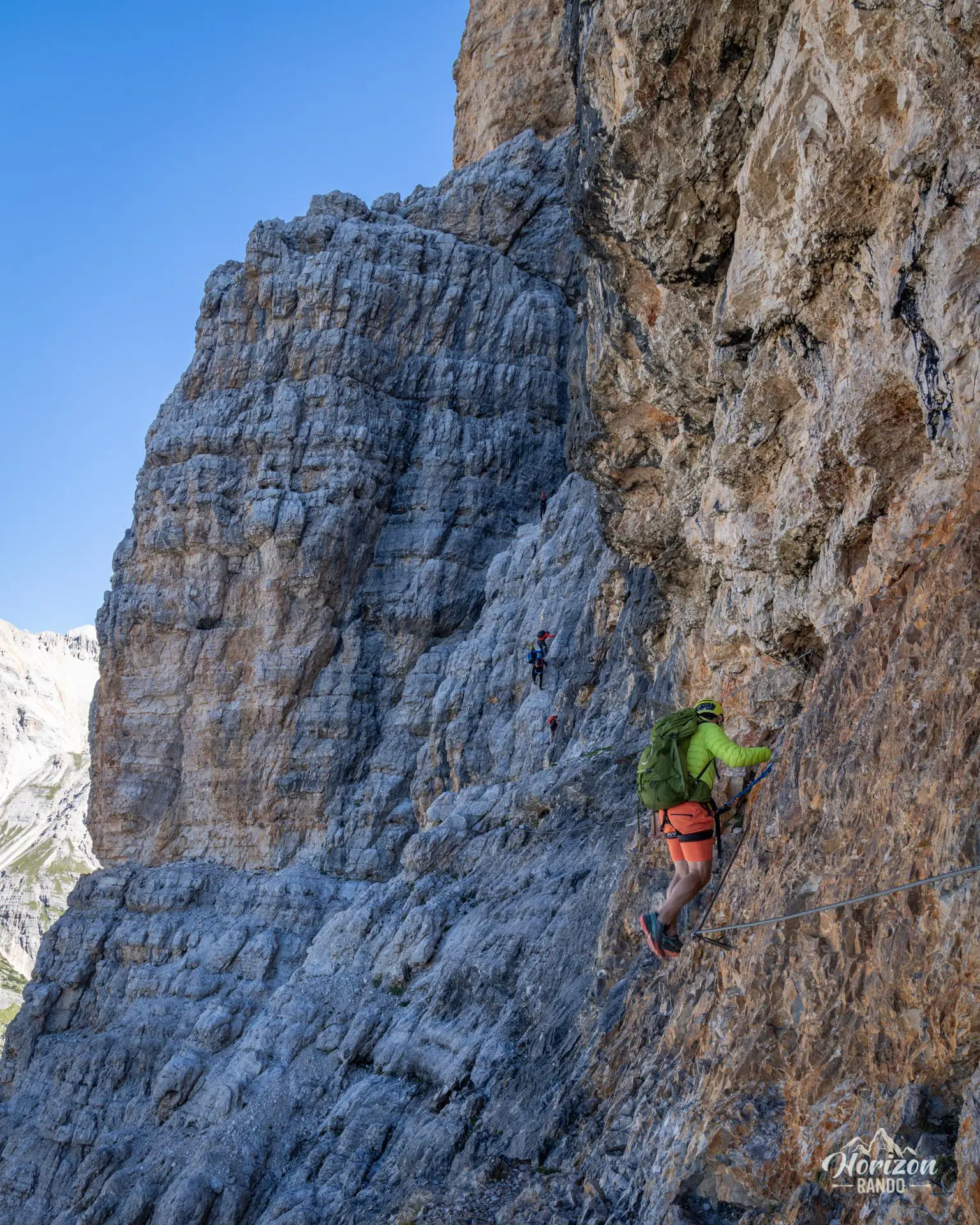
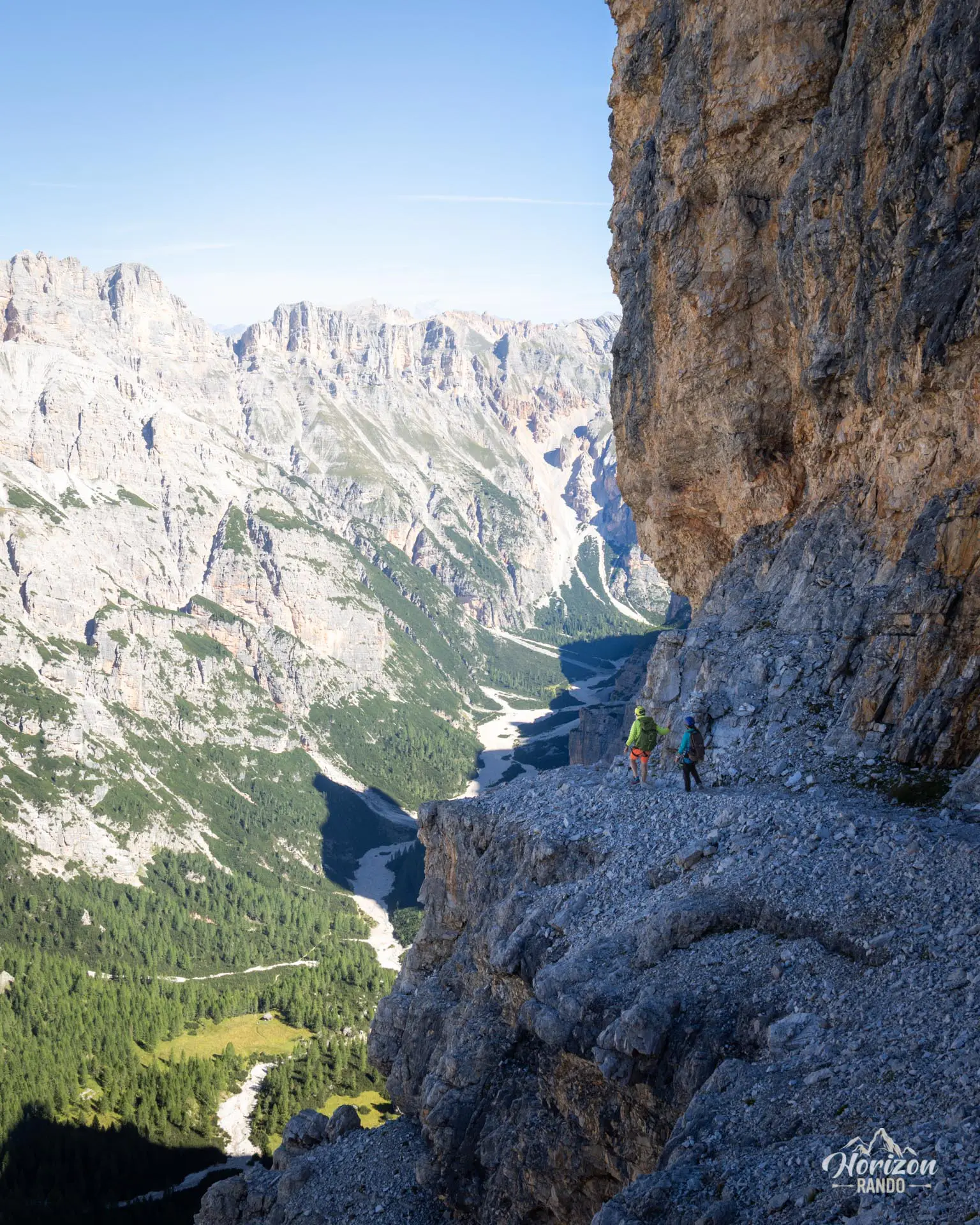
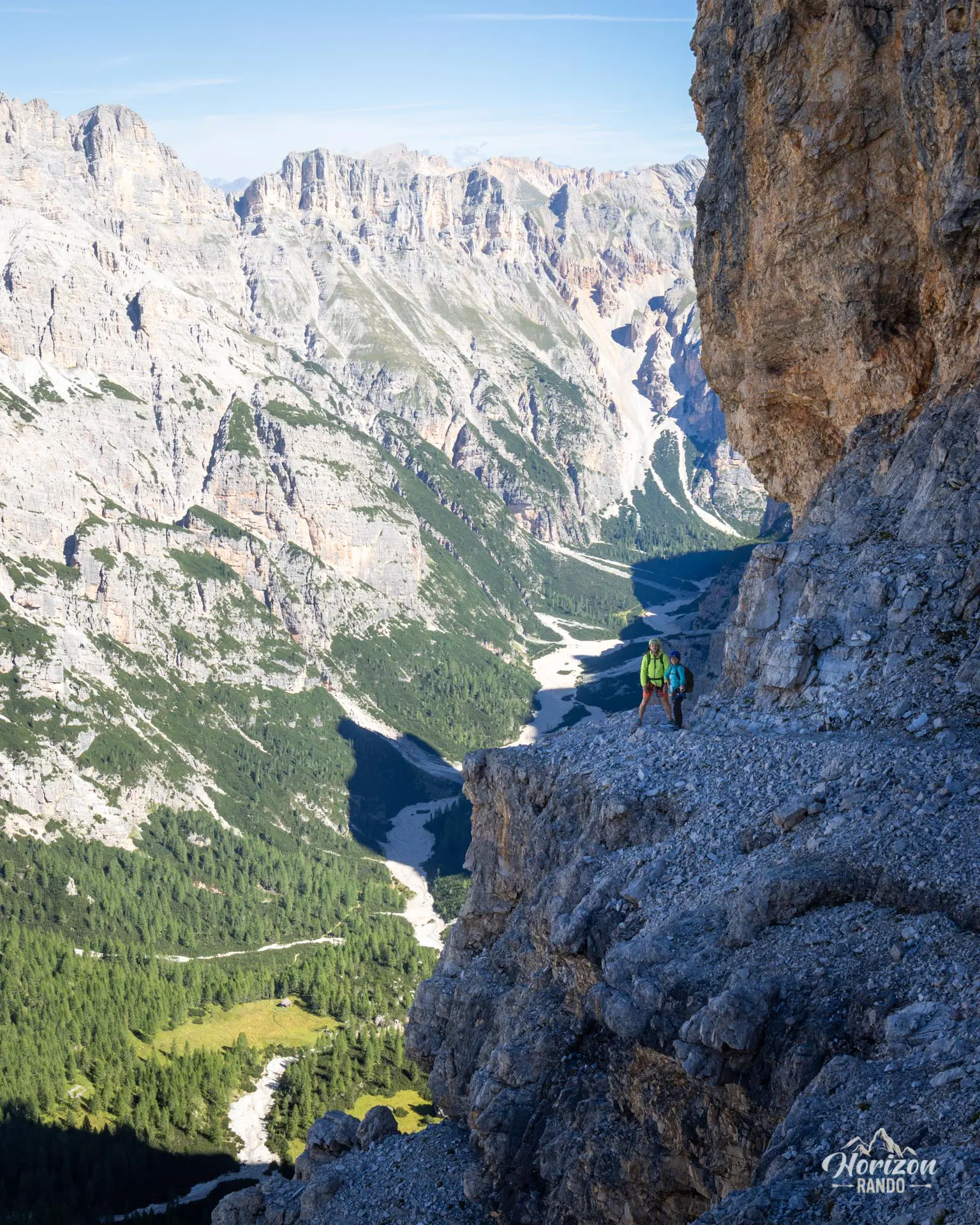
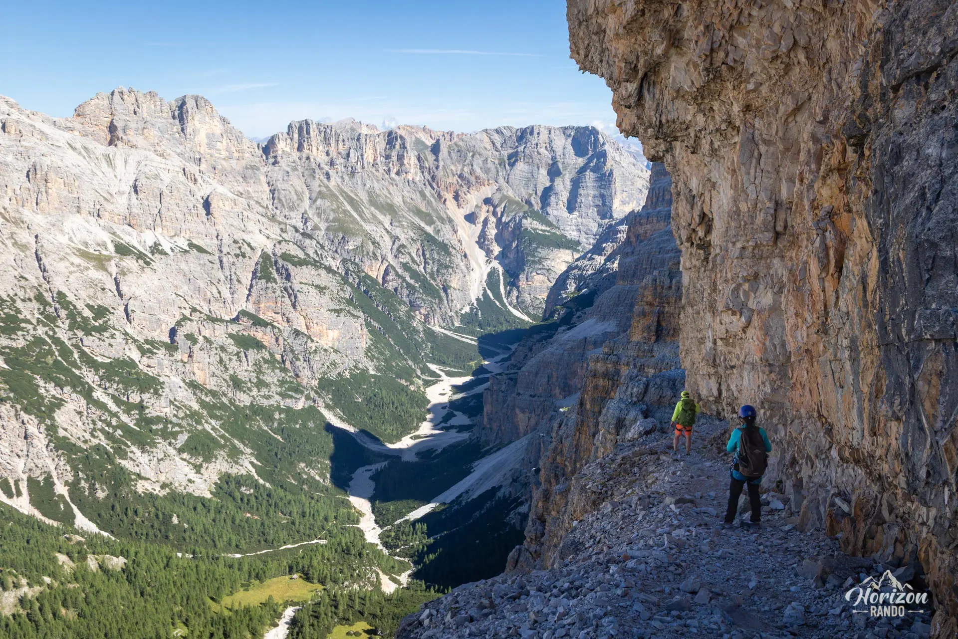
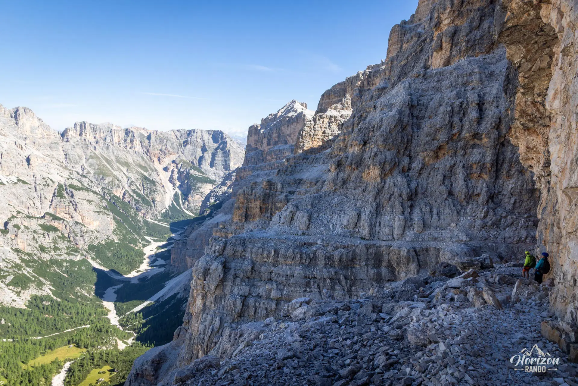
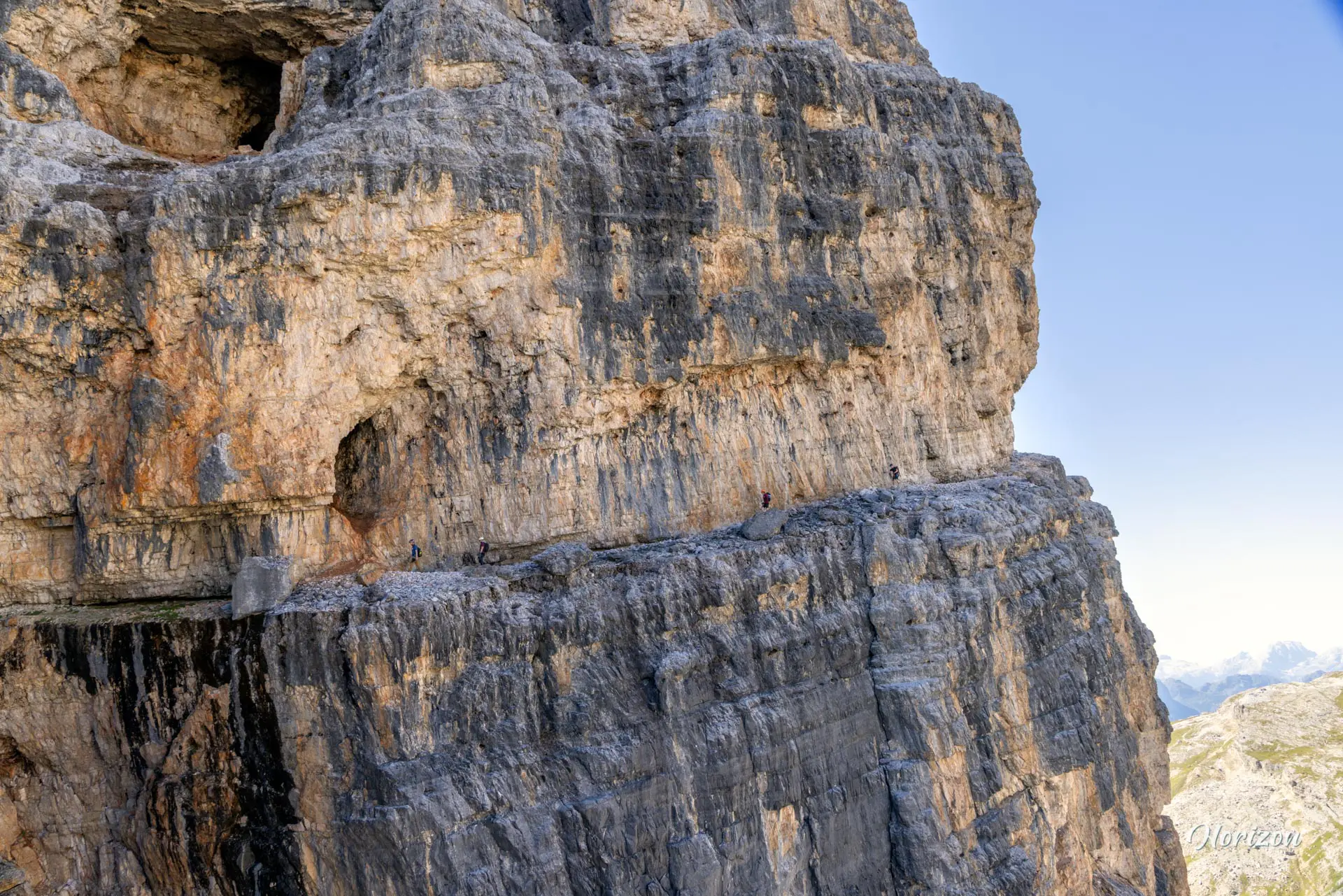
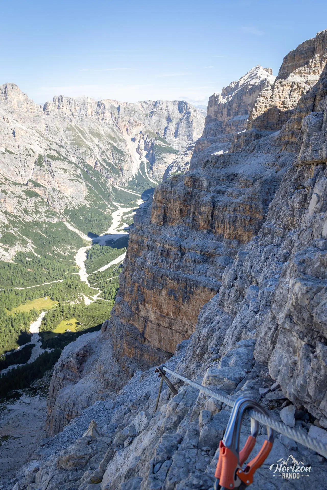
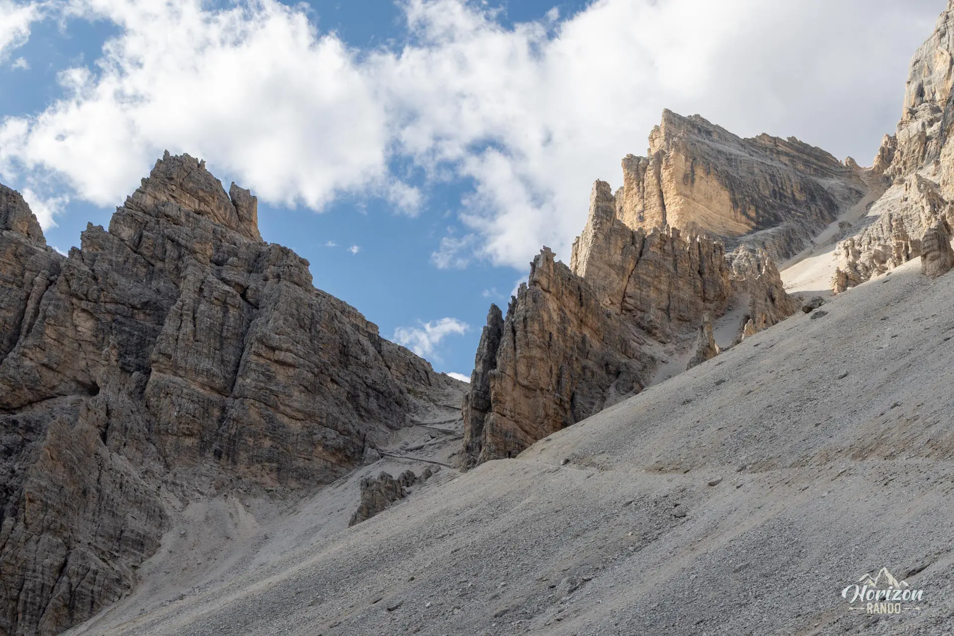
From the tunnel exit, about twenty minutes of walking leads to the start of the via ferrata proper (2,520 m). It alternates between short rock steps, long partially equipped ledges, and diagonal traverses. The holds are generally good, and the difficulty remains moderate (around C), despite a few exposed sections.
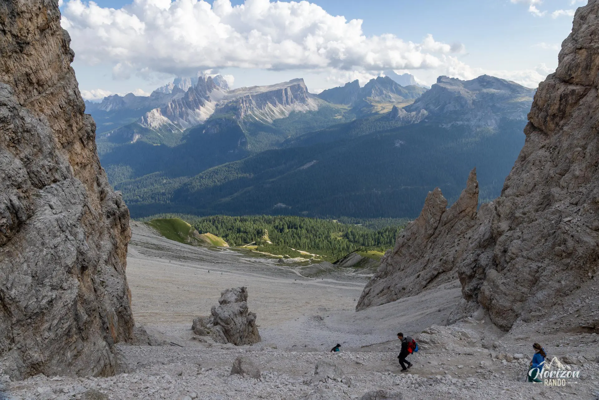
Near Tre Dita (2,696 m), you will reach a fork: to the left is the escape route (marked "Cantore") toward Rifugio Giussani, and to the right is the summit ("Cima"). For this loop, take the left fork. The trail skirts around Tofana di Rozes and gently descends toward Rifugio Giussani (2,580 m). From the refuge, the straightforward Trail No. 403 leads back to the parking lot in about an hour.
What you'll love
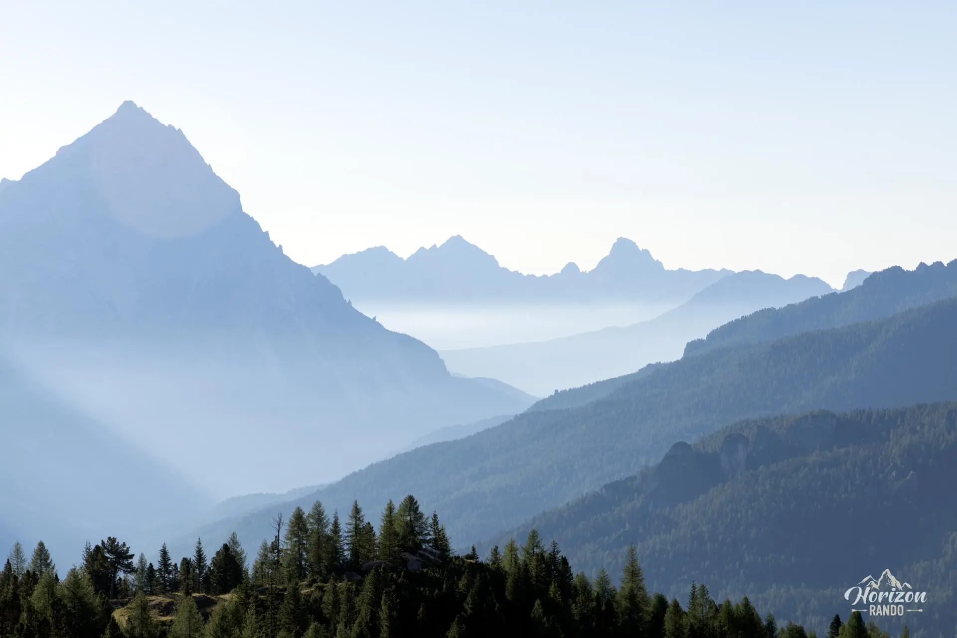
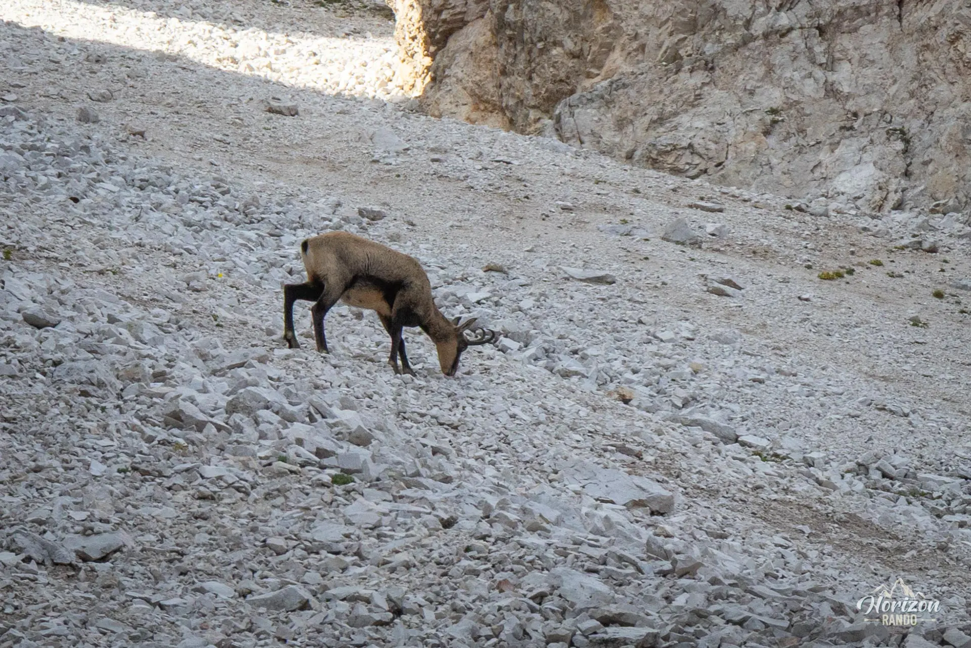
- The varied route featuring war tunnels, airy ledges, equipped rock steps, and stunning views of Lagazuoi and the Tofane massif.
- The Castelletto Gallery, steeped in the history of the Alpini and the Italian front.
- The well-deserved break at Rifugio Giussani, situated in a rocky cirque at the foot of Tofana di Mezzo.
Hike technical sheet
➡️ Hiking parameters
➡️ Hiking parameters
➡️ Hiking parameters
Map and elevation profile of the hike
Slideshow
Nearby hikes

Tofana di Rozes Hike
- Difficulty : Hard
- Duration : 6 h
- Distance : 10.5 km
- Elevation gain : 1180 m

Via Ferrata Lipella - Tofana di Rozes Summit
- Hiking Difficulty : Hard
- Via Ferrata Difficulty : C/D (Difficult)
- Duration : 8 h
- Distance : 11.6 km
- Elevation gain : 1320 m

Via Ferrata Ra Bujela
- Hiking Difficulty : Easy
- Via Ferrata Difficulty : B/C (Moderatly difficult)
- Duration : 3 h 30
- Distance : 6.3 km
- Elevation gain : 600 m

Cinque Torri Hike
- Difficulty : Easy
- Duration : 2 h 45
- Distance : 6.9 km
- Elevation gain : 450 m
Map of the 10 closest hikes
Hikes to discover

Via Ferrata Averau
- Hiking Difficulty : Moderate
- Via Ferrata Difficulty : A/B (Easy)
- Duration : 3 h 30
- Distance : 8.4 km
- Elevation gain : 580 m

Via Ferrata Sass Rigais
- Hiking Difficulty : Very Hard
- Via Ferrata Difficulty : A (Easy)
- Duration : 6 h 30
- Distance : 11 km
- Elevation gain : 1080 m

Via Ferrata Ivano Dibona and Marino Bianchi
- Hiking Difficulty : Very Hard
- Via Ferrata Difficulty : C (Difficult)
- Duration : 11 h
- Distance : 15.9 km
- Elevation gain : 1810 m

Piz Boè and Piz Selva Hike
- Difficulty : Hard
- Duration : 6 h 30
- Distance : 16.2 km
- Elevation gain : 930 m

Sass de Putia Hike and Via Ferrata
- Hiking Difficulty : Hard
- Via Ferrata Difficulty : A (Easy)
- Duration : 7 h
- Distance : 17.4 km
- Elevation gain : 1200 m

Lago di Braies Loop
- Difficulty : Very easy
- Duration : 1 h 15
- Distance : 3.7 km
- Elevation gain : 90 m