
Piz Boè and Piz Selva Hike
Hike overview
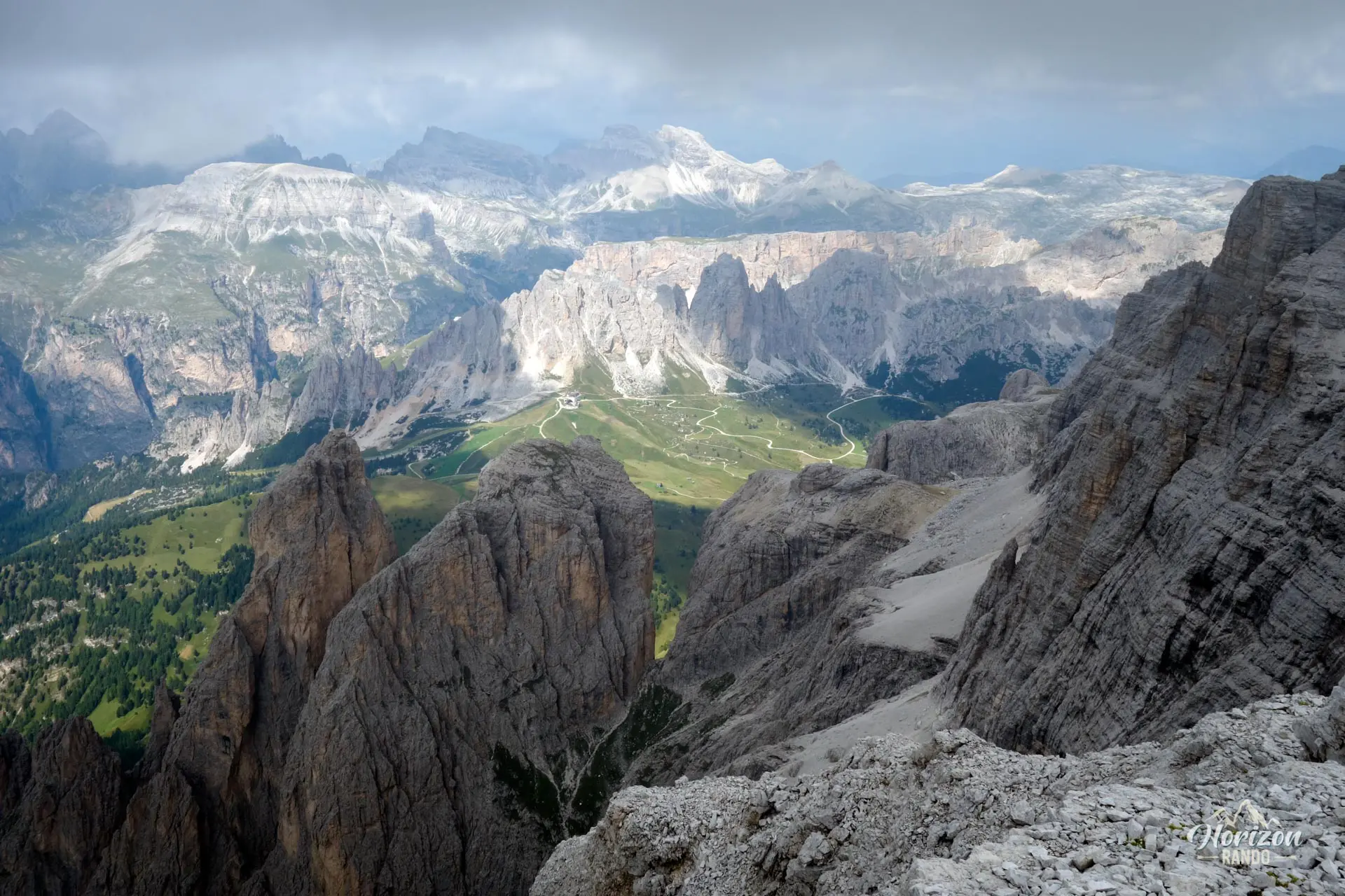
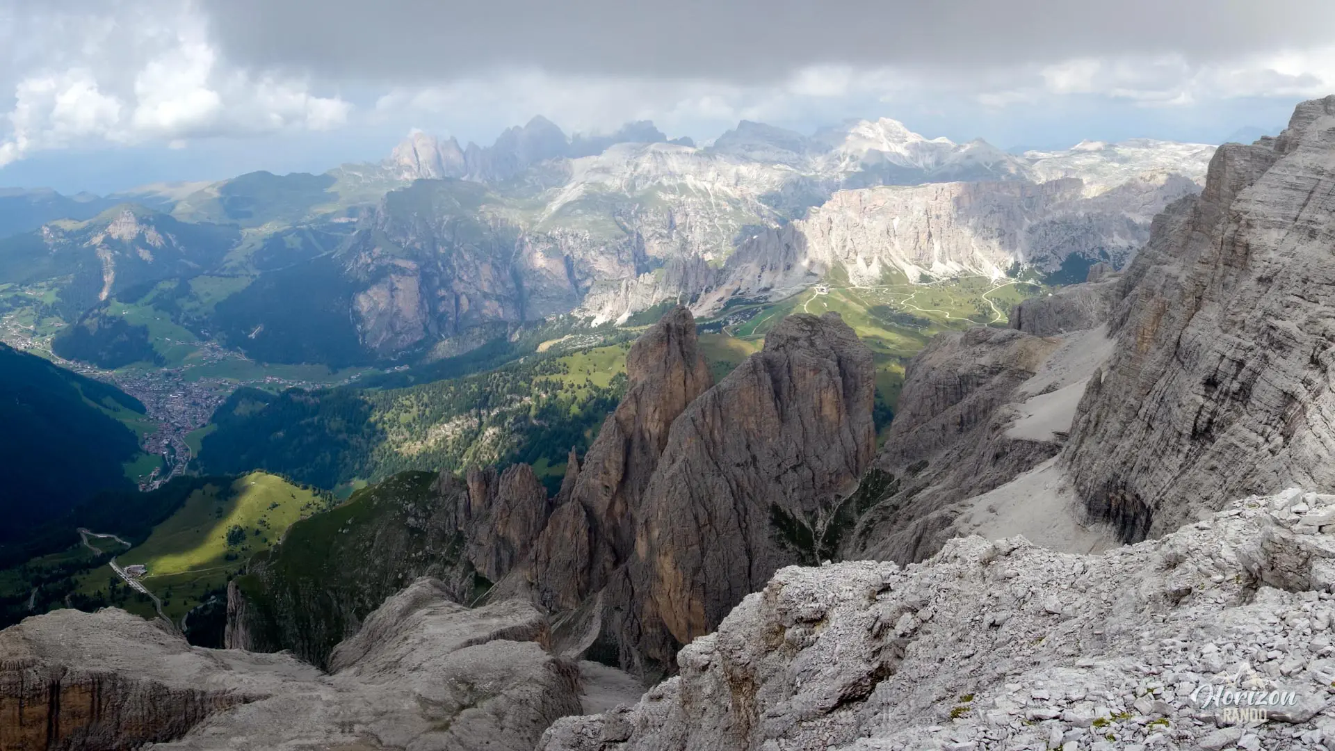
This hike extends the classic ascent of the Piz Boè by crossing the Altipiano delle Mesules, a vast, rocky plateau perched over 2,900 meters high in the heart of the Sella Massif. After passing Rifugio Boè, you will make your way through an almost lunar landscape to Piz Selva (2,940 m), which towers steeply over Val Gardena.
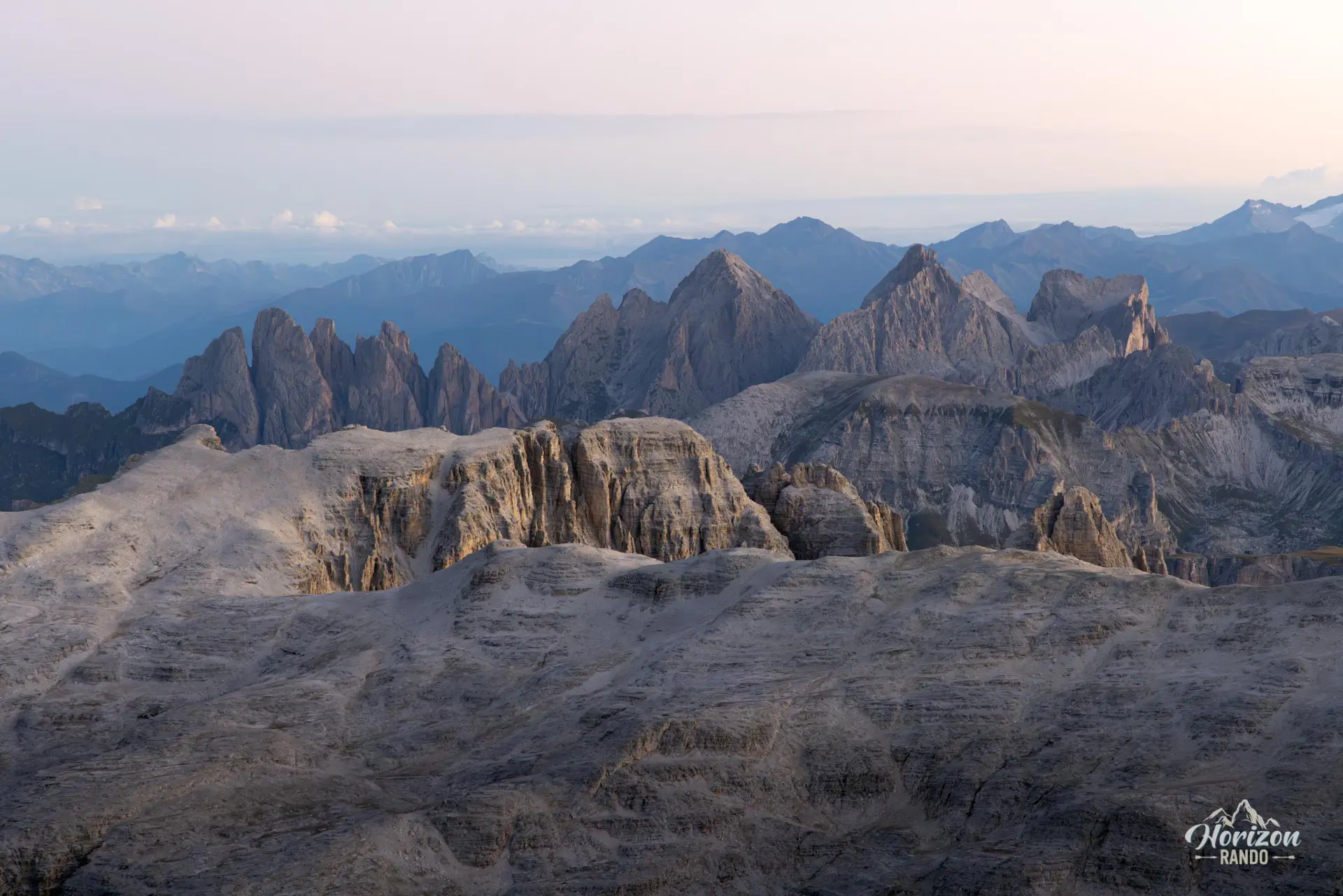
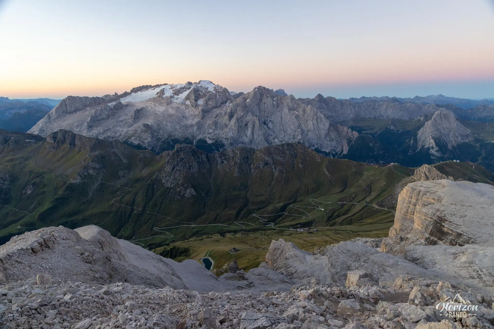
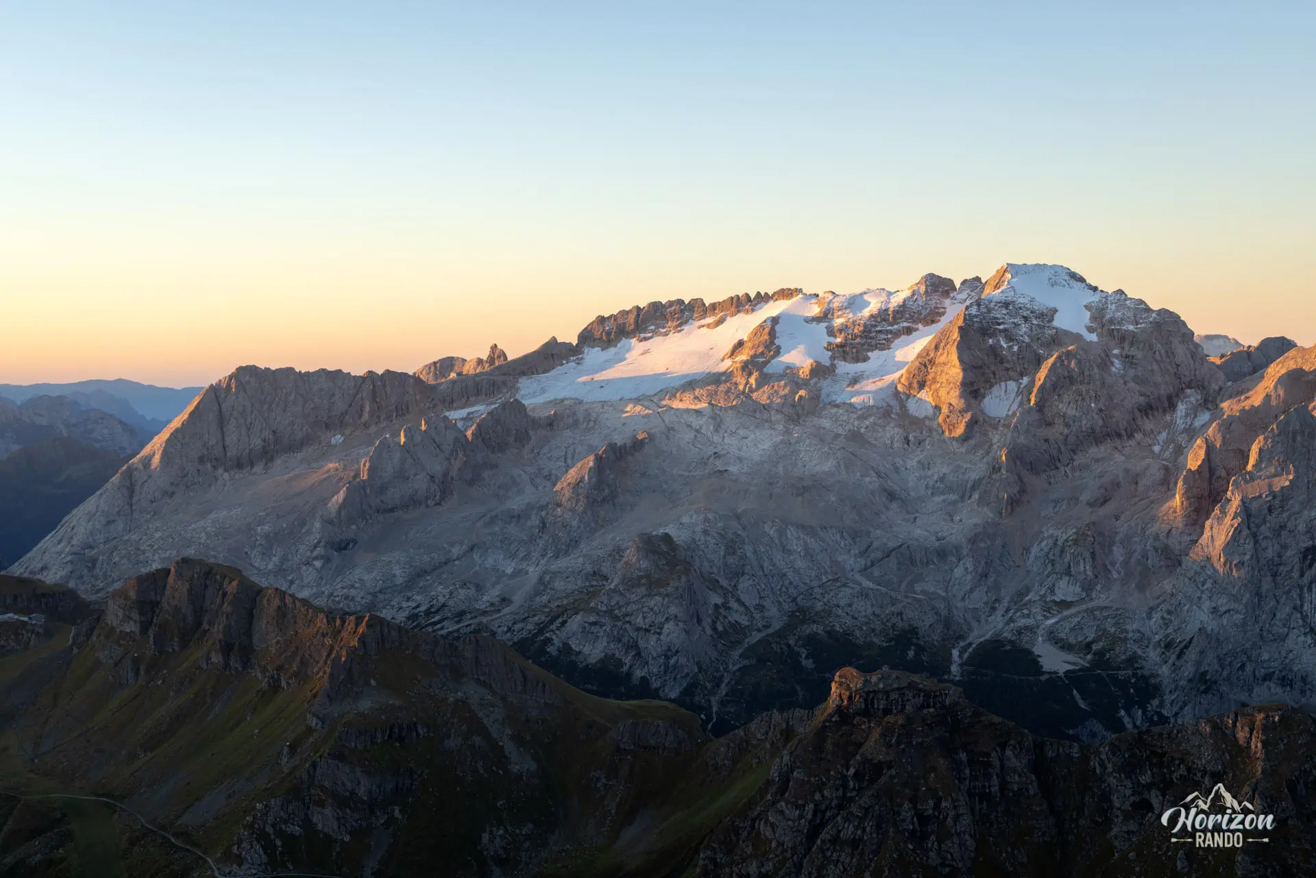
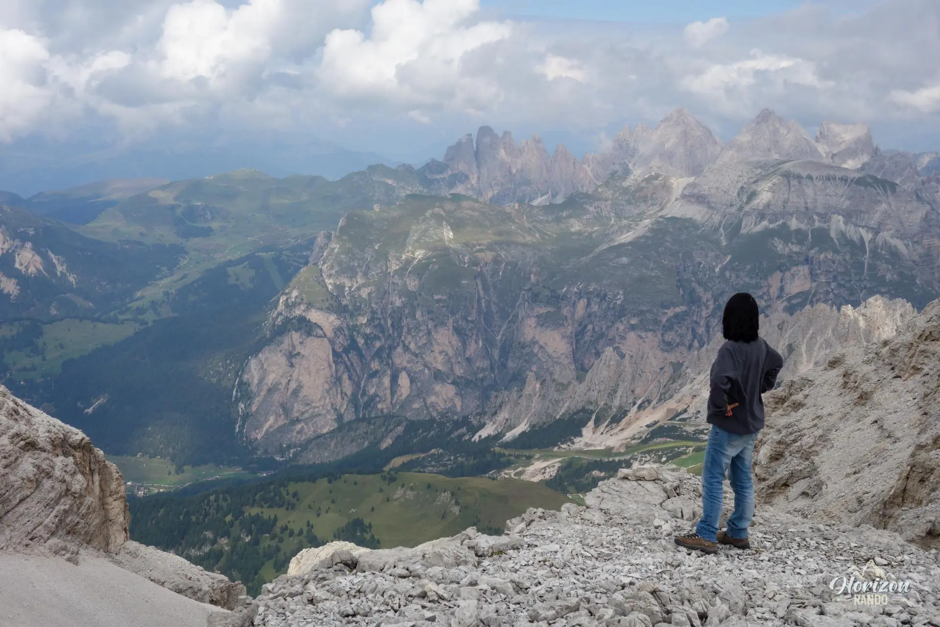
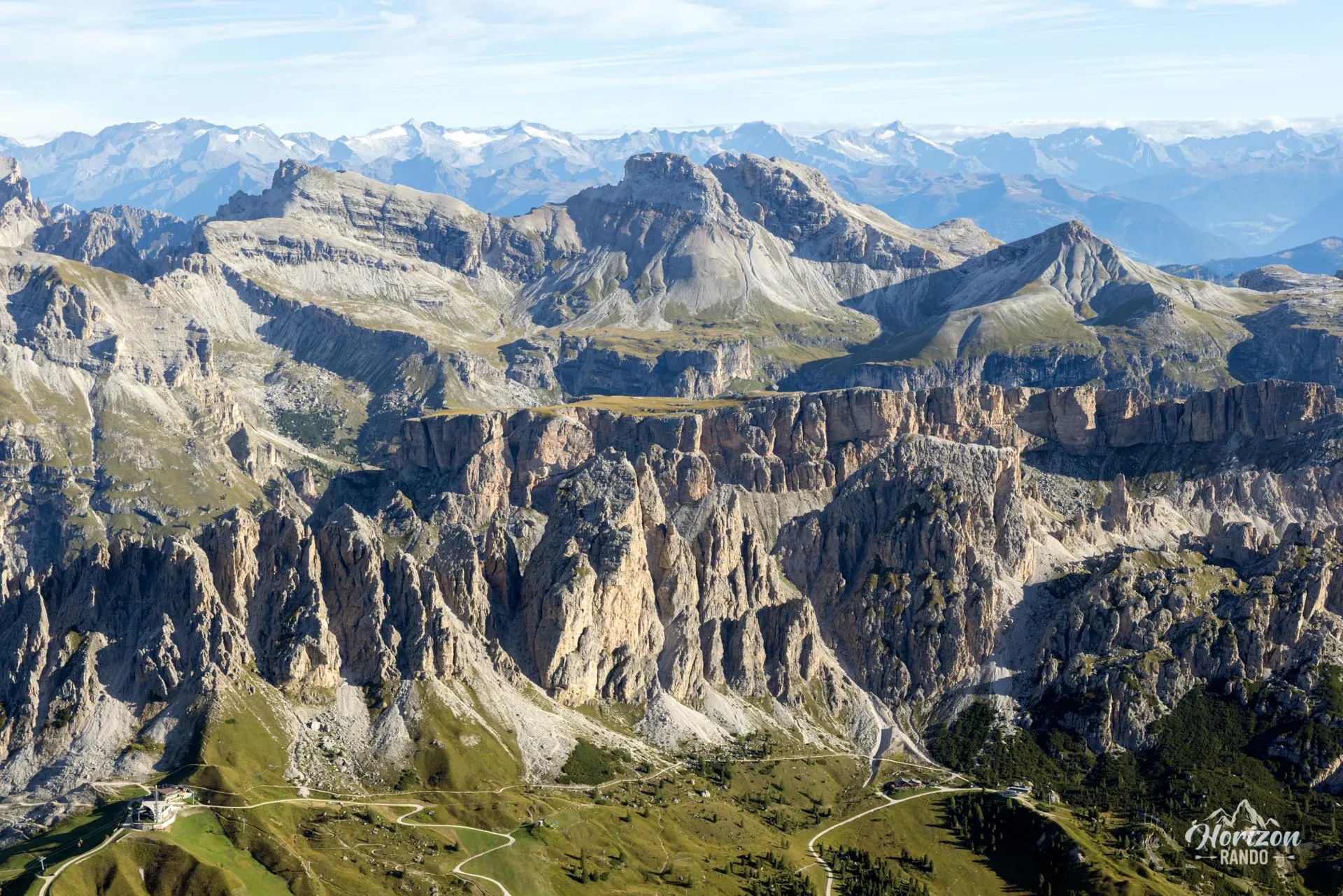
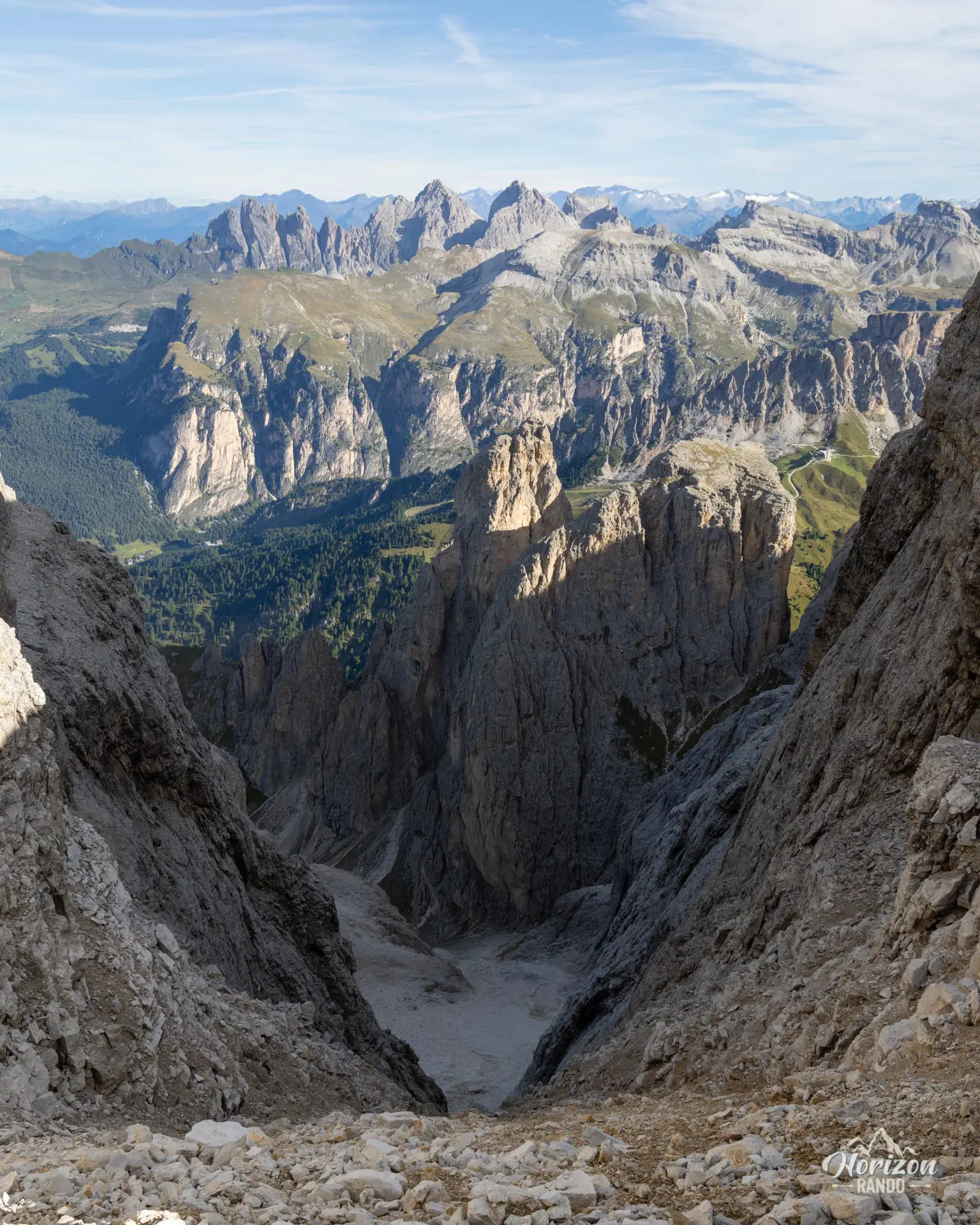
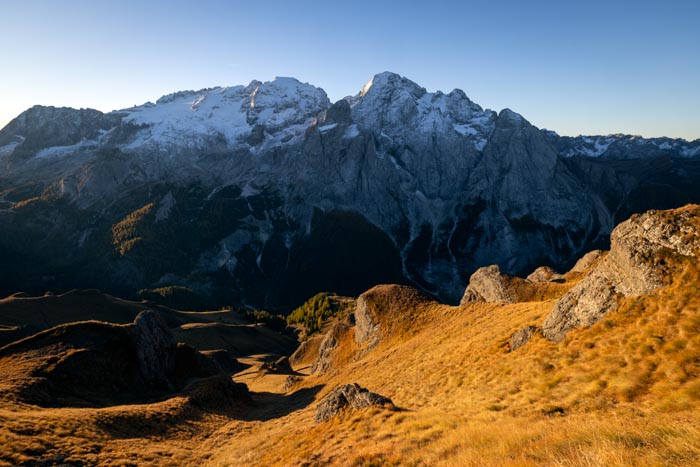
Throughout the route, you can see the Marmolada and Odle massifs, the Sassolungo, and, on clear days, the Austrian Alps. The contrast is striking: the crowds at Piz Boè give way to the almost total solitude of this rocky plateau.
Remarks
Parking: There is a large paid parking lot at Passo Pordoi (indicative price in 2025: €2/hour, maximum €10). Free parking spots are also available along the road near the pass but fill up quickly during peak season.
Sass Pordoi Cable Car: Open from mid-May to early November, generally from 9 a.m. to 5 p.m. Indicative price in 2025: €32 per adult for a round trip. Current fares and schedules are available on the official Sass Pordoi website.
Time Management: The route is long and the cable car closes around 5 p.m., so if you're unsure about your return time, it's best to only take the cable car up. The hike down from Forcella Pordoi to Passo Pordoi takes less than an hour and gives you more flexibility with your schedule. Download the GPX track for Passo Pordoi – Forcella Pordoi
Description and difficulties of the hike
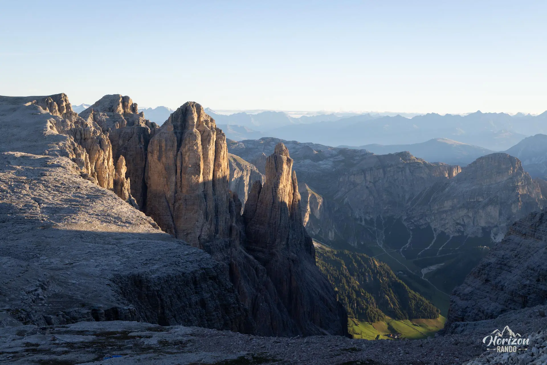
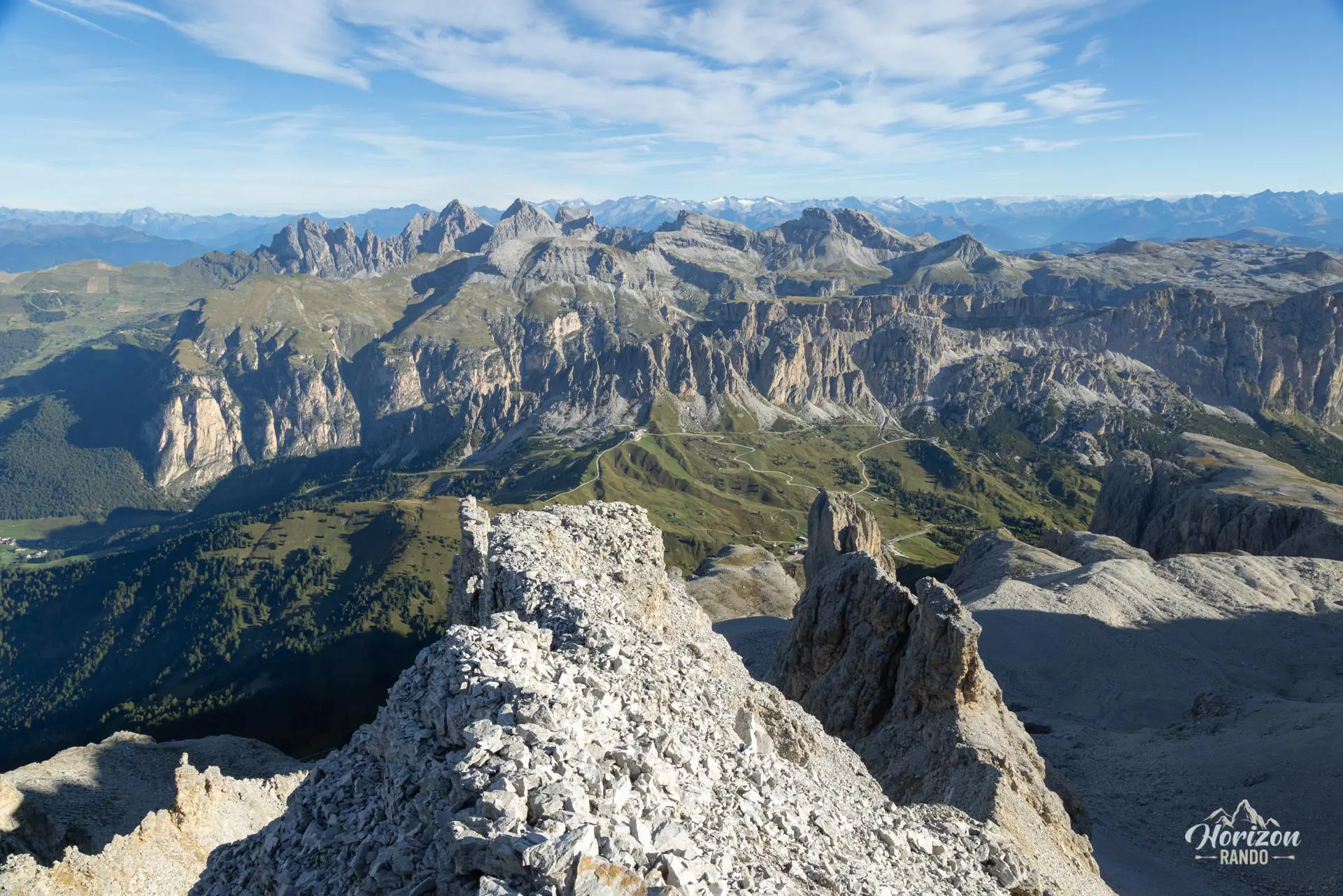
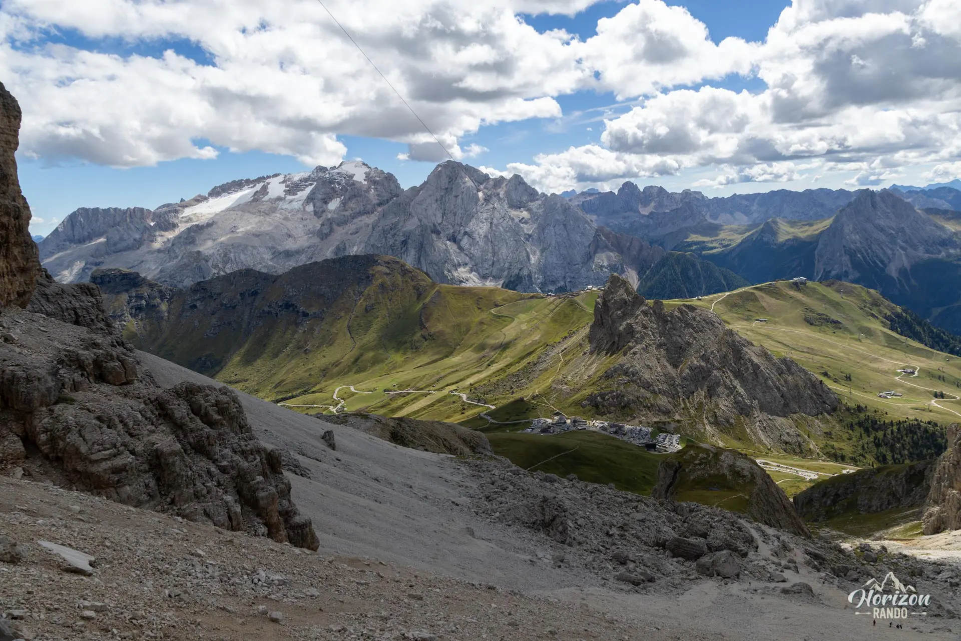
From the upper station of the Sass Pordoi cable car (2,950 m), descend via trail no. 627A to Forcella Pordoi (2,848 m), where a small mountain hut is nestled in the pass. Continue on trail no. 627, then turn onto trail no. 638, which begins the ascent toward Piz Boè (3,152 m). The final section includes two or three rock steps with handlines. There is no major technical difficulty, but some scrambling with moderate exposure. The summit, where Rifugio Capanna Fassa stands, offers a 360° panorama of the greatest massifs of the Dolomites: Marmolada, Sassolungo, Sella, and Tofane.
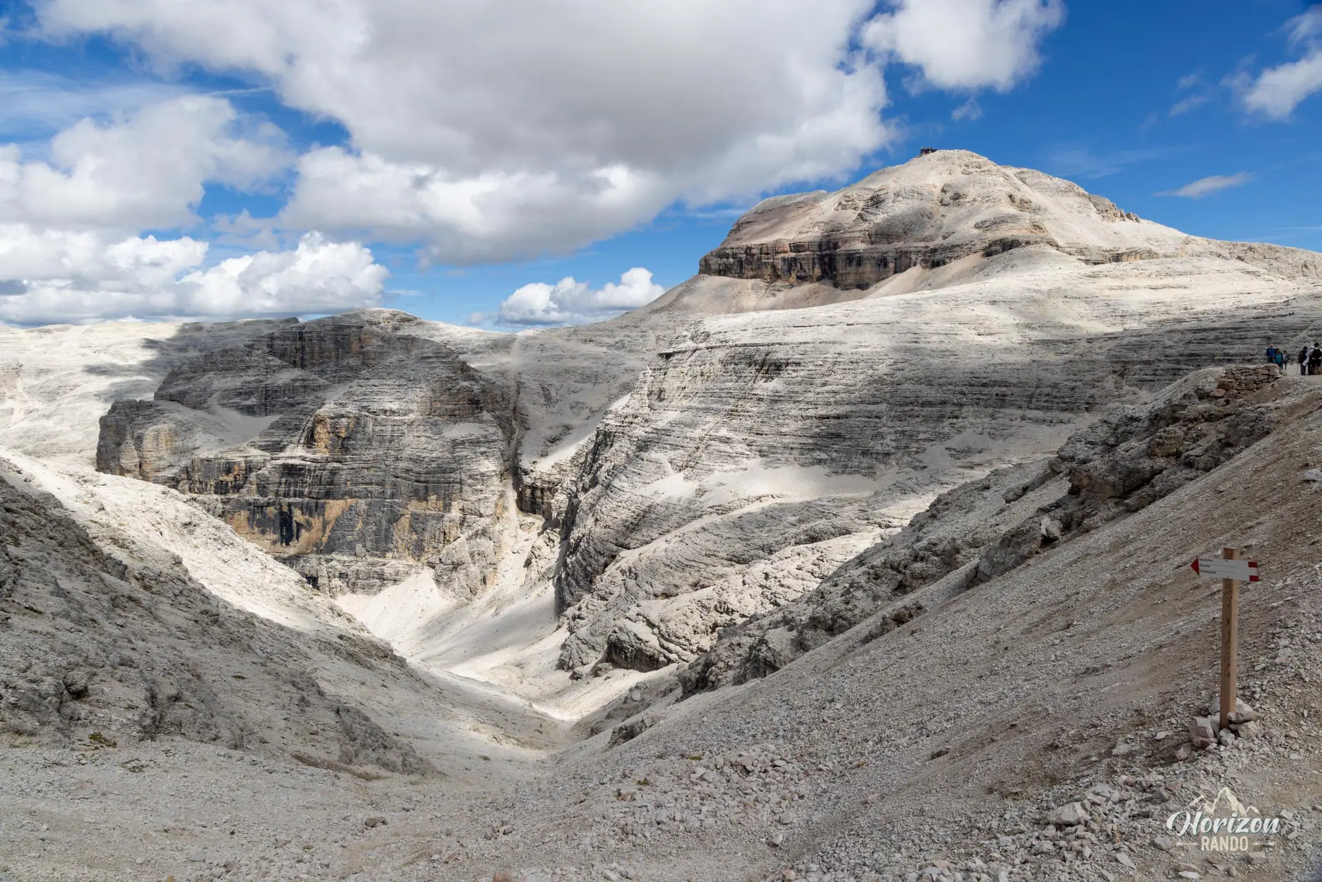
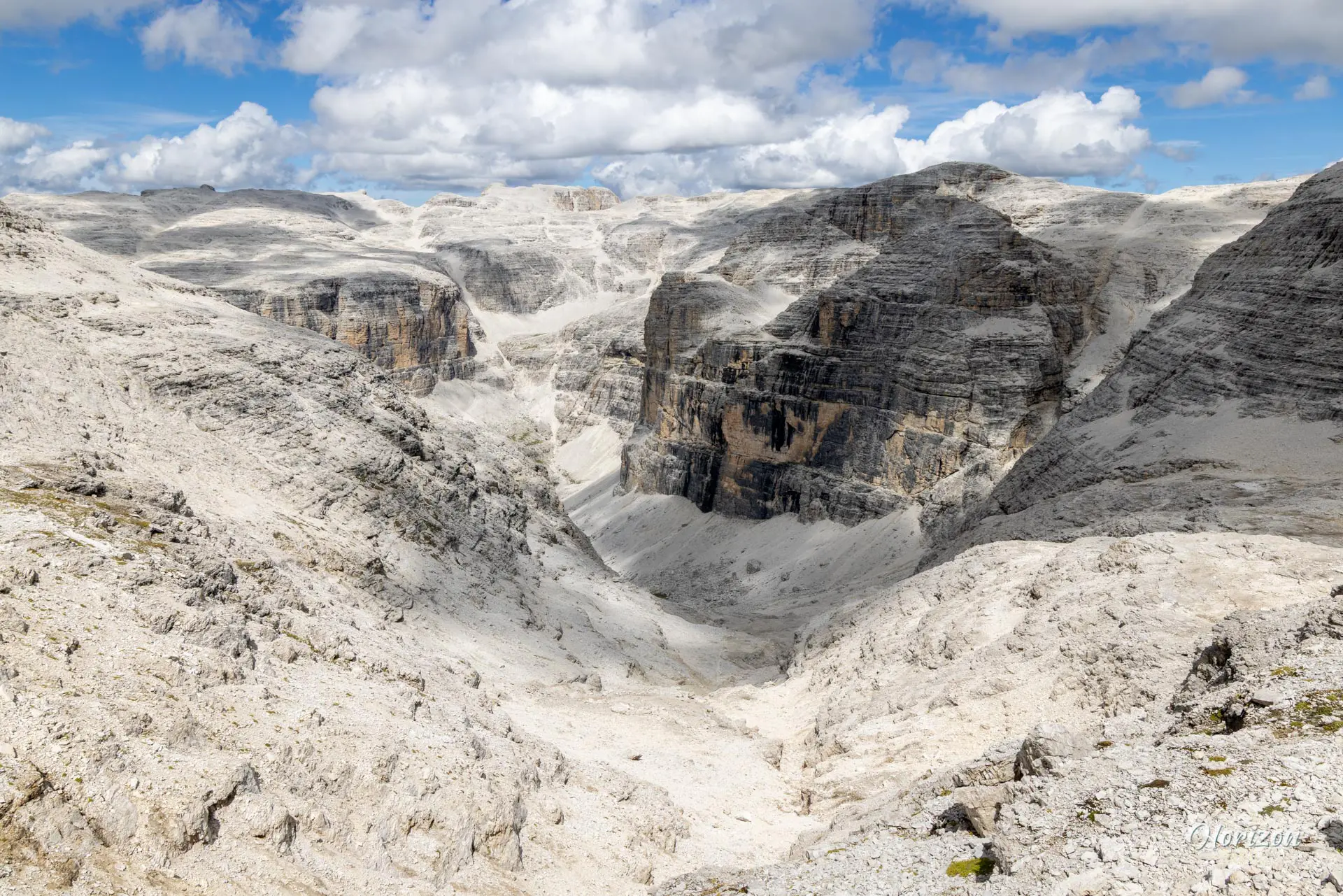
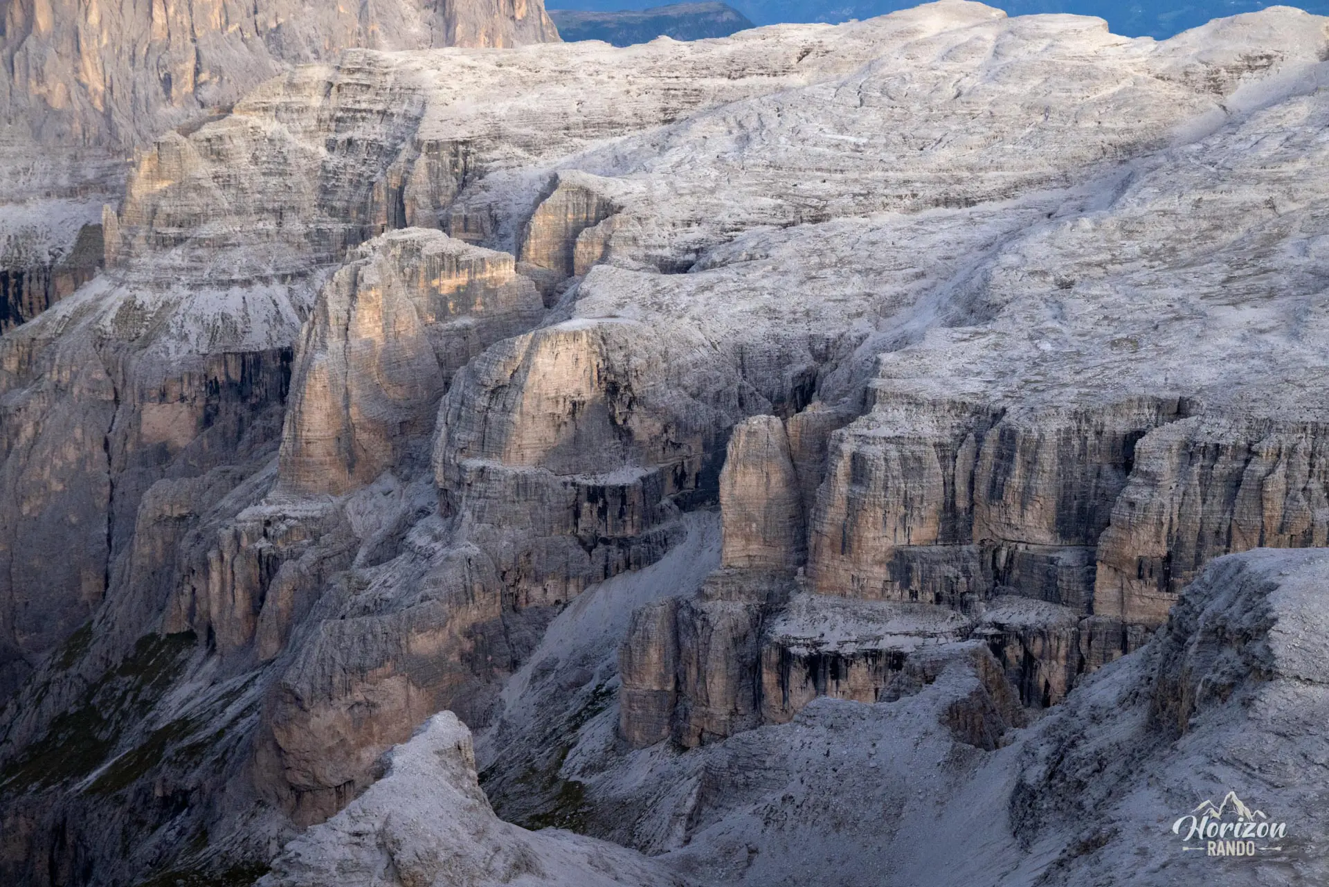
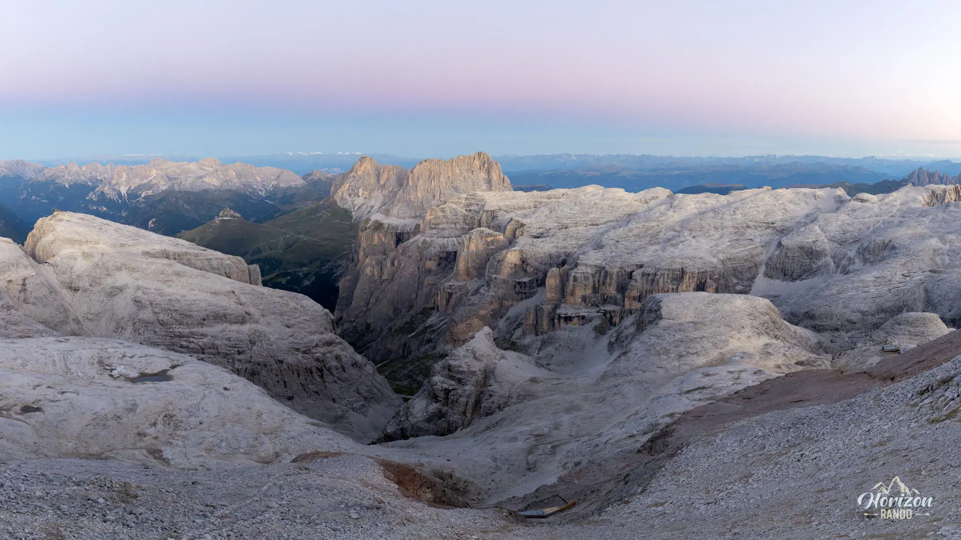
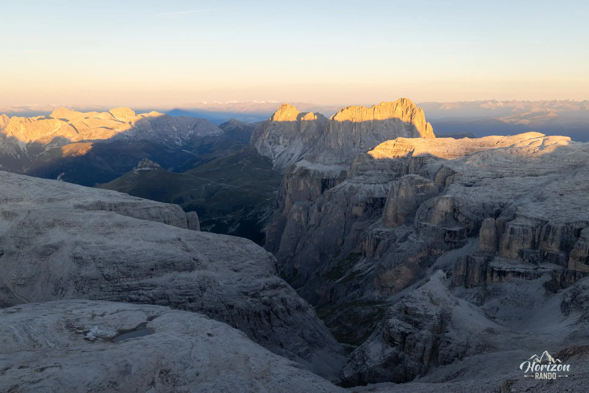
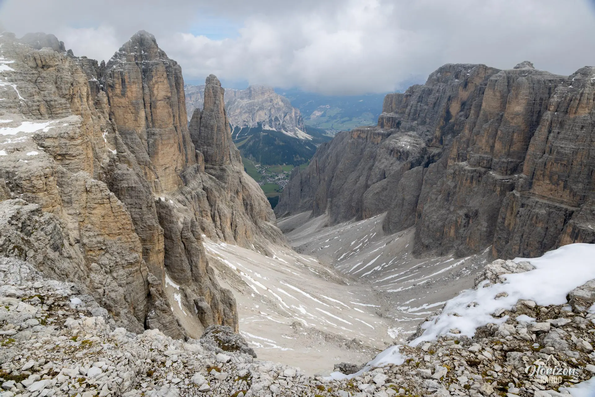
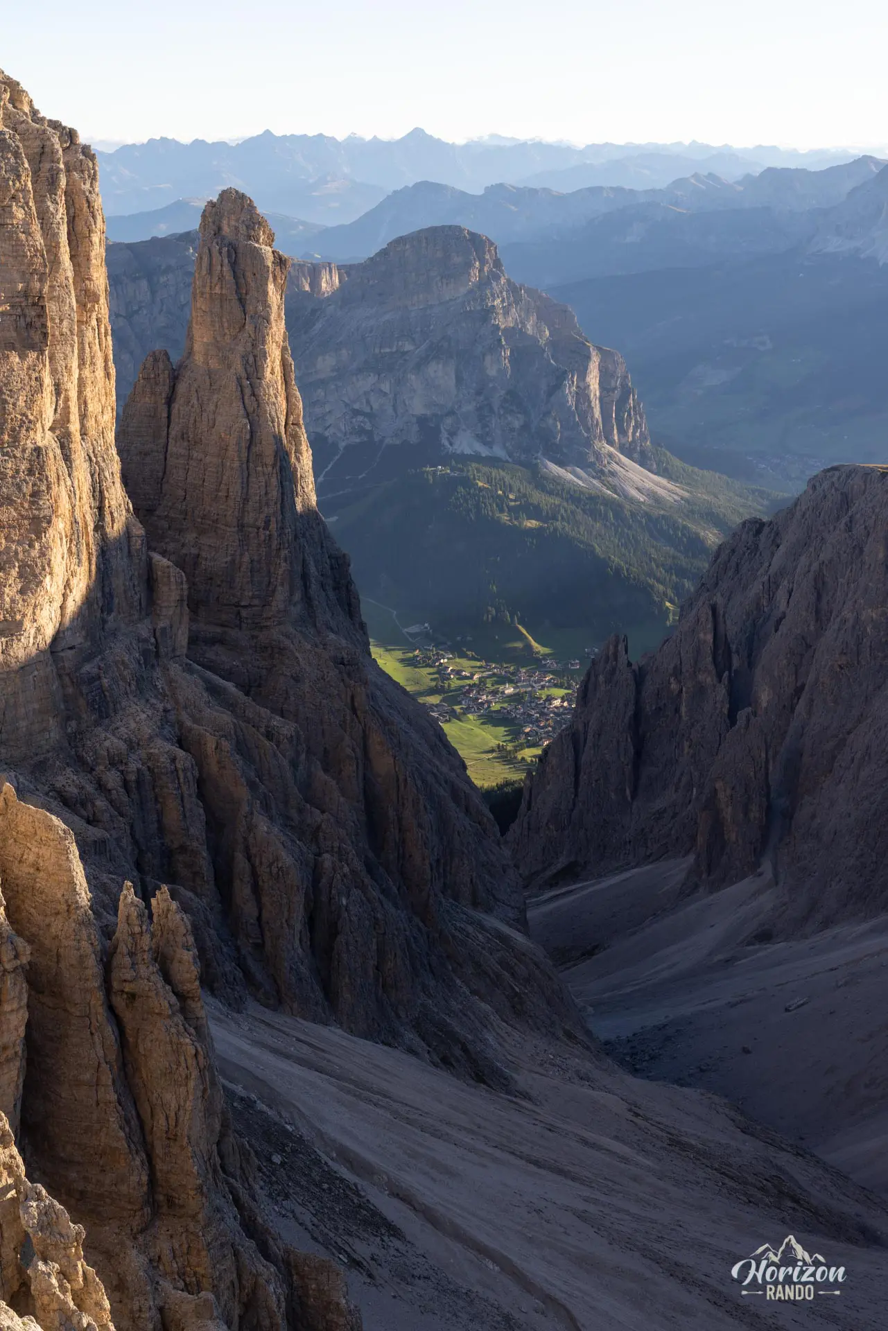
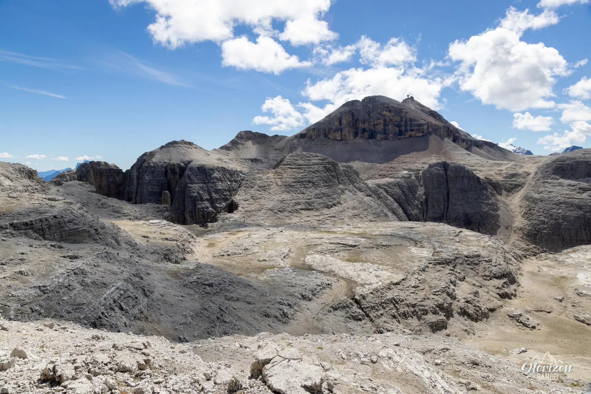
From the summit, descend via trail no. 638 toward Rifugio Boè (2,871 m). Then, switch to trail no. 647, heading north toward Forcella d'Antersass (2,839 m). At the junction, take trail no. 649 due west toward Passo Sella. Beyond this point, the number of hikers drops sharply, and you will begin traversing the vast, rocky Altipiano delle Mesules plateau, which is dotted with scree and stretches to the horizon.
Trail 649 branches into several parallel routes. The main path remains relatively flat and skirts around the peaks. To enjoy the panoramic view of the Puez-Odle massif and Val Gardena, take the higher route. This route follows the edge of the northern plateau and allows you to climb several small peaks along the way: Piz Rotic, Piz Beguz, and Piz Miara. These short, easy climbs offer a bird's-eye view of the valleys below.
Piz Selva is reached via a final short climb. The summit, not very prominent, primarily serves as a viewpoint overlooking the Sassolungo and the western slope of the massif. The return route follows trails 649 and 647 to Rifugio Boè, then trails 627 and 627A to the Sass Pordoi cable car.
There are trail markers everywhere, but since all the trails in the area have the same red and white markings, you must always check the numbers at intersections. A marker only indicates that you're on a trail, not necessarily the correct one.
What you'll love
- Combining Piz Boè with Piz Selva: completing one of the most accessible "3,000-meter peaks" in the Dolomites and exploring the lunar plateau of the Sella massif in depth on a single route.
- The contrast in traffic between the standard, very busy route up Piz Boè and the traverse to Piz Selva, where you'll hardly see anyone.
- The northern panorama from the edge of the plateau, which offers unobstructed views of the Puez-Odle massif, Val Gardena, and Sassolungo.
- The three mountain huts along the route: Rifugio Pordoi, Capanna Piz Fassa, and Rifugio Boè, which offer a chance for a gourmet break or an overnight stay at high altitude for those who wish.
Hike technical sheet
➡️ Hiking parameters
➡️ Hiking parameters
➡️ Hiking parameters
Map and elevation profile of the hike
Slideshow


Nearby hikes
Padon Ridge and Viel del Pan Loop Hike
- Difficulty : Easy
- Duration : 2 h 45
- Distance : 7.4 km
- Elevation gain : 420 m

Passo Pordoi to Lago di Fedaia via Viel del Pan Hike
- Difficulty : Moderate / Hard
- Duration : 5 h 30
- Distance : 15.3 km
- Elevation gain : 780 m

Piz Boè Hike
- Difficulty : Easy
- Duration : 2 h 45
- Distance : 6.3 km
- Elevation gain : 460 m

Sassolungo Loop
- Difficulty : Moderate
- Duration : 5 h 30
- Distance : 16.1 km
- Elevation gain : 790 m
Map of the 10 closest hikes
Hikes to discover

Forca Rossa and Rifugio Fuciade Hike
- Difficulty : Moderate
- Duration : 4 h 15
- Distance : 10.9 km
- Elevation gain : 680 m

Via Ferrata Ivano Dibona
- Hiking Difficulty : Hard
- Via Ferrata Difficulty : B (Moderatly difficult)
- Duration : 7 h
- Distance : 8.9 km
- Elevation gain : 1180 m

Via Ferrata Degli Alpini and Monte Lagazuoi
- Hiking Difficulty : Moderate
- Via Ferrata Difficulty : C (Difficult)
- Duration : 5 h
- Distance : 8 km
- Elevation gain : 830 m

Lago di Braies Loop
- Difficulty : Very easy
- Duration : 1 h 15
- Distance : 3.7 km
- Elevation gain : 90 m

Via Ferrata Innerkofler - Monte Paterno
- Hiking Difficulty : Moderate
- Via Ferrata Difficulty : A/B (Easy)
- Duration : 4 h 30
- Distance : 9.5 km
- Elevation gain : 650 m

Fanes Waterfalls Hike and Via Ferrata
- Hiking Difficulty : Moderate
- Via Ferrata Difficulty : A (Easy)
- Duration : 4 h 30
- Distance : 10 km
- Elevation gain : 560 m