
Via Ferrata Degli Alpini and Monte Lagazuoi
Hike overview
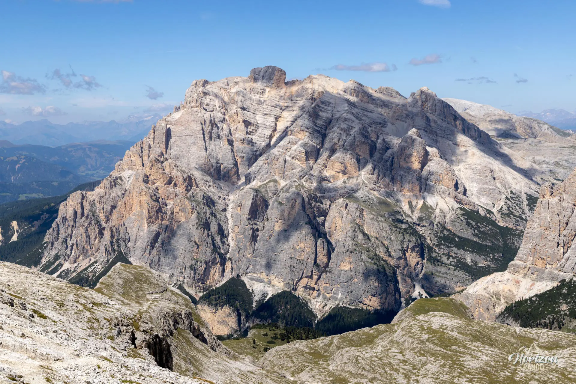
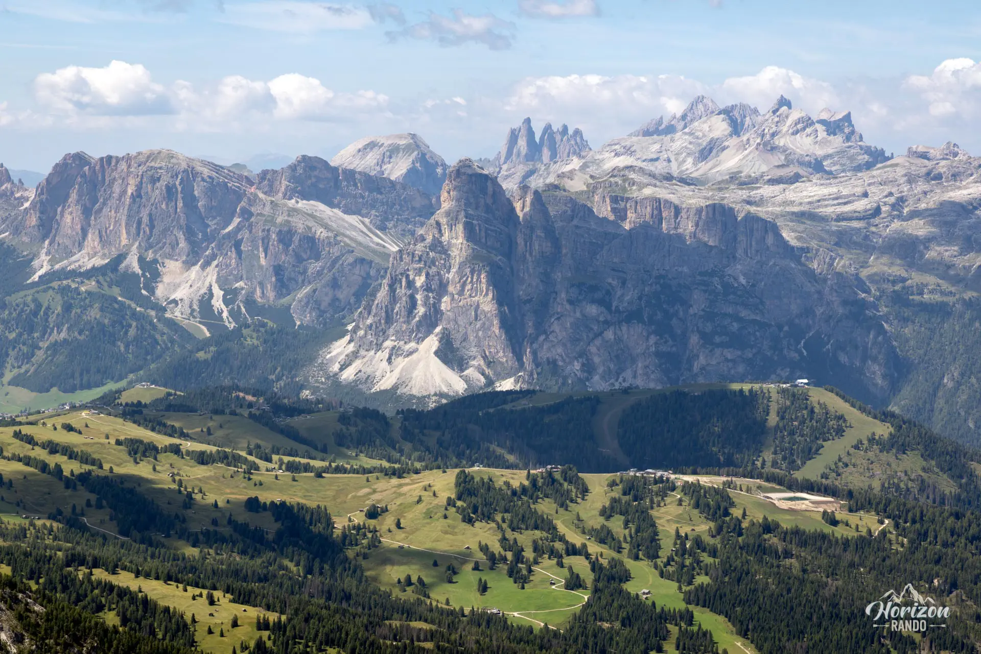
Starting from Col Gallina, this route combines two iconic routes in the Cortina d'Ampezzo area. First, the Via Ferrata degli Alpini climbs vertically up the west face of Col dei Bos. Then, hikers traverse through the tunnels dug into Mount Lagazuoi by Italian troops between 1915 and 1917. With two peaks, a challenging via ferrata, a historic underground route, and a 360° panorama of the Tofane, Marmolada, Sella, and Cinque Torri massifs, this day in the Dolomites will be unforgettable.
Remarks
Parking: Parking is available in a large, free lot at Col Gallina, below Passo Falzarego. As is the case throughout the Dolomites, it fills up quickly during peak season.
Timing: Set out early, ideally before 8:00 a.m., to avoid guided groups and lines at the foot of the via ferrata.
Equipment: Mandatory equipment for the via ferrata includes a helmet, harness, and energy-absorbing lanyard. Gloves are recommended, as pulling on the cable is necessary in some places. A headlamp is essential for the tunnels. Bring a warm layer because it is cold and damp in the tunnels, even in the middle of summer.
Route direction: The route direction is counterclockwise: via ferrata on the ascent and tunnels on the descent. This is the only possible route. The via ferrata can only be done on the ascent.
Description and difficulties of the hike
From the Col Gallina parking lot, the trail crosses a small bridge over the Rio Lagazuoi and climbs up to a wide mule track. Follow the signposts for "Col dei Bos". Pass near remnants of the Great War, such as former military hospitals and observation post ruins, before reaching the base of the cliff in about twenty minutes. The approach is short and easy.
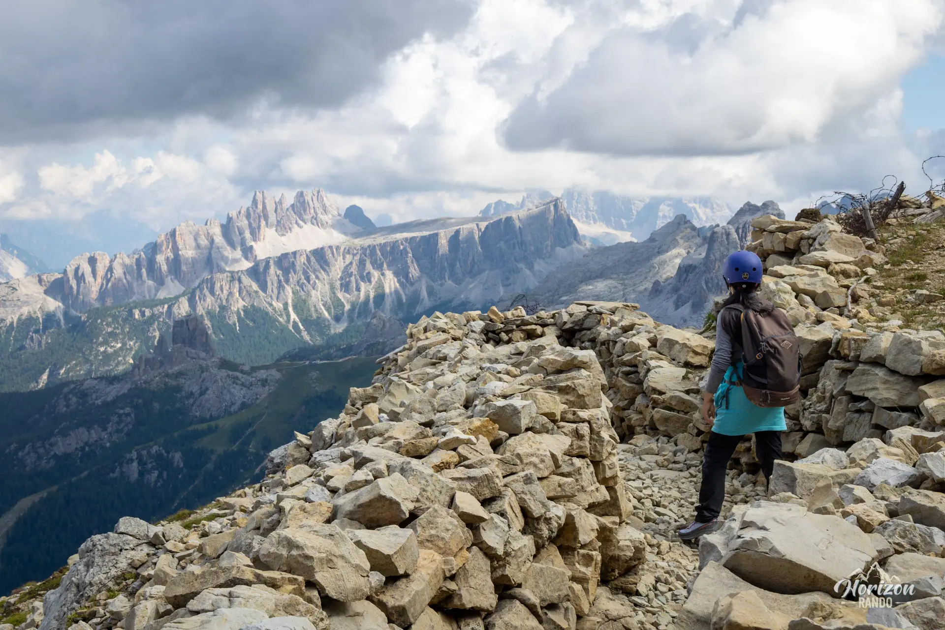
The Via Ferrata degli Alpini begins with its most challenging section right away: about twenty vertical meters along two cracks on smooth rock with few natural holds, requiring firm pulls on the cable. Once past this initial section, the route becomes easier with well-equipped rock steps, airy traverses with good holds, and short ledges connecting equipped sections. Exposure remains high along virtually the entire route, with a particularly exposed section when rounding a spur about two-thirds of the way up. The final wall, some ten meters high with good holds, leads to the summit plateau and the wooden cross at Col dei Bos. Allow about two hours for this equipped section.
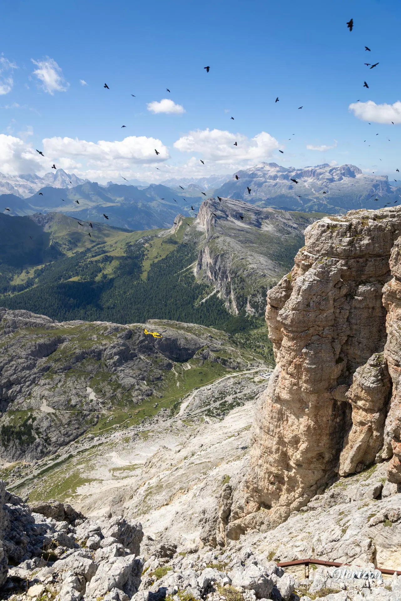
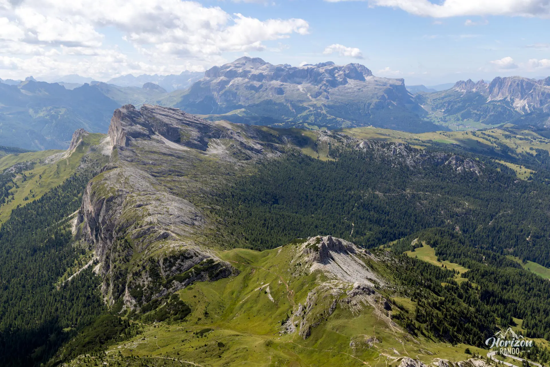
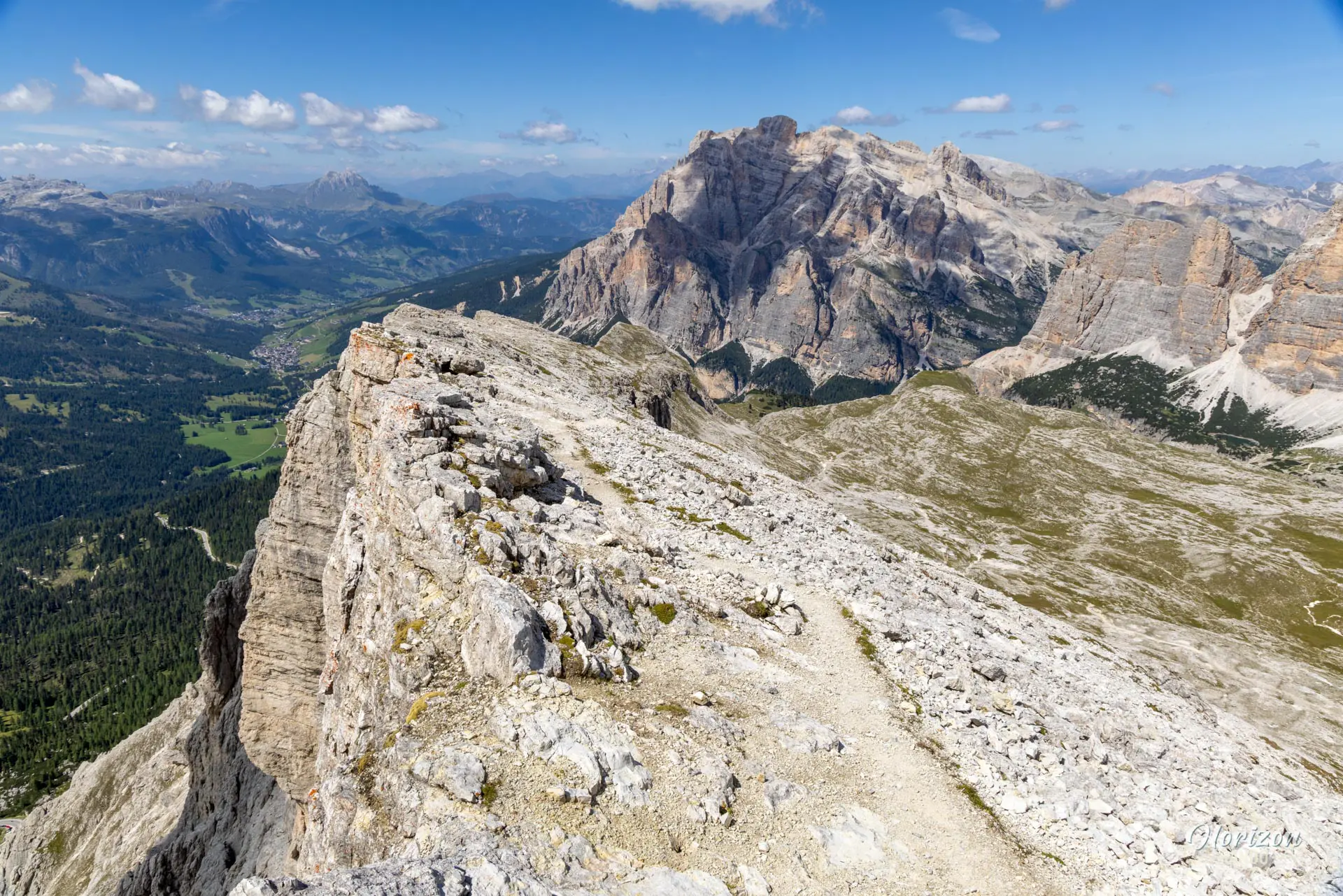
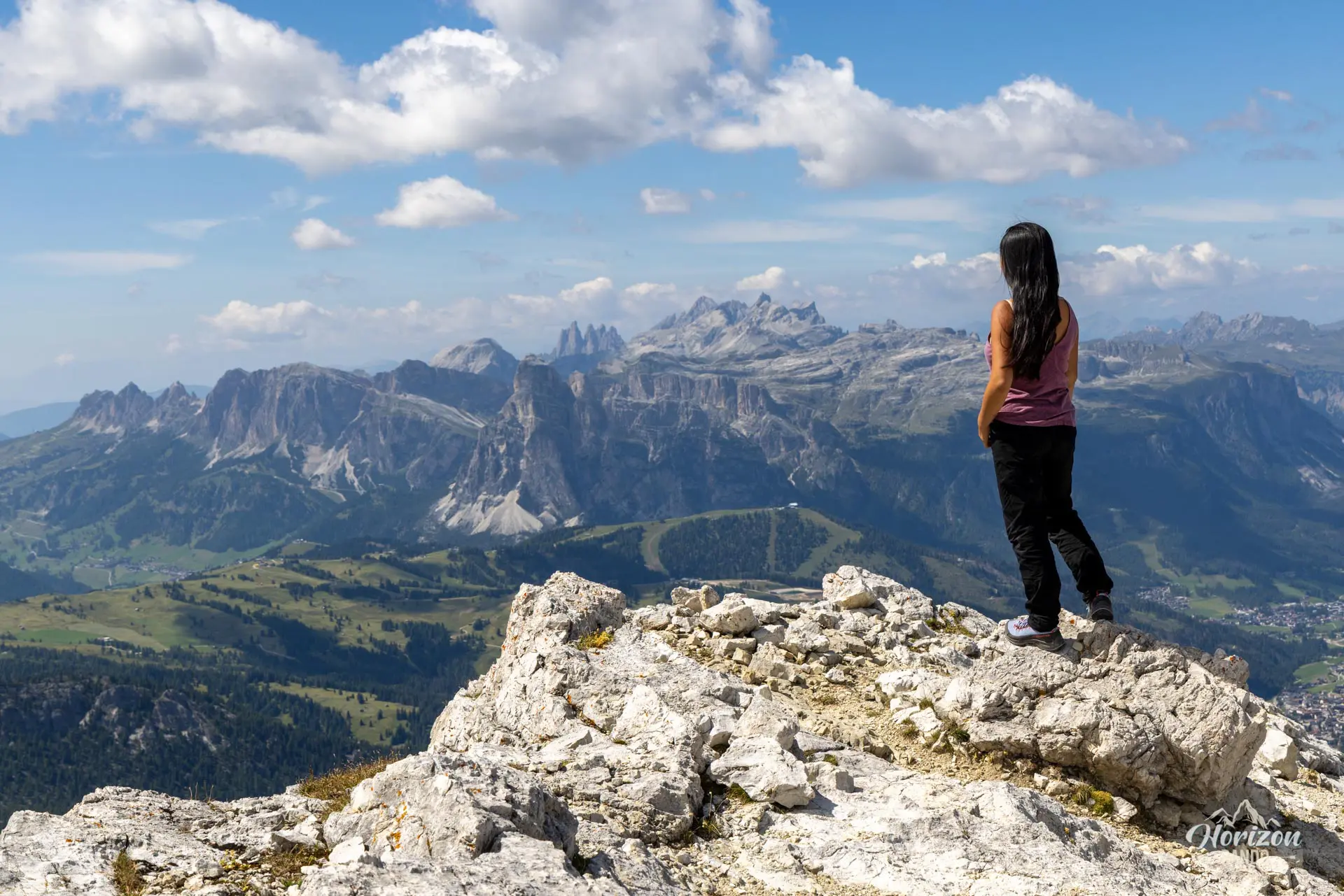
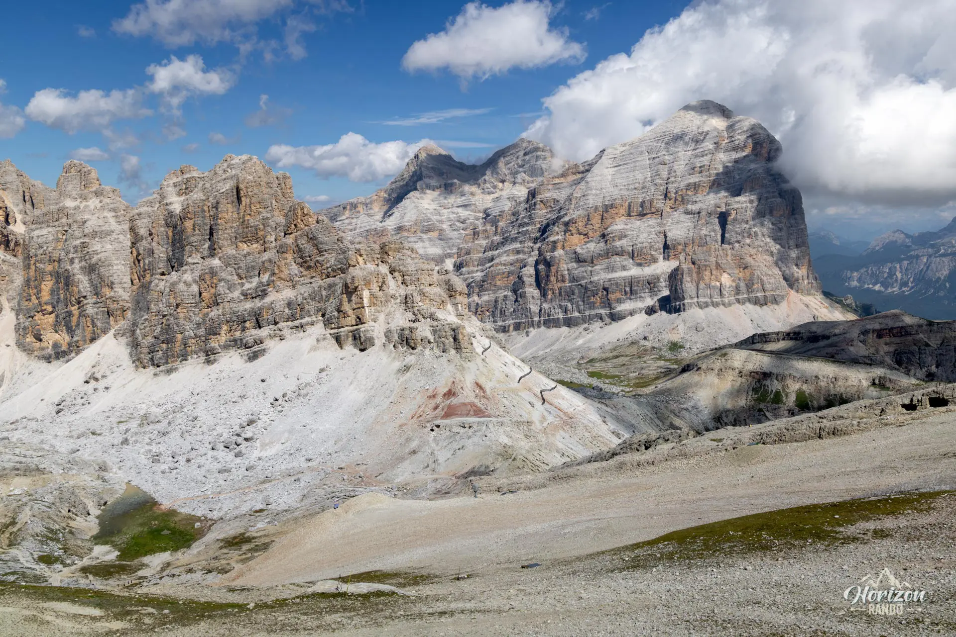
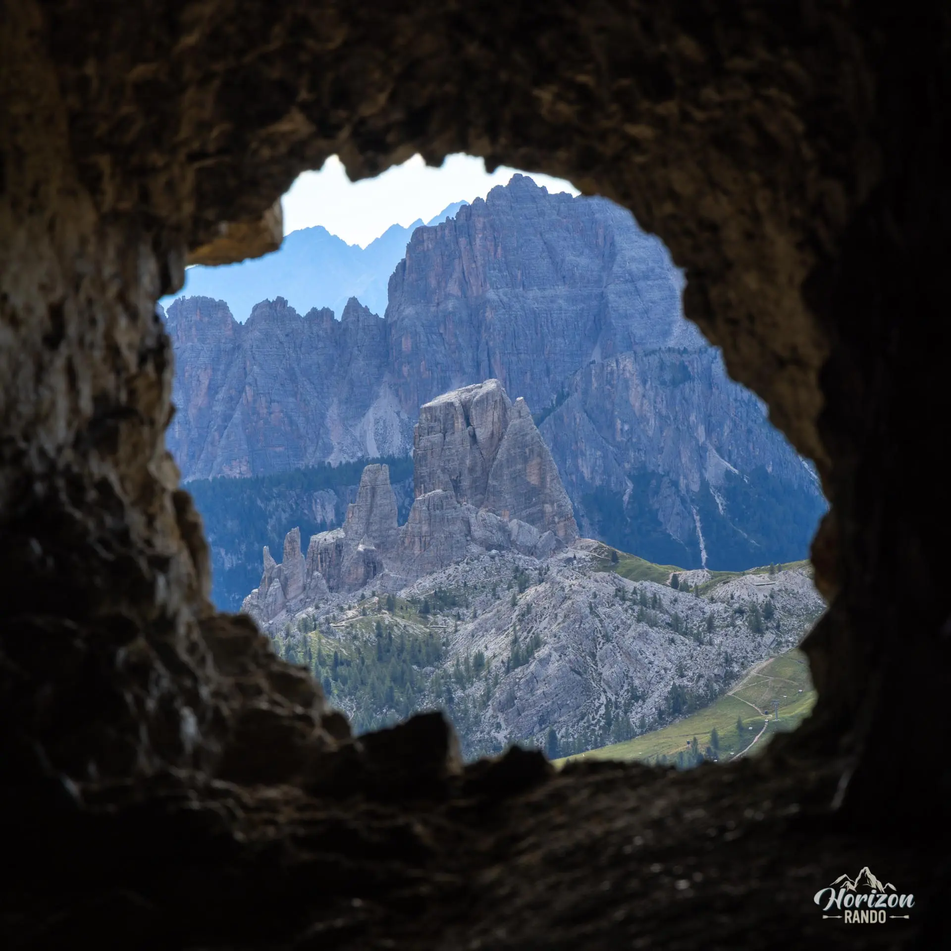
From the summit of Col dei Bos, an unmarked trail heads north toward Forcella Travenanzes (2,507 m). The GPS track is helpful here for finding the correct route. This is also the section where you'll encounter the fewest hikers. At the pass, you will join Trail No. 401, which you will follow to the Lagazuoi Refuge. From the refuge, it takes about 15 minutes to reach the 2,778 m summit of Piccolo Lagazuoi, the highest point of the circuit. From there, you can see the Tofane, the Marmolada, Croda da Lago, and the Sella.
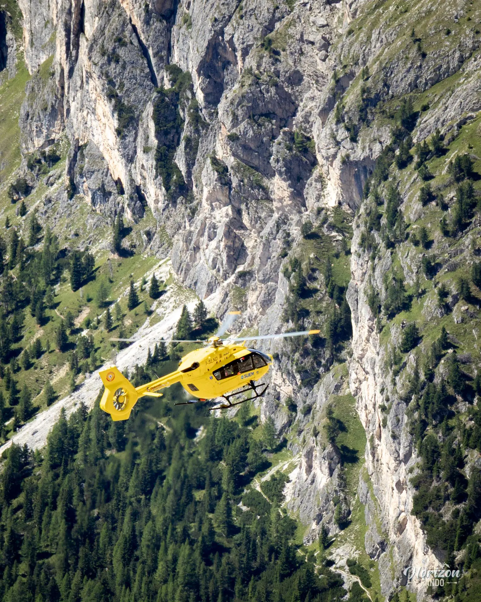
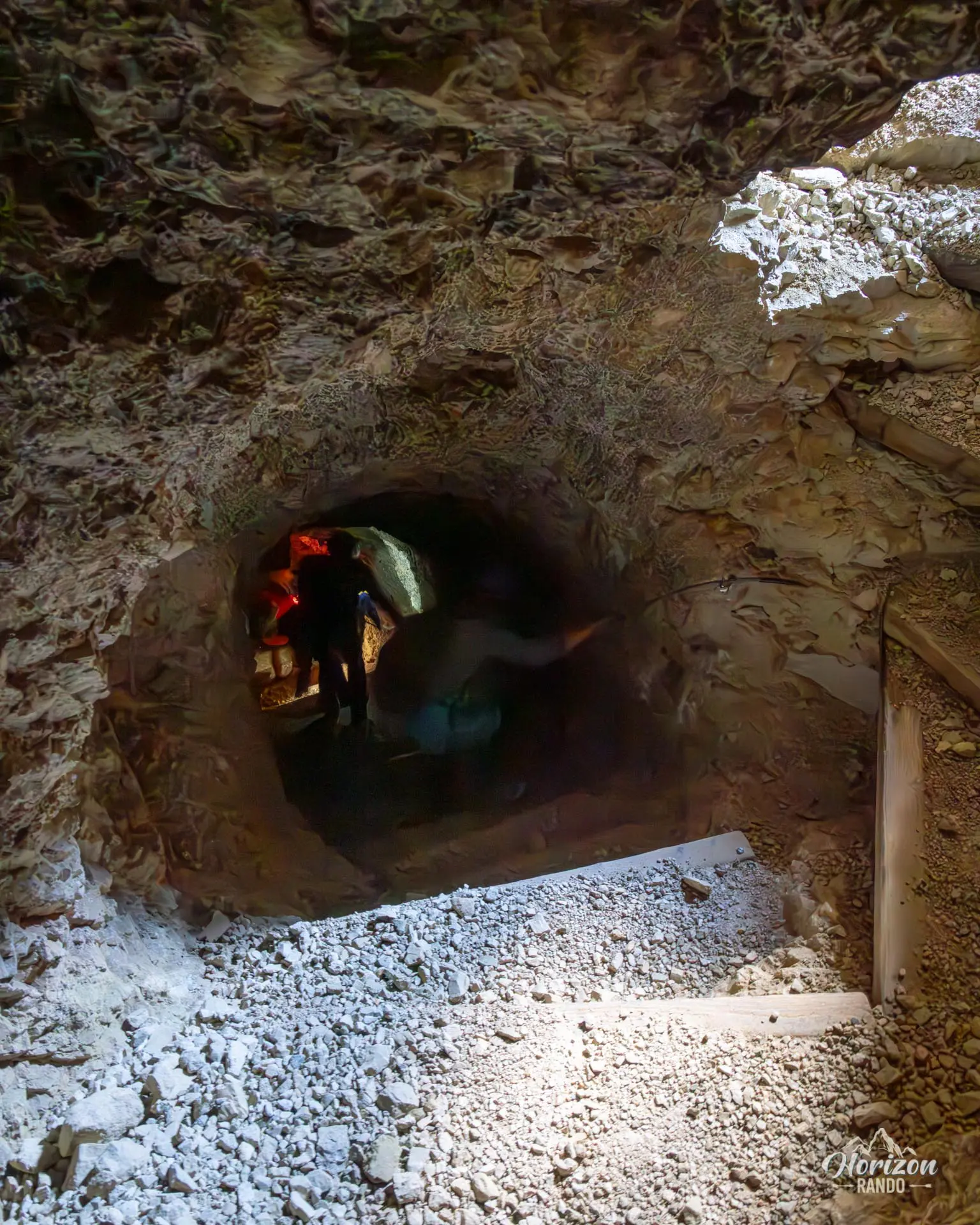
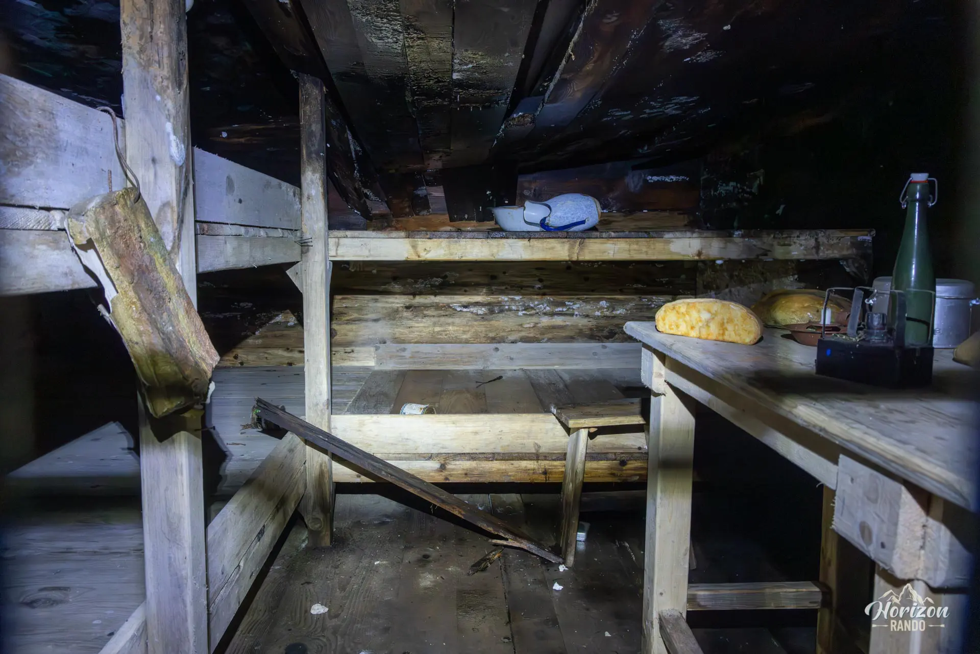
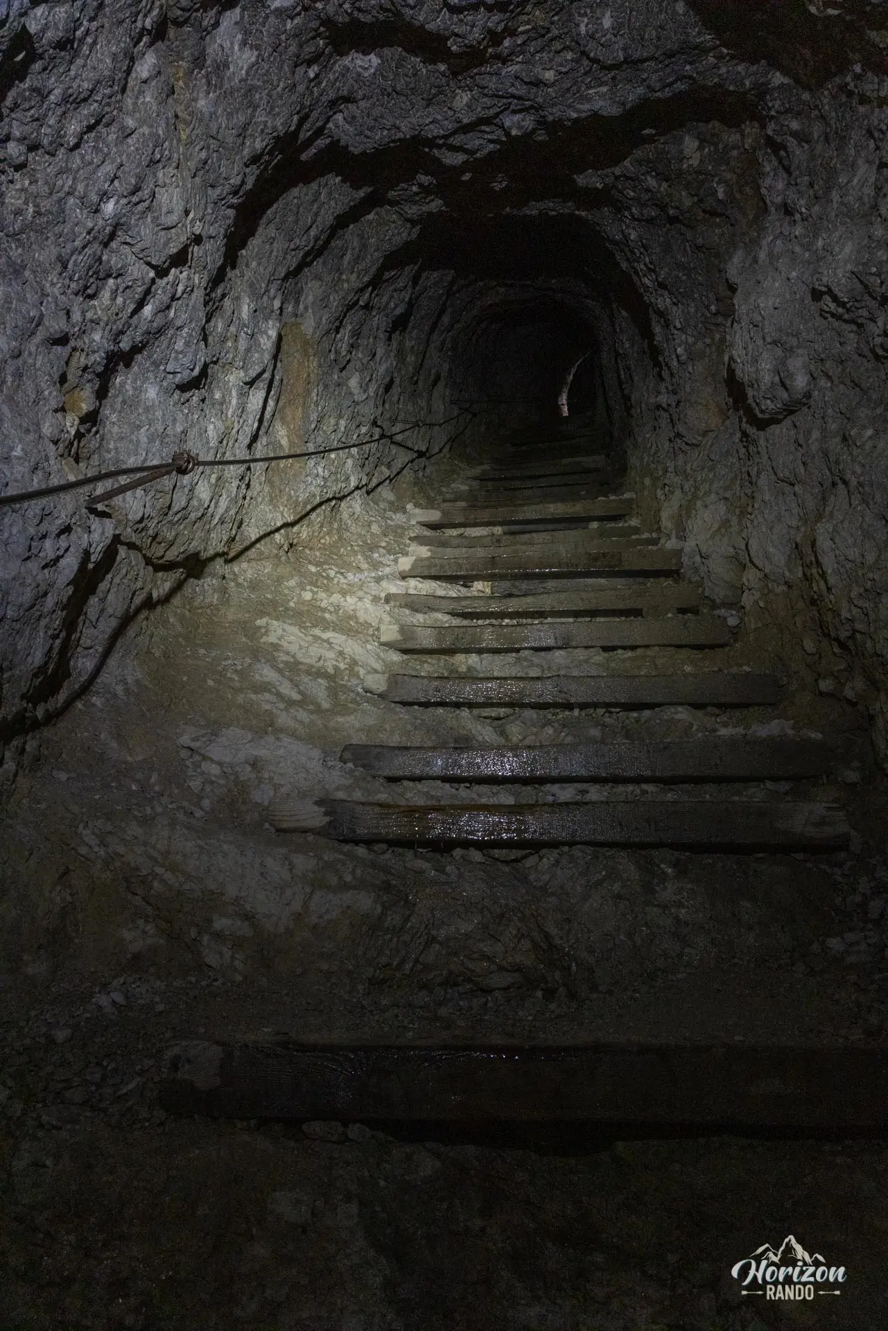
The descent takes place through the Lagazuoi tunnels. The Anticima Tunnel alternates between short horizontal passages and long staircases carved into the rock that are often very steep and equipped with a fixed cable handline. A headlamp and helmet are essential—the interior is dark, water drips from the ceiling, and the high, uneven steps become slippery. Several reconstructed rooms (dormitories, observation posts, and remnants of equipment) offer insight into the living conditions of Italian troops between 1915 and 1917. Allow about an hour in the tunnels, longer if you linger at the historical panels. Bring a warm layer because the temperature remains low inside, even in the middle of summer.
At the exit, you will reach Trail No. 402, which descends in switchbacks toward Passo Falzarego. Before reaching the pass, a small, unmarked trail on the left leads back to the Col Gallina parking lot in about fifteen minutes.
What you'll love
- The Via Ferrata degli Alpini: vertical, airy, with a twenty-minute approach for a via ferrata of nearly 400 meters of elevation gain.
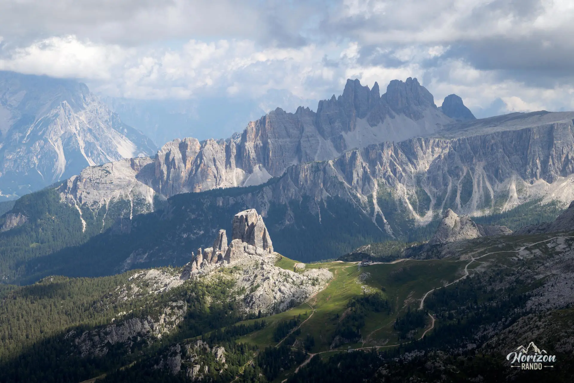
- The summit of Piccolo Lagazuoi (2,778 m) and its 360° panorama of the greatest mountain ranges of the Dolomites.
- The Anticima tunnels, that offer a rare glimpse into the warfare waged by Italian troops between 1915 and 1917. They feature informational panels, reconstructed barracks, and observation posts carved into the rock.
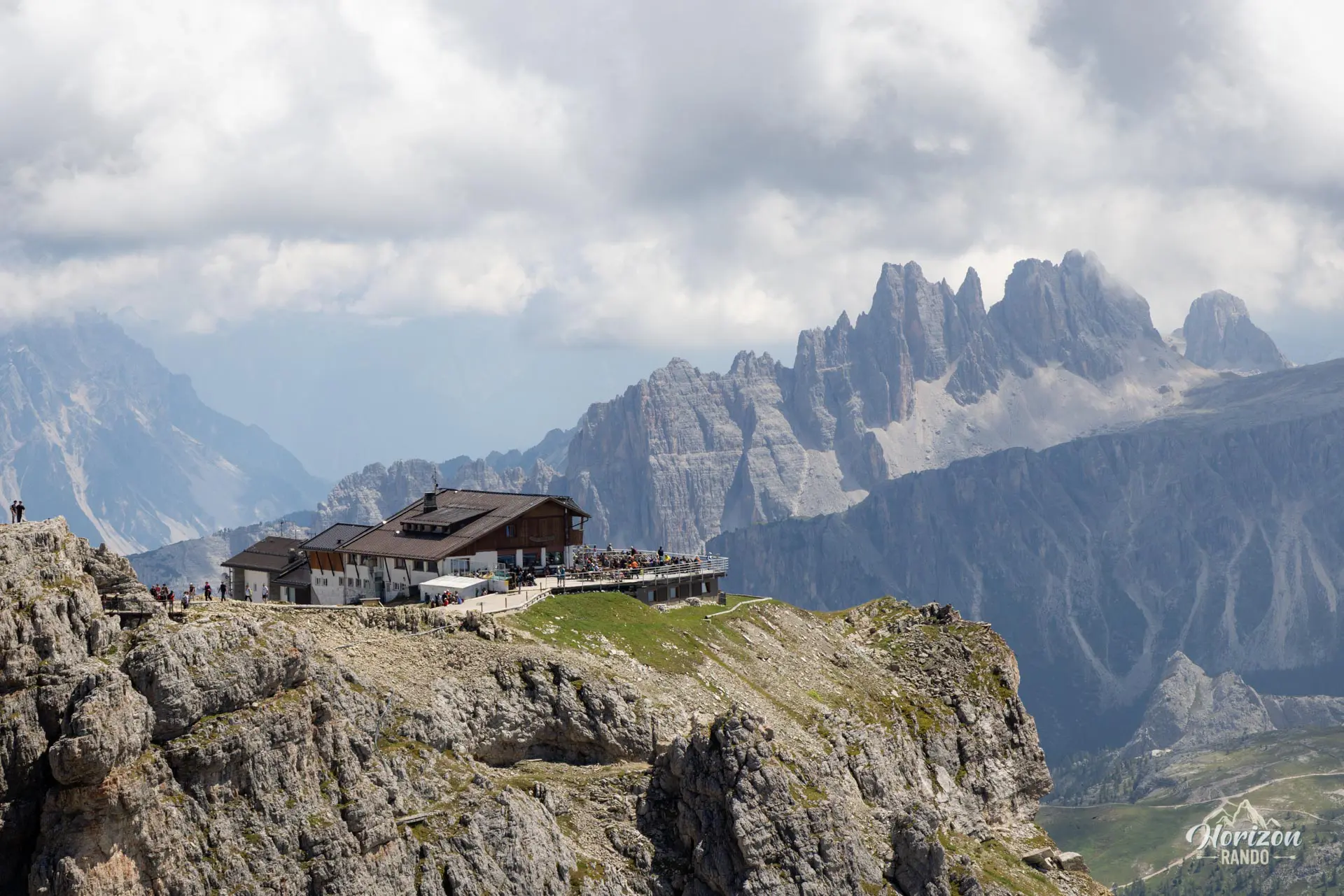
- The Rifugio Lagazuoi, perched near the summit, offers food and lodging and has one of the most beautiful terraces in the Dolomites.
Hike technical sheet
➡️ Hiking parameters
➡️ Hiking parameters
➡️ Hiking parameters
Map and elevation profile of the hike
Slideshow


Nearby hikes

Lago Limides, Monte Nuvolau and Cinque Torri Circuit
- Difficulty : Moderate
- Duration : 4 h 30
- Distance : 11.1 km
- Elevation gain : 790 m

Lago di Limides Hike
- Difficulty : Very easy
- Duration : 1 h
- Distance : 2.4 km
- Elevation gain : 150 m

Via Ferrata Degli Alpini - Col dei Bos
- Hiking Difficulty : Easy
- Via Ferrata Difficulty : C (Difficult)
- Duration : 3 h 15
- Distance : 3.7 km
- Elevation gain : 490 m

Croda Negra Hike
- Difficulty : Easy
- Duration : 2 h 45
- Distance : 7.3 km
- Elevation gain : 450 m
Map of the 11 closest hikes
Hikes to discover

Via Ferrata Averau
- Hiking Difficulty : Moderate
- Via Ferrata Difficulty : A/B (Easy)
- Duration : 3 h 30
- Distance : 8.4 km
- Elevation gain : 580 m

Via Ferrata Lipella - Tofana di Rozes Summit
- Hiking Difficulty : Hard
- Via Ferrata Difficulty : C/D (Difficult)
- Duration : 8 h
- Distance : 11.6 km
- Elevation gain : 1320 m

Via Ferrata Innerkofler - Monte Paterno
- Hiking Difficulty : Moderate
- Via Ferrata Difficulty : A/B (Easy)
- Duration : 4 h 30
- Distance : 9.5 km
- Elevation gain : 650 m

Sass de Putia Hike and Via Ferrata
- Hiking Difficulty : Hard
- Via Ferrata Difficulty : A (Easy)
- Duration : 7 h
- Distance : 17.4 km
- Elevation gain : 1200 m

Via Ferrata Sass Rigais
- Hiking Difficulty : Very Hard
- Via Ferrata Difficulty : A (Easy)
- Duration : 6 h 30
- Distance : 11 km
- Elevation gain : 1080 m

Via Ferrata Ra Gusela
- Hiking Difficulty : Easy
- Via Ferrata Difficulty : A (Easy)
- Duration : 3 h 30
- Distance : 8 km
- Elevation gain : 610 m