
Piz Boè Hike
Hike overview
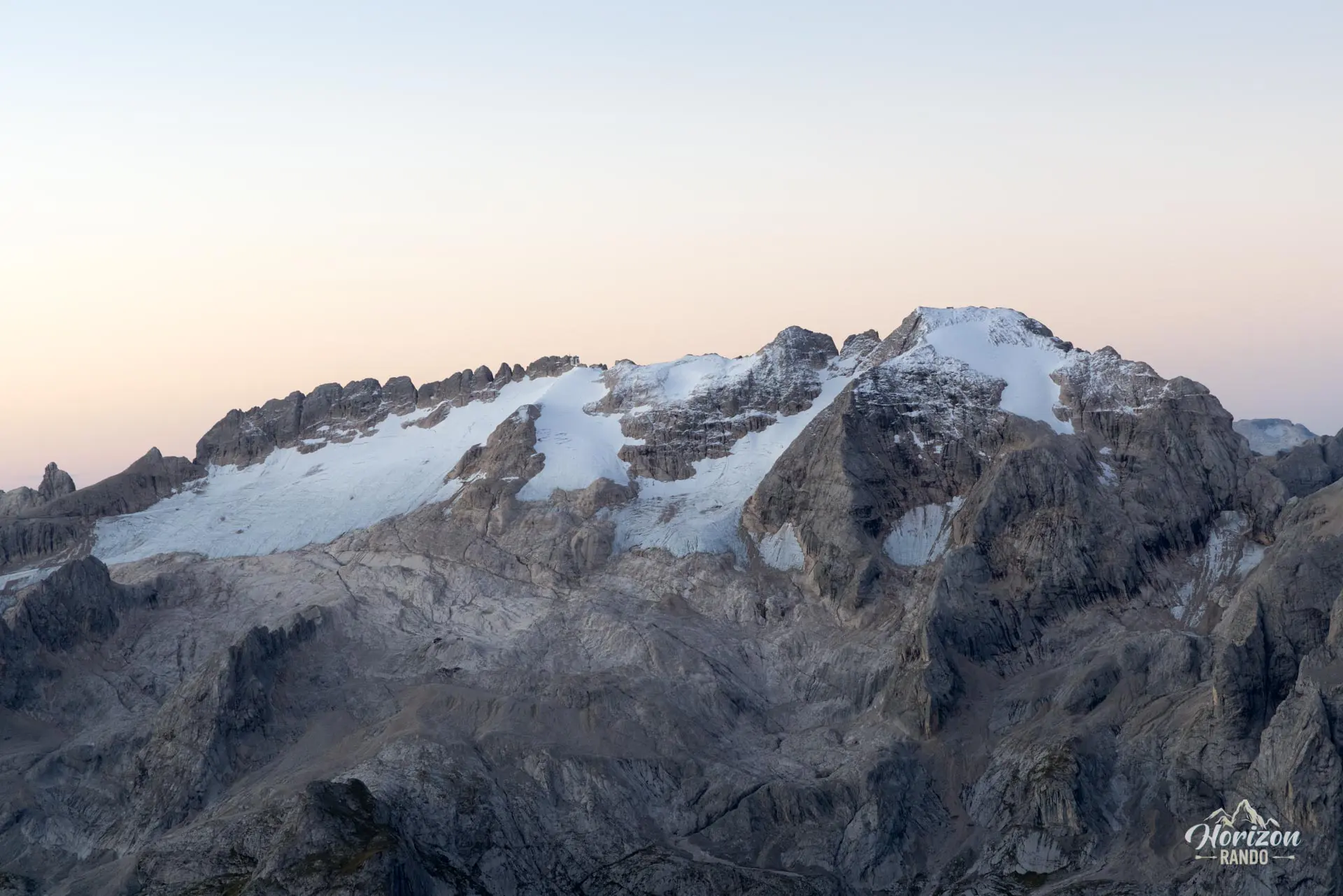
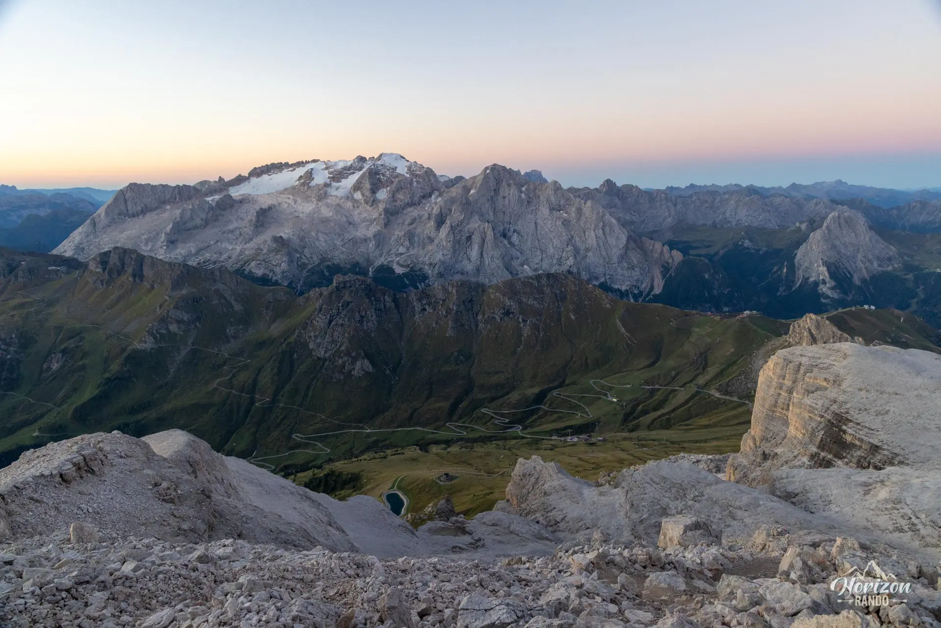
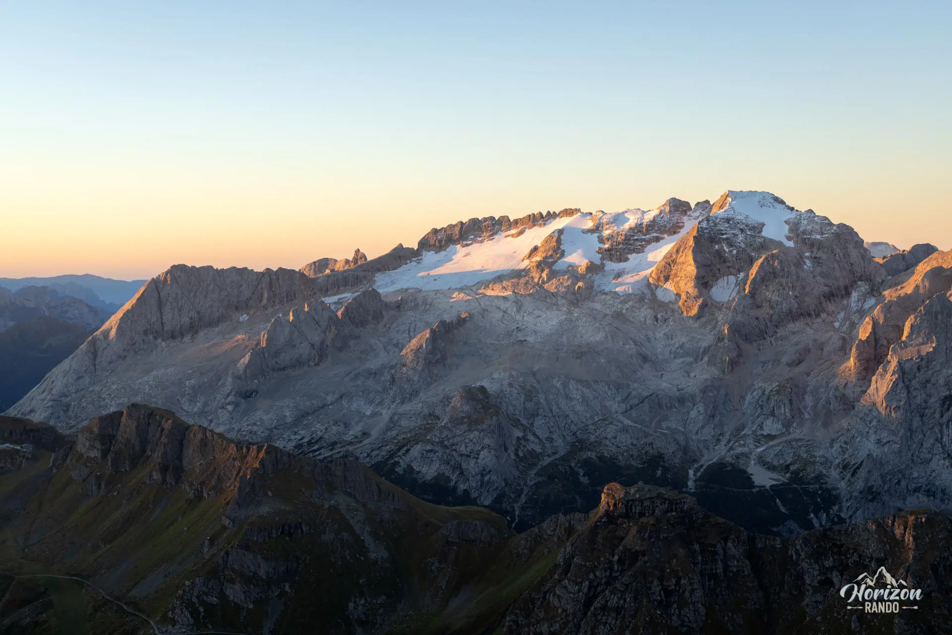
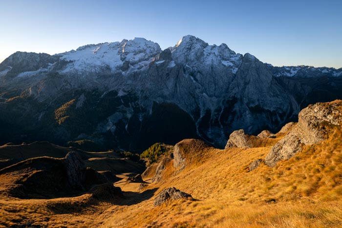
At 3,152 meters, Piz Boè is the highest peak in the Sella Group and one of the most accessible "3,000-meter peaks" in the Dolomites. The Sass Pordoi cable car significantly shortens the ascent, allowing you to traverse a nearly lunar-like rocky plateau in just a few hours with legendary peaks, such as the Marmolada and the Sassolungo, as a backdrop.
However, this ease of access also makes it one of the most popular hikes in the region, with a significant influx of hikers as soon as the lifts open.
Remarks
Parking: There is a large paid parking lot at Passo Pordoi (indicative price in 2025: €2/hour, maximum €10). Free spots are also available along the road near the pass but fill up quickly during peak season.
Sass Pordoi cable car: The Sass Pordoi cable car is open from mid-May to early November, generally from 9 a.m. to 5 p.m.. Indicative price in 2025: €32 per adult for a round trip. Check the official Sass Pordoi website for current rates and schedules.
Alternative without the cable car: I recommend this option to avoid the crowds. Aim to start before 7 a.m. to reach Forcella Pordoi before the first cable car riders and enjoy the final ascent in peace. Simply follow trail no. 627 from Passo Pordoi to Forcella Pordoi, where you'll join the route described on this page. However, expect twice the elevation gain (about 1,000 meters) and a total duration of about five hours. Download the GPX track for Passo Pordoi – Forcella Pordoi.
Ideal time of year: From early July to late September. The high altitude shortens the hiking season compared to most other hikes in the Dolomites, and there is a risk of snow and patches of ice at the beginning and end of the season.
Description and difficulties of the hike
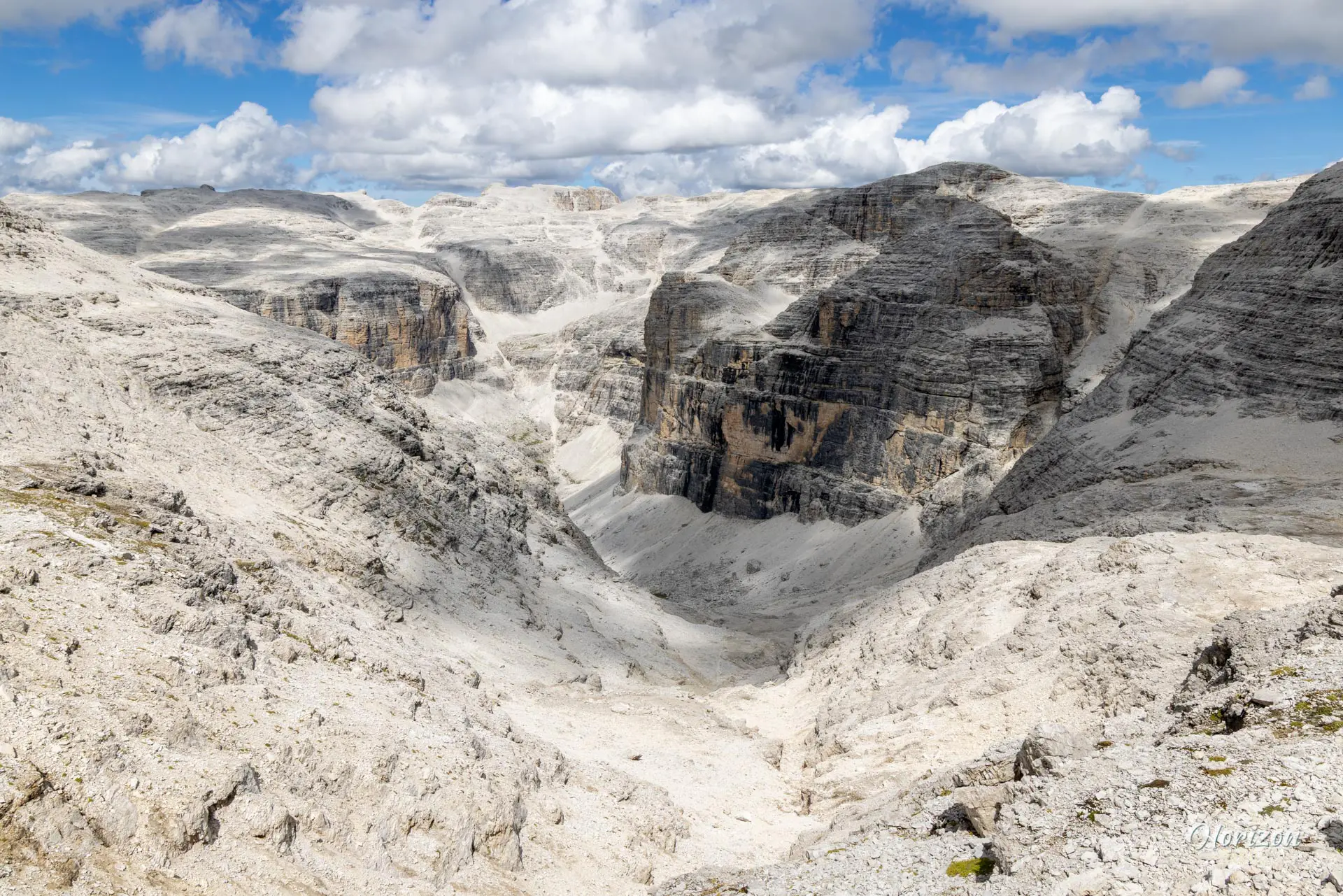
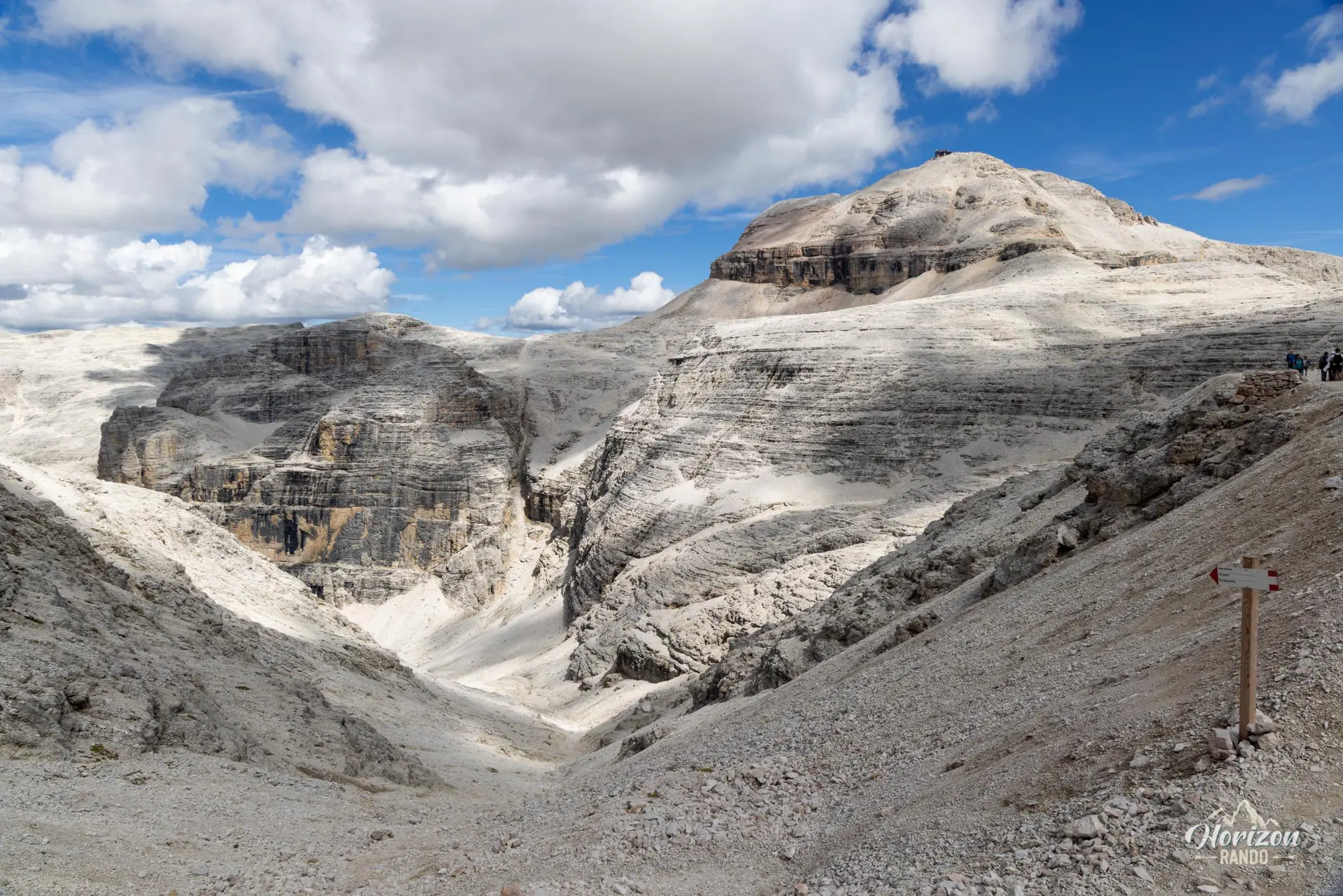
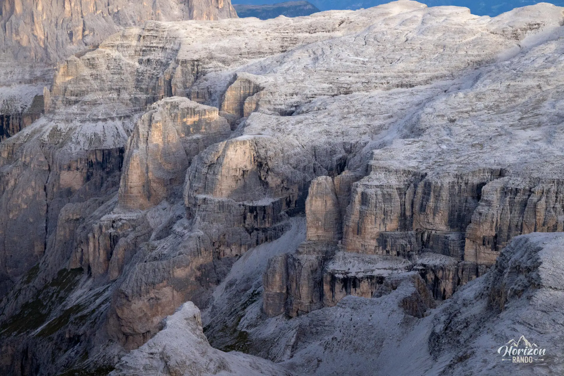
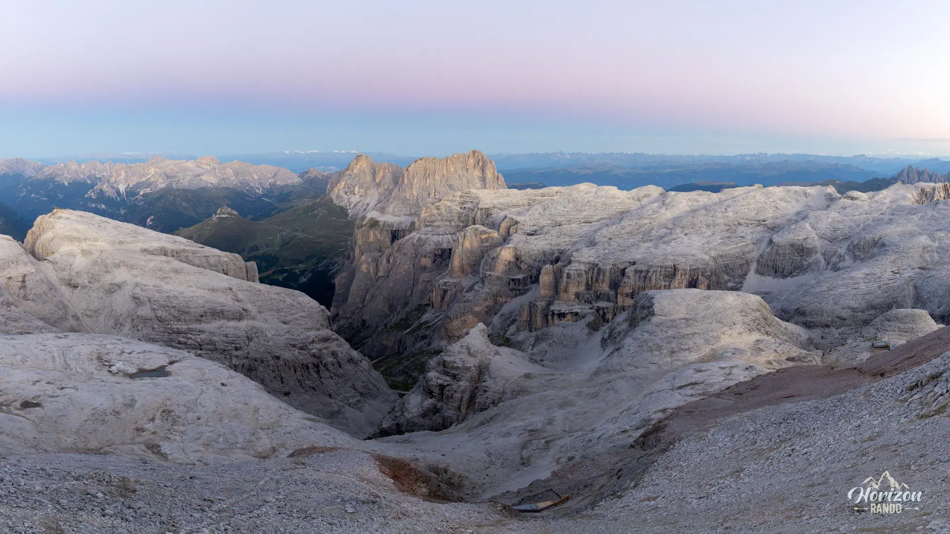
Upon exiting the upper station of Sass Pordoi (2,950 m), follow trail no. 627A toward Piz Boè. The trail descends about 100 meters via switchbacks over scree to Forcella Pordoi (2,848 m), where a small mountain hut is located in the pass. Continue on trail no. 627, which crosses a stony, almost lunar-looking plateau. Then, turn onto trail no. 638, which begins the ascent toward Piz Boè.
There are markings everywhere, and directional signs are posted at all intersections. However, be careful: all trails in the area are marked in red and white. These markings only indicate that you are on a trail, not necessarily the correct one, so you must carefully check the numbers at intersections.
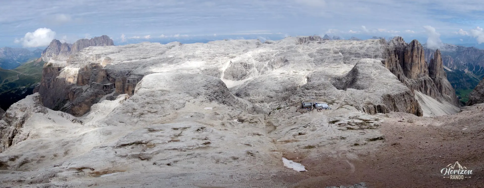
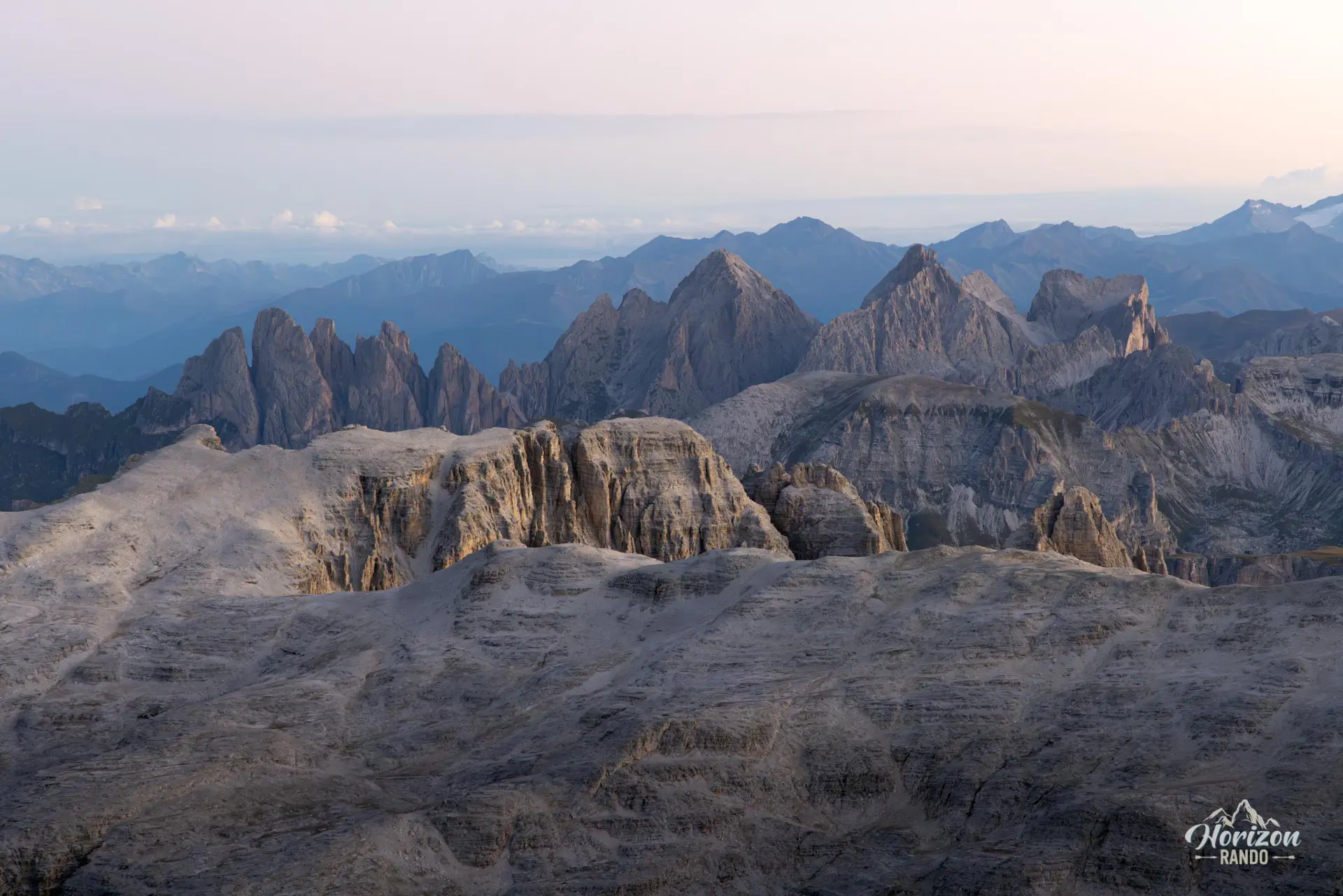
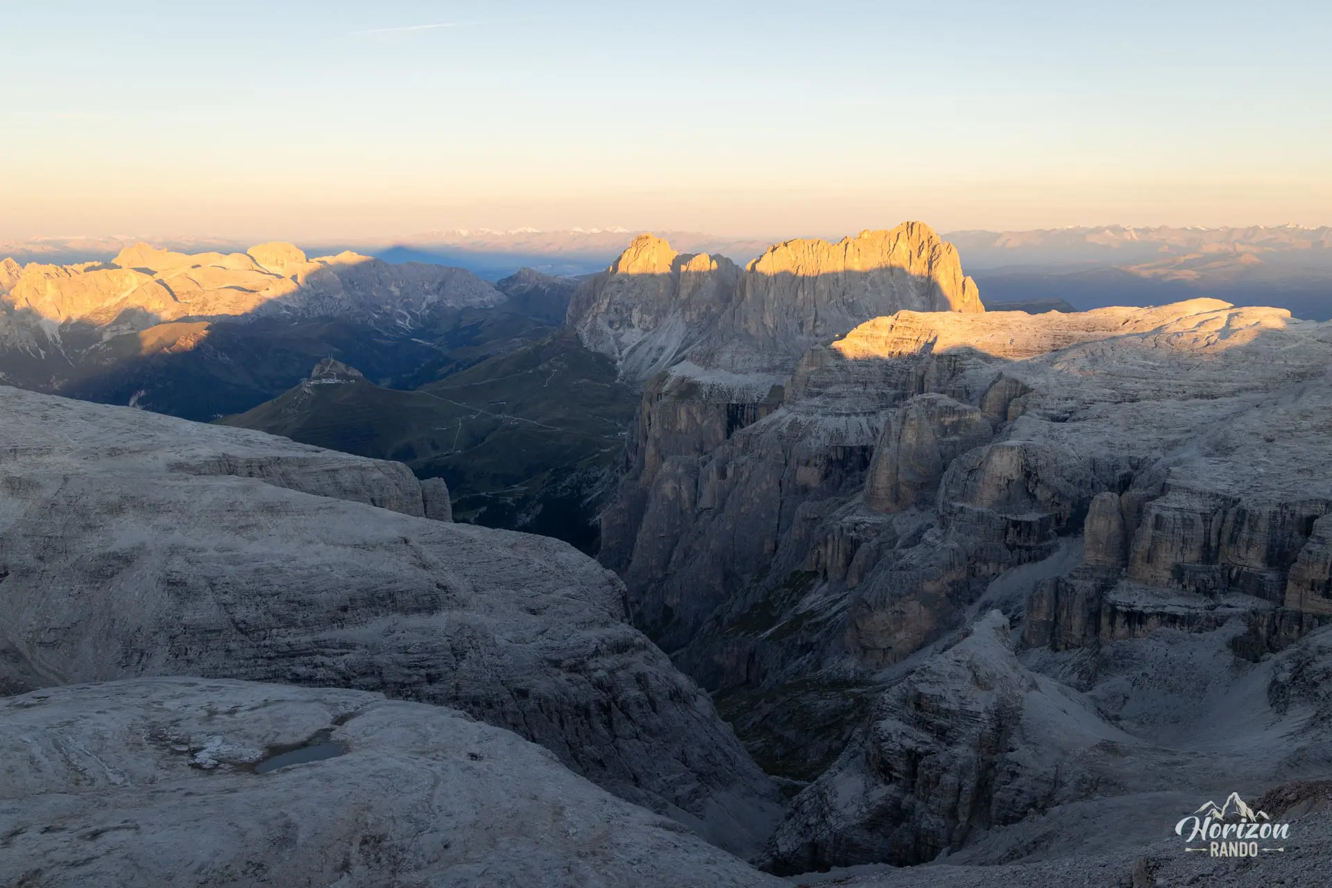
The final section of the ascent includes two to three rock steps with handlines. There is no major technical difficulty, just a few easy rock-climbing steps with moderate exposure. You will then emerge at the summit, where Rifugio Capanna Fassa stands. From there, you can enjoy a 360° panorama of the greatest Dolomite massifs—Marmolada, Sassolungo, Sella, and Tofane—and, on a clear day, the view extends all the way to the Austrian Alps.
The descent follows trail no. 638 to Rifugio Boè (2,871 m), then trails no. 627 and 627A to the cable car. Several sections are equipped with handlines, and there are a few slightly dizzying stretches on the way down to the Rifugio Boè.
What you'll love
- An accessible 3,000-meter peak: One of the few "3,000s" in the Dolomites that can be reached in half a day without via ferrata equipment.
- The spectacular panorama from the summit with unobstructed views of the Marmolada, Sassolungo, Catinaccio, and the Tofane.
- The almost lunar atmosphere of a vast, rocky, desert-like plateau bordered by sheer, vertical cliffs.
- The three huts along the route: Rifugio Pordoi, Capanna Piz Fassa (at the summit), and Rifugio Boè, which offer a chance for a gourmet break or an overnight stay at high altitude for those who wish.
Hike technical sheet
➡️ Hiking parameters
➡️ Hiking parameters
➡️ Hiking parameters
Map and elevation profile of the hike
Slideshow

Nearby hikes
Padon Ridge and Viel del Pan Loop Hike
- Difficulty : Easy
- Duration : 2 h 45
- Distance : 7.4 km
- Elevation gain : 420 m

Passo Pordoi to Lago di Fedaia via Viel del Pan Hike
- Difficulty : Moderate / Hard
- Duration : 5 h 30
- Distance : 15.3 km
- Elevation gain : 780 m

Piz Boè and Piz Selva Hike
- Difficulty : Hard
- Duration : 6 h 30
- Distance : 16.2 km
- Elevation gain : 930 m

Sassolungo Loop
- Difficulty : Moderate
- Duration : 5 h 30
- Distance : 16.1 km
- Elevation gain : 790 m
Map of the 10 closest hikes
Hikes to discover

Via Ferrata Ivano Dibona
- Hiking Difficulty : Hard
- Via Ferrata Difficulty : B (Moderatly difficult)
- Duration : 7 h
- Distance : 8.9 km
- Elevation gain : 1180 m

Forca Rossa and Rifugio Fuciade Hike
- Difficulty : Moderate
- Duration : 4 h 15
- Distance : 10.9 km
- Elevation gain : 680 m

Via Ferrata Merlone - from Lago d'Antorno to Cima Cadin
- Hiking Difficulty : Moderate
- Via Ferrata Difficulty : B/C (Moderatly difficult)
- Duration : 6 h
- Distance : 9.6 km
- Elevation gain : 1010 m

Croda da Lago Loop
- Difficulty : Moderate
- Duration : 5 h
- Distance : 12.8 km
- Elevation gain : 910 m

Via Ferrata Ra Gusela
- Hiking Difficulty : Easy
- Via Ferrata Difficulty : A (Easy)
- Duration : 3 h 30
- Distance : 8 km
- Elevation gain : 610 m

Via Ferrata Ra Gusela and Averau
- Hiking Difficulty : Moderate
- Via Ferrata Difficulty : A/B (Easy)
- Duration : 4 h 30
- Distance : 9 km
- Elevation gain : 720 m