
Via Ferrata Ivano Dibona
Hike overview
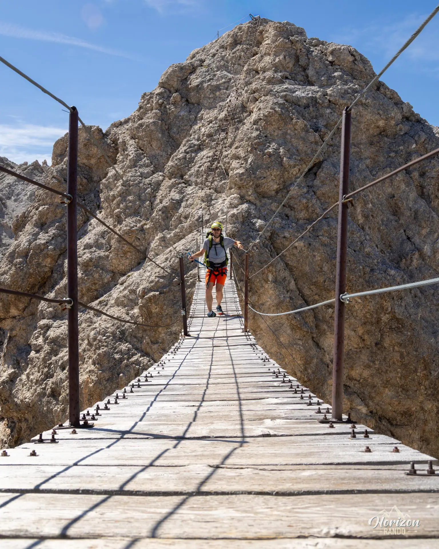
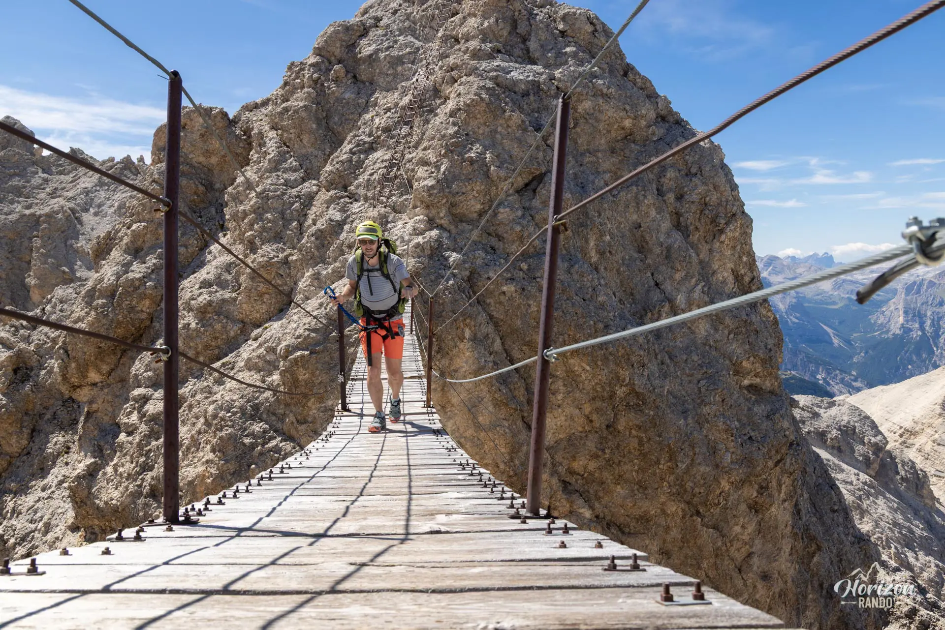
The via ferrata Ivano Dibona runs along the lengthy southern ridge of the Cristallo massif, northeast of Cortina d'Ampezzo. The route features numerous equipped sections, scenic hiking trails, tunnels, and a spectacular 30-meter suspension bridge made famous by the movie Cliffhanger.
While not technically difficult, the route is demanding due to its length, altitude, and exposure to the void and the elements (wind and storms). Since the Son Forca chairlift and Rifugio Lorenzi closed in 2016, foot traffic has dropped significantly. Today, it is one of the major via ferrata routes in the Dolomites where you can still hike in relative tranquility. It is a magnificent immersion in typical high-mountain landscapes and one of my favorite routes in the Dolomites.
Remarks
Equipment: A complete via ferrata kit is required (helmet, harness, and lanyard with an energy absorber). Trekking poles are useful for the final descent.
Ideal period: from early July to late September. Early in the season, snow may remain in the Staunies gully and on the northern sections of the ridge, so check conditions before setting out.
Rio Gere – Son Forca chairlift: generally open from 8:30 a.m. to 4:30 p.m., from mid-June to late September. This time frame is sufficient, but short, for completing the entire circuit in a single day—set out on the first run. For schedules and rates, visit skipasscortina.com. There is a very large free parking lot at Rio Gere.
Alternative without the chairlift: start on foot from Passo Tre Croci via trail no. 203. Expect a 300-meter elevation gain and an additional 1.5-hour walk (download the GPX track).
Extension: from Rifugio Lorenzi—the end of the Dibona via ferrata equipped section—the Marino Bianchi via ferrata begins. For the complete circuit, which includes both routes, see the sheet for the Ivano Dibona and Marino Bianchi via ferratas.
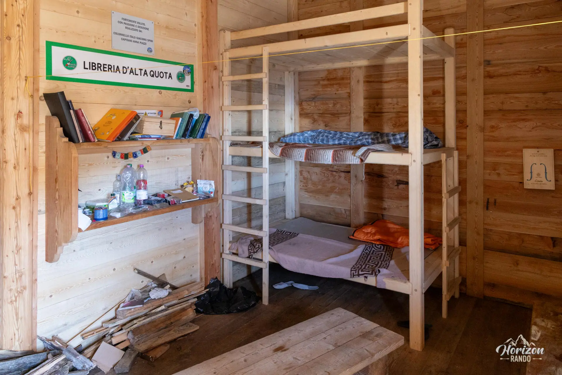
Buffa di Perrero bivouac: unmanned and very basic (see photos). It is useful in case of emergency or to split the route over two days.
Description and difficulties of the hike
There are two possible starting points: from the top of the Son Forca chairlift (the shortest option, but subject to operating hours) or directly from Passo Tre Croci via trail no. 203. The latter adds about 300 meters of elevation gain and an hour and a half of walking round-trip. Passo Tre Croci is also the starting point for the popular Lago di Sorapis trail. Plan to arrive early to find parking. The chairlift parking lot is larger and free and is a better option if you're starting at the first chair.
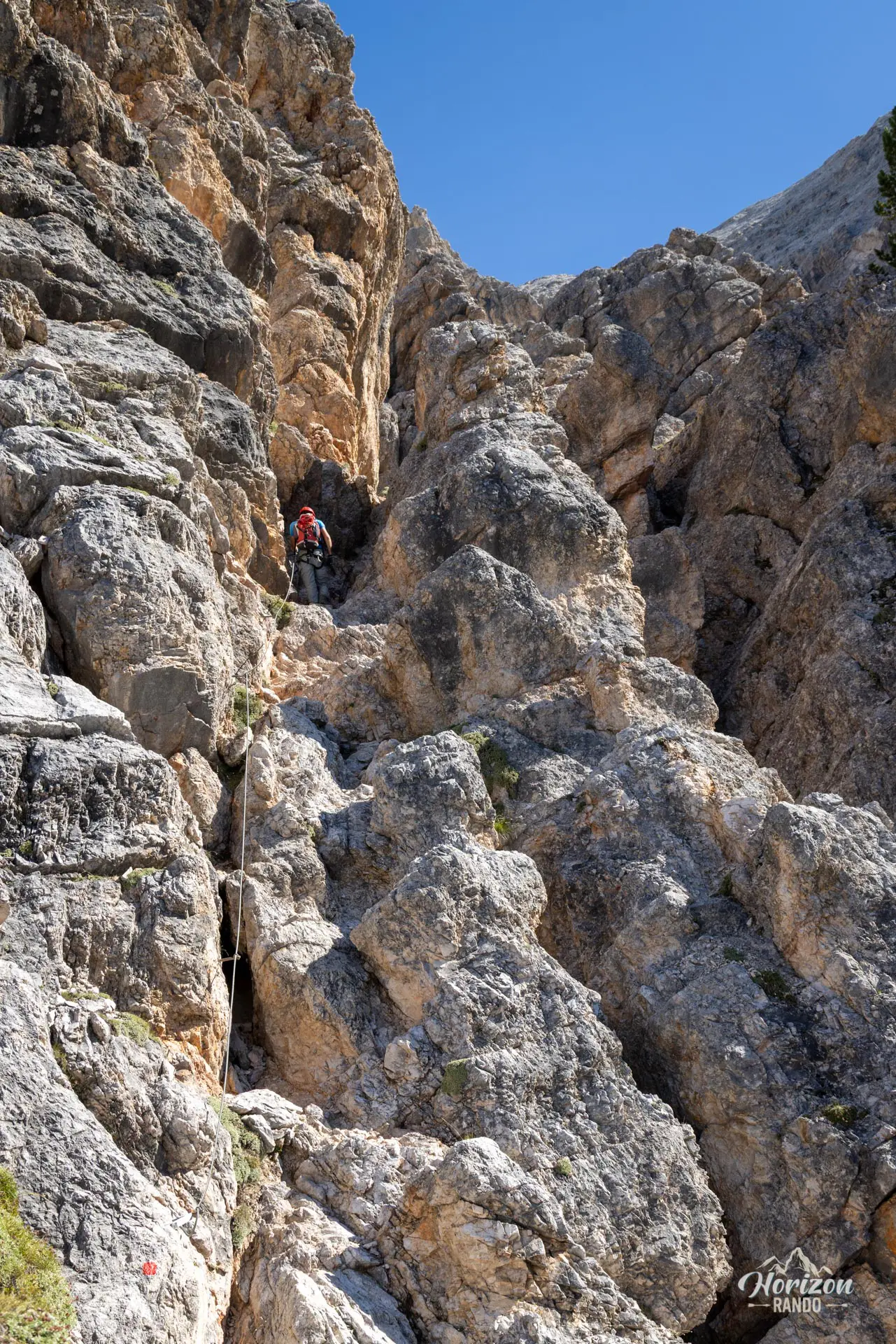
I recommend hiking the loop clockwise to avoid the Staunies scree gully on the ascent, which is particularly grueling. The approach hike takes just over an hour: 400 meters of elevation gain over about 3 kilometers. From Rifugio Son Forca, descend toward Val Padeon along a marked but unnumbered trail that traverses the mountainside. Then, gradually climb northward to the base of the via ferrata. The route starts gently with short equipped rock steps up to Forcella del Vecio (2,687 m).
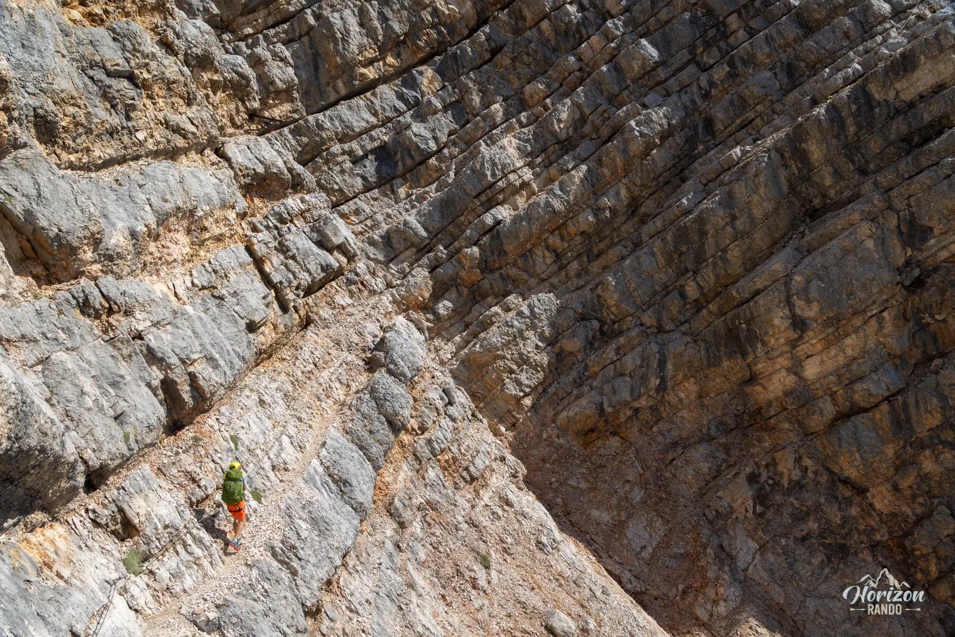
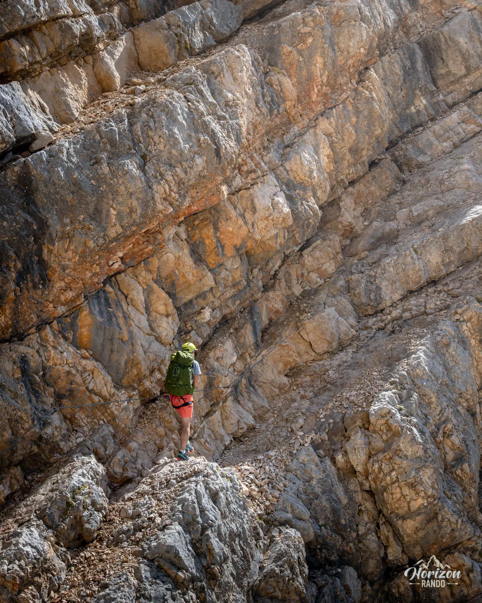
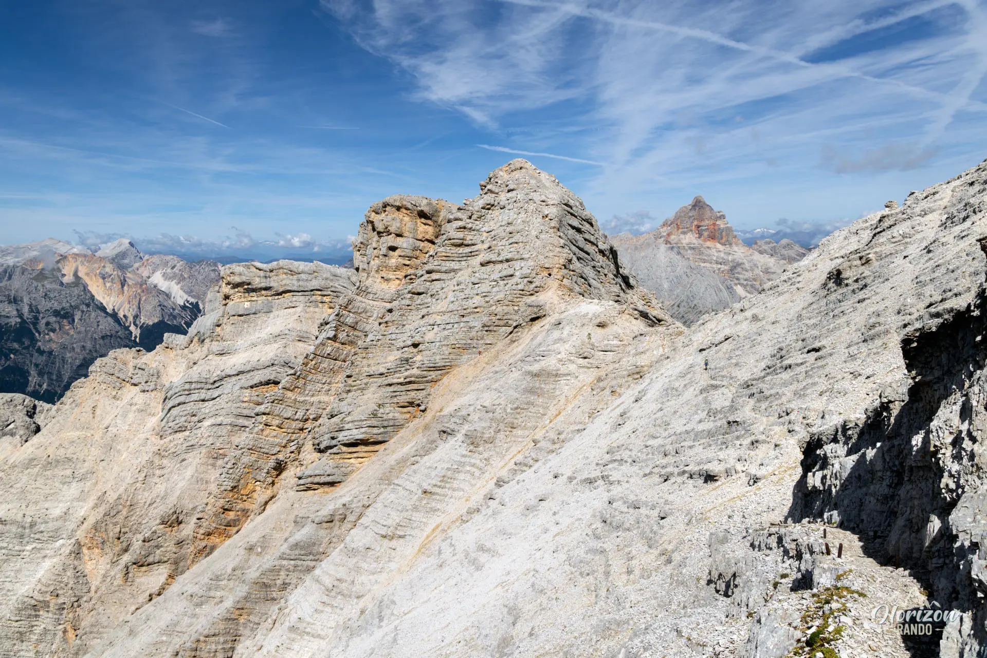
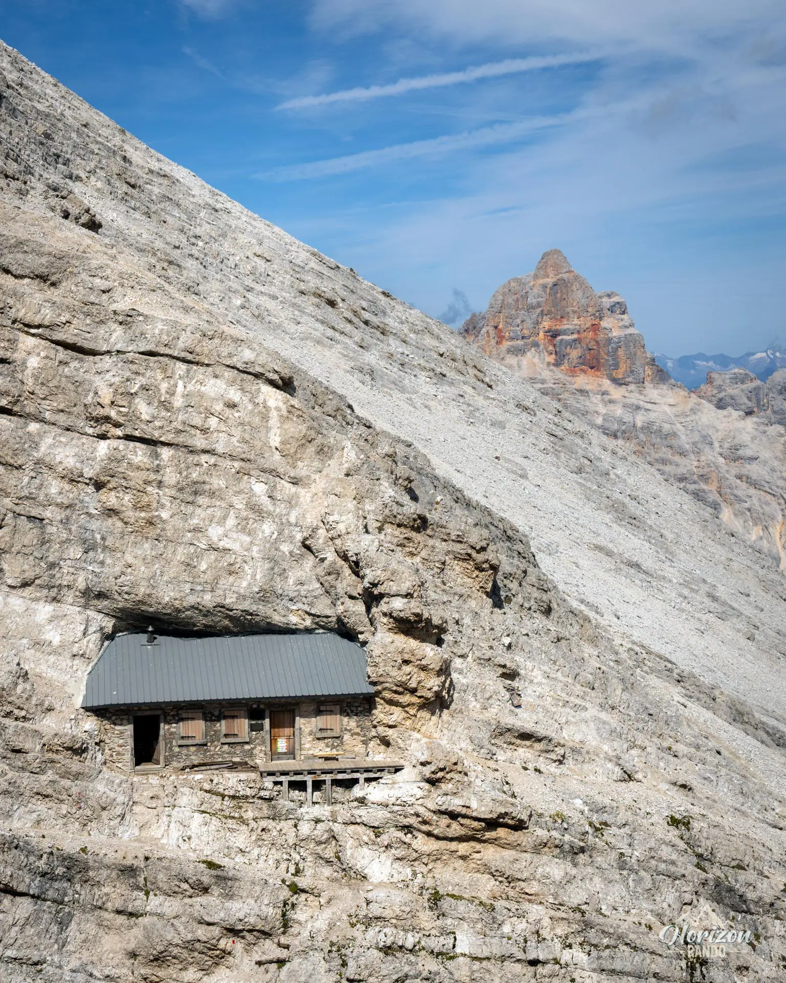
It continues along the ridge for several kilometers, alternating between equipped sections, ledges cut into the rock face, short WWI tunnels, and unequipped sections. The equipped sections are not very technical, but there are frequent airy passages: you must remain vigilant and belay yourself systematically, even on the easy ledges. You will reach the Buffa di Perrero bivouac (2,770 m), a former military shelter that was restored in 2022 and clings to the face of Forcella Padeon. Beyond that, you will pass Forcella Grande, which has the remains of barracks, and then reach the summit of Cresta Bianca (2,932 m).
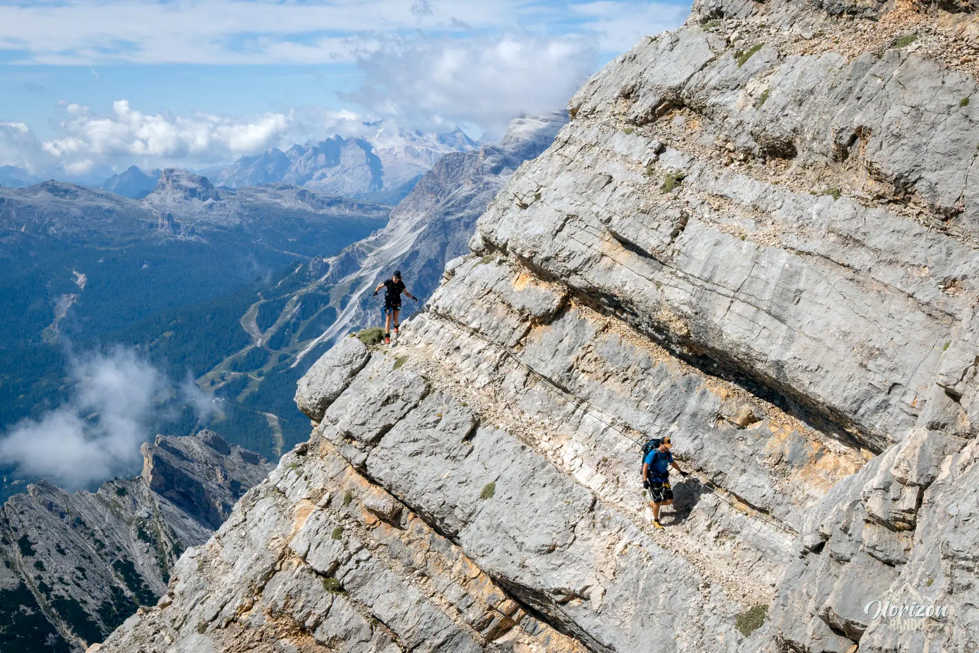
As you approach Ponte Cristallo, the equipped sections become longer, alternating between rock steps and airy ledges. A short round trip from the ridge leads to the summit of Cristallino d'Ampezzo (3,008 m)—a detour not to be missed for its 360° panorama of the Tre Cime, the Tofane, the Sorapiss, and the entire Cristallo massif.
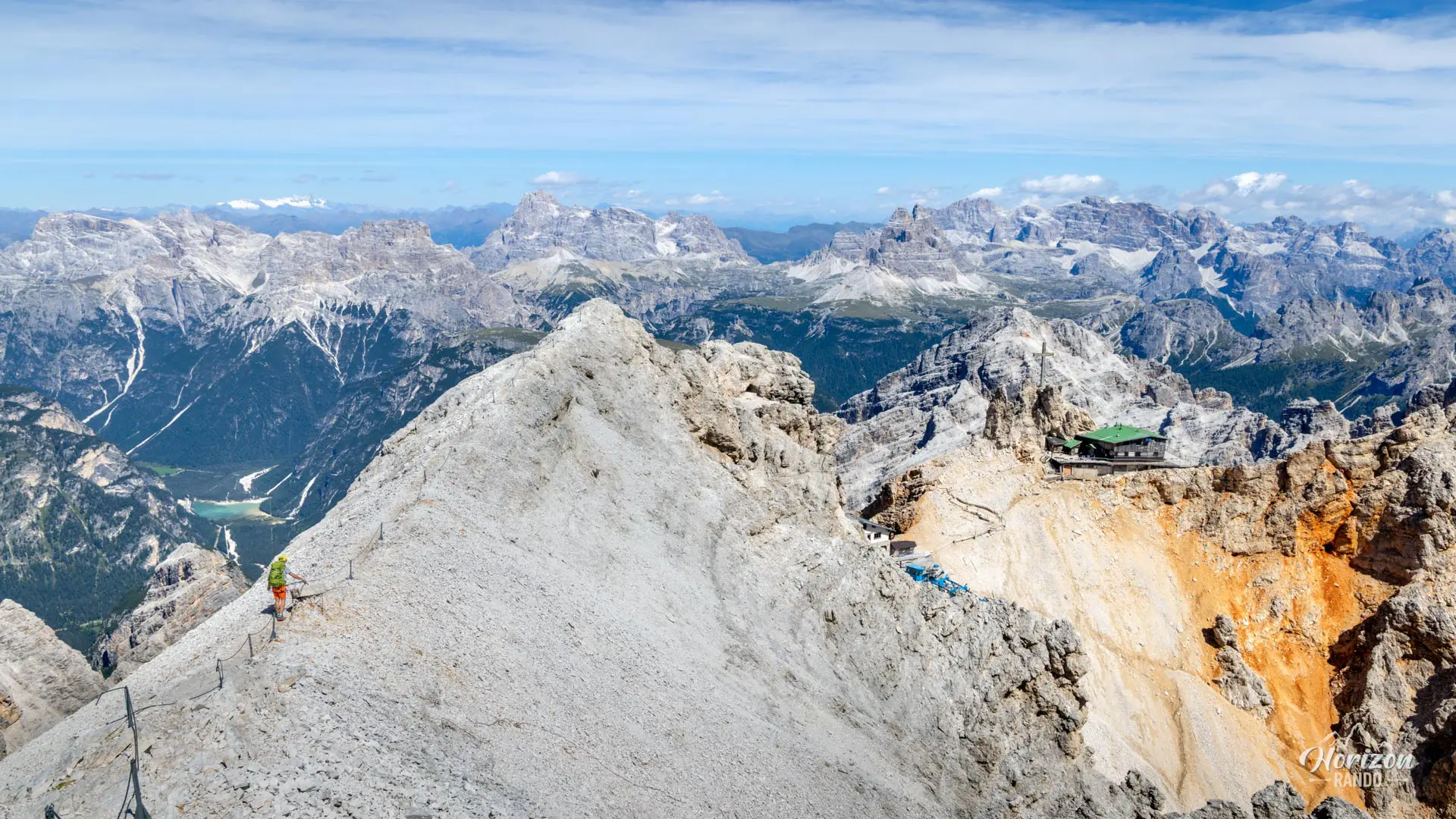
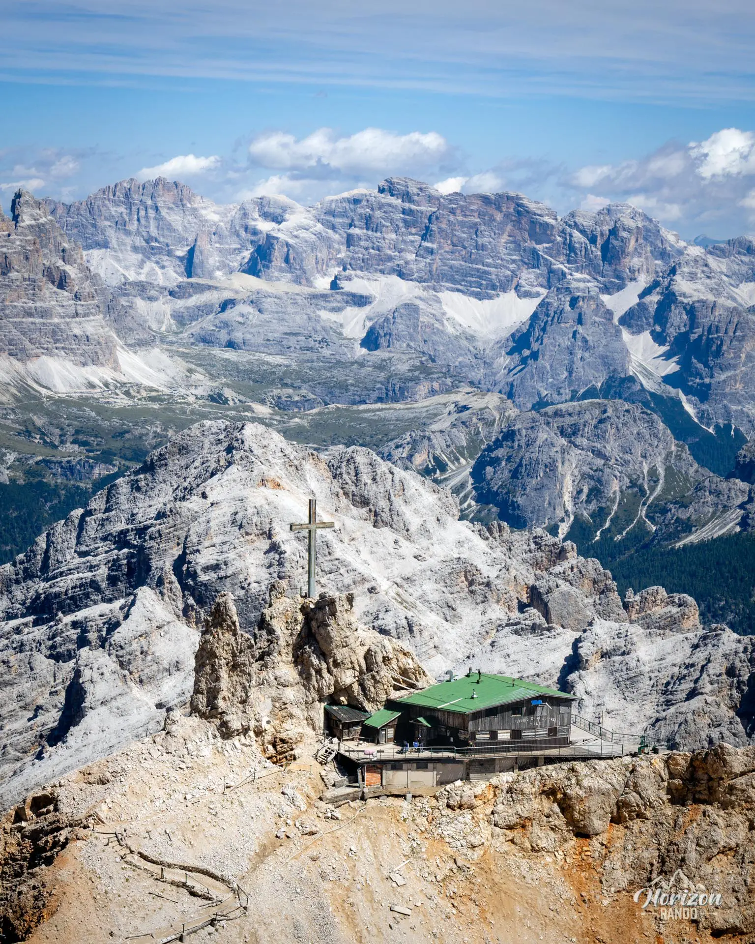
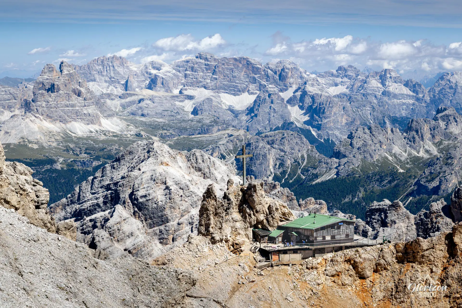
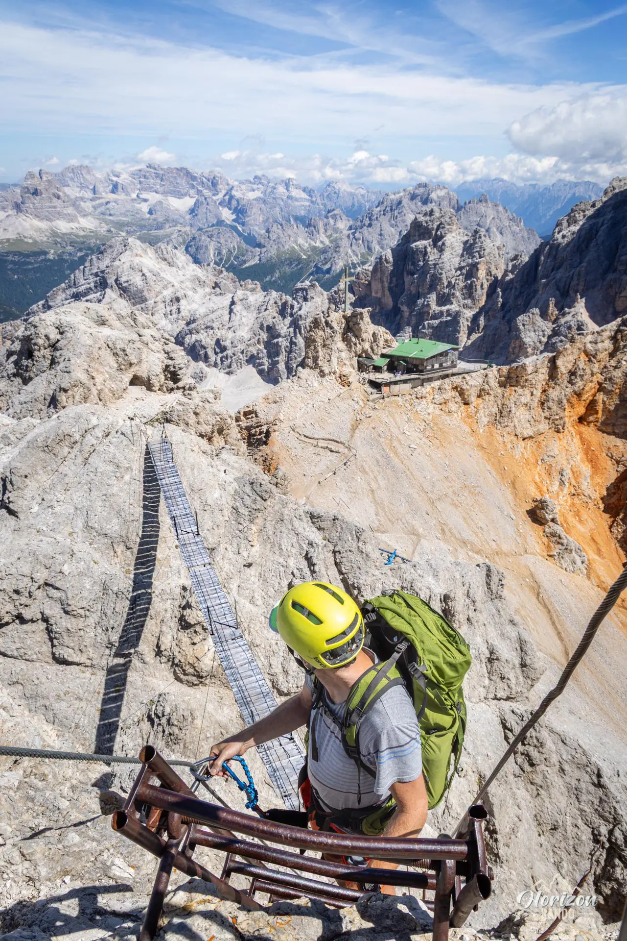
Next, you cross the Ponte Cristallo, a thirty-meter-high suspension bridge and true emblem of the route. After a few more ladders and cables, you will reach Forcella Staunies (2,906 m) and the ruins of Rifugio Lorenzi, which has been closed since 2016 and is in an advanced state of disrepair.
From Forcella Staunies, the final descent begins with approximately 700 meters of elevation loss down a long, steep gully on unstable scree. This section is manageable for hikers who are comfortable with this type of terrain, such as taking long strides and sliding in a controlled manner with each step; others will find it long and hard on the knees. At the bottom, you will reach the Son Forca Mountain Hut, then the chairlift, and finally, the Rio Gere parking lot.
What you'll love
- The long, panoramic ridge traverse, which offers hours of exceptional views of the Eastern Dolomites, including the Tofane, Sorapiss, Cristallo, and Tre Cime peaks.
- The immersion in the history of World War I with tunnels, barracks, observation posts, and the Buffa di Perrero bivouac.
- The 30-meter suspension bridge and the series of ladders at the end of the route, which were made famous by the movie Cliffhanger.
- The surprisingly low foot traffic for such a renowned via ferrata.
Hike technical sheet
➡️ Hiking parameters
➡️ Hiking parameters
➡️ Hiking parameters
Map and elevation profile of the hike
Slideshow


Nearby hikes

Via Ferrata Marino Bianchi
- Hiking Difficulty : Hard
- Via Ferrata Difficulty : C (Difficult)
- Duration : 6 h
- Distance : 11.8 km
- Elevation gain : 1090 m

Via Ferrata Ivano Dibona and Marino Bianchi
- Hiking Difficulty : Very Hard
- Via Ferrata Difficulty : C (Difficult)
- Duration : 11 h
- Distance : 15.9 km
- Elevation gain : 1810 m

Lago di Sorapis Hike
- Difficulty : Moderate
- Duration : 4 h 30
- Distance : 12.1 km
- Elevation gain : 500 m

Via Ferrata Michielli Strobel
- Hiking Difficulty : Hard
- Via Ferrata Difficulty : C (Difficult)
- Duration : 5 h
- Distance : 6.8 km
- Elevation gain : 950 m
Map of the 12 closest hikes
Hikes to discover

Monte Cernera Hike
- Difficulty : Moderate / Hard
- Duration : 2 h 45
- Distance : 5.9 km
- Elevation gain : 530 m

Lago di Braies Loop
- Difficulty : Very easy
- Duration : 1 h 15
- Distance : 3.7 km
- Elevation gain : 90 m

Croda da Lago Loop
- Difficulty : Moderate
- Duration : 5 h
- Distance : 12.8 km
- Elevation gain : 910 m

Via Ferrata Averau
- Hiking Difficulty : Moderate
- Via Ferrata Difficulty : A/B (Easy)
- Duration : 3 h 30
- Distance : 8.4 km
- Elevation gain : 580 m

Monte Nuvolau, Monte Averau and Cinque Torri Circuit
- Hiking Difficulty : Hard
- Via Ferrata Difficulty : A/B (Easy)
- Duration : 5 h 30
- Distance : 11.4 km
- Elevation gain : 950 m

Sass de Putia Hike and Via Ferrata
- Hiking Difficulty : Hard
- Via Ferrata Difficulty : A (Easy)
- Duration : 7 h
- Distance : 17.4 km
- Elevation gain : 1200 m