
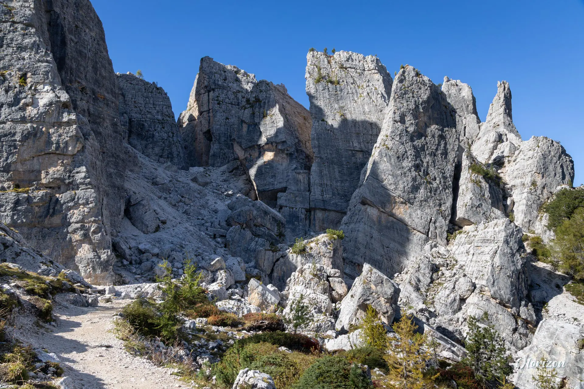
Cinque Torri Hike
Hike overview
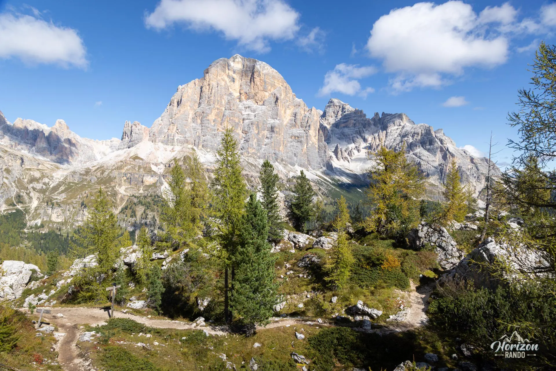
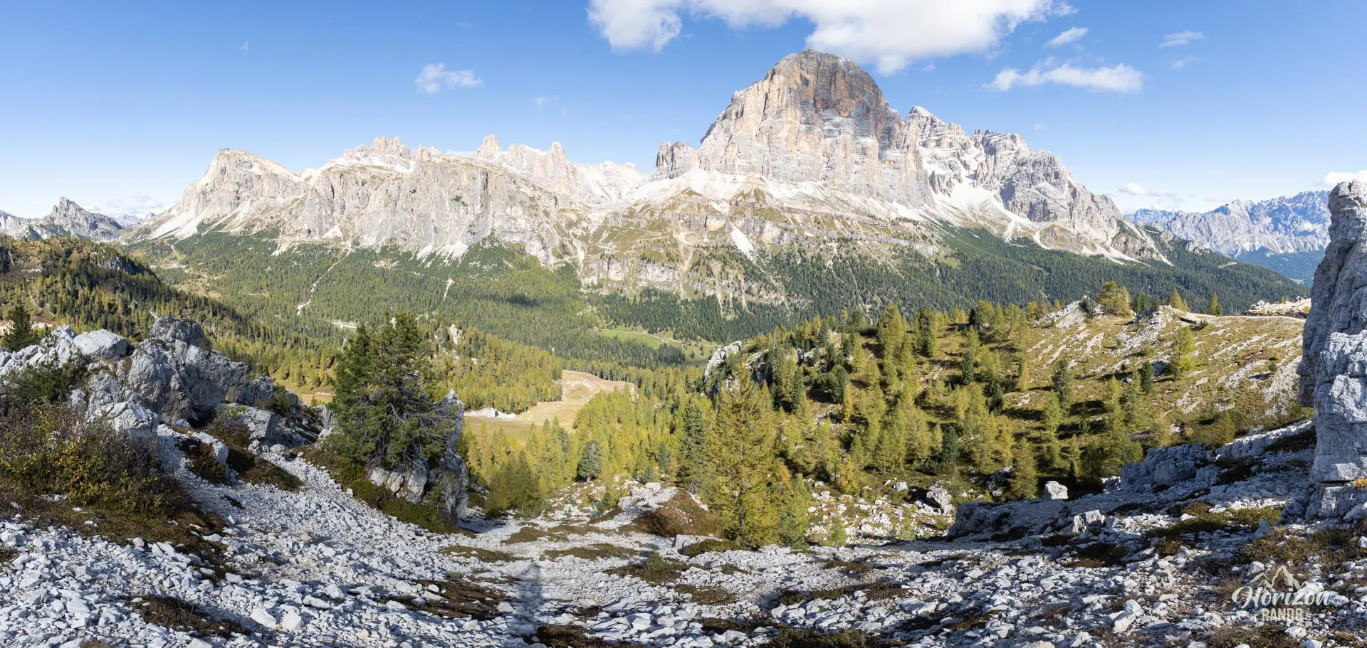
Located opposite the Tofane massif above Cortina d'Ampezzo, this hike leads to the foot of the Cinque Torri, a rock formation of five instantly recognizable towers. The route passes through a larch and spruce forest, opens onto a panoramic overlook facing the Tofane, and crosses the Great War open-air museum site. This accessible route has no technical difficulty and is ideal for a first taste of the Dolomites.
Remarks
Parking: parking is free at the lower station of the Cinque Torri chairlift (Bai de Dones), on the road between Cortina d'Ampezzo and Passo Falzarego.
Chairlift option: Take the Bai de Dones–Scoiattoli chairlift up and/or down to focus on touring the towers.
Possible extension: The route easily connects with the Averau Hut and Monte Nuvolau (the oldest hut in the Dolomites), for a more demanding day out.
Description and difficulties of the hike
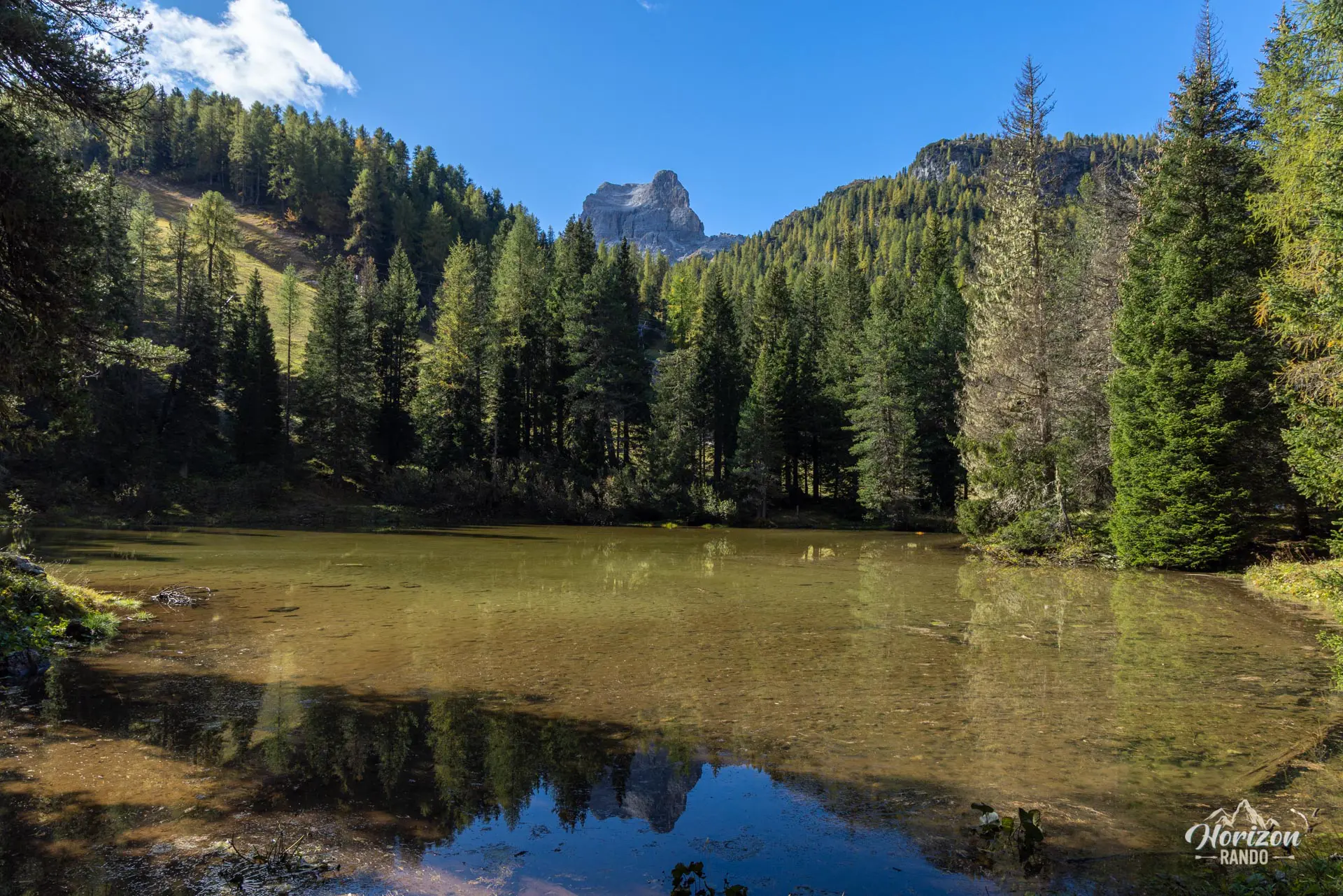
From the Bai de Dones chairlift parking lot, Trail 424 climbs through the forest and circles Lago Bai de Dones before joining Trail 425 toward Rifugio Scoiattoli and the Cinque Torri. At the base of the towers, a loop trail makes a complete circuit of them — this is where the Great War Open-Air Museum is located, with restored trenches, shelters, and observation posts from the battles between the Italians and the Austro-Hungarians (1915–1917). Signposts line the route, which is virtually flat.
The descent follows Trail 440, which is less frequented and sparsely marked; pay close attention at junctions. It eventually joins Trail 424, which leads back to the parking lot.
Note: The route itself is unmarked, but junctions are clearly signposted with trail numbers.
What you'll love
- The Cinque Torri themselves: five towers with distinctive silhouettes that are impressive when viewed up close.
- The Great War open-air museum, which offers a free, self-guided tour and is remarkably well-restored.
- The unobstructed views of the south face of Tofana di Rozes throughout the route.
Hike technical sheet
➡️ Hiking parameters
➡️ Hiking parameters
➡️ Hiking parameters
Map and elevation profile of the hike
Slideshow


Nearby hikes

Lago Limides, Monte Nuvolau and Cinque Torri Circuit
- Difficulty : Moderate
- Duration : 4 h 30
- Distance : 11.1 km
- Elevation gain : 790 m

Lago di Limides Hike
- Difficulty : Very easy
- Duration : 1 h
- Distance : 2.4 km
- Elevation gain : 150 m

Via Ferrata Degli Alpini - Col dei Bos
- Hiking Difficulty : Easy
- Via Ferrata Difficulty : C (Difficult)
- Duration : 3 h 15
- Distance : 3.7 km
- Elevation gain : 490 m

Via Ferrata Degli Alpini and Monte Lagazuoi
- Hiking Difficulty : Moderate
- Via Ferrata Difficulty : C (Difficult)
- Duration : 5 h
- Distance : 8 km
- Elevation gain : 830 m
Map of the 11 closest hikes
Hikes to discover

Croda Fiscalina Loop via Rifugio Locatelli
- Difficulty : Hard
- Duration : 7 h 30
- Distance : 18.5 km
- Elevation gain : 1210 m

Via Ferrata Sass Rigais
- Hiking Difficulty : Very Hard
- Via Ferrata Difficulty : A (Easy)
- Duration : 6 h 30
- Distance : 11 km
- Elevation gain : 1080 m

Via Ferrata Innerkofler - Monte Paterno
- Hiking Difficulty : Moderate
- Via Ferrata Difficulty : A/B (Easy)
- Duration : 4 h 30
- Distance : 9.5 km
- Elevation gain : 650 m

Via Ferrata Averau
- Hiking Difficulty : Moderate
- Via Ferrata Difficulty : A/B (Easy)
- Duration : 3 h 30
- Distance : 8.4 km
- Elevation gain : 580 m

Monte Nuvolau, Monte Averau and Cinque Torri Circuit
- Hiking Difficulty : Hard
- Via Ferrata Difficulty : A/B (Easy)
- Duration : 5 h 30
- Distance : 11.4 km
- Elevation gain : 950 m

Via Ferrata Ra Gusela and Averau
- Hiking Difficulty : Moderate
- Via Ferrata Difficulty : A/B (Easy)
- Duration : 4 h 30
- Distance : 9 km
- Elevation gain : 720 m