
Monte Lagazuoi and Lagazuoi Tunnels Hike
Hike overview
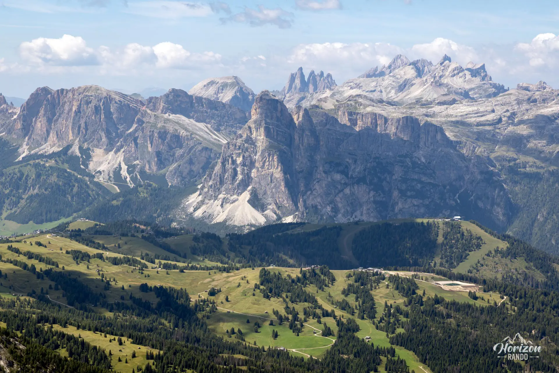
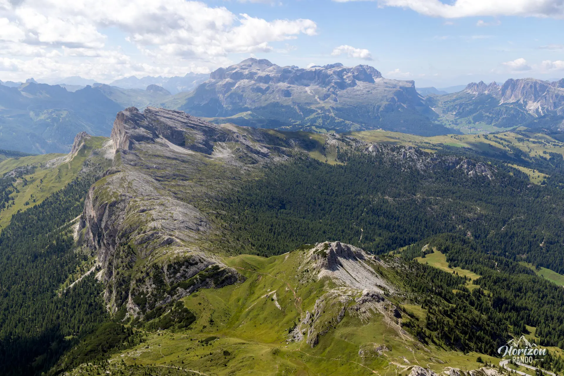
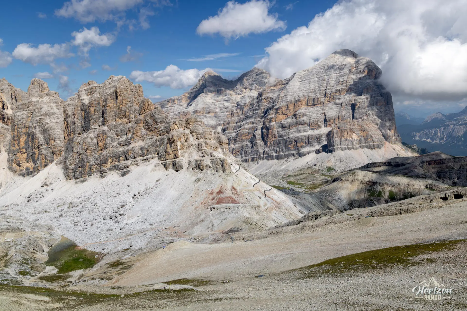
Starting from the Passo Falzarego, this loop hike combines hiking with historical immersion in one of the most significant World War I sites in the Dolomites. The route passes through the tunnels dug into the face of Piccolo Lagazuoi by Italian troops between 1915 and 1917. It then emerges at the summit, offering a 360° panorama of the region's major mountain ranges: Tofane, Marmolada, Sella, Civetta, and Cinque Torri.
Remarks
Parking: A large, free parking lot is available at Passo Falzarego (as of 2025), at the base of the Lagazuoi cable car. It gets very busy during peak season, so arrive early to ensure you find a spot.
Equipment: Headlamp and helmet required. Bring a warm layer because it's cold and damp in the tunnel, even in the middle of summer.
Direction of the hike: Clockwise is recommended because the high, slippery steps in the tunnels are easier to navigate on the way up. You'll also encounter fewer hikers this way, which helps avoid bottlenecks in the tunnels.
Alternative route: Take the Lagazuoi cable car to descend (or ascend) directly to Passo Falzarego from the summit. Schedules and rates are available on the official website lagazuoi.it.
Description and difficulties of the hike
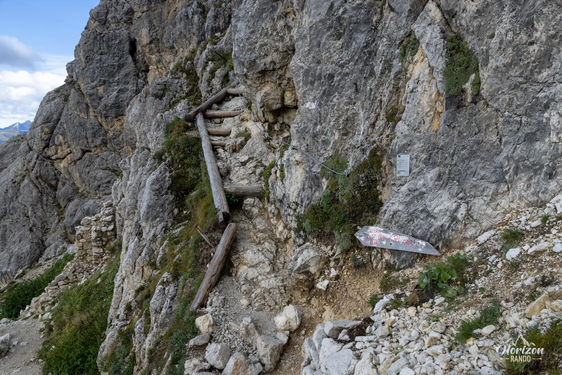
From the Passo Falzarego parking lot, follow trail no. 402, which winds up the south face of Lagazuoi. After about 20 minutes, at the fork marked "Galleria," turn left to reach the lower entrance of the tunnel.
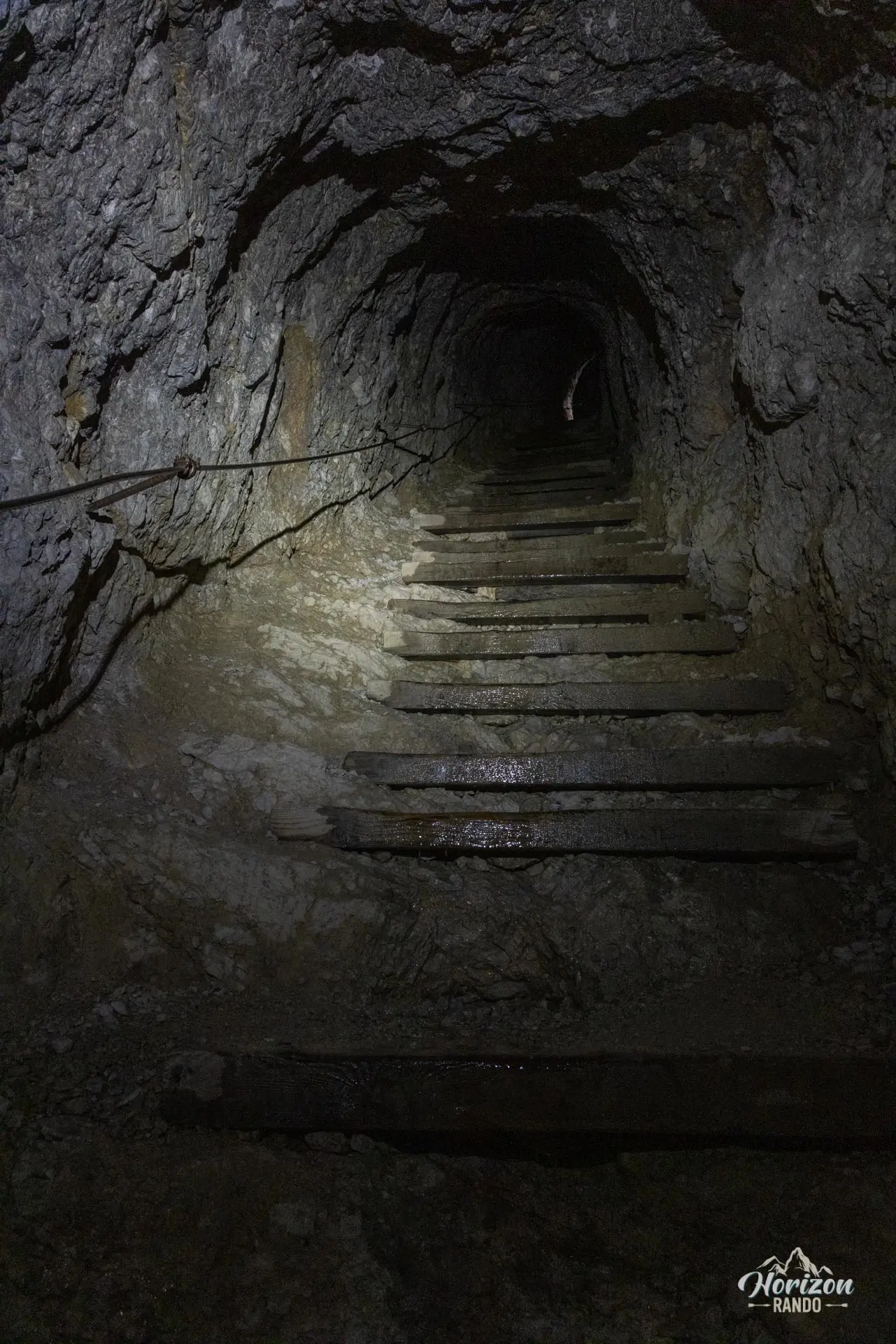
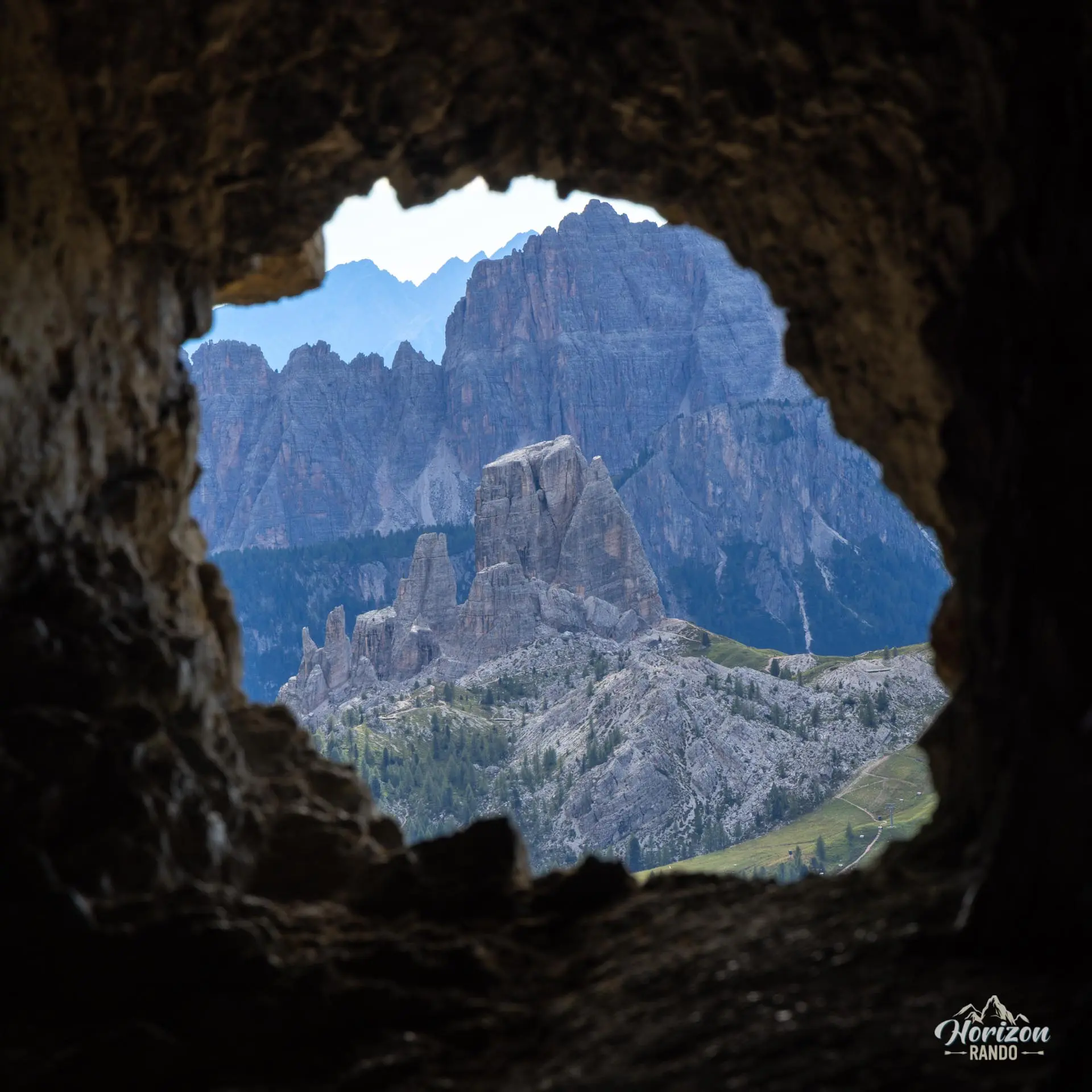
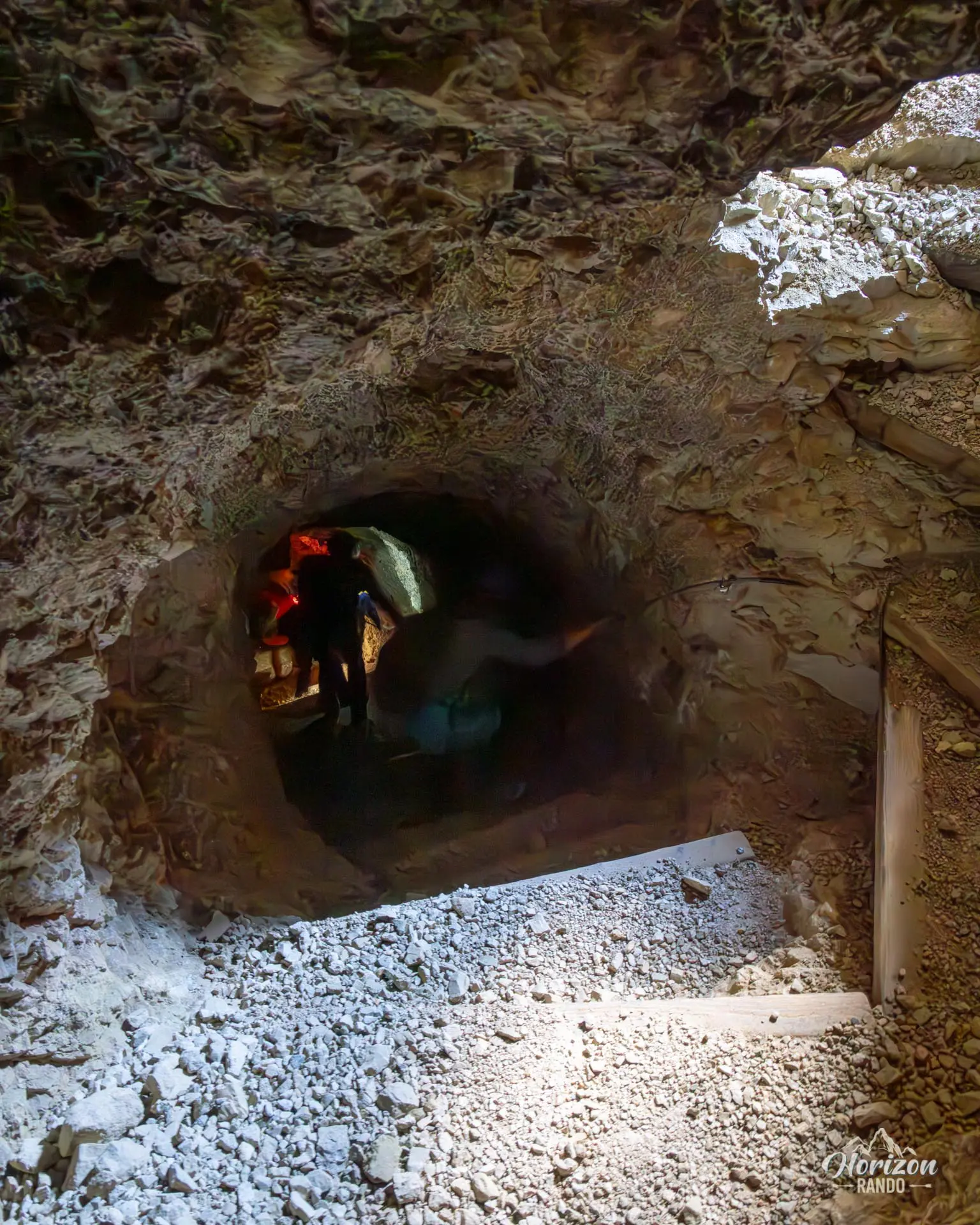
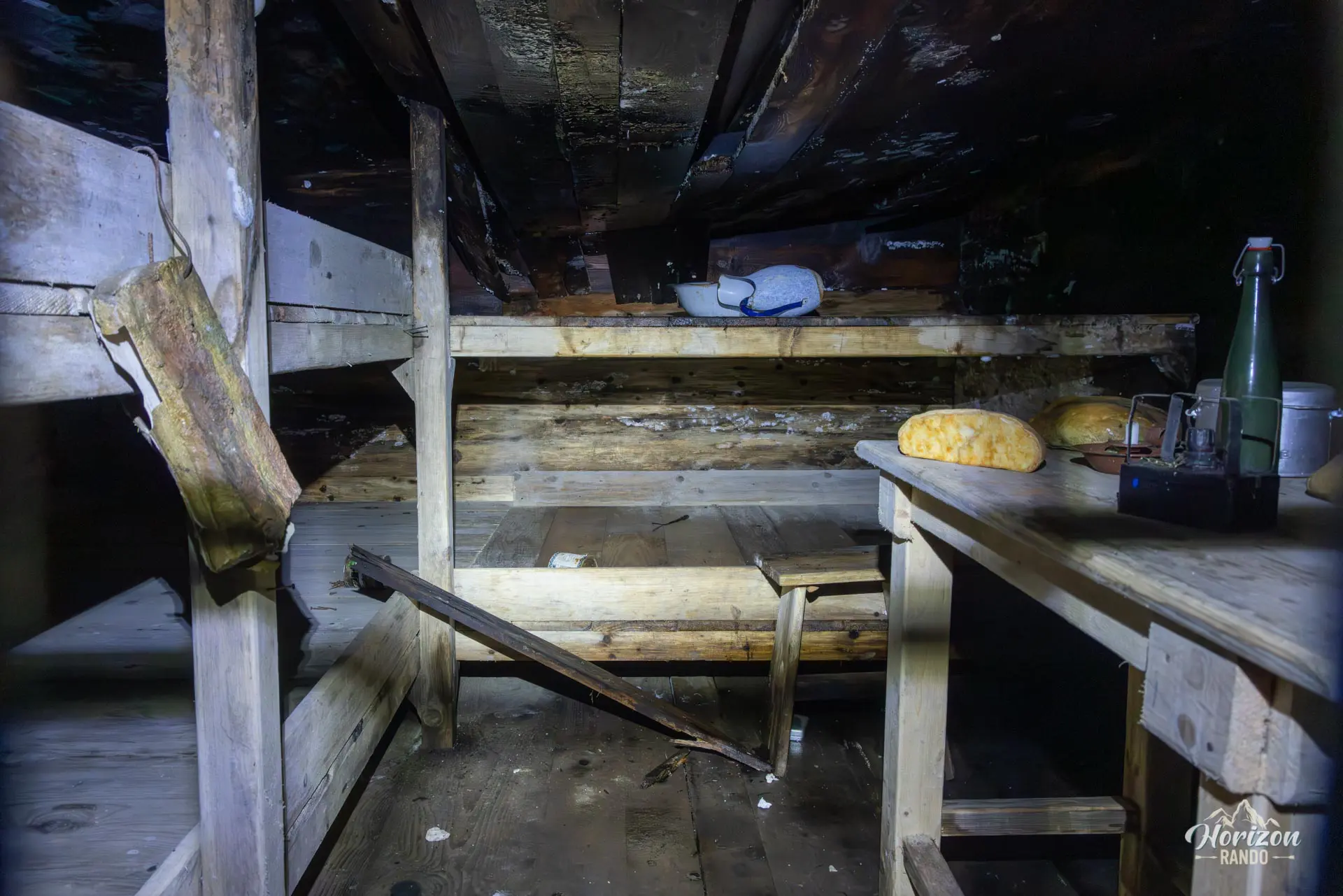
The Galleria dell'Anticima is the highlight of the hike. Inside, the path alternates between short horizontal sections and long staircases carved into the rock, which are often steep. A fixed cable runs along the stairs and serves as a handrail. While a harness and lanyard aren't necessary, a headlamp and helmet are essential. The interior is dark, water drips from the ceiling, and the high, uneven steps become slippery. Several openings in the wall offer sweeping views of Passo Falzarego. Plan to spend about an hour in the tunnel, longer if you want to read the historical panels and explore the reconstructed rooms (dormitories, observation posts, and remnants of equipment). Bring a warm jacket because the temperature remains low in the tunnel, even in the middle of summer.
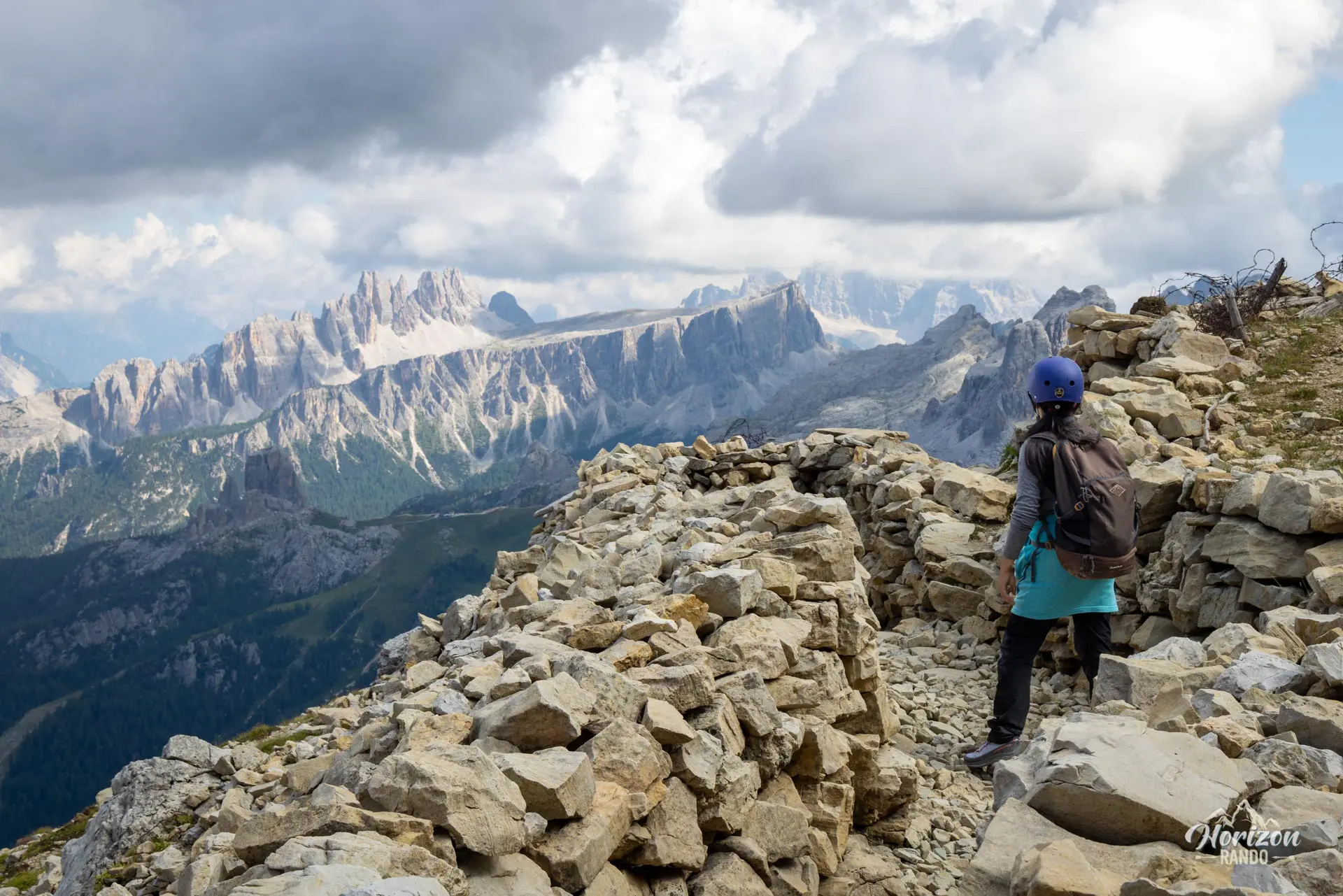
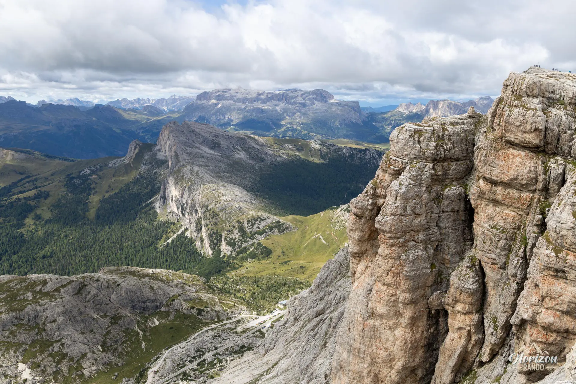
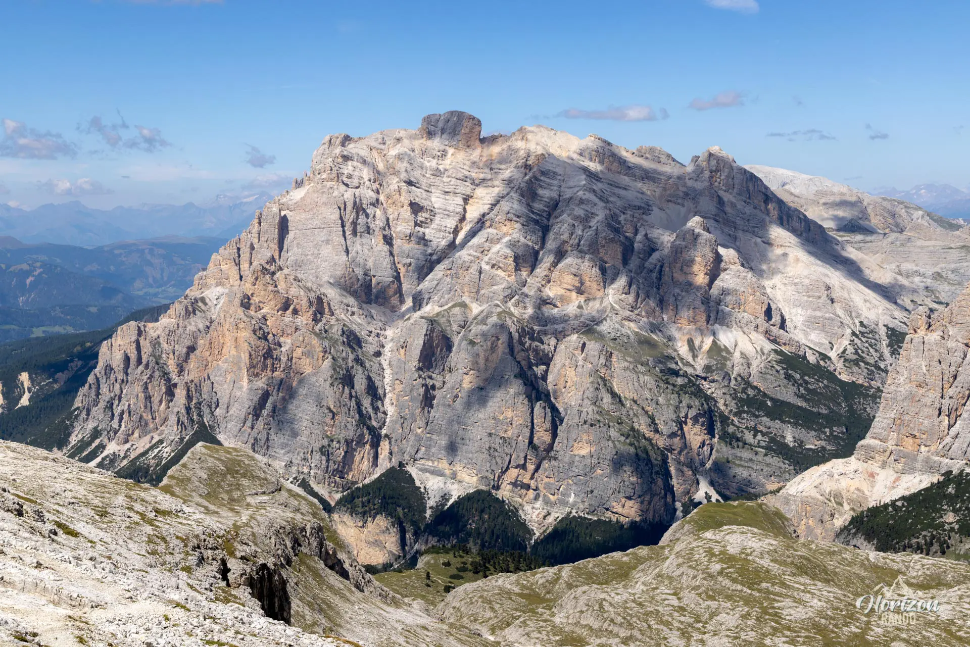
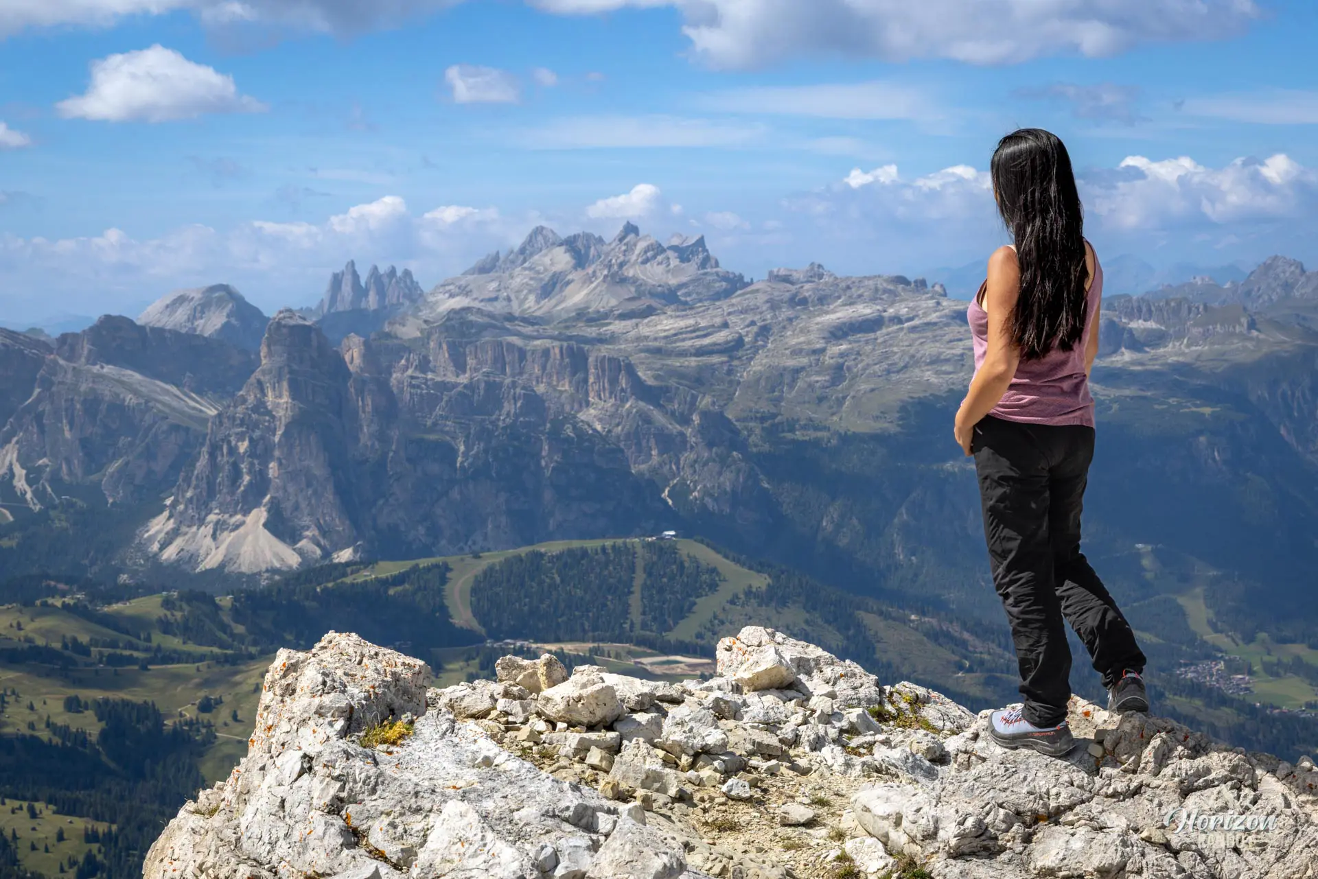
After exiting the tunnel, a few switchbacks along old trenches will lead you to the Rifugio Lagazuoi. Then, in about fifteen minutes, you will reach the summit of Piccolo Lagazuoi (2,778 m), the highest point of the hike. From there, you can take in panoramic views of the Tofane, the Marmolada, the Civetta, Croda da Lago, and the Sella massif.
The descent follows trail no. 401 toward Forcella Travenanzes (2,507 m), then trail no. 402 to Passo Falzarego. Caution is required on the descent, which is largely on a steep slope covered with loose gravel that can be particularly hard on ankles and knees. Trekking poles are strongly recommended.
What you'll love
- The route through the tunnels, which offers an immersive experience of the war fought by Italian troops between 1915 and 1917. The route features informational panels, reconstructed barracks, and observation posts carved into the rock.
- The panoramic view from the summit of Piccolo Lagazuoi overlooking the region's largest mountain ranges.
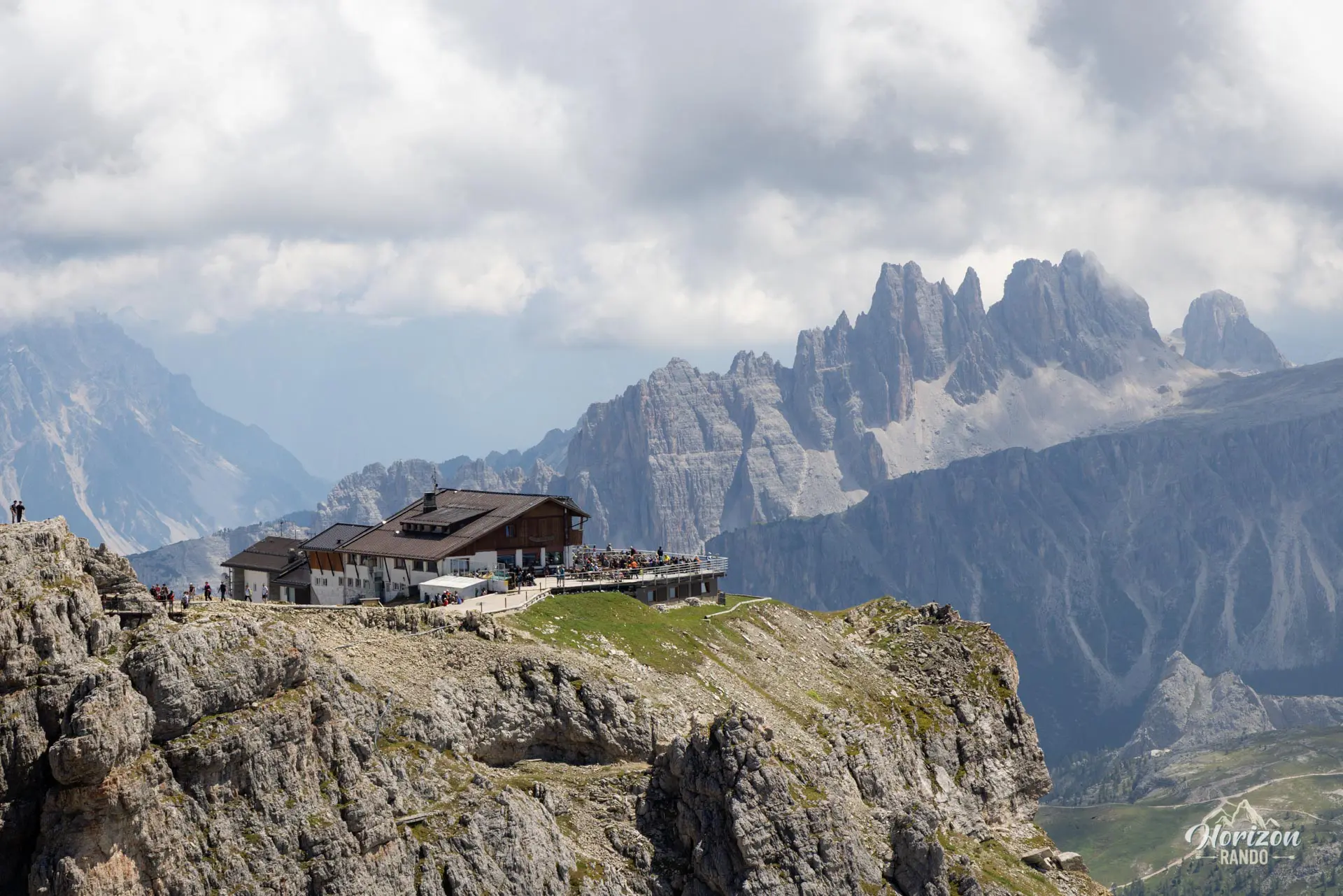
- Rifugio Lagazuoi, perched near the summit and offering food and lodging with one of the most beautiful views of the Dolomites.
Hike technical sheet
➡️ Hiking parameters
➡️ Hiking parameters
➡️ Hiking parameters
Map and elevation profile of the hike
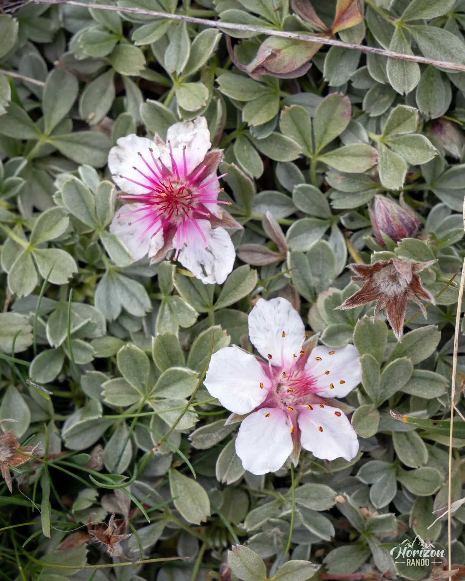
Slideshow

Nearby hikes

Croda Negra Hike
- Difficulty : Easy
- Duration : 2 h 45
- Distance : 7.3 km
- Elevation gain : 450 m

Lago Limides, Monte Nuvolau and Cinque Torri Circuit
- Difficulty : Moderate
- Duration : 4 h 30
- Distance : 11.1 km
- Elevation gain : 790 m

Lago di Limides Hike
- Difficulty : Very easy
- Duration : 1 h
- Distance : 2.4 km
- Elevation gain : 150 m

Via Ferrata Degli Alpini - Col dei Bos
- Hiking Difficulty : Easy
- Via Ferrata Difficulty : C (Difficult)
- Duration : 3 h 15
- Distance : 3.7 km
- Elevation gain : 490 m
Map of the 10 closest hikes
Hikes to discover

Via Ferrata Ivano Dibona
- Hiking Difficulty : Hard
- Via Ferrata Difficulty : B (Moderatly difficult)
- Duration : 7 h
- Distance : 8.9 km
- Elevation gain : 1180 m

Fanes Waterfalls Hike and Via Ferrata
- Hiking Difficulty : Moderate
- Via Ferrata Difficulty : A (Easy)
- Duration : 4 h 30
- Distance : 10 km
- Elevation gain : 560 m

Sass de Putia Hike and Via Ferrata
- Hiking Difficulty : Hard
- Via Ferrata Difficulty : A (Easy)
- Duration : 7 h
- Distance : 17.4 km
- Elevation gain : 1200 m

Monte Mulaz Hike
- Difficulty : Hard
- Duration : 7 h 30
- Distance : 18.6 km
- Elevation gain : 1420 m

Via Ferrata Ra Gusela
- Hiking Difficulty : Easy
- Via Ferrata Difficulty : A (Easy)
- Duration : 3 h 30
- Distance : 8 km
- Elevation gain : 610 m

Via Ferrata Lipella - Tofana di Rozes Summit
- Hiking Difficulty : Hard
- Via Ferrata Difficulty : C/D (Difficult)
- Duration : 8 h
- Distance : 11.6 km
- Elevation gain : 1320 m