
Rauðibotn Crater Hike
Hike overview
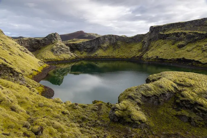
The Rauðibotn crater is part of the Eldgja canyon, the largest volcanic canyon in the world, created by the massive eruption of the Katla volcano in the 10th century. Rauðibotn means red bottom in Icelandic, referring to the bright red volcanic rock that makes up the crater and creates a striking contrast with the yellow moss, intense blue lake, and Hólmsá River. This hike is a true hidden gem of the Highlands, revealing extraordinary and wild landscapes.
Remarks
Access: The easiest way to reach the start of the hike is to take the F208 and then the F210 roads. Note that these roads are only open in the summer, and a 4x4 vehicle is required. If you are coming from the south, you will not have to cross any rivers. However, if you are coming from the north (e.g., Landmannalaugar), you will encounter several medium-sized rivers.
Warning: If you are coming from the north on the F208, ignore the GPS directions that lead you to the F233. Although this is a shortcut, it involves crossing one of the most difficult rivers in Iceland. Instead, continue on the F208, then the F210.
If you are coming from the west, you will also encounter an obstacle: the Hólmsá River, which can sometimes be very deep. Do not attempt to cross it without a specially equipped 4x4 vehicle.
Read more: See the section on driving in the Highlands for more information, including how to cross rivers.
Difficulties of the hike
A well-marked trail now connects the parking lot to the Hólmsárfoss waterfalls. The trail becomes slightly rockier during the ascent and around the crater but presents no major difficulties. This is a very accessible route that is not to be missed!
What you'll love
- Spectacular color contrasts: the red crater walls covered with fluorescent yellow moss and the deep blue lake.
- Discover Lake Hólmsárlón, with its blue-green waters, and the Hólmsárfoss waterfalls along the Hólmsá River.
- Incredible views of the Highlands with unforgettable panoramas of Mælifell and the Mýrdalsjökull glacier from the crater's heights.
- Complete isolation in the wilderness, truly far from the crowds of the Golden Circle.
Hike technical sheet
➡️ Hiking parameters
➡️ Hiking parameters
➡️ Hiking parameters
Map and elevation profile of the hike
Slideshow


")

Nearby hikes


Map of the 13 closest hikes
Hikes to discover
Let chance guide your steps: discover a random selection of the best hikes in Iceland.

Diamond beach
Cratère de Tjarnargígur

Landmannalaugar to Ljótipollur Hike
- Difficulty : Moderate
- Duration : 4 h 30
- Distance : 13 km
- Elevation gain : 330 m

Fjaðrárgljúfur Canyon Hike
- Difficulty : Very easy
- Duration : 1 h
- Distance : 2.2 km
- Elevation gain : 70 m

Chutes d'Aldeyjarfoss
