
Thakgil Blue Circuit Hike
Hike overview
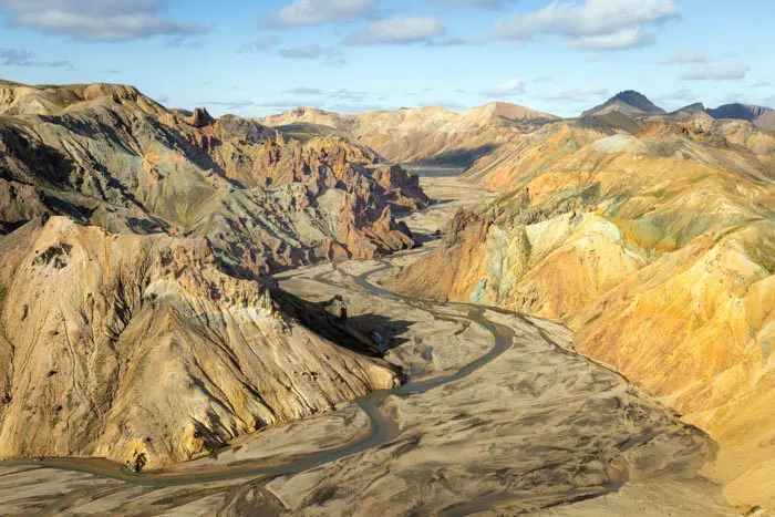
Thakgil (or Þakgil) exudes a mystical atmosphere far from classic tourist sites. Its scenery is reminiscent of that of Thórsmörk. Its landscapes are characterized by gorges and canyons with sheer walls draped in green moss that contrasts with the black volcanic rocks. This unique place is worth discovering—it was truly one of my favorites.
The blue Thakgil circuit is the shortest and most accessible hike in the area. It's ideal for those short on time or for gloomy days when the peaks are shrouded in clouds.
Remarks
Access: To reach Thakgil, drive on Route 214 for 16 kilometers. As it is not an F-road, Route 214 is accessible by all types of vehicles, but a 4x4 or SUV is recommended as the road is very rough and dotted with potholes.
Opening period: Like the Thakgil trails, this road is only open in the summer. The exact dates depend on snow conditions.
Accommodation: I strongly recommend spending at least one night at the Thakgil campground. Nestled in the heart of a natural amphitheater, the campground is surrounded by impressive rock walls covered with green moss that look almost impassable. Don't miss the cozy cave where campers can relax and share a meal at the end of a day of hiking.
Difficulties of the hike
There are four hikes available from the campground. The blue trail is the shortest and easiest. Like all the trails in Thakgil, this one is well-maintained and marked (in blue, as you might have guessed!). While it does not present any major difficulties, some slopes can be steep, especially on the descent back to the campground.
What you'll love
- Spectacular landscapes: Vertiginous gorges and canyons with rocky walls covered in bright green moss.
- Ease of access: It's a perfect introduction to the unique landscapes of Thakgil.
- The mystical, unspoiled atmosphere: This little-known site provides an authentic escape from tourist crowds.
Hike technical sheet
➡️ Hiking parameters
➡️ Hiking parameters
➡️ Hiking parameters
Map and elevation profile of the hike
Slideshow


Nearby hikes

Thakgil Yellow Circuit Hike
- Difficulty : Hard
- Duration : 6 h
- Distance : 15.1 km
- Elevation gain : 770 m

Thakgil Purple Circuit Hike
- Difficulty : Moderate
- Duration : 4 h 30
- Distance : 11.2 km
- Elevation gain : 480 m

Hatta Hike
- Difficulty : Moderate
- Duration : 2 h 45
- Distance : 6.5 km
- Elevation gain : 530 m

Reynisfjall Hike
- Difficulty : Easy
- Duration : 2 h 30
- Distance : 7.3 km
- Elevation gain : 300 m
Map of the 10 closest hikes
Hikes to discover
Let chance guide your steps: discover a random selection of the best hikes in Iceland.

Snækollur Hike
- Difficulty : Moderate
- Duration : 3 h 15
- Distance : 5.1 km
- Elevation gain : 600 m

Thingvellir National Park Hike
- Difficulty : Very easy
- Duration : 1 h 30
- Distance : 5.1 km
- Elevation gain : 80 m
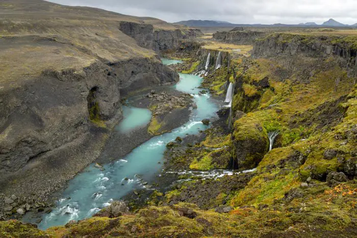
Canyon de Sigöldugljúfur
Bláhnúkur, Skalli and Grænihryggur Circuit
- Difficulty : Very Hard
- Duration : 9 h
- Distance : 23.7 km
- Elevation gain : 1500 m
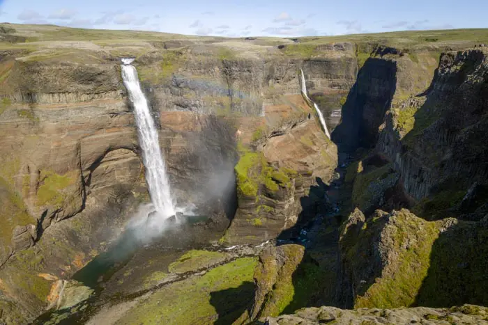
Chutes de Haifoss

Laki Craters Hike
- Difficulty : Easy
- Duration : 1 h 45
- Distance : 3.2 km
- Elevation gain : 260 m