
Hatta Hike
Hike overview
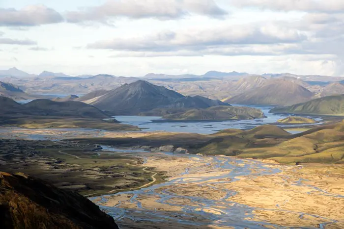
The Hatta hike leads to the highest peak near Vík, an iconic village on Iceland's south coast. Though not well-known, this climb offers spectacular, varied views of glaciers, lakes, endless black-sand beaches, and the imposing cliffs of the south coast.
From the 515-meter summit, you can enjoy breathtaking views of the village of Vík and its famous church, the Reynisdrangar rock formations, the Dyrhólaey peninsula, the Mýrdalsjökull glacier, and the entire south coast stretching as far as the eye can see.
Difficulties of the hike
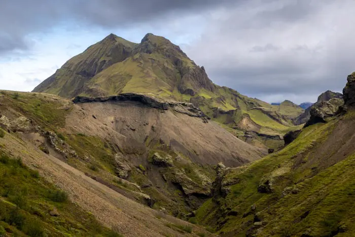
The trail has a few relatively steep slopes, particularly at the beginning and end of the ascent, but no technical difficulties. The route is clearly marked with colored poles all the way to the summit, making navigation much easier. Hatta is one of the few peaks in the region with a hiking trail, allowing you to explore these magnificent landscapes away from the tourist crowds.
What you'll love
- The 360-degree panorama from the summit: You will overlook the village of Vík and admire the famous Reynisdrangar rock formations emerging from the ocean, the Mýrdalsjökull glacier and the black sand expanses of Mýrdalssandur.
- The diversity of landscapes: Glaciers, black sand beaches, cliffs, lakes, and the ocean come together to form a condensed version of Iceland's beauty.
- The tranquility of the route: Unlike the region's ultra-popular tourist sites, Hatta remains a peaceful hike to enjoy nature in complete serenity
Hike technical sheet
➡️ Hiking parameters
➡️ Hiking parameters
➡️ Hiking parameters
Map and elevation profile of the hike
Slideshow


")
")
")


Nearby hikes

Reynisfjall Hike
- Difficulty : Easy
- Duration : 2 h 30
- Distance : 7.3 km
- Elevation gain : 300 m

Plage de Reynisfjara

Dyrhólaey Peninsula Hike
- Difficulty : Easy
- Duration : 1 h 30
- Distance : 4.1 km
- Elevation gain : 160 m

Thakgil Blue Circuit Hike
- Difficulty : Easy
- Duration : 1 h 30
- Distance : 4 km
- Elevation gain : 250 m
Map of the 11 closest hikes
Hikes to discover
Let chance guide your steps: discover a random selection of the best hikes in Iceland.

Fimmvörðuháls Trek
- Difficulty : Very Hard
- Duration : 10 h
- Distance : 23.8 km
- Elevation gain : 1320 m
Suðurnámur Hike
- Difficulty : Moderate
- Duration : 3 h 30
- Distance : 10.1 km
- Elevation gain : 510 m

Rauðibotn Crater Hike
- Difficulty : Easy
- Duration : 2 h 30
- Distance : 6.8 km
- Elevation gain : 280 m

Glacier de Svínafellsjökull

Cascades de Brúarfoss
Rjúpnafell Hike
- Difficulty : Very Hard
- Duration : 6 h
- Distance : 14.3 km
- Elevation gain : 920 m