
Laki Craters Hike
Hike overview
Discover the Lakagígar (Laki craters), a series of 130 craters aligned over 27 kilometers along a volcanic fissure on either side of the Laki volcano. The craters were formed during the Skaftáreldar eruption of 1783, which spewed 14 cubic kilometers of lava over eight months.
This eruption had a significant global impact, causing the death of a quarter of Iceland's population. The sulfur dioxide cloud reached Europe, disrupting the climate for several years, contributing to poverty and famine, and playing a key role in the French Revolution of 1789.
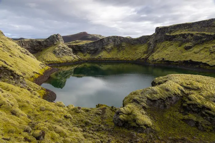
From the 812-meter-high summit of Laki, you can admire this line of craters against the backdrop of the vast Vatnajökull ice cap, creating a magnificent and moving landscape. If you are lucky enough to visit after a few days of rain, the moss covering the lava fields will be bright yellow, creating a striking contrast with the black lava.
Remarks
Access: F-roads are only open in the summer, and a 4x4 vehicle is required. Allow about two hours to travel from Route 1 to Laki. First, take Route F206, then F207, which is a circular one-way road. Be prepared to cross several rivers, including two medium-sized ones.
Read more: See the section on driving in the Highlands for more information, including how to cross rivers.
Facilities: At the trailhead, which is literally in the middle of nowhere, you will find a ranger hut, restrooms, and picnic tables.
Difficulties of the hike
The trail leading to the summit of Laki is well-marked and presents no technical difficulties. In less than an hour, you will reach the summit and be rewarded with a breathtaking panorama of the spectacular alignment of the Lakagígar craters.
On the way back, take the short detour to the "Visitor Trail." Walk through the interior of one of the Lakagígar craters and immerse yourself in an apocalyptic landscape!
What you'll love
- Exceptional panoramic view: From the summit, enjoy a 360° view of the 27 kilometers of Lakagígar and the imposing Vatnajökull glacier to the north.
- Isolation and tranquility: Far from the tourist attractions of the Golden Circle, you can enjoy the serenity and absolute calm of these places.
- Exploring the craters: Combine your climb with the "Visitor Trail," which takes you through one of the Lakagígar craters and into the heart of the immense eruptive fissure.
- Geological richness: Discover a site that bears witness to one of the most significant eruptions in modern history.
Hike technical sheet
➡️ Hiking parameters
➡️ Hiking parameters
➡️ Hiking parameters
Map and elevation profile of the hike
Slideshow


Nearby hikes


Map of the 10 closest hikes
Hikes to discover
Let chance guide your steps: discover a random selection of the best hikes in Iceland.
Drone : Sud Hvolsvöllur
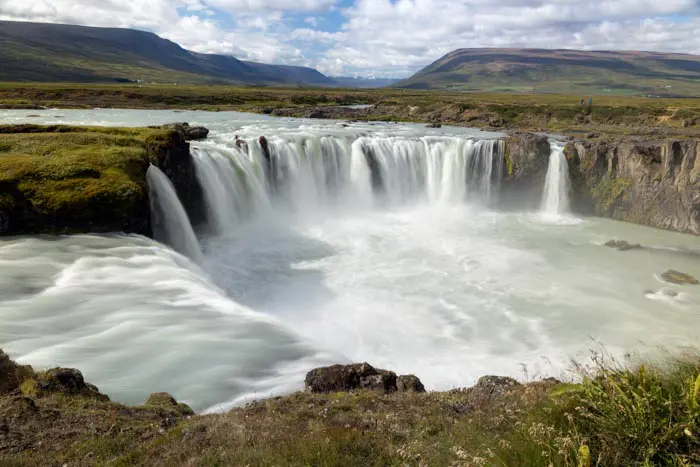
Chutes de Goðafoss

Skógá Waterfall Way
- Difficulty : Moderate
- Duration : 5 h 30
- Distance : 15.7 km
- Elevation gain : 650 m

Kvernufoss Waterfall Hike
- Difficulty : Very easy
- Duration : 0 h 45
- Distance : 1.5 km
- Elevation gain : 60 m

Fjaðrárgljúfur Canyon Hike
- Difficulty : Very easy
- Duration : 1 h
- Distance : 2.2 km
- Elevation gain : 70 m
Bláhnúkur, Skalli and Grænihryggur Circuit
- Difficulty : Very Hard
- Duration : 9 h
- Distance : 23.7 km
- Elevation gain : 1500 m