Kvernufoss Waterfall Hike
Hike overview
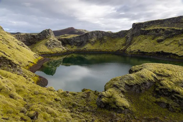
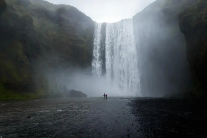
Despite being located just one kilometer from the popular Skógafoss waterfall, the Kvernufoss waterfall is one of Iceland's hidden gems. Standing thirty meters high, Kvernufoss plunges into a narrow gorge through which the Kverna River winds. The intimate canyon offers a spectacular contrast between its dark walls and the intense yellow-green moss.
The trail encircles the waterfall, enabling visitors to admire the spectacle from behind the falls in a cave. It is a must-see, especially since it is located very close to the Golden Circle.
Difficulties of the hike
The route is easy and presents no difficulty. The trail is marked and nearly flat. Only the cave behind the waterfall requires extra caution because the ground is slippery from the constant spray.
What you'll love
- The enchanting setting of the Kvernugil Canyon: The dark volcanic walls covered in lush moss create a magical atmosphere that is perfect for photos.
- Walking behind the waterfall: The natural cavity behind Kvernufoss offers a spectacular view and allows you to experience the full force of the waterfall.
- The tranquility of the place: Unlike its neighbor, Skógafoss, Kvernufoss remains relatively untouched by mass tourism.
Hike technical sheet
➡️ Hiking parameters
➡️ Hiking parameters
➡️ Hiking parameters
Map and elevation profile of the hike
Slideshow


")
")
")
Nearby hikes
Chutes de Skógafoss

Skógá Waterfall Way
- Difficulty : Moderate
- Duration : 5 h 30
- Distance : 15.7 km
- Elevation gain : 650 m

Fimmvörðuháls Trek
- Difficulty : Very Hard
- Duration : 10 h
- Distance : 23.8 km
- Elevation gain : 1320 m

Sólheimasandur Plane Wreck Hike
- Difficulty : Easy
- Duration : 1 h 45
- Distance : 7.3 km
- Elevation gain : 30 m
Map of the 10 closest hikes
Hikes to discover
Let chance guide your steps: discover a random selection of the best hikes in Iceland.

Diamond beach

Drone : Sud Fjallsárlón

Fjaðrárgljúfur Canyon Hike
- Difficulty : Very easy
- Duration : 1 h
- Distance : 2.2 km
- Elevation gain : 70 m

Hengifoss Hike
- Difficulty : Easy
- Duration : 1 h 45
- Distance : 4.9 km
- Elevation gain : 300 m

Dettifoss East Hike
- Difficulty : Easy
- Duration : 1 h 30
- Distance : 3.9 km
- Elevation gain : 70 m