
Hiking on the Islands of Austvågøya and Gimsøya, Lofoten
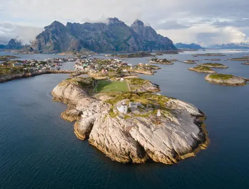
Austvågøya is the gateway to the archipelago and home to its administrative capital, Svolvær. Boasting the archipelago's highest peaks, this imposing island features rugged mountain ranges that plunge into the fjords. In contrast, the small island of Gimsøya offers wide plains, isolated peaks and numerous white-sand beaches facing the Norwegian Sea.
Spread across Austvågøya (5 routes) and Gimsøya (2 routes), these seven hikes range from easy, scenic climbs to challenging cross-country hikes. You can explore Fløya, Svolvær's most popular peak, which features the famous Djevelporten; Festvågtinden, which offers breathtaking views of the village of Henningsvær; and Matmora, a magnificent cross-island hike through the rugged northern landscapes.
→ For practical information on hiking in the Lofoten Islands (when to go, how to get there, where to stay, climate, etc.), check out the Complete Guide to Hiking in the Lofoten Islands.
Map of Hiking Trails on Austvågøya and Gimsøya islands
Iconic hikes on the island of Austvågøya

Festvågtinden - Iconic view of the village of Henningsvær
Difficulty: Moderate
Duration: 3 h
Distance: 3.3 km
Elevation gain: 530 m
This 541-metre peak rises directly from the sea and offers one of the most spectacular views on the island. From the summit, you can enjoy a breathtaking panorama of the picturesque fishing village of Henningsvær and its many islets scattered across the turquoise waters. The climb is steep but technically straightforward, and you can enjoy the added bonus of discovering the charming Heiavatnet lake halfway up. This is an iconic hike that fully deserves its popularity.

Matmora - An alpine traverse through the rocky landscapes of the north
Difficulty: Hard
Duration: 5 h
Distance: 9.6 km
Elevation gain: 840 m
The ascent of this peak, located north of Austvågøya, reveals exceptional panoramic views at every stage. The highlight of the route is the broad plateau overlooking Grunnførfjorden, which offers spectacular views of the Vesterålen islands. At the summit, the rugged terrain unveils magnificent panoramic vistas of the Norwegian Sea and the highest peaks of the Lofoten Islands. This cross-country hike is significantly less crowded than the iconic routes in the south and promises a true adventure in a wild and unspoilt setting.

Fløya - Svolvær's most popular hike
Difficulty: Moderate
Duration: 3 h 30
Distance: 4 km
Elevation gain: 600 m
Austvågøya's most popular hike takes you to an elevation of 575 metres above Svolvær. The trail offers views of the famous Djevelporten rock formation, which is suspended between two cliffs and is one of the most popular photo spots in the Lofoten Islands. At the summit, a 360-degree panorama reveals Svolvær and its harbour, the jagged fjords, the region's lakes and the distinctive silhouette of Svolværgeita. This iconic, accessible and spectacular hike is just two kilometres from the town centre.
List of hikes on the islands of Austvågøya and Gimsøya
| Name of the hike | Photo | Difficulty | Duration | Length | Elevation gain | Popularity | My rating |
|---|