
Matmora Hike
Hike overview
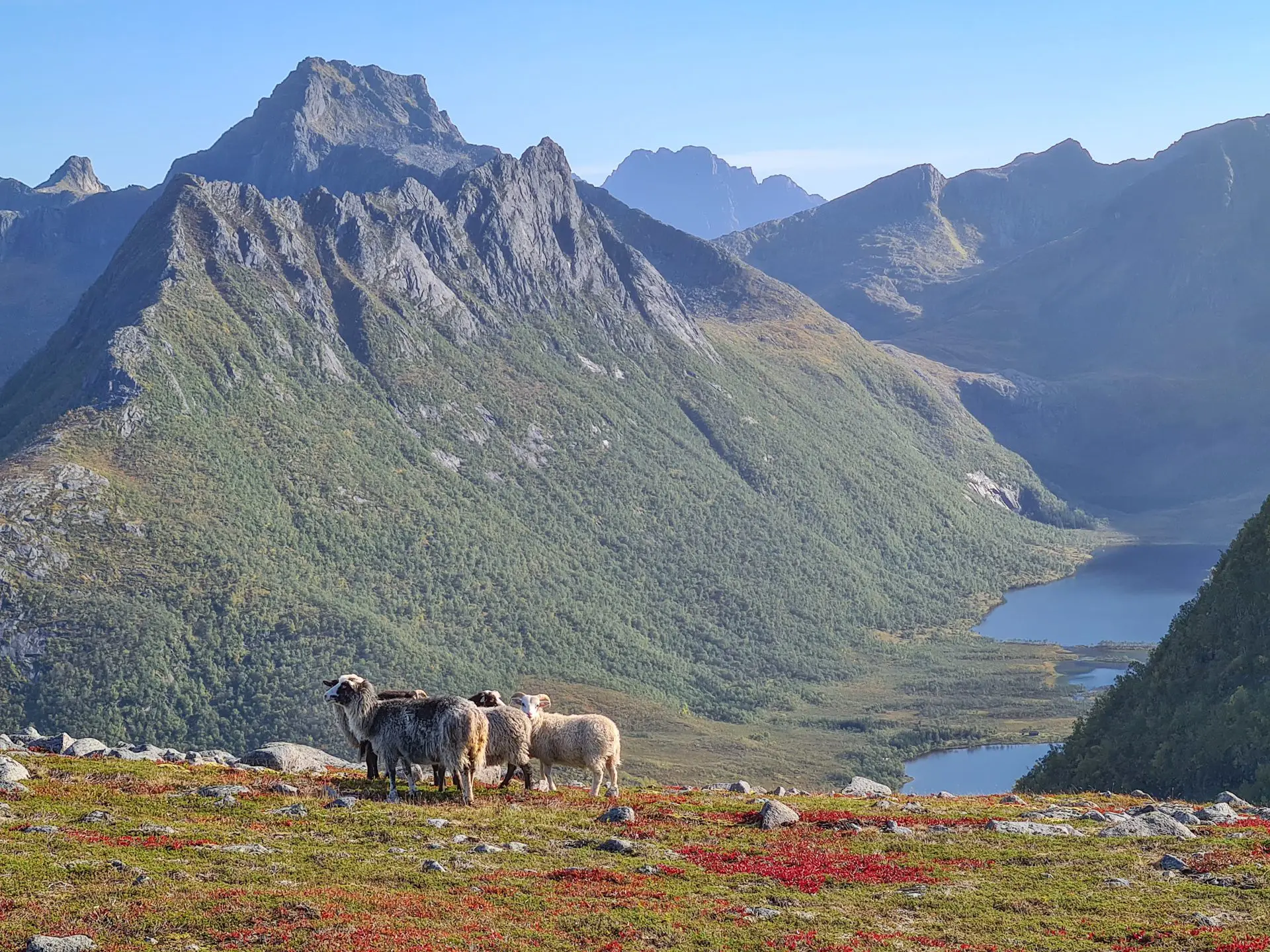
This magnificent hiking route is located north of Austvågøya island in the Lofoten archipelago. Climbing to the 787-meter summit of Matmora reveals exceptional panoramic views of the Grunnførfjord and a striking mineral landscape.
Less frequented than the region's iconic trails, this hike winds through varied environments, including forests, alpine plateaus, and rocky slopes.
Remarks
Best time to go: Mid-June to September on average. See the Norway FAQ for more details.
Route options: There are several possibilities for this hike. You can complete it as a traverse, as described here, or as a round trip from the parking lot to the summit. If you choose the latter, I recommend starting from the northern parking lot (near Delp) so you won't miss the plateau overlooking Grunnførfjorden, one of the highlights of the hike.
Return to the starting point: If you opt for the traverse hike and have two cars, leave one at each parking lot. Otherwise, you can try hitchhiking, though keep in mind that the road is not very busy. Another option is to loop back along the road, which takes about an hour and a half to cover six kilometers.
Difficulties of the hike
The trail is generally clearly visible and presents no major technical difficulties. It crosses different types of terrain: a pleasant climb through the forest for the first hour, then a wide plateau, and finally, the rocky ridge leading to the summit.
Particular care is required when crossing scree slopes, especially during the descent to Rangeldalsvatnet Lake after reaching the summit. As is often the case in Lofoten, the hike is not marked, but the route is easy to follow thanks to the numerous cairns along the way.
What you'll love
- The exceptional panorama from the intermediate plateau overlooking Grunnførfjorden and the surrounding mountains.
- The very mineral landscape at the summit of Matmora, which offers a magnificent, clear panoramic view of the Norwegian Sea, the surrounding fjords, and the Vesterålen Islands on the horizon.
Hike technical sheet
➡️ Hiking parameters
➡️ Hiking parameters
➡️ Hiking parameters
Map and elevation profile of the hike
Slideshow


Nearby hikes

Sautinden Hike
- Difficulty : Moderate
- Duration : 3 h 30
- Distance : 6.9 km
- Elevation gain : 620 m

Kroktinden Hike
- Difficulty : Moderate
- Duration : 4 h
- Distance : 8.3 km
- Elevation gain : 680 m

Hoven Hike
- Difficulty : Easy
- Duration : 2 h
- Distance : 3.8 km
- Elevation gain : 360 m

Fløya Hike
- Difficulty : Moderate
- Duration : 3 h 30
- Distance : 4 km
- Elevation gain : 600 m
Map of the 10 closest hikes
Hikes to discover
Let chance guide your steps: discover a random selection of the best hikes in Norway.

Grytetippen and Keipen Hike
- Difficulty : Hard
- Duration : 6 h
- Distance : 9.6 km
- Elevation gain : 1140 m

Raudmelen Hike
- Difficulty : Moderate
- Duration : 5 h
- Distance : 9.8 km
- Elevation gain : 920 m

Helvete Hike
- Difficulty : Hard
- Duration : 5 h 30
- Distance : 9.6 km
- Elevation gain : 850 m

Molden Hike
- Difficulty : Moderate
- Duration : 3 h 30
- Distance : 8.5 km
- Elevation gain : 610 m

Vallée de Lodalen

Storhornet Hike
- Difficulty : Moderate
- Duration : 4 h
- Distance : 9.3 km
- Elevation gain : 730 m