
Bidean Nam Bian Hike
Hike overview
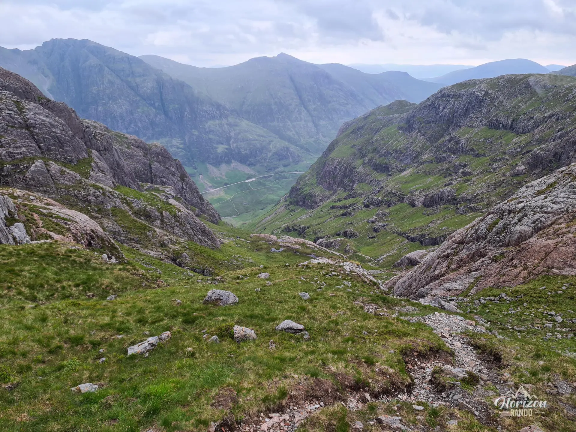
The Bidean Nam Bian hike leads to the highest peak in the Glencoe Valley and the Argyll region, at 1,150 meters. This complex mountain, whose Gaelic name means "cone-shaped peak," forms a spectacular massif composed of multiple ridges and subsidiary peaks. These include the famous Three Sisters of Glencoe, which rise majestically above the valley. The route crosses the Lost Valley before reaching three peaks that offer magnificent views of the Western Highlands.
Remarks
Parking: Begin at the Three Sisters Viewpoint car park on the A82, located approximately 10 kilometers from Glencoe. This free parking lot fills up quickly, especially in good weather. It is strongly recommended that you arrive early in the morning to secure a space.
Snow Conditions: Snowfields may persist until early summer, making the couloir before Bealach Dearg particularly challenging. Without the appropriate equipment (crampons and an ice axe) and experience, it is best to choose another hike or postpone your outing.
Panorama: The vistas offered throughout this hike are among the most beautiful in the valley. The views of the surrounding mountains and lochs are particularly stunning. Please note that the photos, which were taken on a cloudy day, do not fully capture the beauty of the landscapes you will discover.
Difficulties of the hike
Bidean Nam Bian is a long, physically demanding hike with 1,320 meters of elevation gain over 12 kilometers. The terrain is mostly rocky and uneven. The corridor leading to the Bealach Dearg pass from the Lost Valley is particularly steep, slippery, and covered with unstable scree. Great caution is required on this section, which can be dangerous in wet weather or when there is snow.
The ridges connecting the three peaks are rocky but do not present any major technical difficulties or vertiginous passages. You will enjoy walking on them because the panoramic views are magnificent and unobstructed. The route is not marked, but the trail remains clearly visible throughout the hike.
What you'll love
- 360° panoramic views from the summits: Spectacular vistas of Loch Etive to the south, Ben Nevis and the Glencoe Valley to the north, and Loch Leven and Loch Linnhe to the west.
- Progressing along spectacular ridges with breathtaking views on both sides.
- Ascending two Munros in a single hike: Bidean Nam Bian (1,150 m) and Stob Coire Sgreamhach (1,072 m).
- A picturesque descent alongside magnificent waterfalls on the return.
Hike technical sheet
➡️ Hiking parameters
➡️ Hiking parameters
➡️ Hiking parameters
Map and elevation profile of the hike
Slideshow


Nearby hikes

Buachaille Etive Beag Hike
- Difficulty : Moderate
- Duration : 5 h
- Distance : 8.5 km
- Elevation gain : 950 m

Beinn a' Chrùlaiste Hike
- Difficulty : Moderate
- Duration : 3 h 30
- Distance : 6.9 km
- Elevation gain : 620 m

Buachaille Etive Mòr Hike
- Difficulty : Hard
- Duration : 7 h 30
- Distance : 14.4 km
- Elevation gain : 1150 m

Pap of Glencoe Hike
- Difficulty : Moderate
- Duration : 4 h
- Distance : 6.8 km
- Elevation gain : 740 m
Map of the 11 closest hikes
Hikes to discover
Let chance guide your steps: discover a random selection of the best hikes in Scotland.

Suilven Hike
- Difficulty : Hard
- Duration : 7 h
- Distance : 20.3 km
- Elevation gain : 970 m

Lochnagar Hike
- Difficulty : Hard
- Duration : 7 h 30
- Distance : 19.8 km
- Elevation gain : 980 m

Quiraing Hike
- Difficulty : Moderate
- Duration : 4 h
- Distance : 8.1 km
- Elevation gain : 530 m

The Old Man of Storr Hike
- Difficulty : Easy
- Duration : 2 h
- Distance : 4.3 km
- Elevation gain : 350 m

Beinn Eighe Hike
- Difficulty : Hard
- Duration : 8 h 30
- Distance : 19 km
- Elevation gain : 1220 m

Beinn Dearg Mhór Hike
- Difficulty : Hard
- Duration : 5 h 30
- Distance : 11.3 km
- Elevation gain : 910 m