
Monte Castellaz Hike
Hike overview
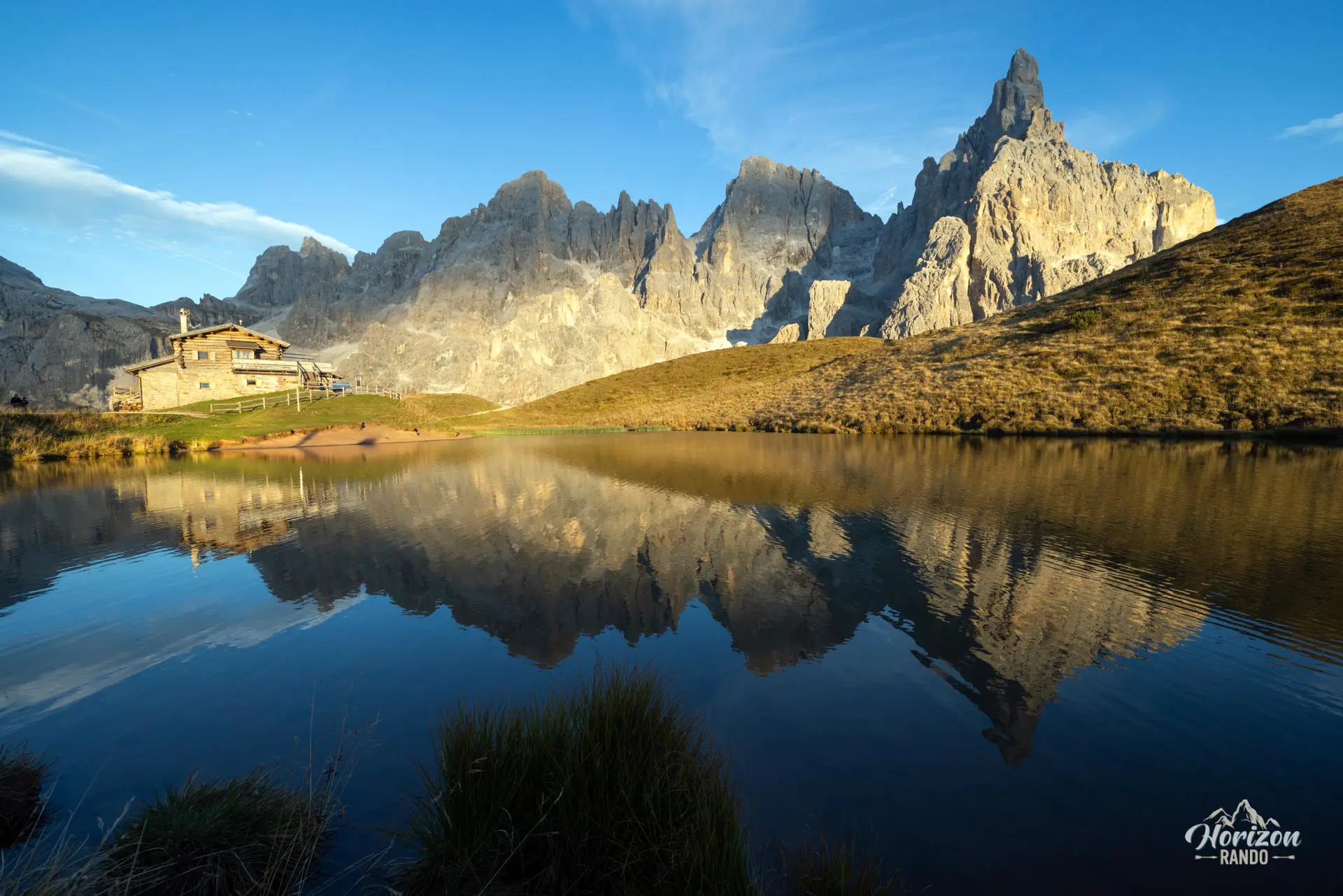
Perched at an elevation of 2,333 meters above Passo Rolle, the modest viewpoint of Monte Castellaz offers a 360° panorama of the Pale di San Martino massif, which is dominated by the jagged silhouette of Cimon della Pala. This route combines the ascent with a visit to Baita Segantini and its famous small lake, one of the most photographed sites in the Dolomites.
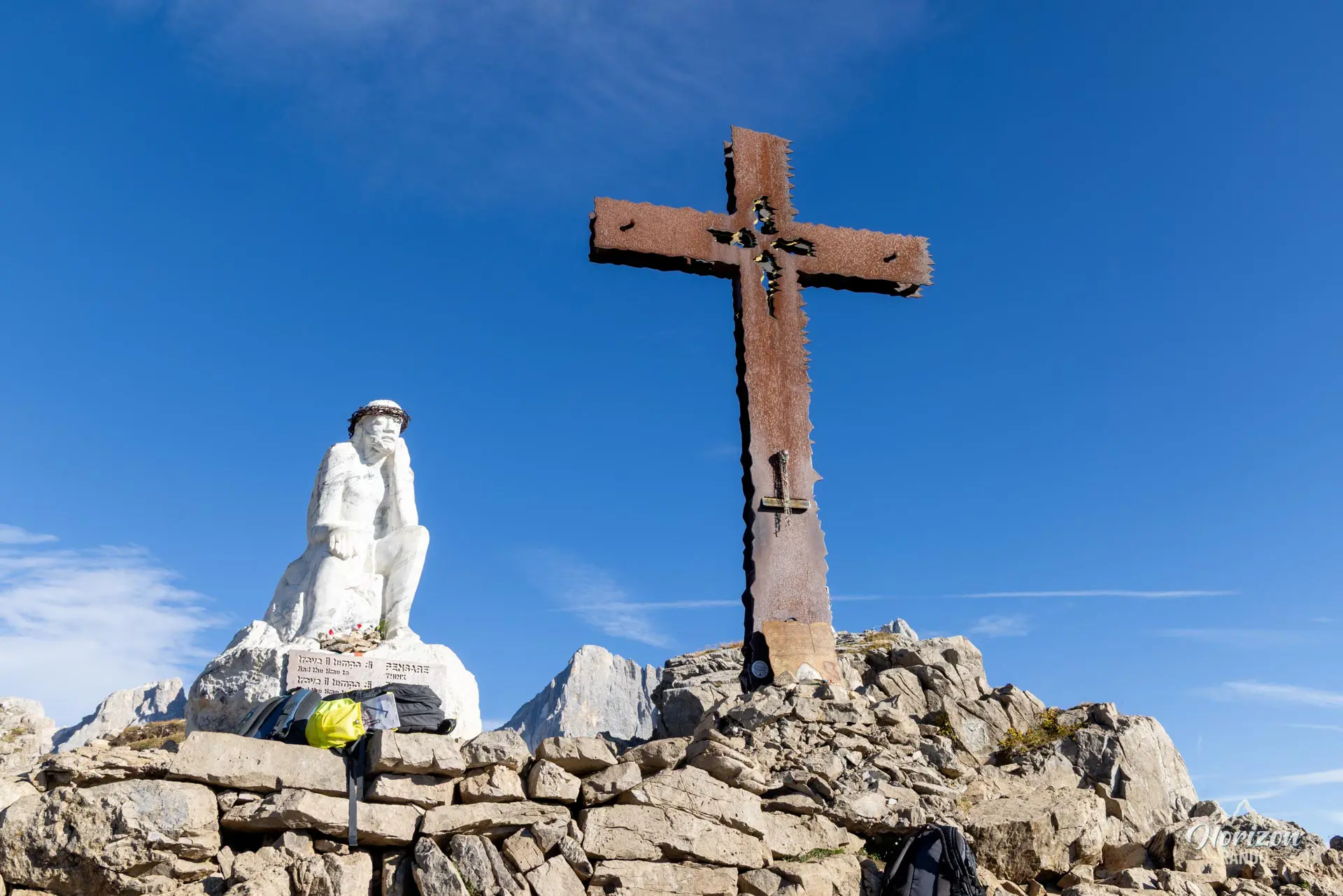
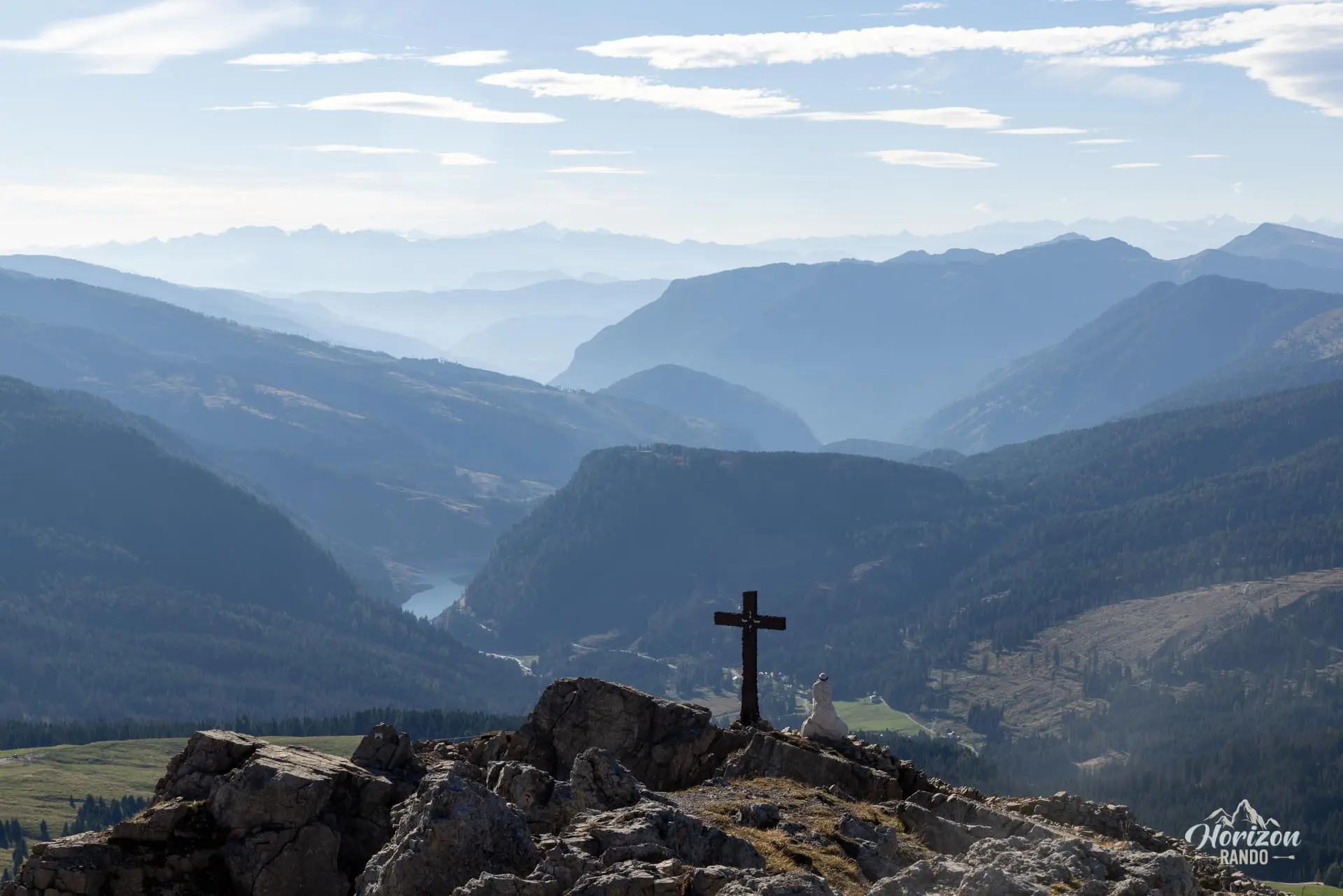
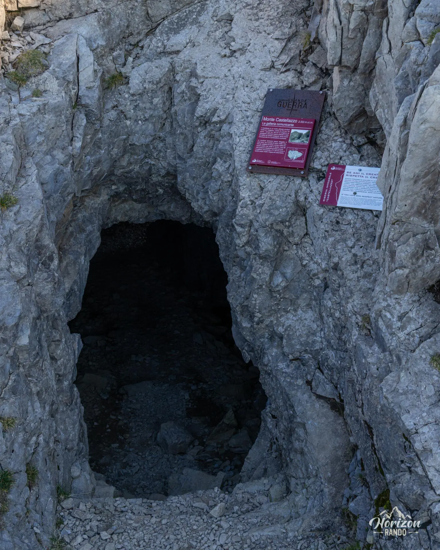
Once you reach the summit, you will see the Cristo Pensante statue and the remains of fortified positions, which serve as a reminder that the area was strategically important during World War I.
Remarks
Parking: Large free parking lot (as of 2025) at Passo Rolle, immediately next to the pass.
Best time to visit: June through October. The area remains accessible in winter (Passo Rolle is a ski resort), but the lake is frozen then. Baita Segantini is closed during the off-season (spring and fall).
Description and difficulties of the hike
From the Passo Rolle parking lot, cross the road and follow the trail heading due north. After about 500 meters, you'll reach an intersection with Strada Val Venegia, a gravel road. There are two options from there: the gravel road, with very wide switchbacks, leads to Capanna Cervino on a gentle slope, and a hiking trail winds parallel to it, slightly steeper but noticeably more pleasant. In either case, you will reach Rifugio Capanna Cervino (2,082 m) in about fifteen minutes.
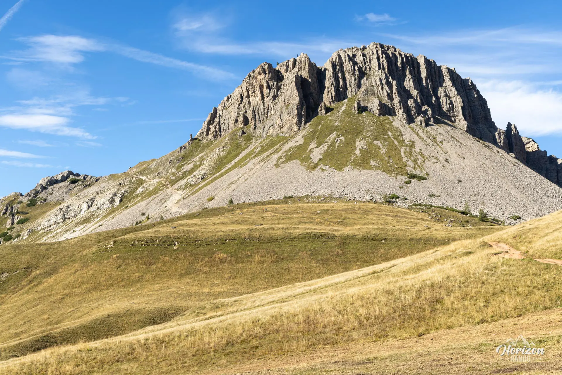
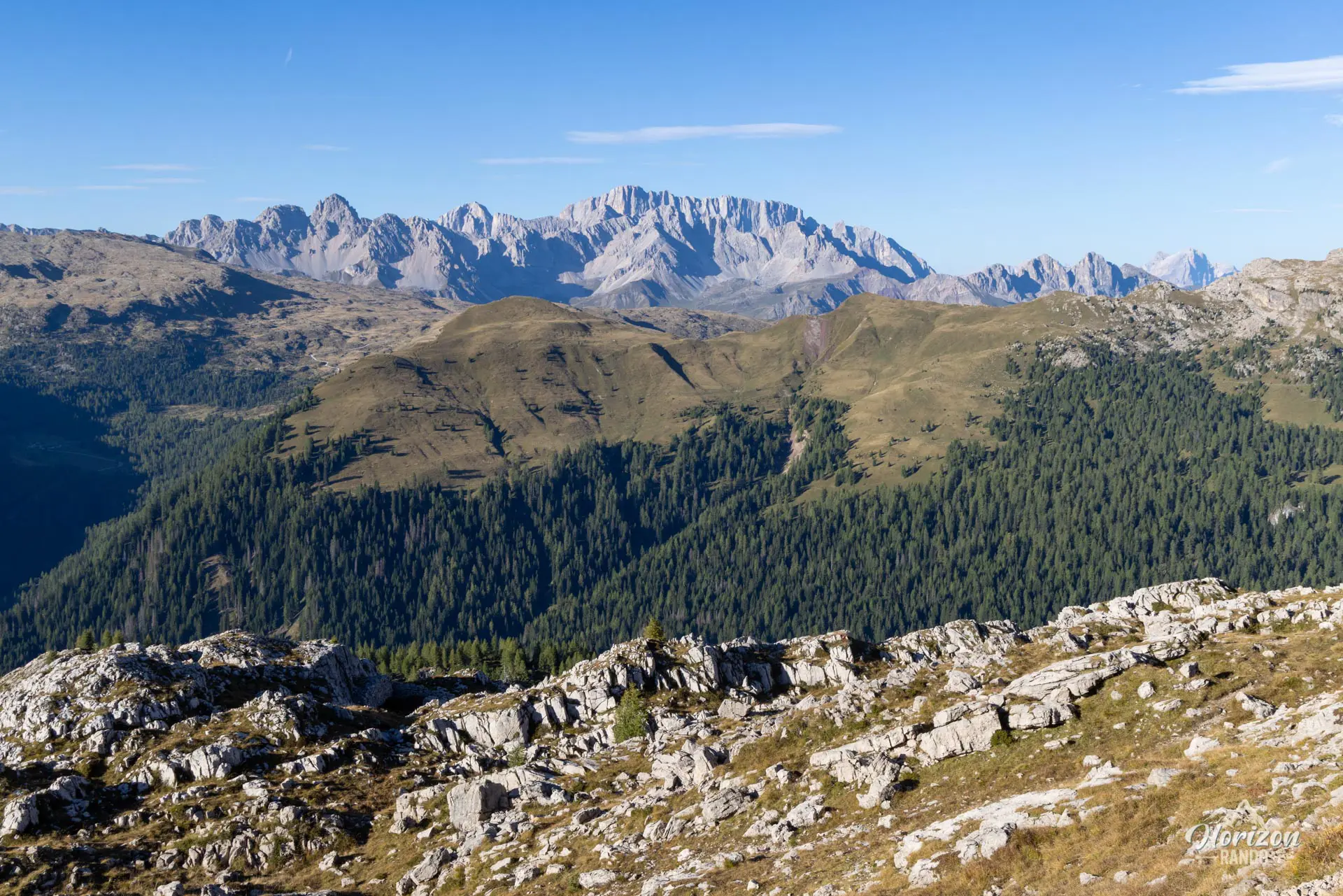
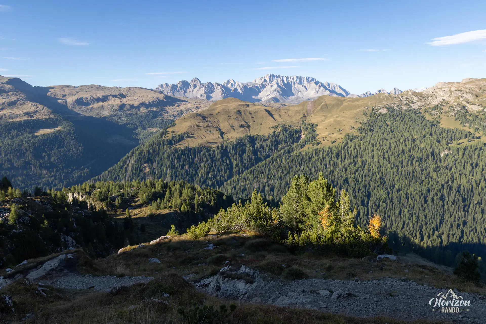
A few minutes past the refuge, at a clearly marked intersection, leave the track and turn left toward "Castellazzo." Monte Castellaz is visible from the start of the hike. Its rounded, isolated silhouette, crowned by a white statue, stands out clearly to the north of the track. The trail passes under a chairlift and crosses a grassy hollow before switching to the southwest slope of Castellaz. The ascent first follows a contour path, then climbs steeper slopes on a stony trail with no technical difficulties or exposed sections. You will emerge onto the summit plateau, where the Cristo Pensante statue seems to watch over the peak.
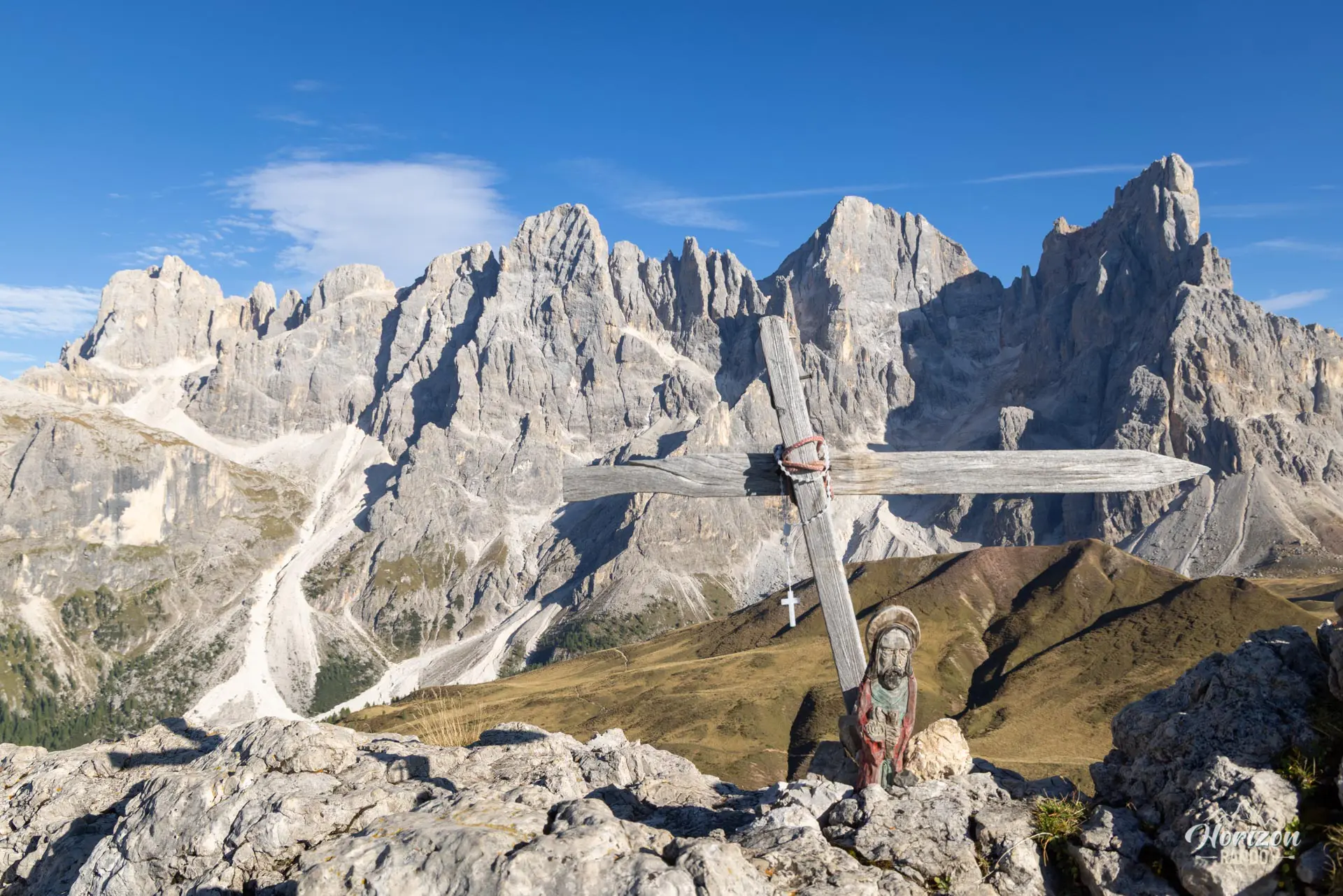
From the summit, the panorama embraces the entire northern chain of the Pale di San Martino, from left to right: Monte Mulaz, Cima dei Bureloni, Cima della Vezzana, and Cimon della Pala (3,184 m), sometimes nicknamed the "Matterhorn of the Dolomites." A plaque recalls that Monte Castellaz was fortified by the Italian Alpini between 1915 and 1917 to protect Passo Rolle, and a few remnants of the Great War remain along the route.
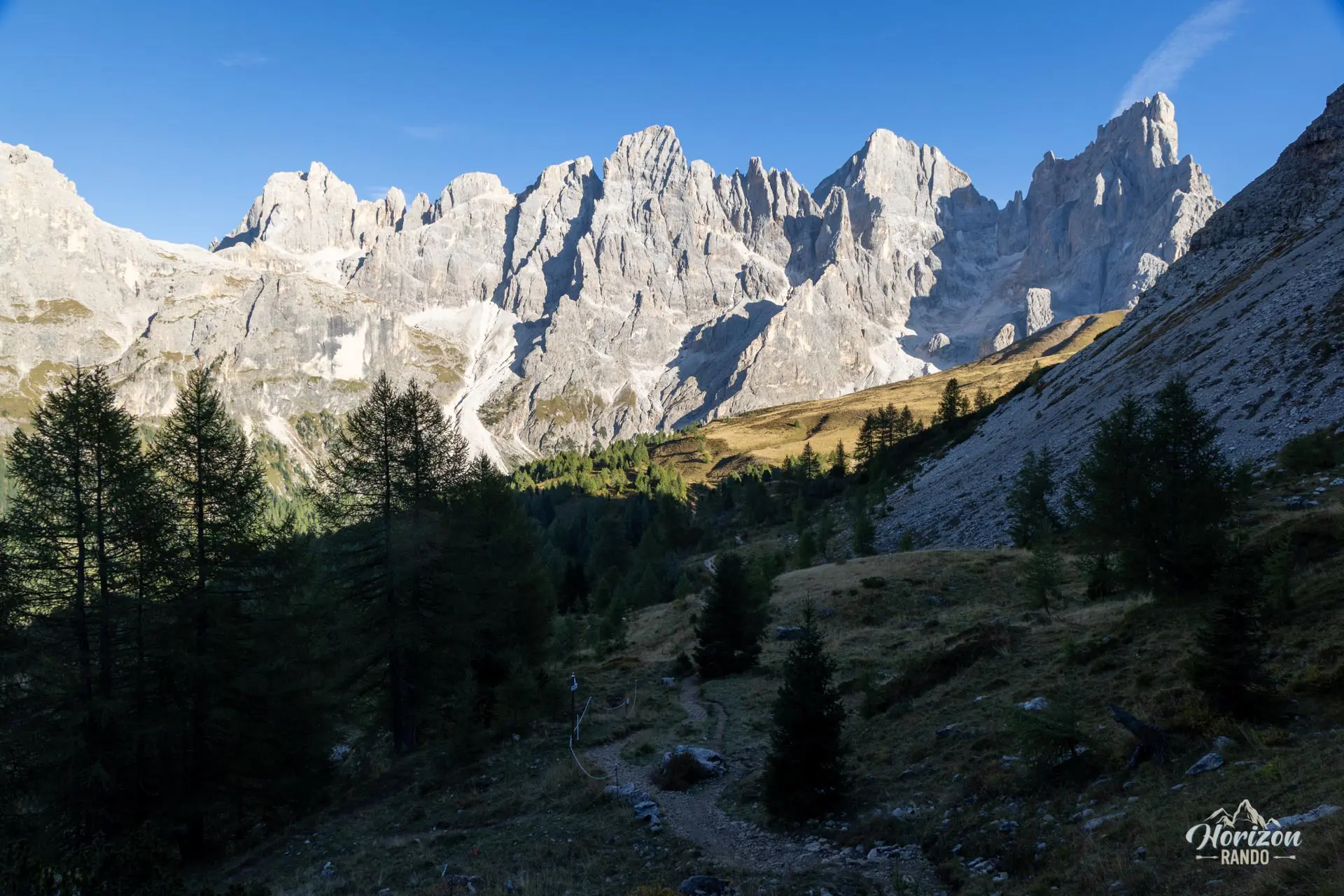
The descent follows the north face of Castellaz on a trail slightly steeper than the ascent, but without any real difficulty. The route then crosses high-altitude meadows and skirts the summit of Costazza before reaching Baita Segantini. The small lake, the mountain hut, and the wall of the Pale di San Martino compose one of the most photographed scenes in the Dolomites. Return to Passo Rolle via Strada Val Venegia, a wide gravel road on a very gentle slope, or the more pleasant parallel hiking trail.
What you'll love
- The 360° panorama from the summit, which reveals the entire northern chain of the Pale di San Martino.
- The scene at Baita Segantini, where the small lake, historic mountain hut, and Pale di San Martino rock face come together to form one of the most photogenic scenes in the Dolomites.
- Remnants of World War I: Monte Castellaz was fortified by the Alpini, and traces of this military history still dot the route.
- The moderate traffic on Castellaz, which contrasts sharply with the crowds around Baita Segantini.
Hike technical sheet
➡️ Hiking parameters
➡️ Hiking parameters
➡️ Hiking parameters
Map and elevation profile of the hike
Slideshow


Nearby hikes

Baita Segantini Hike
- Difficulty : Easy
- Duration : 1 h 30
- Distance : 4.2 km
- Elevation gain : 230 m

Monte Cavallazza and Laghi di Colbricon Hike
- Difficulty : Moderate
- Duration : 3 h
- Distance : 7 km
- Elevation gain : 500 m

Monte Mulaz Hike
- Difficulty : Hard
- Duration : 7 h 30
- Distance : 18.6 km
- Elevation gain : 1420 m

Val Venegia and Baita Segantini Hike
- Difficulty : Moderate
- Duration : 4 h
- Distance : 12.6 km
- Elevation gain : 510 m
Map of the 12 closest hikes
Hikes to discover

Via Ferrata Lipella - Tofana di Rozes Loop
- Hiking Difficulty : Moderate
- Via Ferrata Difficulty : C (Difficult)
- Duration : 6 h
- Distance : 9.2 km
- Elevation gain : 810 m

Via Ferrata Lipella - Tofana di Rozes Summit
- Hiking Difficulty : Hard
- Via Ferrata Difficulty : C/D (Difficult)
- Duration : 8 h
- Distance : 11.6 km
- Elevation gain : 1320 m

Via Ferrata Ivano Dibona and Marino Bianchi
- Hiking Difficulty : Very Hard
- Via Ferrata Difficulty : C (Difficult)
- Duration : 11 h
- Distance : 15.9 km
- Elevation gain : 1810 m

Croda da Lago Loop
- Difficulty : Moderate
- Duration : 5 h
- Distance : 12.8 km
- Elevation gain : 910 m

Piz Boè and Piz Selva Hike
- Difficulty : Hard
- Duration : 6 h 30
- Distance : 16.2 km
- Elevation gain : 930 m

Forca Rossa and Rifugio Fuciade Hike
- Difficulty : Moderate
- Duration : 4 h 15
- Distance : 10.9 km
- Elevation gain : 680 m