
Vajolet Towers Hike
Hike overview
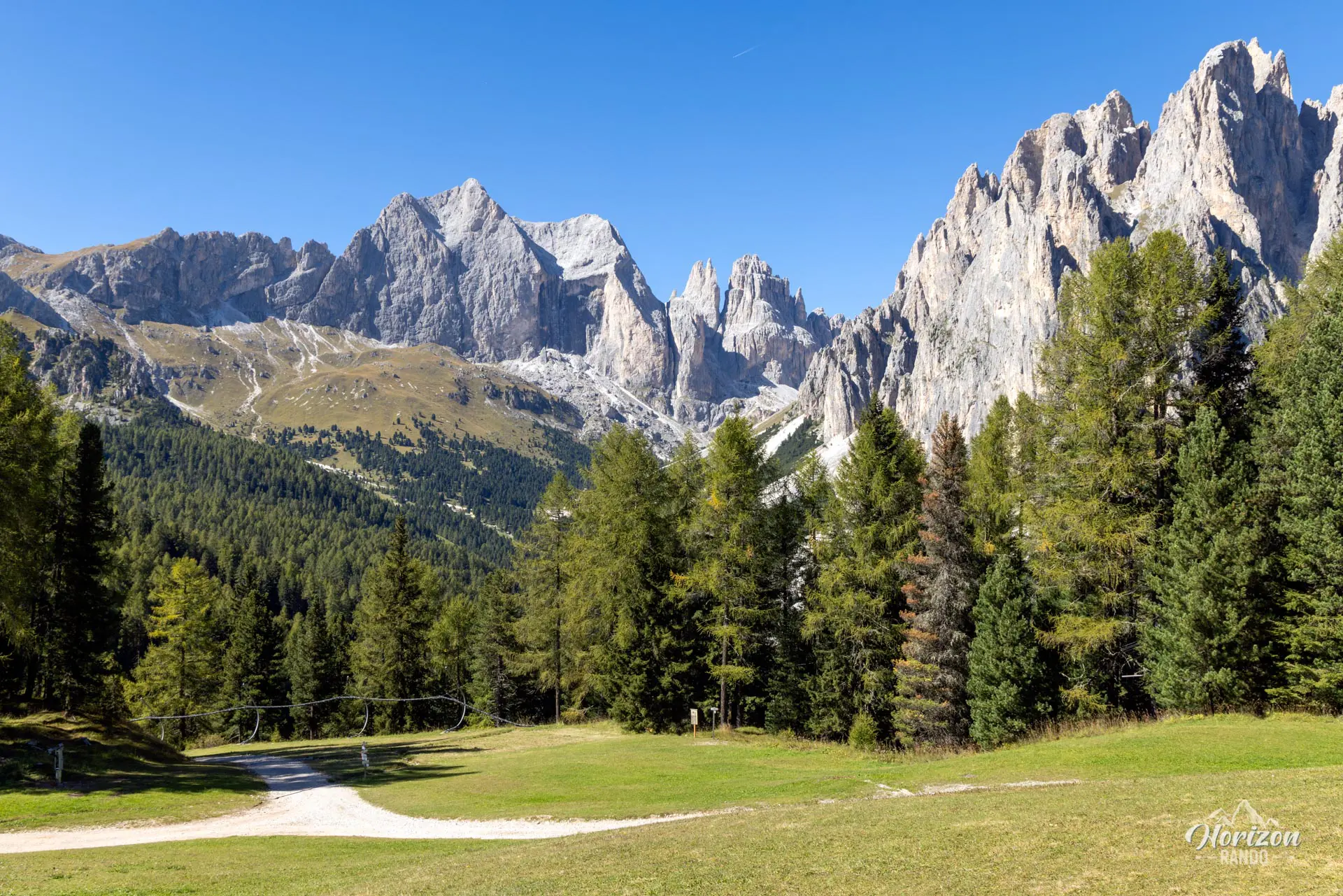
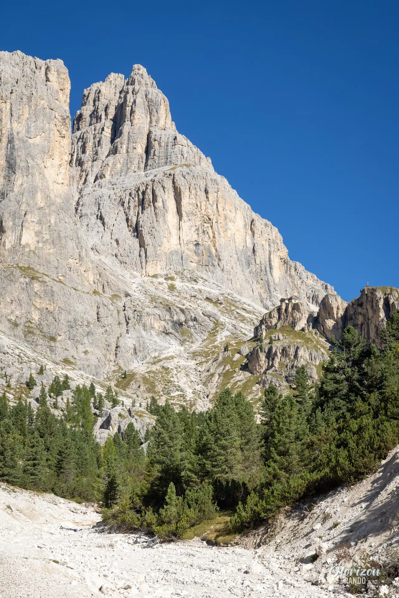
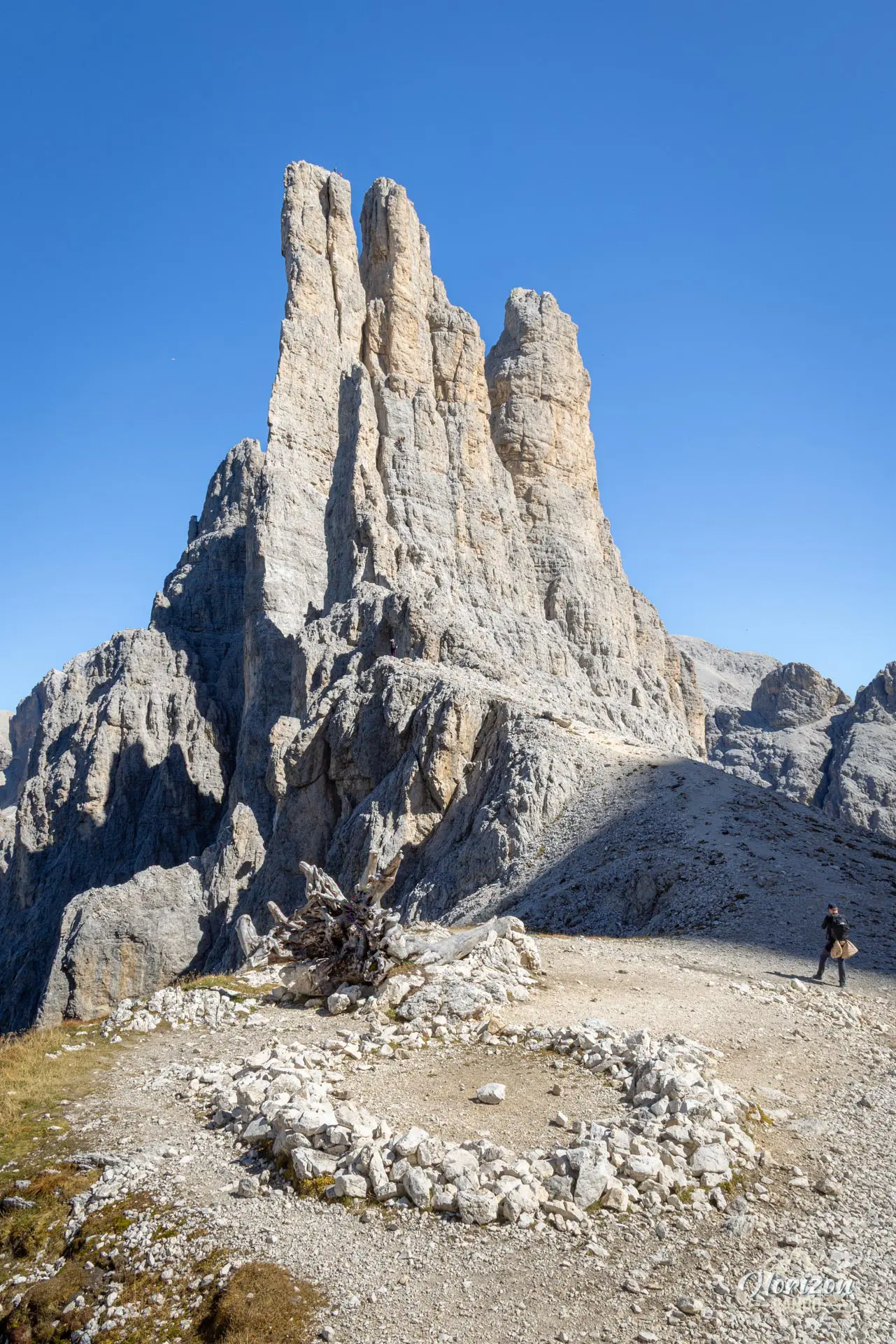
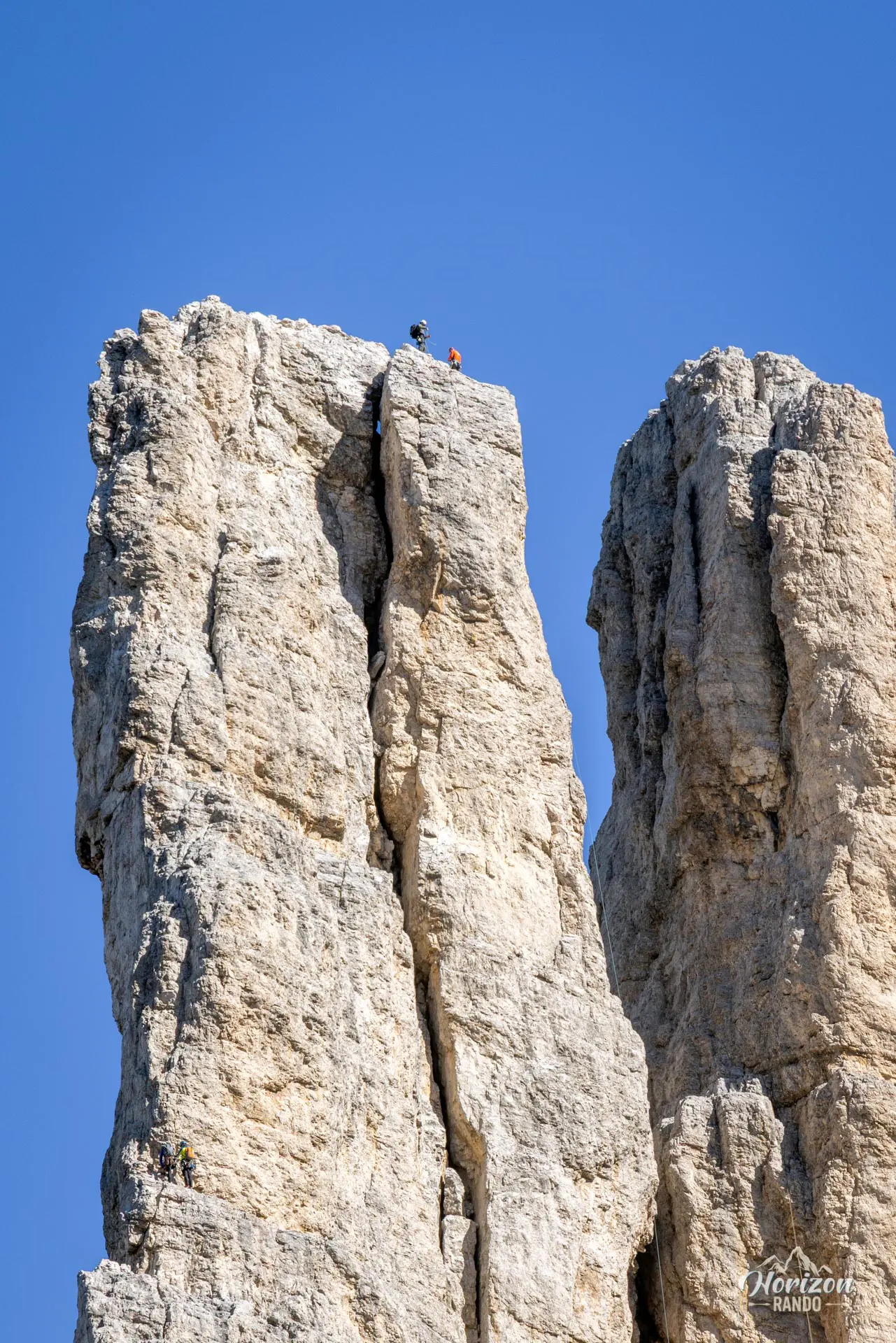
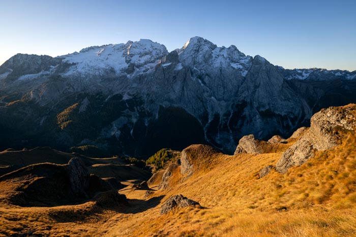
The Vajolet Towers, located in the heart of the Catinaccio massif (known as the Rosengarten in German), are among the most iconic landmarks in the Dolomites. Their six rocky spires soar toward the sky.
This round-trip hike, made easier by the ski lifts in Vigo di Fassa, passes through five mountain huts and offers stunning views of these spectacular peaks. One drawback is that the route is very crowded, and the scenery remains fairly monotonous until you reach the base of the towers.
Remarks
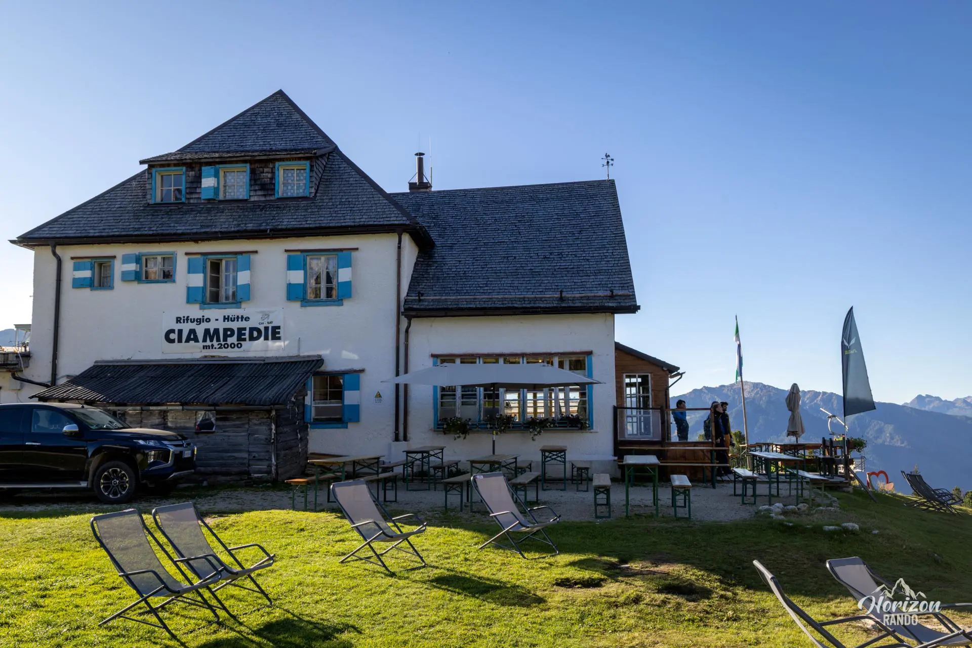
Access and parking: To reach the trailhead (Ciampedie), take the ski lifts. Access on foot is possible, but it significantly lengthens the hike. There are two options: the Vigo–Ciampedie cable car from Vigo di Fassa (open from early June to early November) or the Vajolet 1 and 2 chairlifts, and then the Pian Pecei–Ciampedie chairlifts from Pera di Fassa (open from mid-June to mid-September).
Indicative price in 2025: €28 per person round-trip for each option. Free parking is available at the base of the lifts. For schedules and reservations, visit the official Val di Fassa website (Vigo di Fassa – Catinaccio section).
Note: The "Directions" button on this page leads to the Vigo di Fassa cable car. If you prefer to take the chairlifts, follow this Google Maps link to reach the Pera di Fassa lifts.
Ideal time of year: Late June to early October, when the lifts and mountain huts open. Early in the season, there may be snow patches in the gully between Rifugio Vajolet and Rifugio Re Alberto.
Tip: To avoid crowds and enjoy the light on the peaks, take the first lifts of the morning. Even better, spend the night at Rifugio Re Alberto or Rifugio Passo Santner to watch the sunset or sunrise over the peaks.
Description and difficulties of the hike
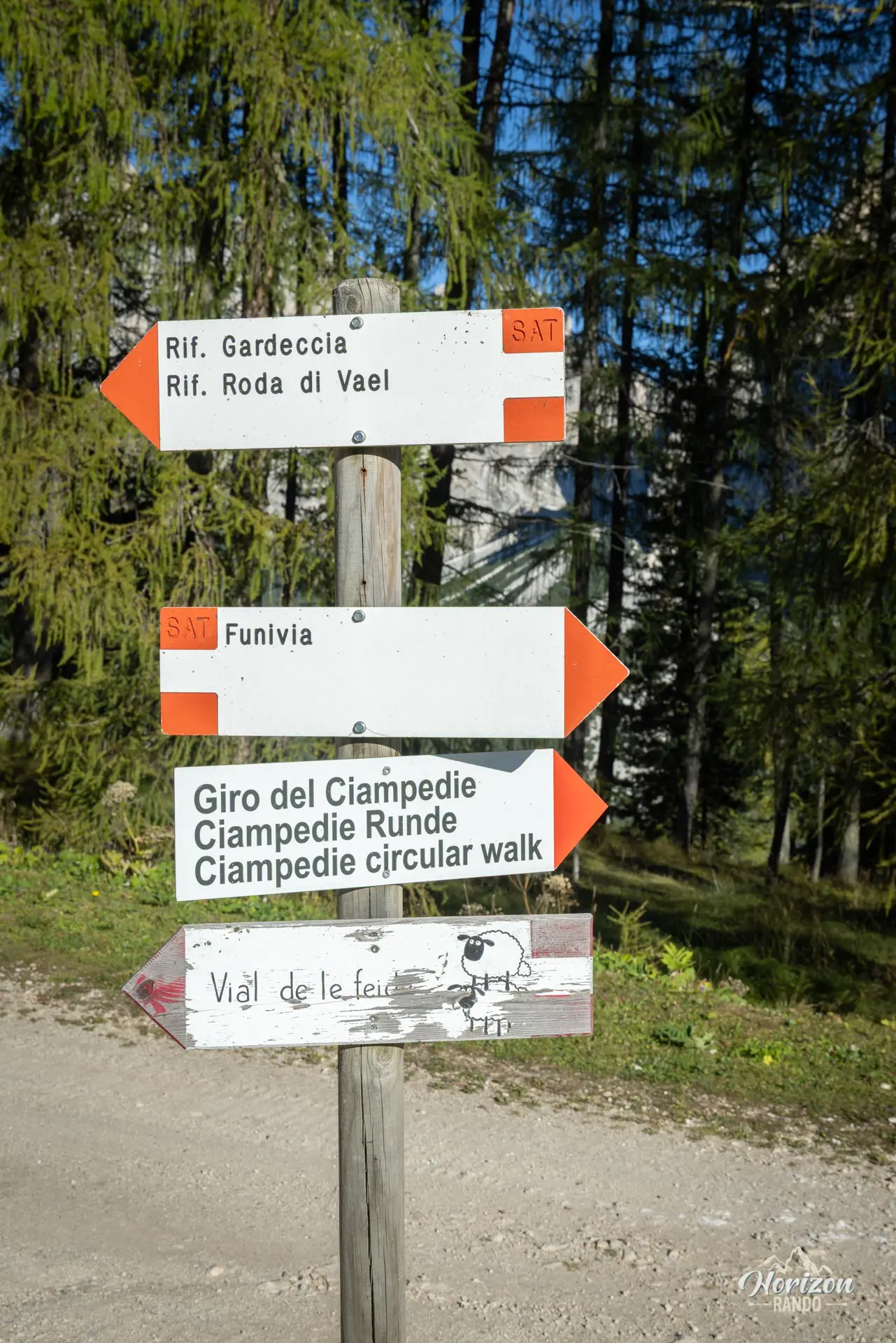
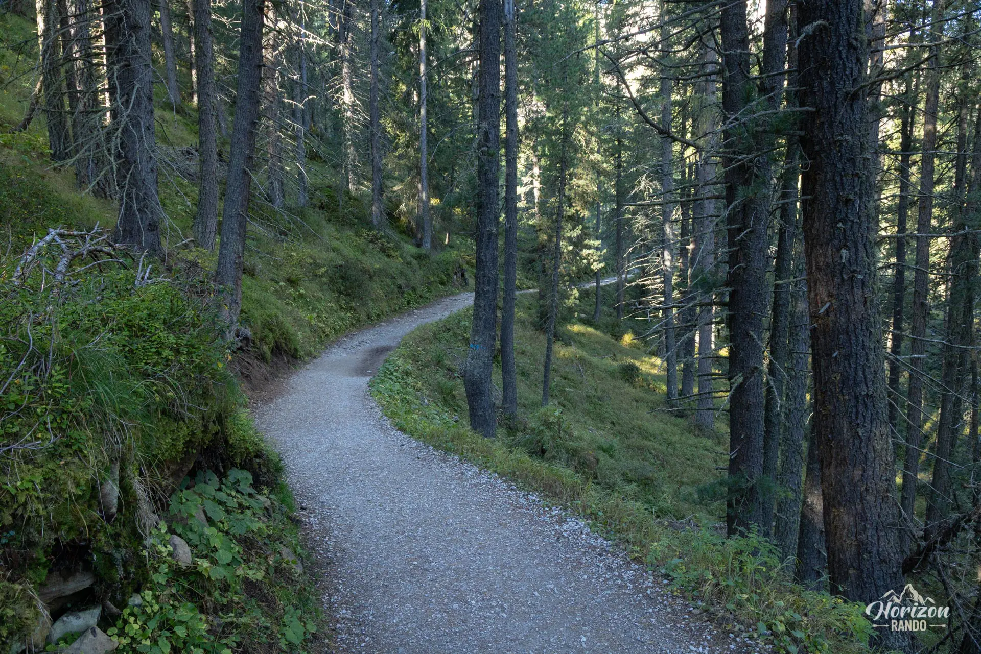
The trail is well-maintained and well-marked from start to finish, with trail numbers and directions to mountain huts at every intersection.
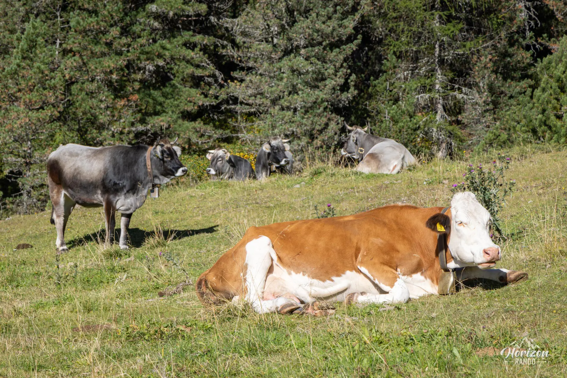
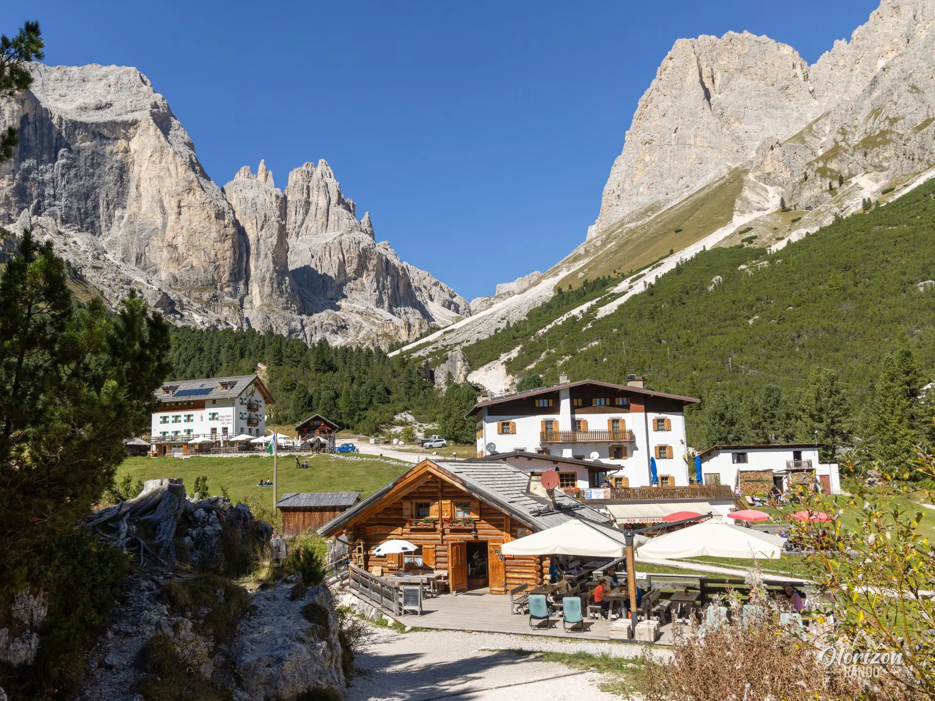
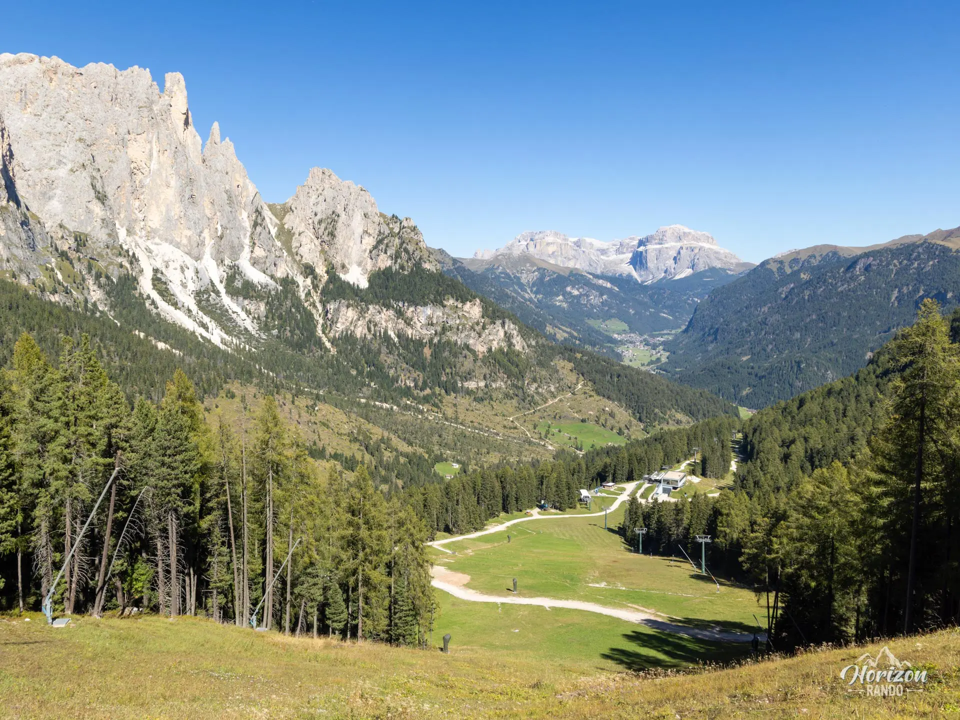
From the Ciampedie cable car station, follow Trail No. 540 toward Rifugio Gardeccia. The first section is almost flat and crosses a wooded area with a few short ascents and descents. At Gardeccia, switch to Trail No. 546, a rocky 4x4 track that climbs steeply up to the Paul Preuss and Vajolet mountain huts. These huts are perched at the foot of the Catinaccio walls.
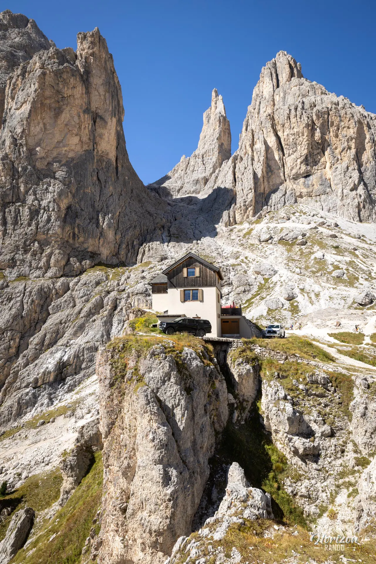
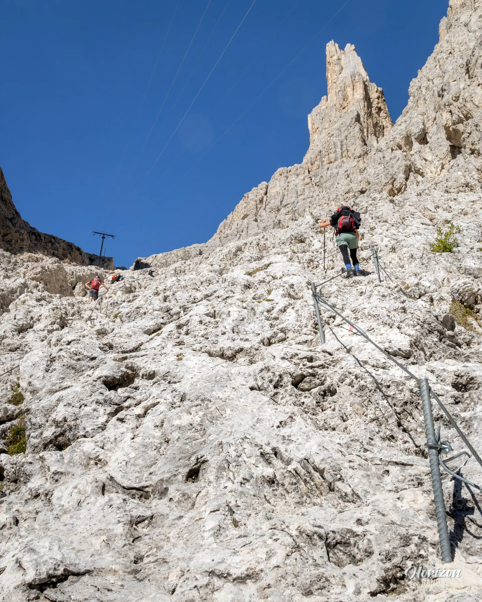
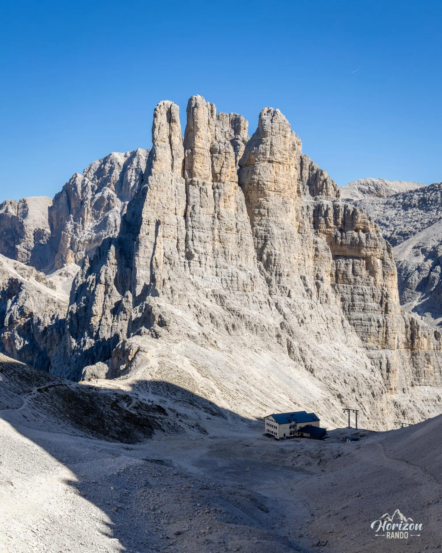
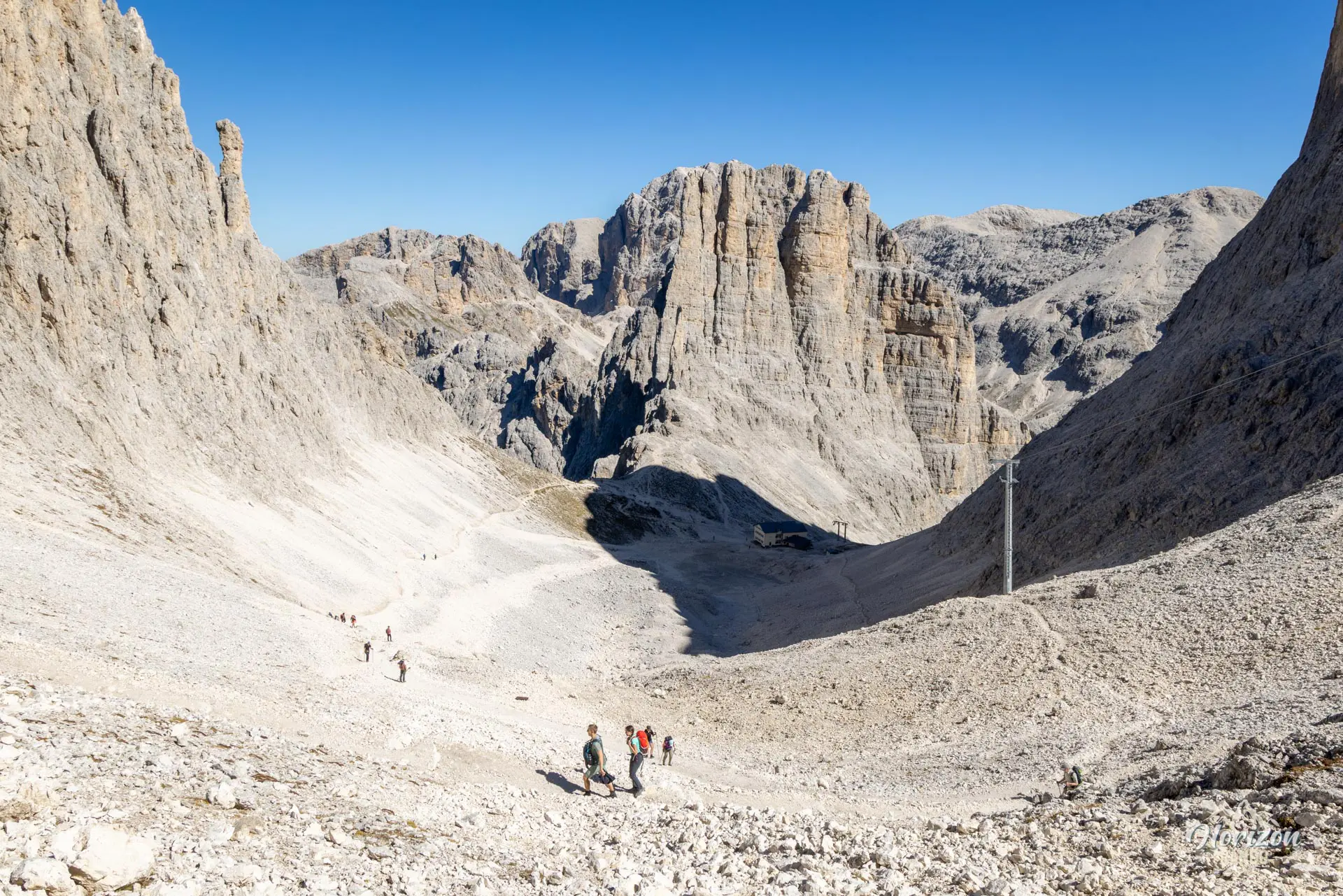
The hike becomes challenging between the Vajolet Refuge and the Re Alberto Refuge (Gartlhütte). Trail No. 542 begins a sustained climb at the base of the towers through a scree gully. Several slightly more technical sections are equipped with handlines. In 30 to 40 minutes, you will reach Rifugio Re Alberto. The best viewpoint is located just above the refuge at Passo Laurin (2,616 m) and is about a five-minute walk away. From there, the Vajolet Towers reveal themselves in all their vertical grandeur with the refuge below providing a sense of scale.
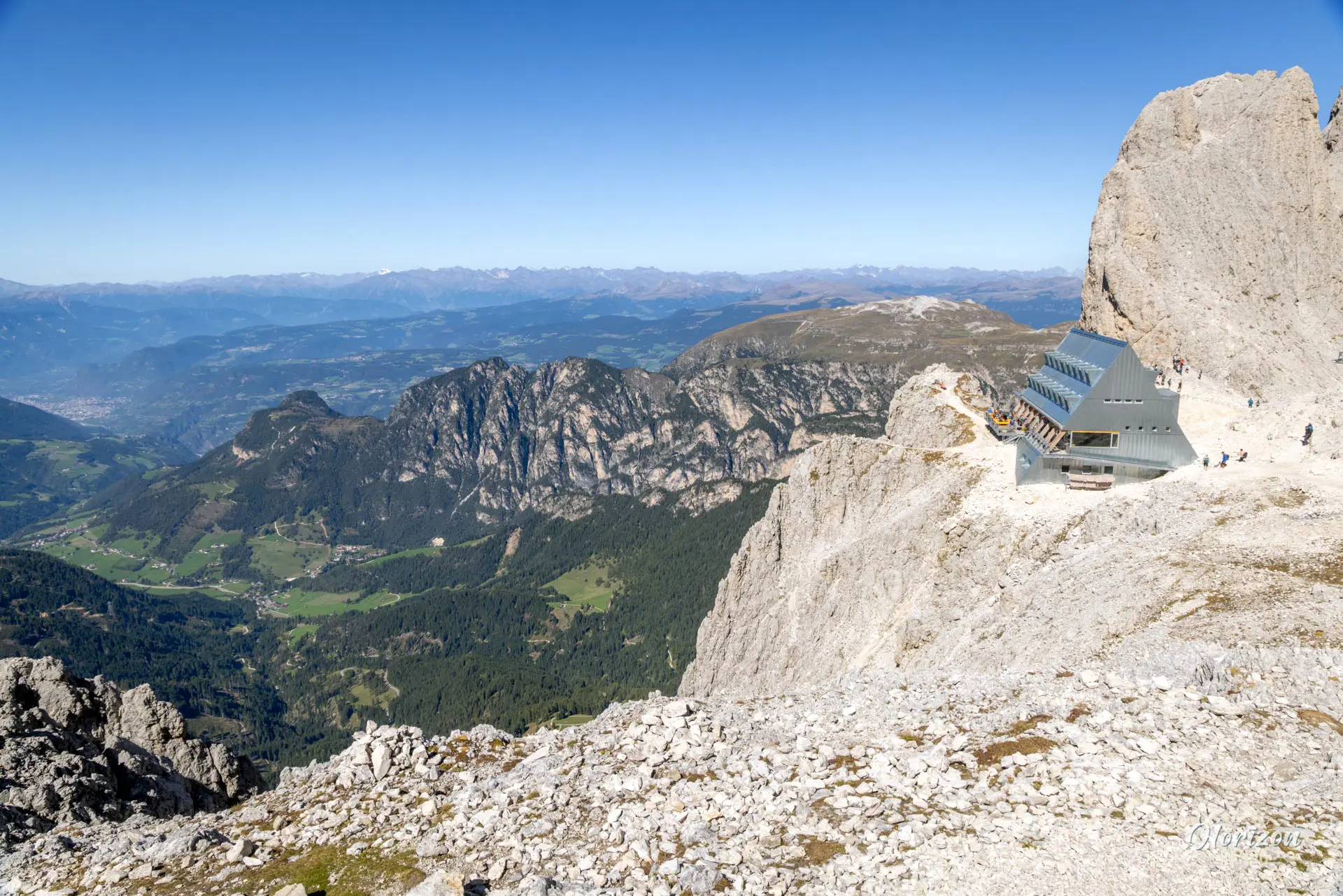
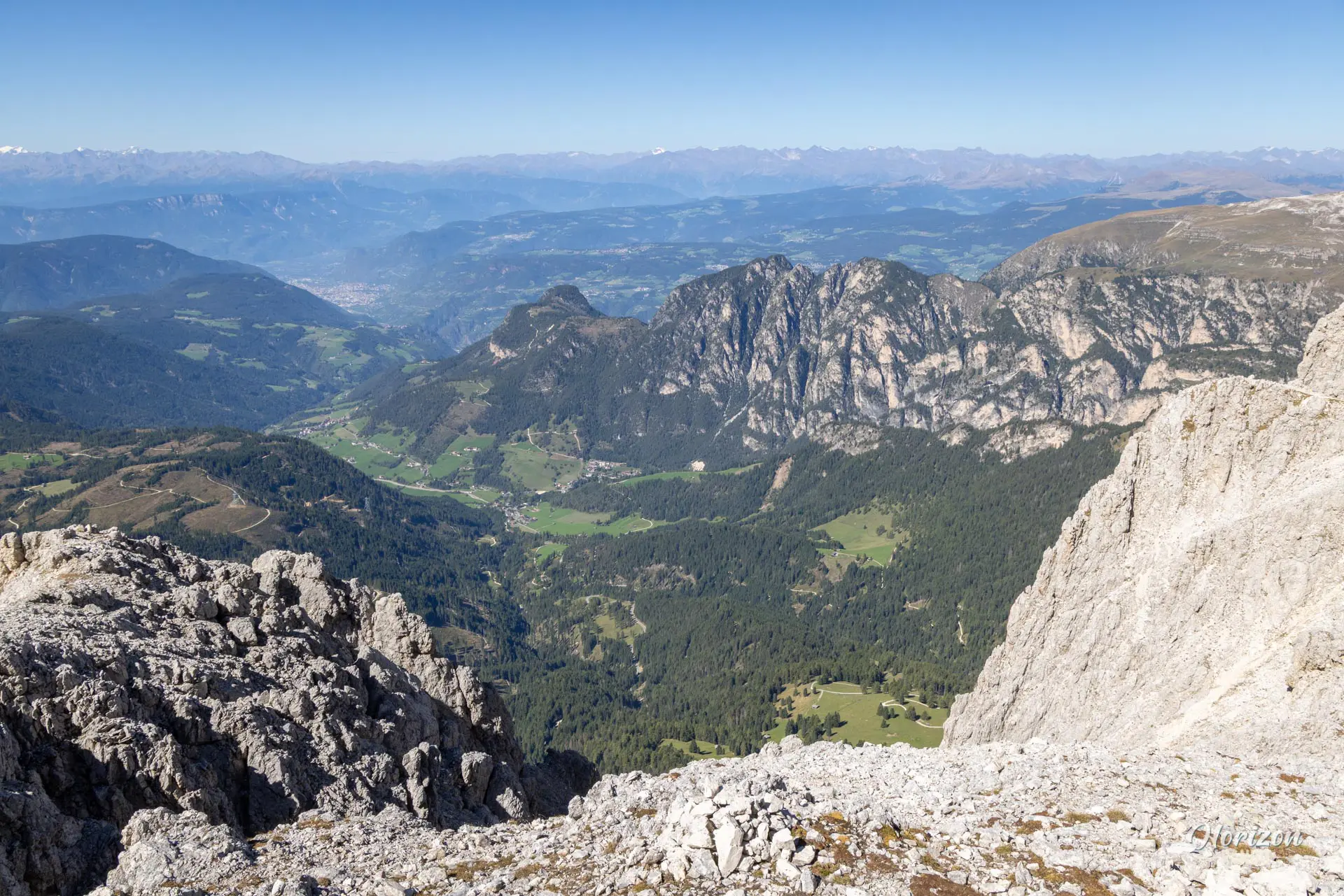
Continue on to Passo Santner and its modern refuge via an easy trail along the mountainside (20 to 30 minutes) to explore the other side and enjoy a different view of the entire tower range. The return trip follows the same route.
What you'll love
- The arrival at Rifugio Re Alberto, where the towers rise like the fingers of a hand reaching toward the sky.
- The five huts along the route (Gardeccia, Paul Preuss, Vajolet, Re Alberto, and Passo Santner), that are perfect for taking a break or sampling South Tyrolean cuisine.
- It's a beautiful gateway to discovering the spectacular Rosengarten massif.
Hike technical sheet
➡️ Hiking parameters
➡️ Hiking parameters
➡️ Hiking parameters
Map and elevation profile of the hike
Slideshow

Nearby hikes

Sassolungo Loop
- Difficulty : Moderate
- Duration : 5 h 30
- Distance : 16.1 km
- Elevation gain : 790 m

Forca Rossa and Rifugio Fuciade Hike
- Difficulty : Moderate
- Duration : 4 h 15
- Distance : 10.9 km
- Elevation gain : 680 m
Padon Ridge and Viel del Pan Loop Hike
- Difficulty : Easy
- Duration : 2 h 45
- Distance : 7.4 km
- Elevation gain : 420 m

Passo Pordoi to Lago di Fedaia via Viel del Pan Hike
- Difficulty : Moderate / Hard
- Duration : 5 h 30
- Distance : 15.3 km
- Elevation gain : 780 m
Map of the 12 closest hikes
Hikes to discover

Via Ferrata Lipella - Tofana di Rozes Summit
- Hiking Difficulty : Hard
- Via Ferrata Difficulty : C/D (Difficult)
- Duration : 8 h
- Distance : 11.6 km
- Elevation gain : 1320 m

Via Ferrata Innerkofler - Monte Paterno
- Hiking Difficulty : Moderate
- Via Ferrata Difficulty : A/B (Easy)
- Duration : 4 h 30
- Distance : 9.5 km
- Elevation gain : 650 m

Croda Fiscalina Loop via Rifugio Locatelli
- Difficulty : Hard
- Duration : 7 h 30
- Distance : 18.5 km
- Elevation gain : 1210 m

Lago Limides, Monte Nuvolau and Cinque Torri Circuit
- Difficulty : Moderate
- Duration : 4 h 30
- Distance : 11.1 km
- Elevation gain : 790 m

Monte Nuvolau, Monte Averau and Cinque Torri Circuit
- Hiking Difficulty : Hard
- Via Ferrata Difficulty : A/B (Easy)
- Duration : 5 h 30
- Distance : 11.4 km
- Elevation gain : 950 m

Via Ferrata Averau
- Hiking Difficulty : Moderate
- Via Ferrata Difficulty : A/B (Easy)
- Duration : 3 h 30
- Distance : 8.4 km
- Elevation gain : 580 m