
Múlagljúfur Canyon Hike
Hike overview
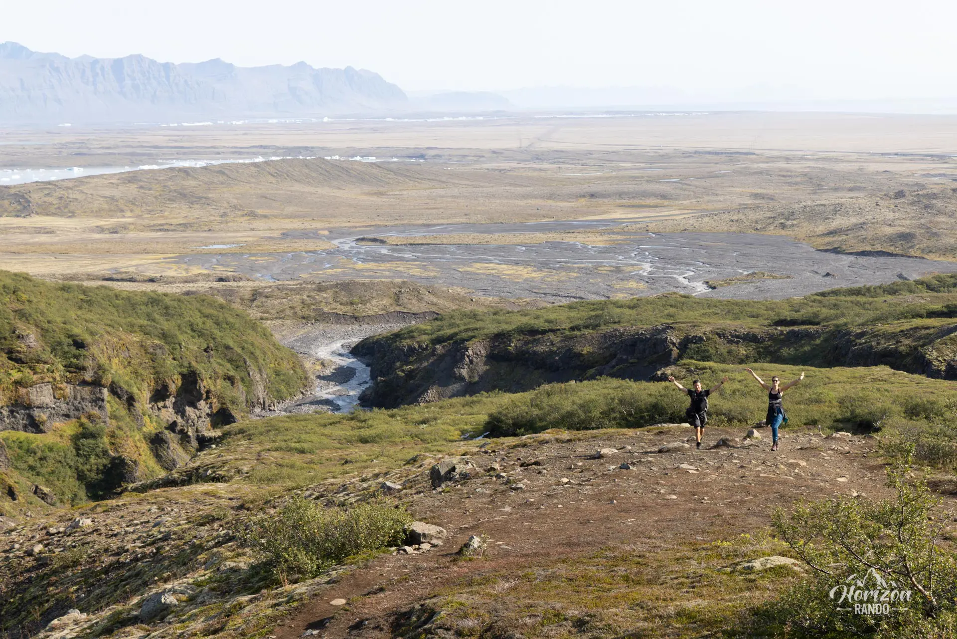
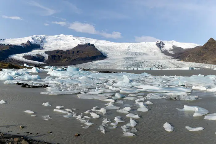
The Múlagljúfur Canyon, also known as the "Secret Canyon," is a must-see destination in southeastern Iceland. Located near the renowned glaciers of Fjallsárlón and Jökulsárlón, this natural wonder remained a closely guarded secret among locals until the early 2020s. However, its popularity continues to grow, and it is poised to become a major tourist destination in the coming years. Take advantage of this opportunity to explore this exceptional place now!
Inside this magnificent, narrow canyon are the Hangandifoss and Múlafoss waterfalls. At 123 meters high, Hangandifoss is one of Iceland's largest waterfalls, offering a breathtaking spectacle. The final viewpoint has a few surprises in store, as very few photos of this location exist.
Once you reach the canyon's banks, the trail winds along the edges, providing an extraordinary hiking experience. Get ready for an unforgettable adventure in one of Iceland's most stunning landscapes!
Remarks
Access and parking: From Route 1, take the unmarked gravel track located about 5 km west of the Fjallsárlón glacier lagoon. A 4x4 vehicle is not necessary. Free parking is available at the end of the track, at the foot of the canyon.
Difficulties of the hike
The trail is clearly marked and does not present any particular difficulty except for a short, narrow passage along the side of a slightly vertiginous cliff. The climb is relatively steep in places but remains accessible to most hikers.
What you'll love
- The exceptional views of the canyon and its two majestic waterfalls, especially Hangandifoss, which plunges 123 meters.
- The relative tranquility of the site: Despite its growing popularity, Múlagljúfur remains much less crowded than major attractions in southern Iceland.
Hike technical sheet
➡️ Hiking parameters
➡️ Hiking parameters
➡️ Hiking parameters
Map and elevation profile of the hike
Slideshow


")
")
")


Nearby hikes


Map of the 9 closest hikes
Hikes to discover
Let chance guide your steps: discover a random selection of the best hikes in Iceland.

Sveinstindur Hike
- Difficulty : Easy
- Duration : 2 h
- Distance : 3.5 km
- Elevation gain : 420 m

Kristínartindar Hike
- Difficulty : Very Hard
- Duration : 7 h
- Distance : 18 km
- Elevation gain : 1100 m

Thakgil Purple Circuit Hike
- Difficulty : Moderate
- Duration : 4 h 30
- Distance : 11.2 km
- Elevation gain : 480 m

Skalli Hike
- Difficulty : Hard
- Duration : 6 h 30
- Distance : 17.7 km
- Elevation gain : 960 m

Eldgjá Canyon Hike
- Difficulty : Easy
- Duration : 2 h
- Distance : 5 km
- Elevation gain : 200 m

Skógá Waterfall Way
- Difficulty : Moderate
- Duration : 5 h 30
- Distance : 15.7 km
- Elevation gain : 650 m