
Faraid Head Hike
Hike overview
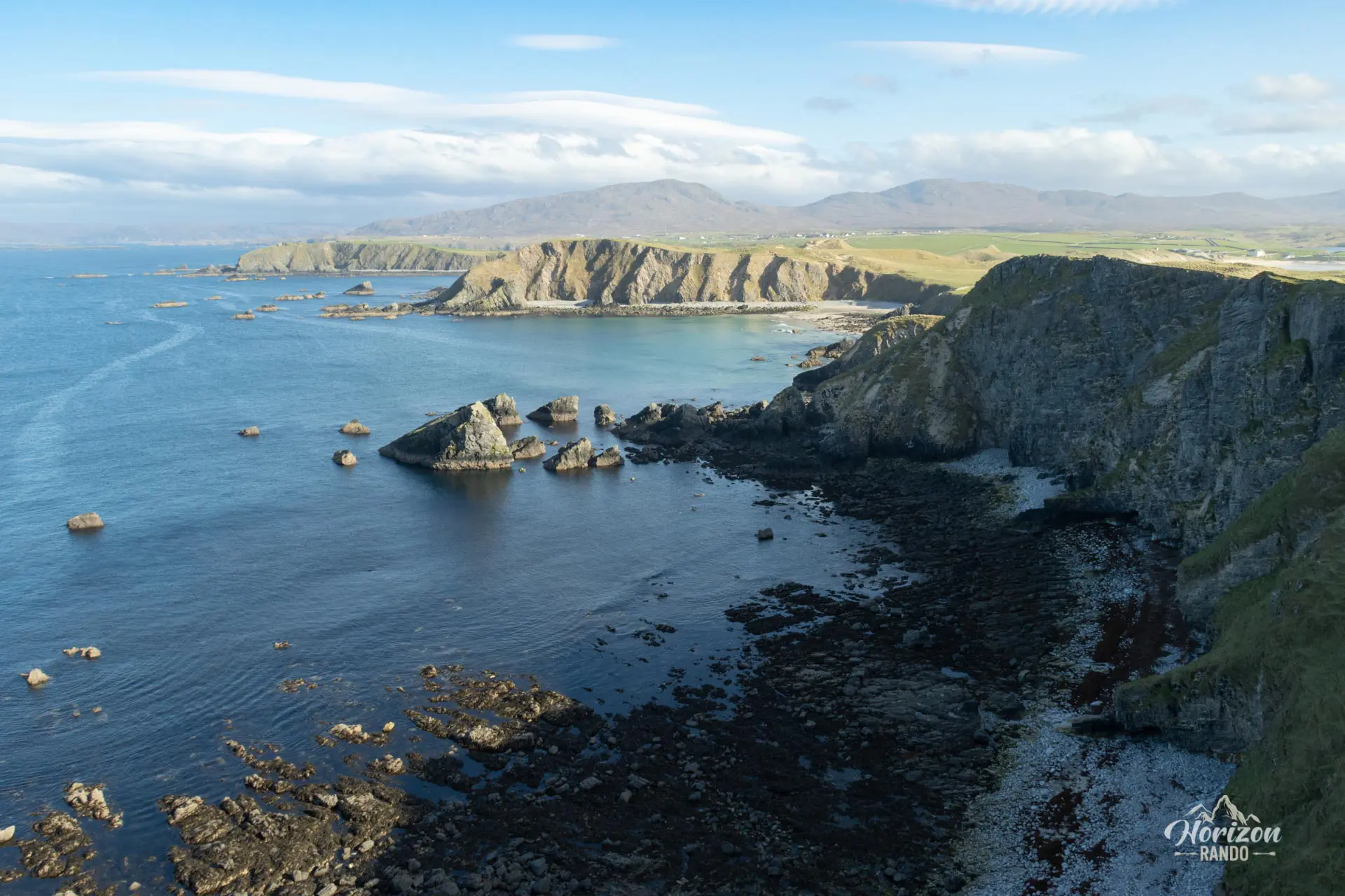
The Faraid Head hike takes you to a small, wild peninsula located at the northernmost tip of Scotland, just a few miles from Durness. The route begins at the stunning Balnakeil white sand beach, passes through a landscape of wind-sculpted dunes, and then ascends to the top of the cliffs overlooking the coast. From there, you can enjoy stunning views of Cape Wrath, White Head, and the impressive rock formations along the coast.
Faraid Head is a paradise for birdwatchers and wildlife lovers. Every spring, it becomes home to large colonies of nesting seabirds, including puffins, guillemots, and cormorants. Gray seals can also be seen on the beaches or in the turquoise waters.
Remarks
Parking: Free parking is available at Balnakeil, near the 17th-century church ruins and Balnakeil House. To get there, follow the secondary road from Durness, passing the Balnakeil Craft Village.
Best time to visit: April to September for the best weather and to see nesting birds, especially puffins from mid-May to mid-July.
Difficulties of the hike
This hike is technically easy and accessible to most people, with a modest elevation gain and relatively flat terrain. However, the trail is not always clearly visible, especially in the dunes and at the top of the cliffs.
What you'll love
- Breathtaking coastal panoramas: Spectacular views of white sandy beaches, cliffs reaching nearly 100 meters in places, and seascapes stretching as far as White Head.
- Exceptional wildlife: opportunities to observe puffin colonies (May to July), guillemots, and other seabirds nesting on the cliffs.
- Paradise beaches: The vast expanse of white sand at Balnakeil and the coves along the route offer tropical-like landscapes.
- Feelings of isolation and being at the end of the world: Experience a wild atmosphere in one of the most remote corners of mainland Scotland.
Hike technical sheet
➡️ Hiking parameters
➡️ Hiking parameters
➡️ Hiking parameters
Map and elevation profile of the hike
Slideshow


Nearby hikes

Oldshoremore Bay Hike
- Difficulty : Easy
- Duration : 3 h 15
- Distance : 8.9 km
- Elevation gain : 270 m

Sandwood Bay Hike
- Difficulty : Easy
- Duration : 3 h 30
- Distance : 12.9 km
- Elevation gain : 190 m

Ben Hope Hike
- Difficulty : Moderate
- Duration : 5 h
- Distance : 7.7 km
- Elevation gain : 930 m

Arkle Hike
- Difficulty : Hard
- Duration : 7 h 30
- Distance : 17.9 km
- Elevation gain : 950 m
Map of the 10 closest hikes
Hikes to discover
Let chance guide your steps: discover a random selection of the best hikes in Scotland.

An Teallach Hike
- Difficulty : Hard
- Duration : 6 h 30
- Distance : 14.1 km
- Elevation gain : 1210 m

Blà Bheinn Hike
- Difficulty : Hard
- Duration : 5 h
- Distance : 8.5 km
- Elevation gain : 940 m

Buachaille Etive Mòr Hike
- Difficulty : Hard
- Duration : 7 h 30
- Distance : 14.4 km
- Elevation gain : 1150 m

Beinn Dearg Mhór Hike
- Difficulty : Hard
- Duration : 5 h 30
- Distance : 11.3 km
- Elevation gain : 910 m

Preshal Hills Hike
- Difficulty : Hard
- Duration : 5 h
- Distance : 11.9 km
- Elevation gain : 610 m

Suilven Hike
- Difficulty : Hard
- Duration : 7 h
- Distance : 20.3 km
- Elevation gain : 970 m