
Lake Mývatn, Höfði Hike
Hike overview
Lake Mývatn, Iceland's fourth largest lake, formed approximately 2,300 years ago due to an eruption. Höfði, a peninsula located on the eastern shore of the lake, is a remarkable place. Once barren, the area was transformed by a couple who planted thousands of trees and plants during their summer vacations. After decades of effort and the death of her husband, she bequeathed Höfði to the county. Today, Höfði is covered with a mini-forest, a rarity in this region.
The hike offers stunning panoramic views of the Kálfastrandarvogar rock pillars, which rise from the lake's waters – volcanic formations created over 2,000 years ago when molten lava met the lake. Far from tourist crowds, this short but memorable walk through this small natural paradise is a must-see in the Mývatn region.
Remarks
Mosquitoes in summer: Lake Mývatn is a beautiful place with many sites of interest nearby. However, it is also one of the only places in Iceland where you will be invaded by mosquitoes. And when I say invaded, I'm not kidding! If you are familiar with midges in Scotland, this is quite similar!
Best time to go: May to September, when conditions are optimal and the vegetation is at its peak. Choose windy days, as they limit the presence of mosquitoes!
Difficulties of the hike
This hike is very easy and accessible to all. The mostly flat route with no significant elevation gain winds through the forest before skirting the shores of the lake. Although the trail is not marked, there are signs in some places to guide you.
What you'll love
- Unique lava formations: The Kálfastrandarvogar pillars, rising out of the lake, offer a fascinating and photogenic geological spectacle.
- A haven of tranquility: Höfði is significantly less crowded than neighboring iconic sites, such as Dimmuborgir and Hverfjall, guaranteeing peace and serenity.
- Birdwatching: The peninsula is an excellent spot for observing the abundant birdlife of Lake Mývatn.
Hike technical sheet
➡️ Hiking parameters
➡️ Hiking parameters
➡️ Hiking parameters
Map and elevation profile of the hike
Slideshow


Nearby hikes

Dimmuborgir Lava Field Hike
- Difficulty : Very easy
- Duration : 1 h
- Distance : 2.7 km
- Elevation gain : 50 m

Hverfjall Crater Hike
- Difficulty : Easy
- Duration : 1 h 30
- Distance : 4.5 km
- Elevation gain : 230 m

Zone géothermique de Hverir

Leirhnjúkur Hike
- Difficulty : Easy
- Duration : 1 h 45
- Distance : 4.6 km
- Elevation gain : 100 m
Map of the 10 closest hikes
Hikes to discover
Let chance guide your steps: discover a random selection of the best hikes in Iceland.

Diamond beach

Stuðlagil Canyon Hike
- Difficulty : Very easy
- Duration : 1 h 30
- Distance : 5.2 km
- Elevation gain : 100 m
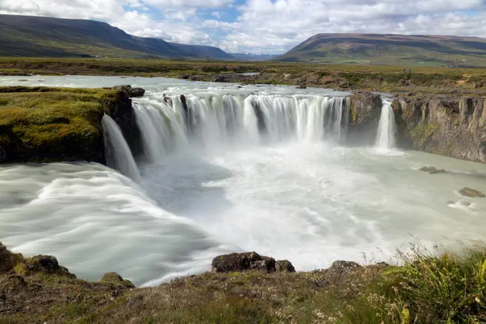
Chutes de Goðafoss

Hengifoss Hike
- Difficulty : Easy
- Duration : 1 h 45
- Distance : 4.9 km
- Elevation gain : 300 m
Bláhnúkur, Skalli and Grænihryggur Circuit
- Difficulty : Very Hard
- Duration : 9 h
- Distance : 23.7 km
- Elevation gain : 1500 m

Brennisteinsalda Hike
- Difficulty : Easy
- Duration : 2 h 45
- Distance : 7.5 km
- Elevation gain : 350 m