
Móði and Magni Craters Hike
Hike overview
The hike to the craters of Móði and Magni begins in Thórsmörk (the Valley of Thor), named after the Norse god. Nestled between the Myrdalsjökull and Eyjafallajökull ice caps in the highlands, this wild region is a favorite place of Icelanders and a true paradise for hikers. Sheltered from Atlantic winds, the valley has a surprisingly mild summer climate, which promotes lush vegetation, including numerous birch forests.
Móði and Magni, named after Thor's sons, are volcanoes born from the famous 2010 eruption of Eyjafjöll, which paralyzed air traffic for weeks. This hike follows the Fimmvörðuháls trek trail on the way out and returns via a wild, less-frequented canyon.
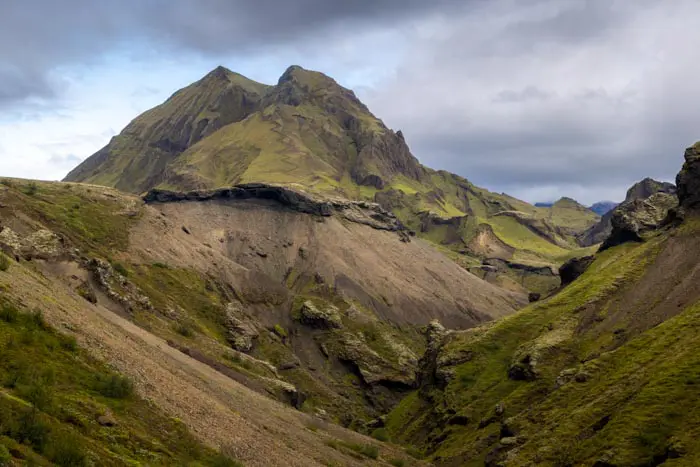
This circuit is particularly rewarding, revealing spectacular and varied panoramas. You will quickly pass from a green valley to a high mountain landscape surrounded by vast glaciers and then to a desert landscape dotted with lava fields as far as the eye can see. Just when you think you've seen it all, the superb Hvannárgil Canyon surprises you on the return trip, rivaling the splendor of the landscapes you passed on the way there.
Remarks
Se rendre à Thórsmörk : je vous conseille fortement de choisir l'une des compagnies de bus pour rejoindre la région. En effet, la route F249 menant à Thórsmörk comporte des traversées de rivières parmi les plus difficiles d'Islande et n'est à réserver qu'aux personnes très expérimentées équipées d'un véhicule adéquat.
Vous pouvez réservez vos billets auprès des compagnies de bus Icelandia et TREX.
Randonnées à Thórsmörk : consultez mon guide des randonnées à Thórsmörk pour vous aider à choisir vos randonnées.
|Getting to Thórsmörk: I strongly recommend taking one of the bus companies to reach the region. The F249 road to Thórsmörk has some of the most challenging river crossings in Iceland and should only be attempted by highly experienced drivers with suitable vehicles.
You can book tickets with the bus companies Icelandia and TREX.
Hiking in Thórsmörk: Check out my Thórsmörk hiking guide to help you choose your hikes.
Difficulties of the hike
As with all hikes in the Thórsmörk region, the trail is well-maintained and clearly marked. This route follows the Fimmvörðuháls trek trail on the way out and returns via a wild, less-frequented canyon. This challenging hike includes the route's length and significant elevation gain, steep slopes with dizzying passages, and snowy or icy sections at higher elevations that sometimes remain late in the season.
What you'll love
- The Goðahraun lava field: Walking on this black expanse feels like walking on another planet's surface. The chaotic rock formations and fumaroles are a reminder that Iceland is a land in constant evolution.
- Impressive glacier panoramas: Breathtaking views of the Eyjafjallajökull and Mýrdalsjökull glaciers from the volcanic plateau between these two ice giants, illustrating the country's nickname, "Land of Ice and Fire."
- The magnificent Hvannárgil Canyon: This wild, uncrowded canyon has its share of surprises and rivals the spectacular landscapes of the outward journey.
- Exceptional landscape diversity: Breathtaking scenery quickly changes from green valleys to high mountain landscapes surrounded by vast glaciers and then to desert landscapes dotted with lava fields as far as the eye can see.
Hike technical sheet
➡️ Hiking parameters
➡️ Hiking parameters
➡️ Hiking parameters
Map and elevation profile of the hike
Slideshow


")
")
")


")
")
")
")
")


Nearby hikes

Hvannárgil Hike
- Difficulty : Easy
- Duration : 2 h
- Distance : 4.9 km
- Elevation gain : 380 m

Réttarfell Hike
- Difficulty : Hard
- Duration : 1 h 45
- Distance : 3.8 km
- Elevation gain : 300 m

Tindfjöll Circuit Hike
- Difficulty : Moderate
- Duration : 3 h 30
- Distance : 8.8 km
- Elevation gain : 380 m
Rjúpnafell Hike
- Difficulty : Very Hard
- Duration : 6 h
- Distance : 14.3 km
- Elevation gain : 920 m
Map of the 10 closest hikes
Hikes to discover
Let chance guide your steps: discover a random selection of the best hikes in Iceland.

Snækollur Hike
- Difficulty : Moderate
- Duration : 3 h 15
- Distance : 5.1 km
- Elevation gain : 600 m

Bláhnúkur and Brennisteinsalda Hike
- Difficulty : Moderate
- Duration : 4 h
- Distance : 9.9 km
- Elevation gain : 620 m

Lac de Bláhylur
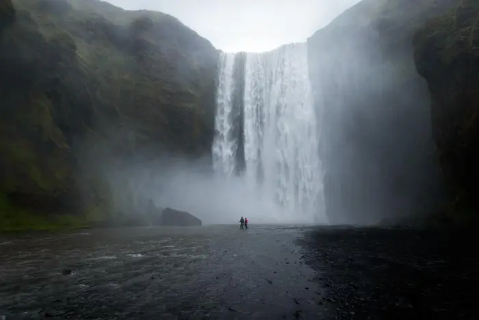
Chutes de Skógafoss

Thingvellir National Park Hike
- Difficulty : Very easy
- Duration : 1 h 30
- Distance : 5.1 km
- Elevation gain : 80 m
