Askja
Important note: I didn't have the opportunity to visit Askja as I didn't have a 4WD when I was in the area. It's a place I'd really like to explore, and the rating in “My Rating” only reflects my first impression of the site.
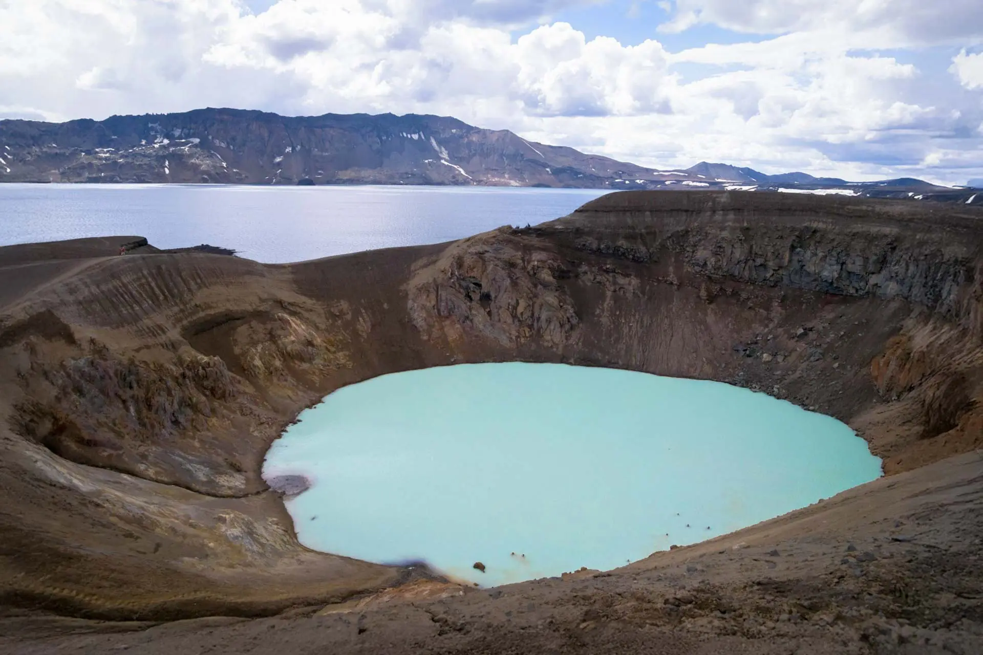
Askja is a vast volcanic caldera located in the Icelandic Highlands, in the heart of the Ódáðahraun desert, north of the Vatnajökull glacier. Formed by successive eruptions, it is home to two iconic lakes: Öskjuvatn, the second deepest in Iceland (220 m), and Víti, a geothermal crater with milky, warm water (around 25°C).
For more information on Askja and hiking in the surrounding area, check out the excellent websites smartrippers (in French) or epiciceland (in English).
Viewpoint technical sheet
Remarks
Accessible only in summer (June to September) with a 4WD vehicle, which is required to cross rough F-roads (such as F910 or F88). Guided super-jeep or bus tours are available from Mývatn or Akureyri.
For detailed information on 4WD access to Askja, visit the excellent epiciceland website.
Nearby hikes

Chutes d'Aldeyjarfoss

Lake Mývatn, Höfði Hike
- Difficulty : Very easy
- Duration : 0 h 45
- Distance : 1.4 km
- Elevation gain : 30 m

Dimmuborgir Lava Field Hike
- Difficulty : Very easy
- Duration : 1 h
- Distance : 2.7 km
- Elevation gain : 50 m

Hverfjall Crater Hike
- Difficulty : Easy
- Duration : 1 h 30
- Distance : 4.5 km
- Elevation gain : 230 m
Hikes to discover
Let chance guide your steps: discover a random selection of the best hikes in Iceland.